The Escalante River was low, really low. SnoFlo reported that the river was currently 90% below average with no recorded stream flow, at least at the gage just outside of the small town of Escalante. But I knew if we couldn’t make this trip happen now, it may never come to life. I had received some funding through the American Alpine Club Live Your Dream grant to complete the expedition. With a plan to leave the US in the fall and not being sure when (and if) I would come back, we decided to go for it.
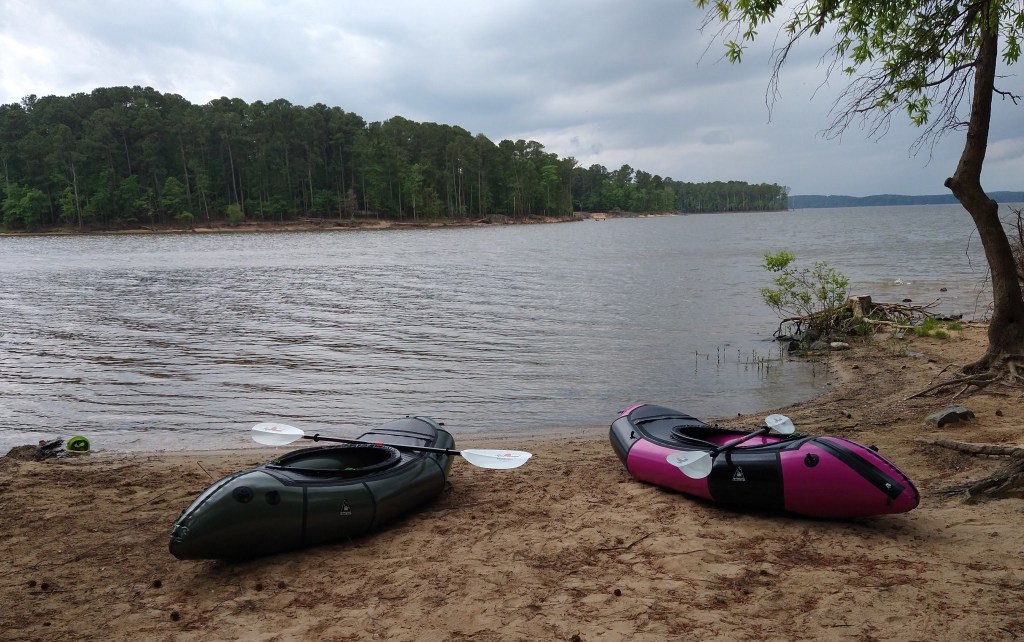
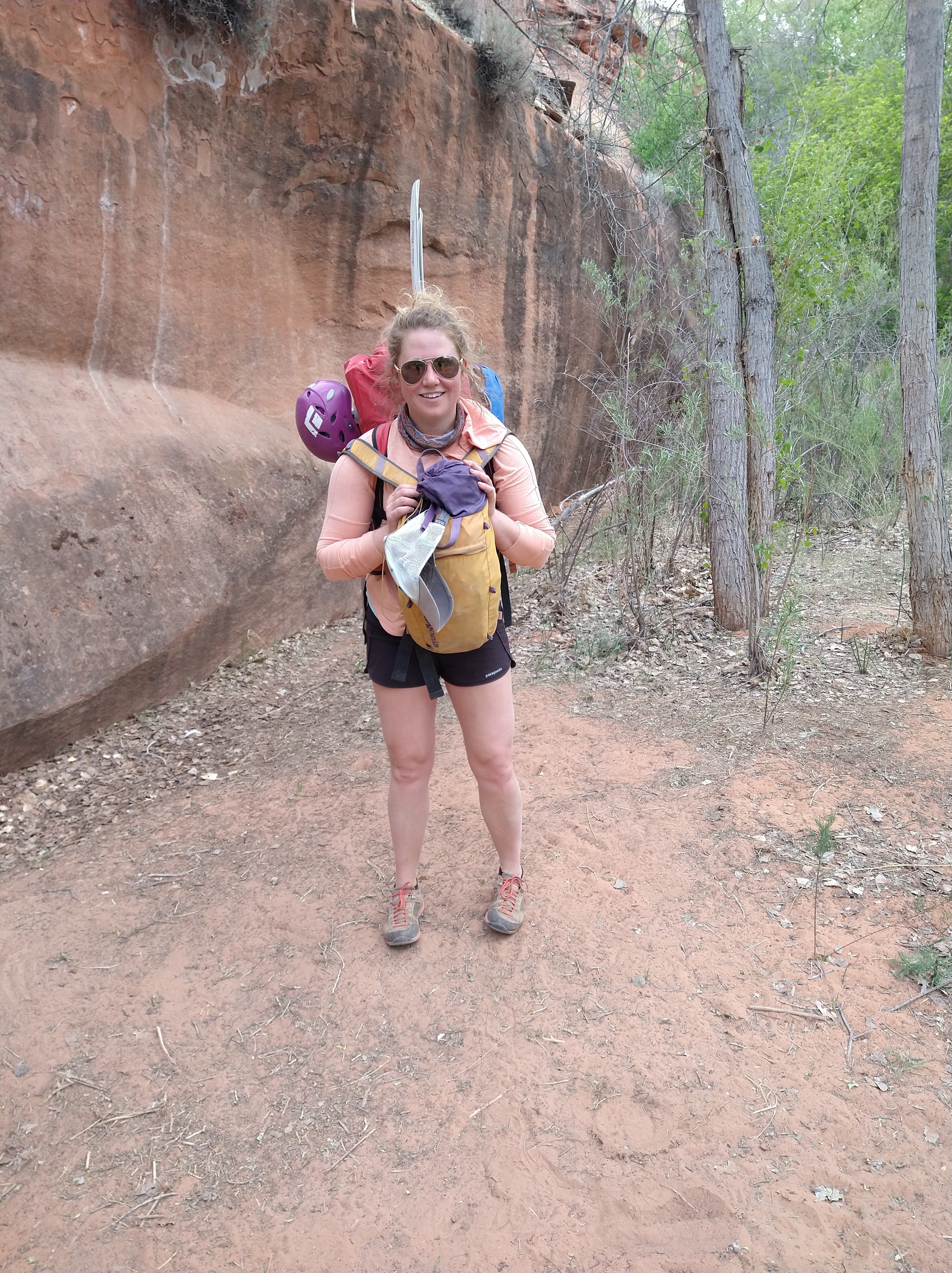
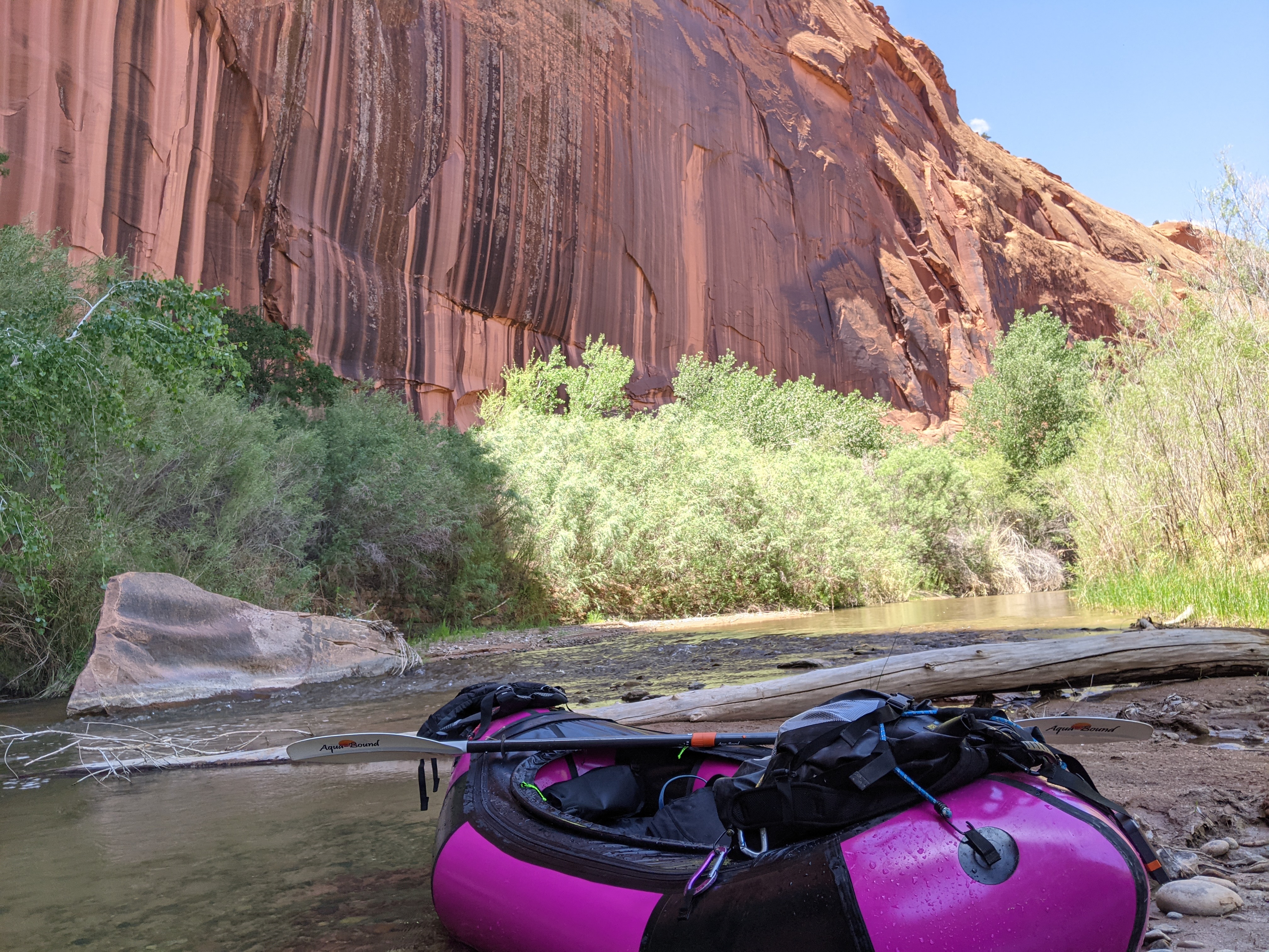
We had ordered our Alpaka packrafts just in time for them to be constructed and shipped to North Carolina. They arrived two weeks before the trip. I picked out an earthy green color and Andre thought he was getting an eggplant purple raft. His turned out to be more pink and quickly a name was settled for her – “Chiquita”. My raft took a bit for a name to stick, but eventually it was settled as “Terra”. We learned how to use the cargo fly (a zipper in the raft that would allow us to store our gear inside the packraft while we floated) and practiced packing them neatly to help with the trek we would need to do down to the river.
Evenings after work became a scramble to complete the list of tasks that had felt like we had tons of time for, and now just a matter of days. Fortunately, we were house sitting – so a house that usually holds a family with 3 kids was now covered in a gear explosion as we sorted through the items that were essential and what were not.
I worked at the kitchen table and used Caltopo to map out the paddling sections and estimate how many miles we would have to hike, paddle, or hitch hike over the course of the trip. I added coordinates of technical canyons along the river and nearby. The point of the trip was to combine packrafting with canyoneering. We planned to paddle about 70 miles from Egypt Canyon down to Lake Powell and take out at Hole-in-the-rock, while doing a few technical canyons along the way. Each pack would weigh about 60 lbs. Our take out point would not have a second vehicle to shuttle back so we planned two days to either hike the 40 miles up the road, or hitchhike. We’d stash some water jugs at a few points along the road in case we did need to walk. While I plotted the map, Andre set up a Spot satellite phone his parents gifted him in preparation for the trip. We named the spot “Sammy” and if all went as planned it would only be sending out the default message he set up, “Still floating and canyoning along merrily!” with the coordinates of where we were at. He also organized the rental car, a Nissan Xterra, that we would pick up after we landed in Salt Lake City and drive down to Egypt Canyon TH.
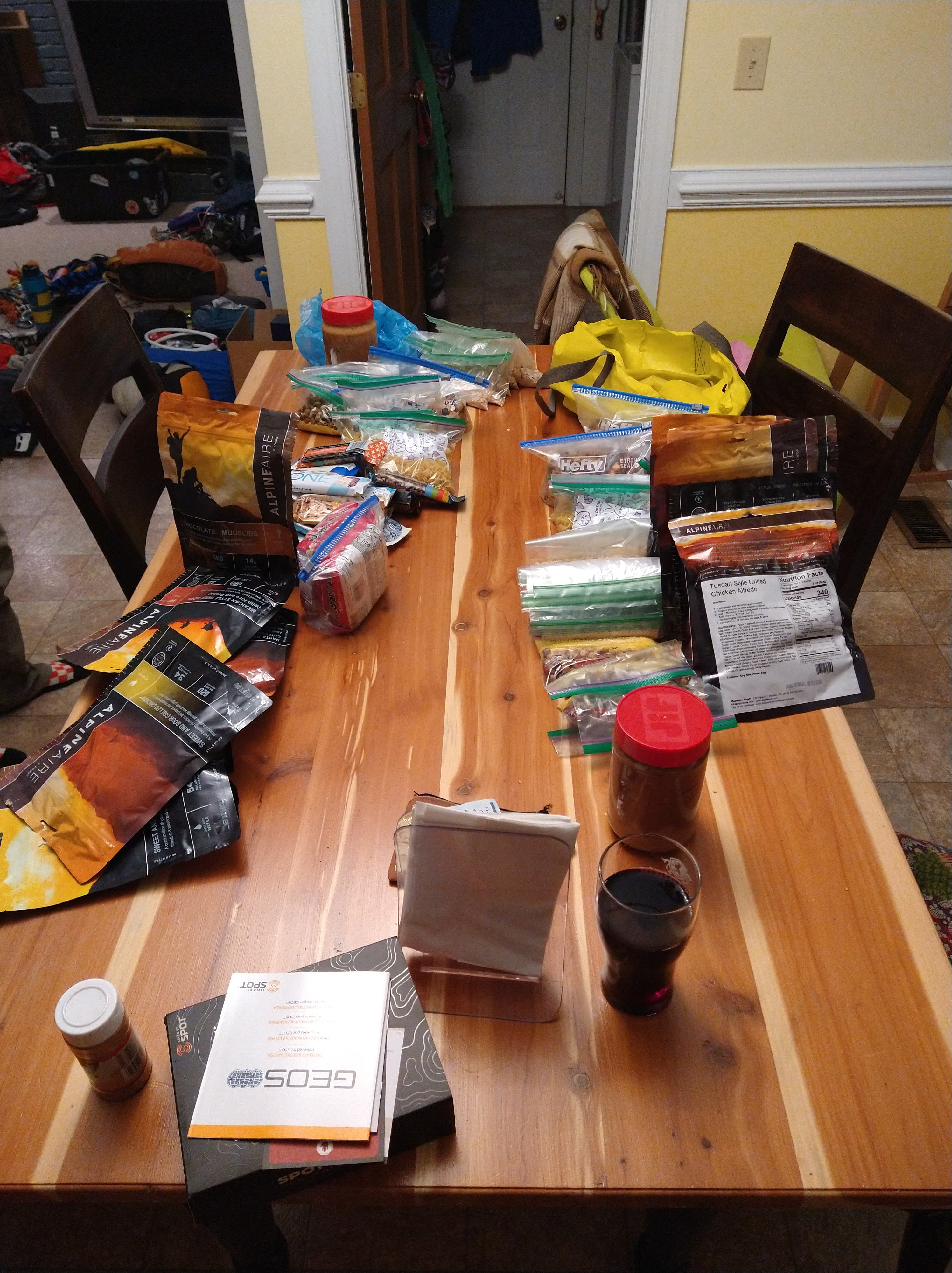
We made runs to the store to get enough food for the potential 12 days we were planning on being on the river and road walking back. Couscous, macaroni, ramen, trailmix, and oatmeal were scooped out into small ziplock bags for each meal. We splurged and got a few AlpineAir dehydrated dinners to balance out the bland couscous and ramen meals. We packed enough protein bars to snack on one per day, threw in some beef jerky, and a peanut butter/nutella/cracker/cranberry concoction. As we bagged and sorted the food it looked like way too much to be able to fit in our packs, but it also didn’t look like a whole lot of food that we’d get to eat over the course of the week and a half.
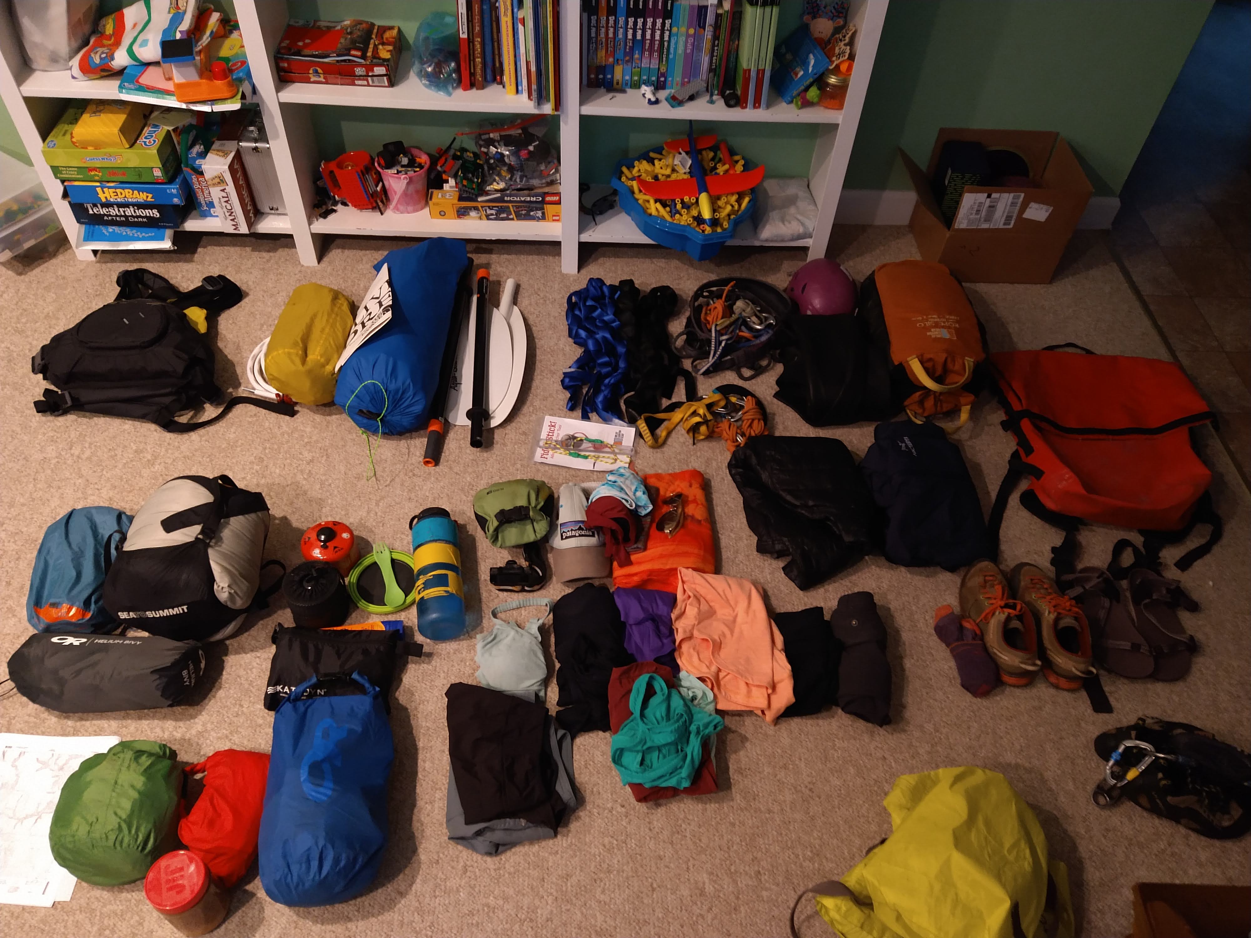
It wasn’t until the night before our flight that we packed our bags to see if everything fit. It did, but barely, and we had to get creative with bunji cords and carabiners to attach things to the outside of our packs. Once we knew we could carry everything down in our packs of choice, we had to repack for what would be allowed on a plane. Clearly a backpack with paddles, raft, and sleeping pad all latched on to the outside would not be appropriate as checked baggage. We’d weigh ourselves, then grab one of the checked bags and get back on the scale to make sure they were under 50 lbs. We each checked two bags, some of the gear (like climbing equipment) we wouldn’t carry on the rafting/canyoneering trip and planned to use in the days we got out of the canyon before the flight back. Everything fit into our checked bags except for our life jackets and a small day pack; I’d like to think we were at least somewhat amusing boarding a plane with a life jacket as a carry-on. Especially on a flight that passes over no water whatsoever between North Carolina and Utah.
Day 1:
We landed in SLC around 10:30 AM. As we waited at the baggage claim, 3 out of 4 packs appeared. We watched, waited, wondered. My yellow duffle bag containing my raft, paddles, and canyoneering rope was M.I.A. It wasn’t like a bag of cloths were lost, the vessel that would carry me for 50 miles down a river was. Luckily, after an hour in the small room near the exit of the airport for baggage claim, I was told it had been unloaded from the correct plane and just wasn’t delivered to the terminal. Back at the baggage terminal, the red lights came on with the siren and my lonely, yellow duffel surfaced from the world below and onto the conveyor belt. Only an hour or so behind, and with all of the gear now, we headed to find some food before our rental car pick-up at 1 PM. We ate as much as we could from an extra-large cheese and pepperoni pizza before boxing the rest and walking the last mile to the car pick up. The two checked bags each felt okay by themselves, but together, and with the day packs on our chests, our trudge was slow to the car rental. I wondered how we would travel with most of this weight for the weeks we had planned.
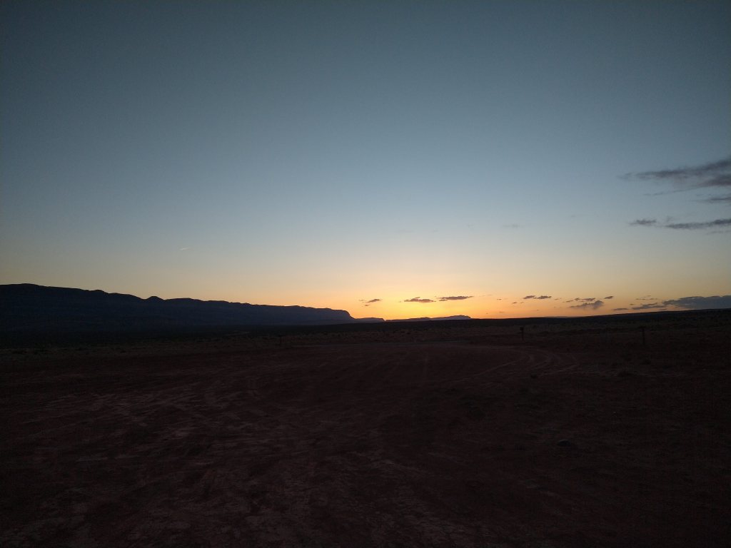
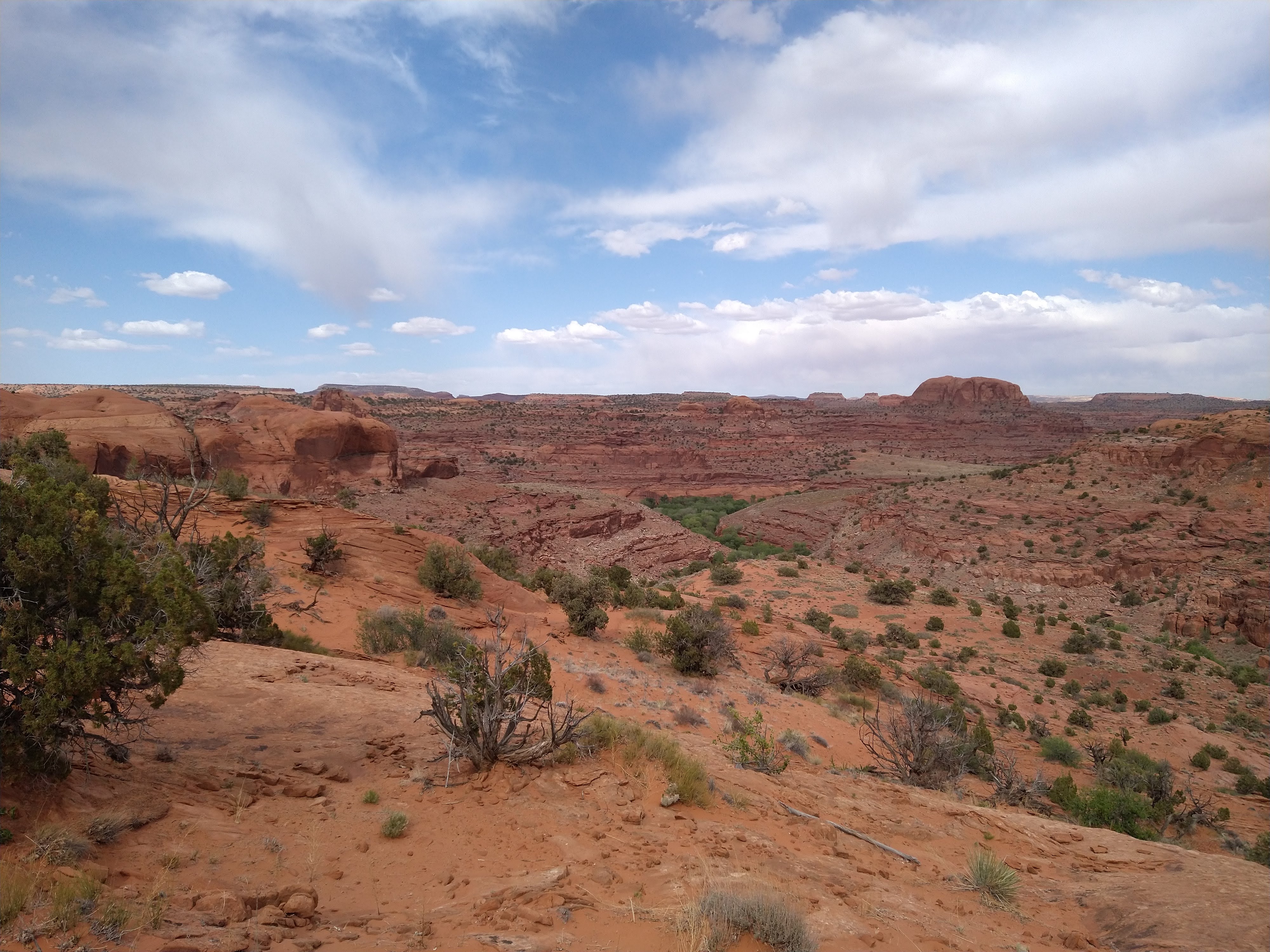
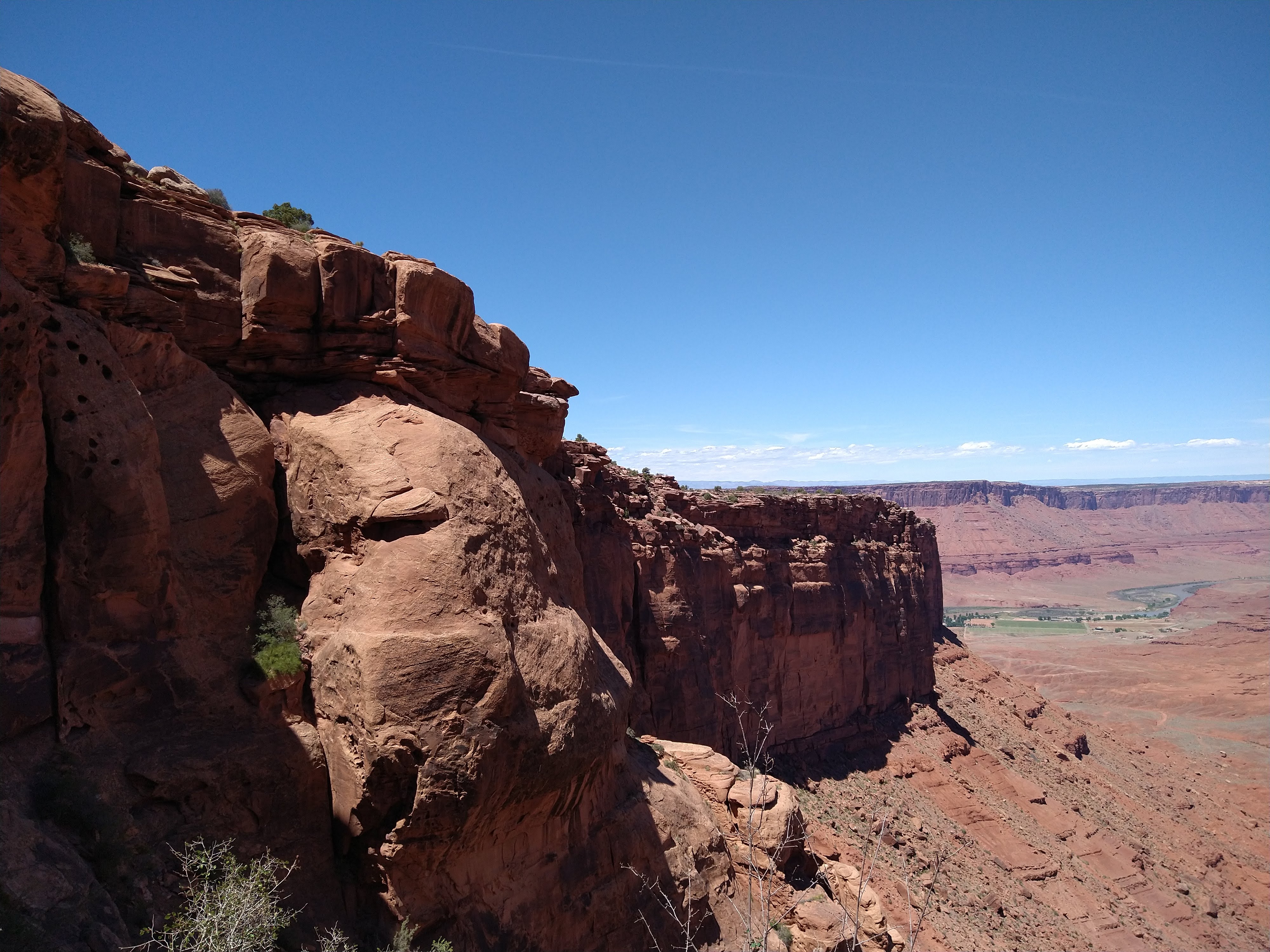
The Xterra had a loose steering wheel, or so it seemed. With both of us being used to driving big, heavy vans, the rental seemed finicky and something was definitely off with its steering. Four hours later we arrived at Hole in the Rock road and started the jarring, washboard drive to find a place to sleep. We pulled in to Peek-a-boo canyon overflow parking area and climbed on top of the roof of the car to have some sunset beers. The dry, warm, desert air felt so familiar and comforting – like a hug. This would be Andre’s first time in Utah, and first everything we’d be doing… canyoneering, packrafting, climbing arches and mesas and canyon walls. I was so excited to share this magical place with him. I was still a bit doubtful that we could pull off this trip, but the magic of the desert convinced me this was right. On our way to Peek-a-boo we dropped off some jugs of water for our potential hike out the road.
Day 2:
We headed down to Egypt Canyon the next day. The packs were heavy, and we didn’t load them well. Andre’s raft dropped from his pack on the first heavy step down off a ledge less than a mile from the trailhead. I had a water pump stabbing into my back and wished I had packed better. But the three miles weren’t a big deal and soon we were setting up camp along the Escalante River. It was flowing, and deep enough to float mostly, so we were feeling optimistic. We set up our bivies – his a bivy hammock that could also be staked out on the ground and mine just a ground bivy big enough to encapsulate my sleeping bag and myself. It felt strange being so close to each other and sleeping apart since we had been coexisting in either of our vans or my old apartment almost every day of our relationship. That was the only night we slept in our own bivies; after we’d bunk up together in his slightly bigger bivy and mine would be used for our gear.


Day 3:
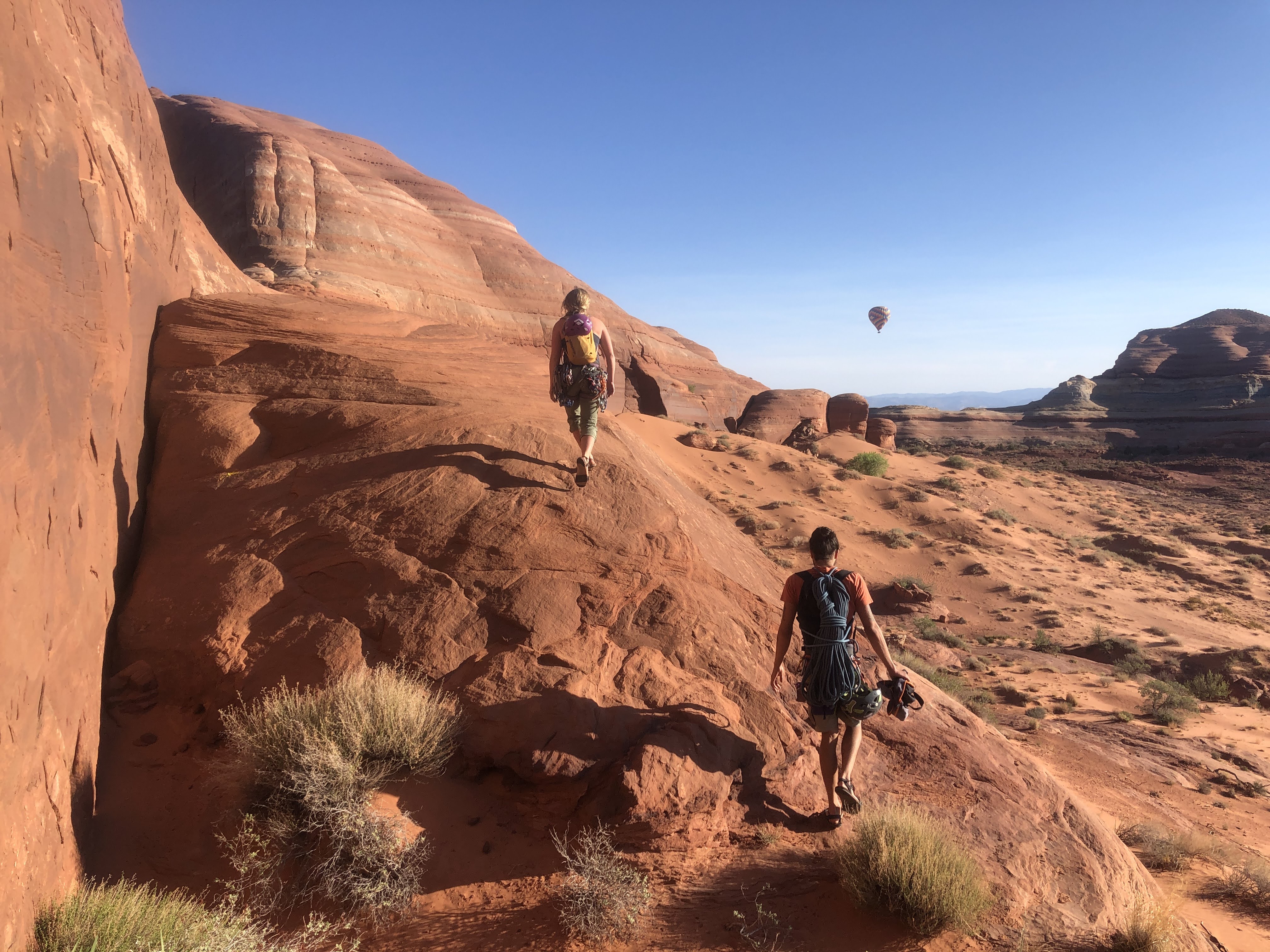
We awoke with stoke for the trip, fresh and ambitious for our adventure. We packed our camping gear inside the rafts and lashed our canyoneering gear on top of them. We’d be doing Neon Canyon that day and needed the ropes and gear accessible. Before we set off, two older men hiking down chatted with us. One had done a similar rafting trip before and mentioned how low the water was, which we were now painfully aware of. He also mentioned some interesting places to stop along the way, including Neon. After a mile or so of paddling we heard a shout, “Stop!” and beached our boats. It was our new friend and we were dubiously at the trailhead for Neon. This was the first clue that rafting in the current conditions of the river may not be very efficient if two hikers, who began behind us, were ahead of us. Still, we were grateful for the heads up as we would have easily rafted by the canyon.


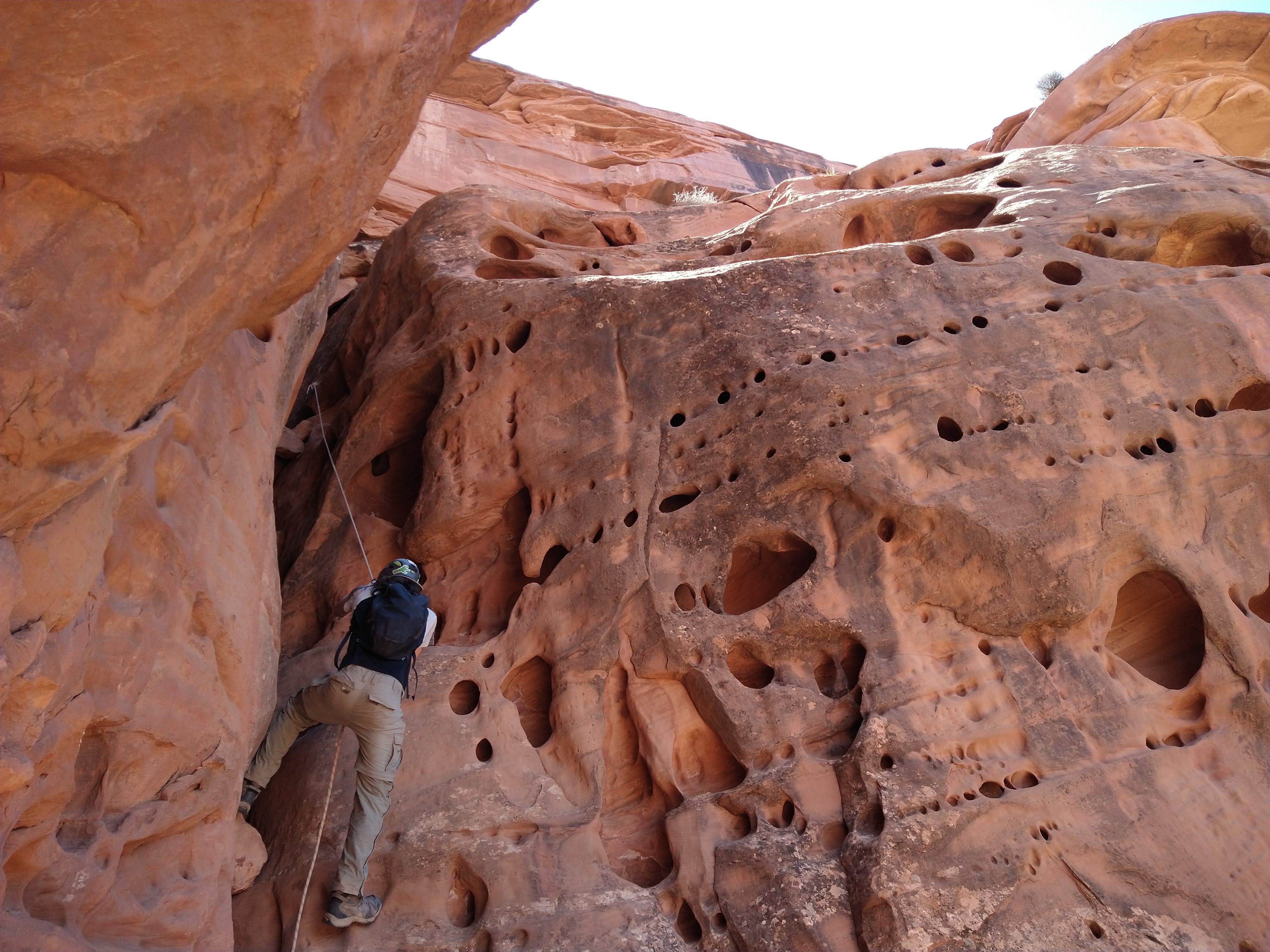
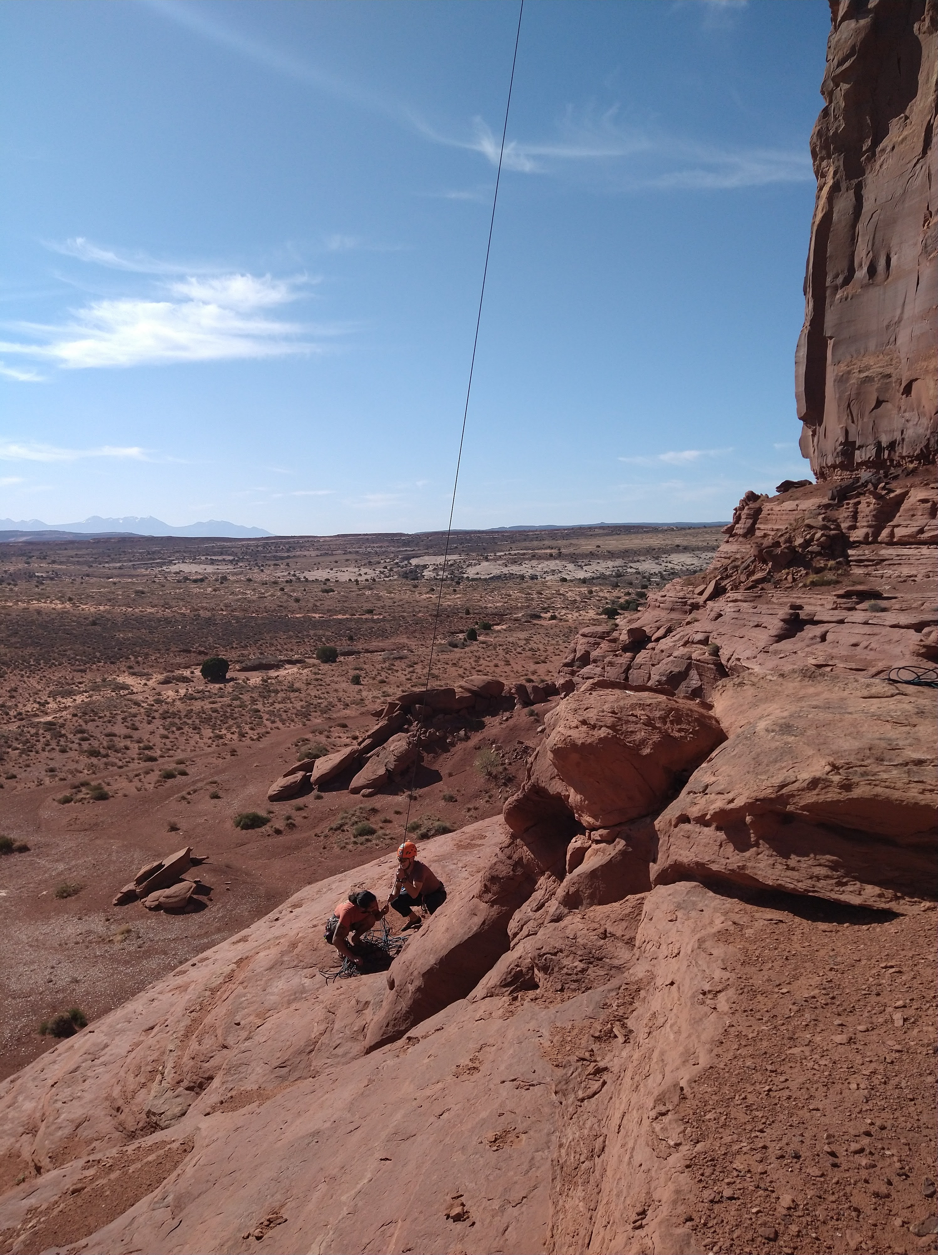
We skirted up and around the rim of Neon Canyon as the sun was heating up the rocks around us. By the time we reached the first rappel, I was ready to drop into the slot canyon and escape the sun. The first rappel was short and dropped us into a sandy wash that we followed down until the walls grew around us. Though the canyon usually contained long sections of wading and swimming (which we brought our wetsuits for), the entire thing was dry. This only further proving to us just how dry this year was. The canyon pinched up and soon we were dropping into a dark slot that led us to a “keeper pothole.” Potholes are smooth hollows in the bedrock that result from geological processes. A pothole becomes a “keeper” when it is sufficiently deep and smooth making them difficult to escape. Water levels can affect the ability to escape too. If the pothole is really deep, but full of water, one can simply swim across and get out at the other edge. But when there isn’t enough water, and it’s still deeper than a human, partner assists or other clever ways are required to get out. The first keeper pothole we came across was indeed empty of water, and really deep. Luckily there was a way to avoid it by climbing up and around, then rappelling down the other side. As we moved through the tight squeezes we would take our packs off and toss them to each other as we worked through the obstacles in the canyon. We would downclimb, work our way through a pothole, rappel, and repeat.


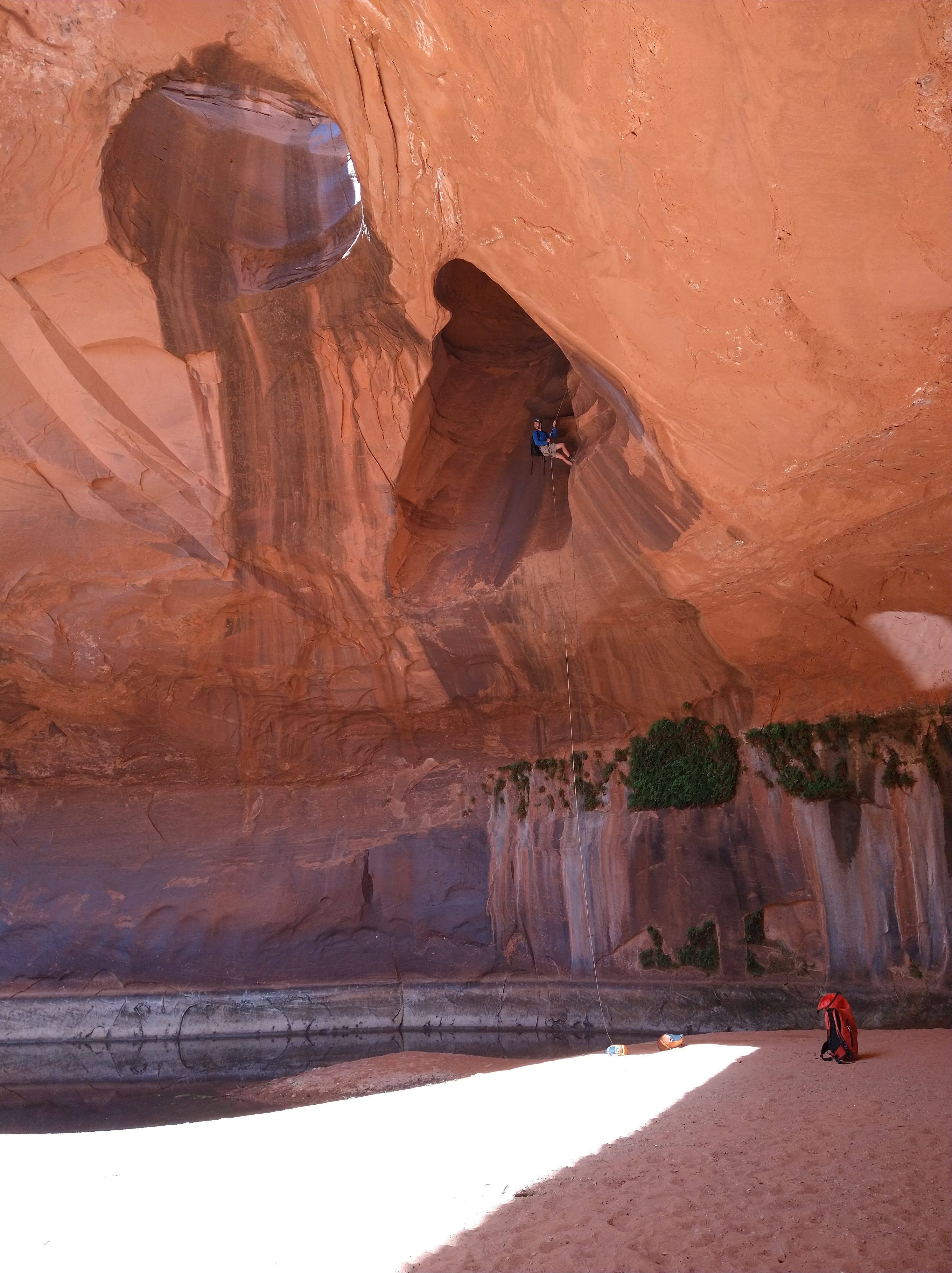
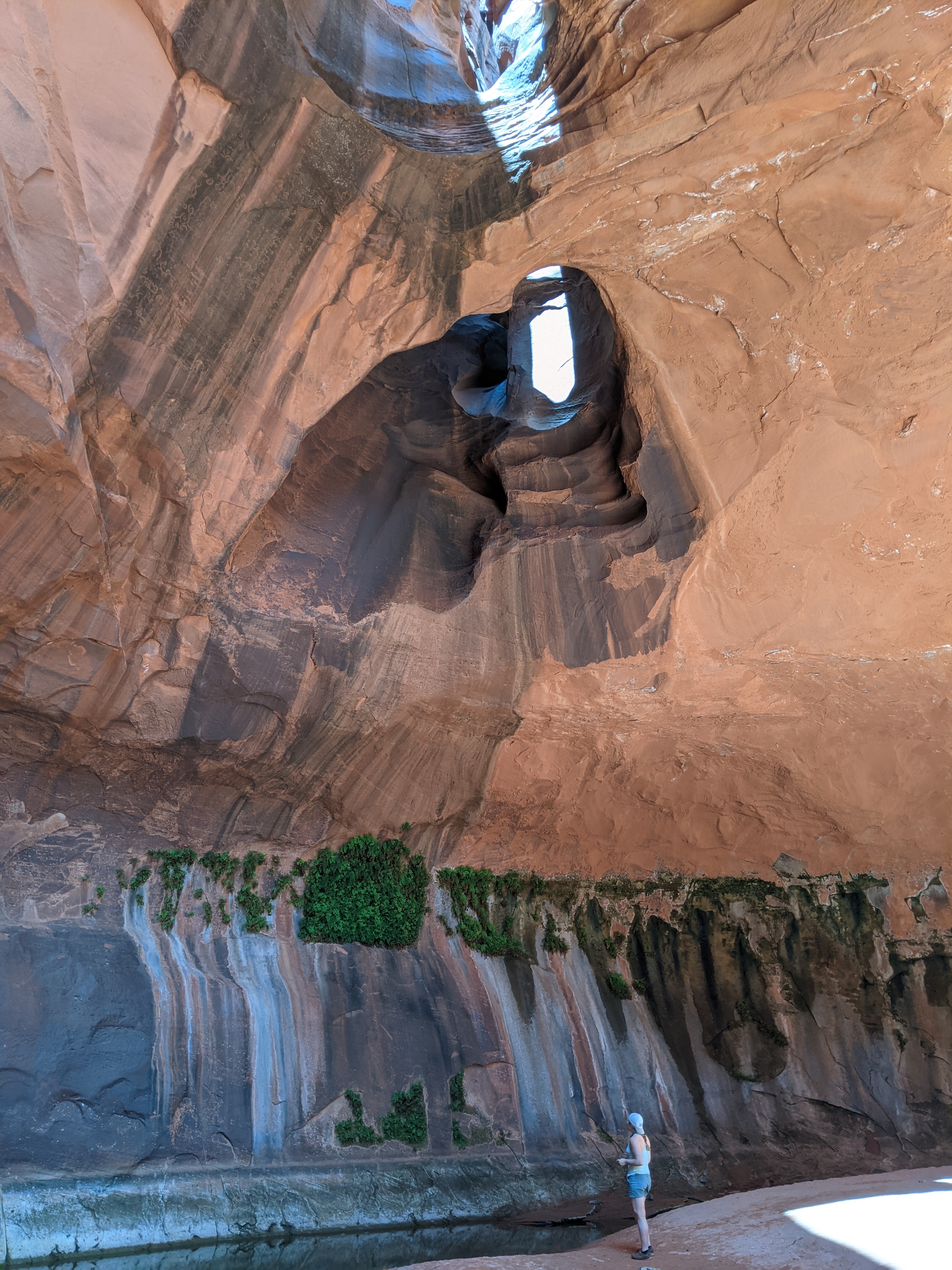
Before the canyon ended at the significant feature known as the “Golden Cathedral,” we took a long break in the sun and tanned in the nude. We knew no one could come up from the last rappel and figured we’d hear voices or ropes being dropped if another canyoneering party came through. Not wanting to leave the alcove, we slowly geared back up and rigged the last rappel. The feature was stunning – a triple pothole arch that hovers over a shallow pool of water. We each took our time dangling like spiders on a web as we descended from the arches.


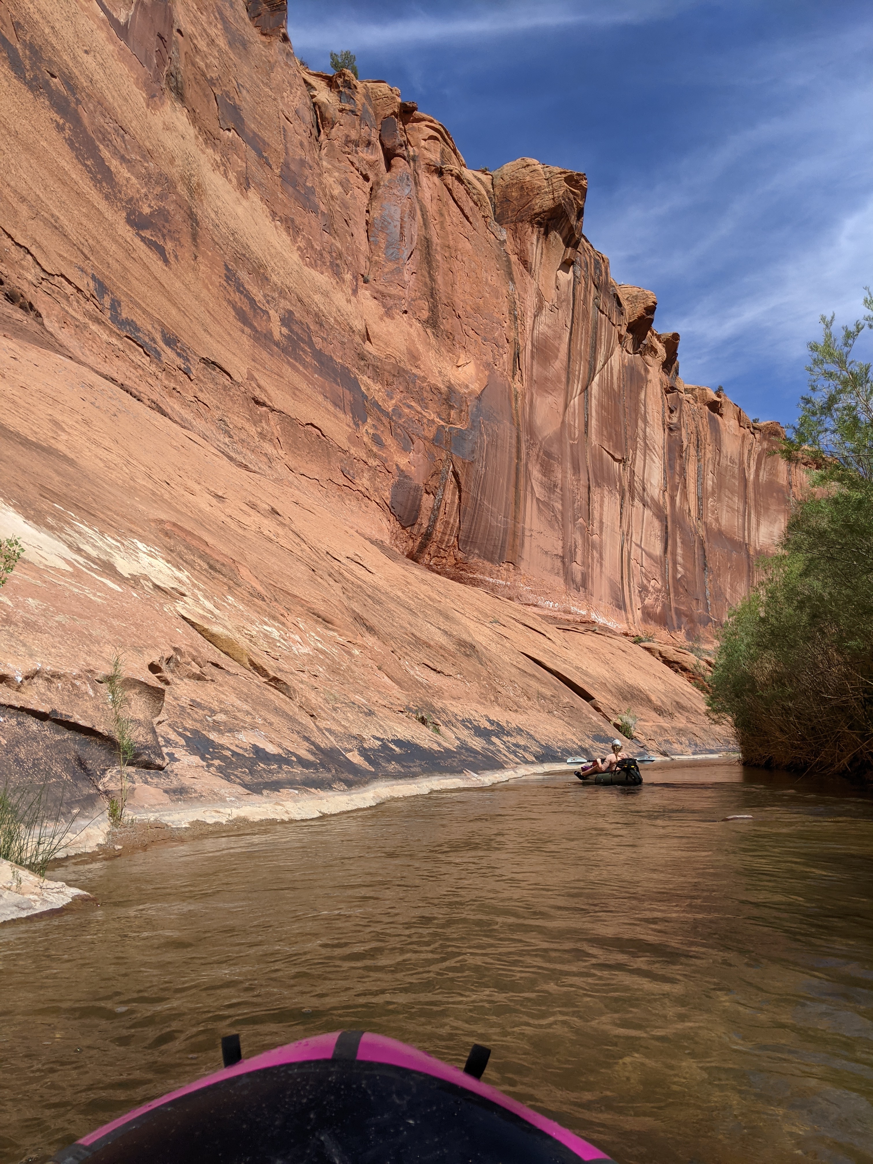
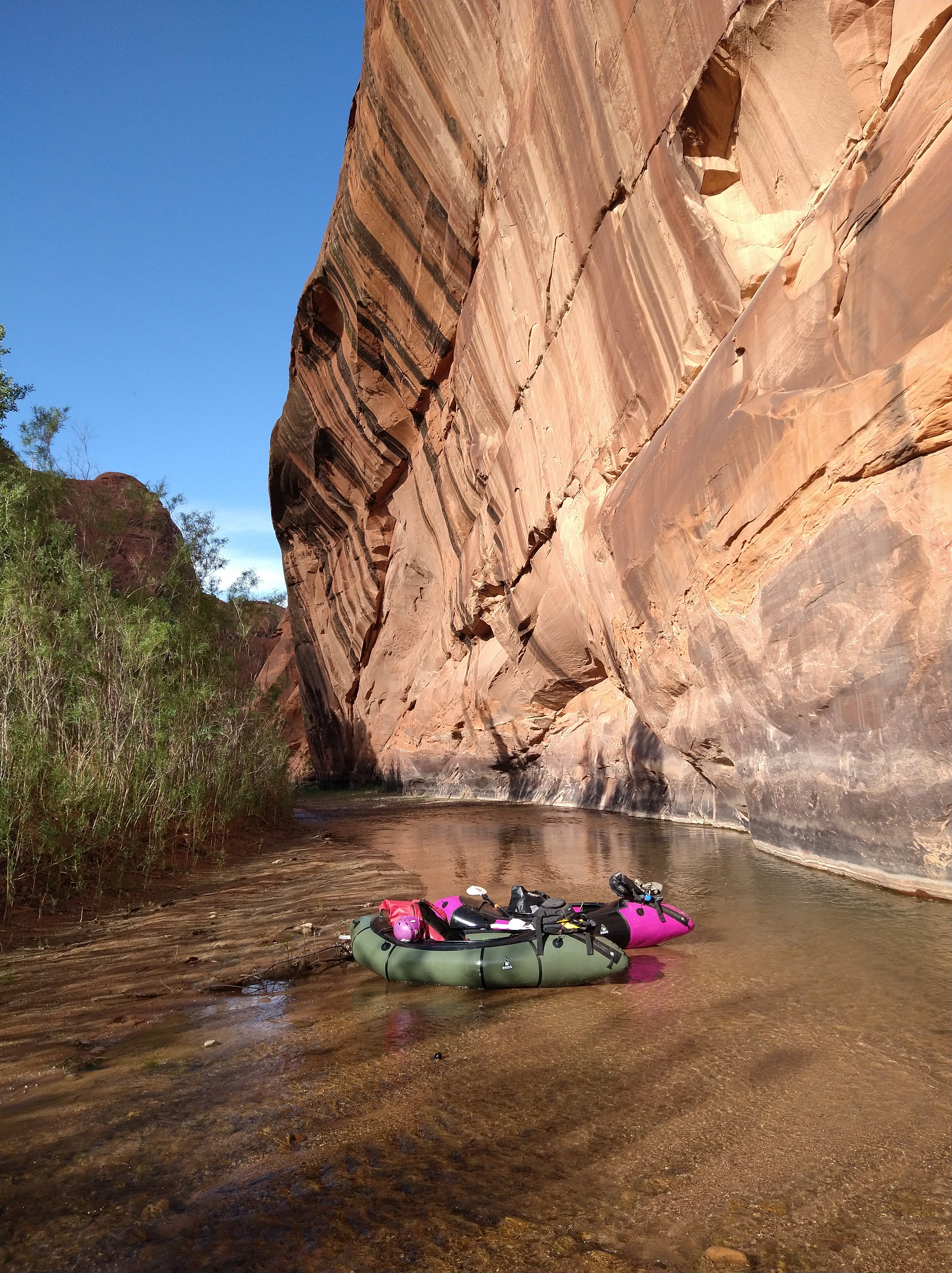
Back at the rafts, we pushed further down the river to find our next campsite. This was a more difficult task than we expected since lots of trip reports described camp spots all along the river. But we were only a few miles from the start of the river and I guess it would make sense that typically people would raft or hike a ways down the canyon, and not take a detour up a side canyon, then look for a place to camp. The sun sank but it stayed warm, as did the shallow water as we’d hop in and out of the boats checking out a bank of the river or pushing our rafts across a rocky spot.
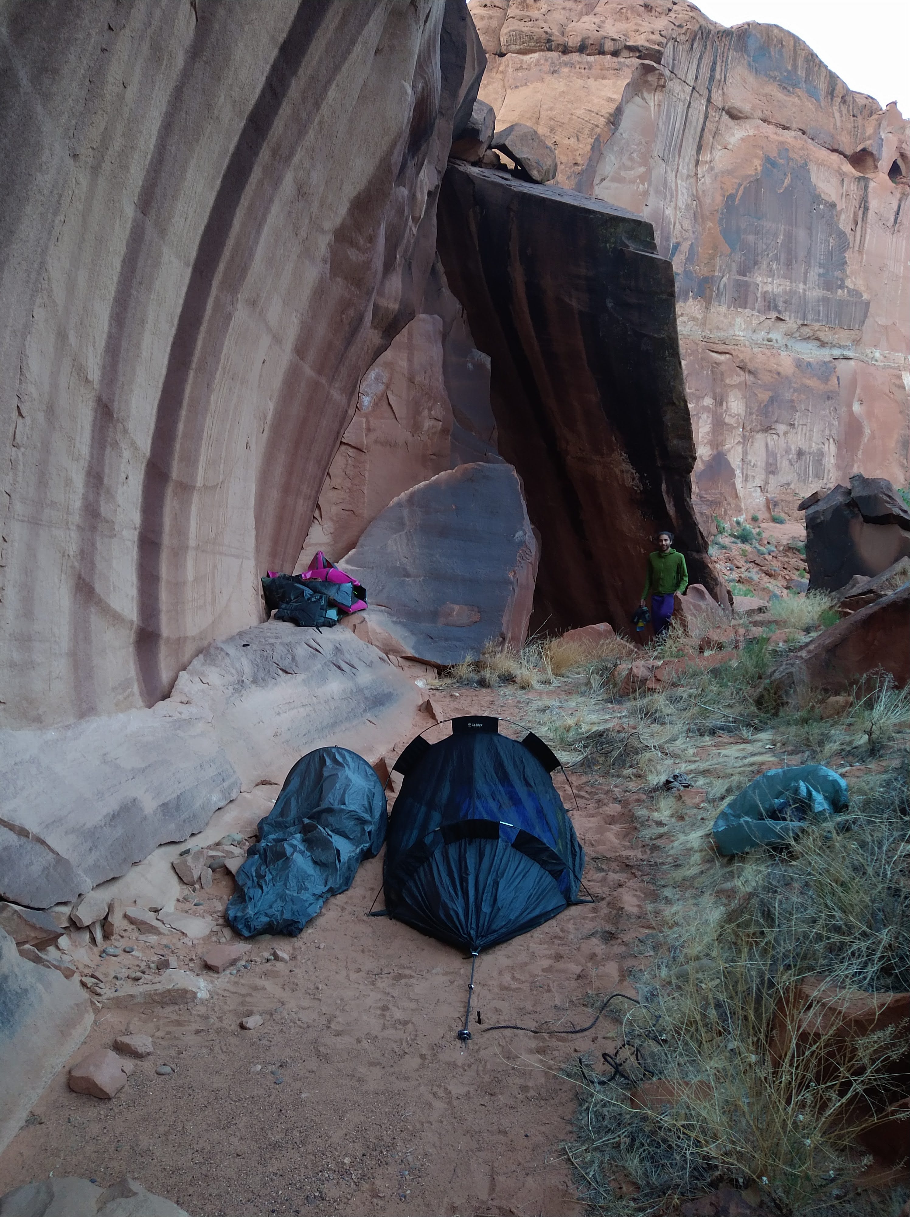
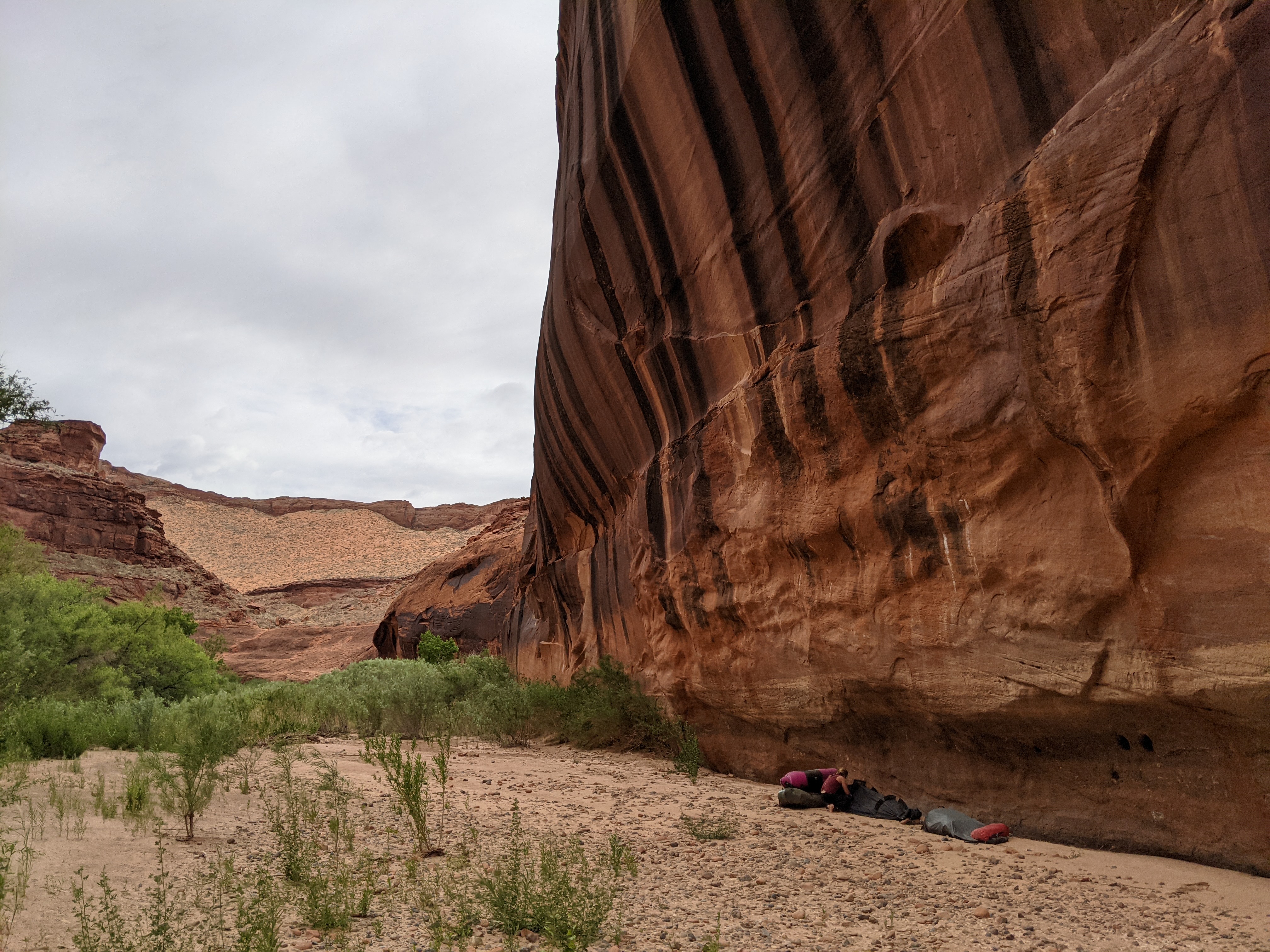
The next day we would be doing Baker Canyon, so we didn’t want to float too far down that we’d have to backtrack up to the canyon the next day. At each bend of the river we checked the map, and finally after a big bend we saw the trail that would be the exit trail of Baker. I hopped out and found a big bench high above the river that we could set up camp. This meant we had to haul our rafts and all of our things up the slope to the bench, which wasn’t ideal after a long day. But within a few trips back and forth, everything was brought up and we began to make camp. The bivy for the two of us was set up next to the gear bivy, we stashed the rafts in a little cave to protect them from being blown away by the increasing wind, and started cooking some ramen. The sun basked the canyon wall to our West long after we saw it sink behind us.
Day 4:
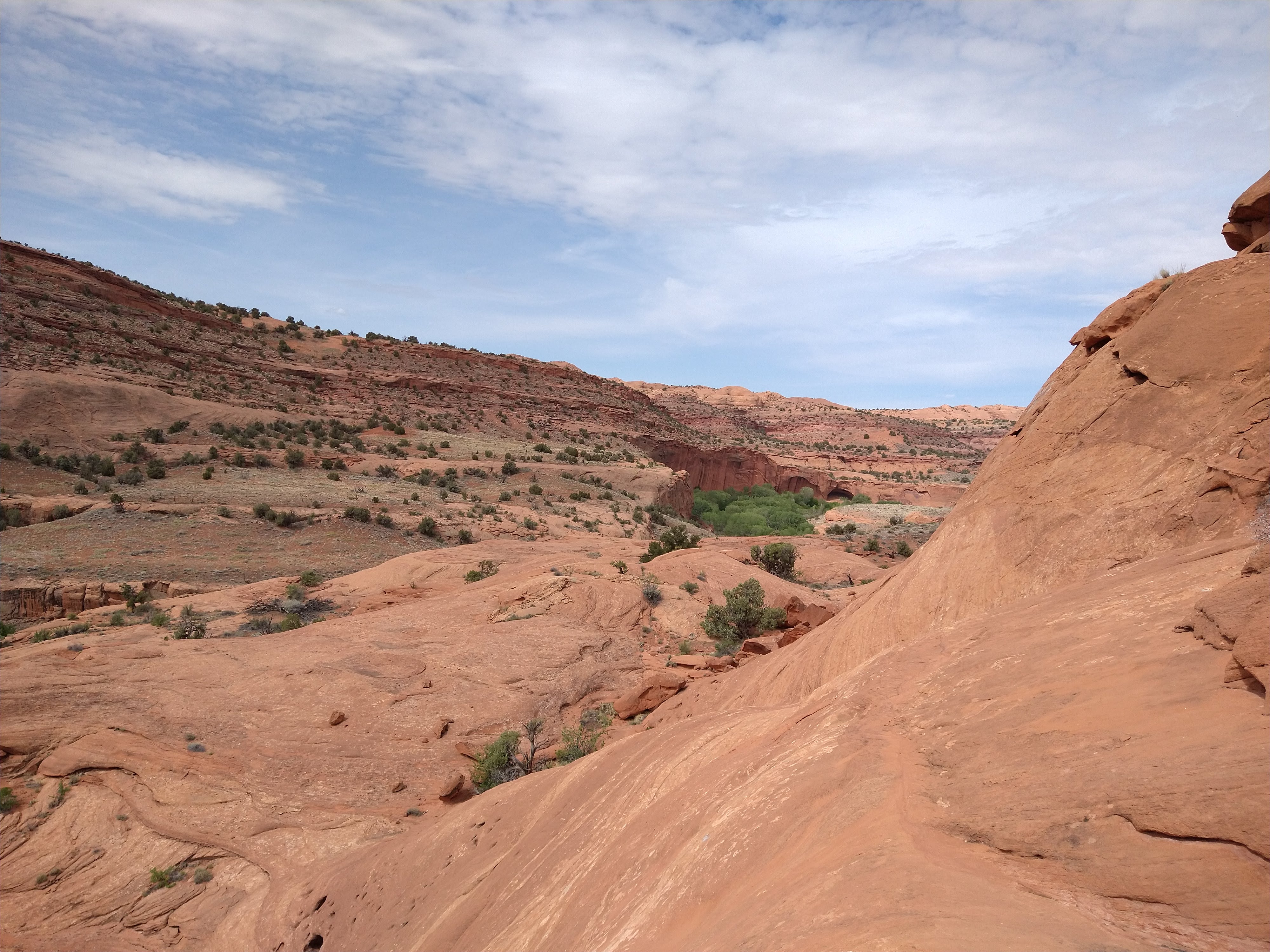
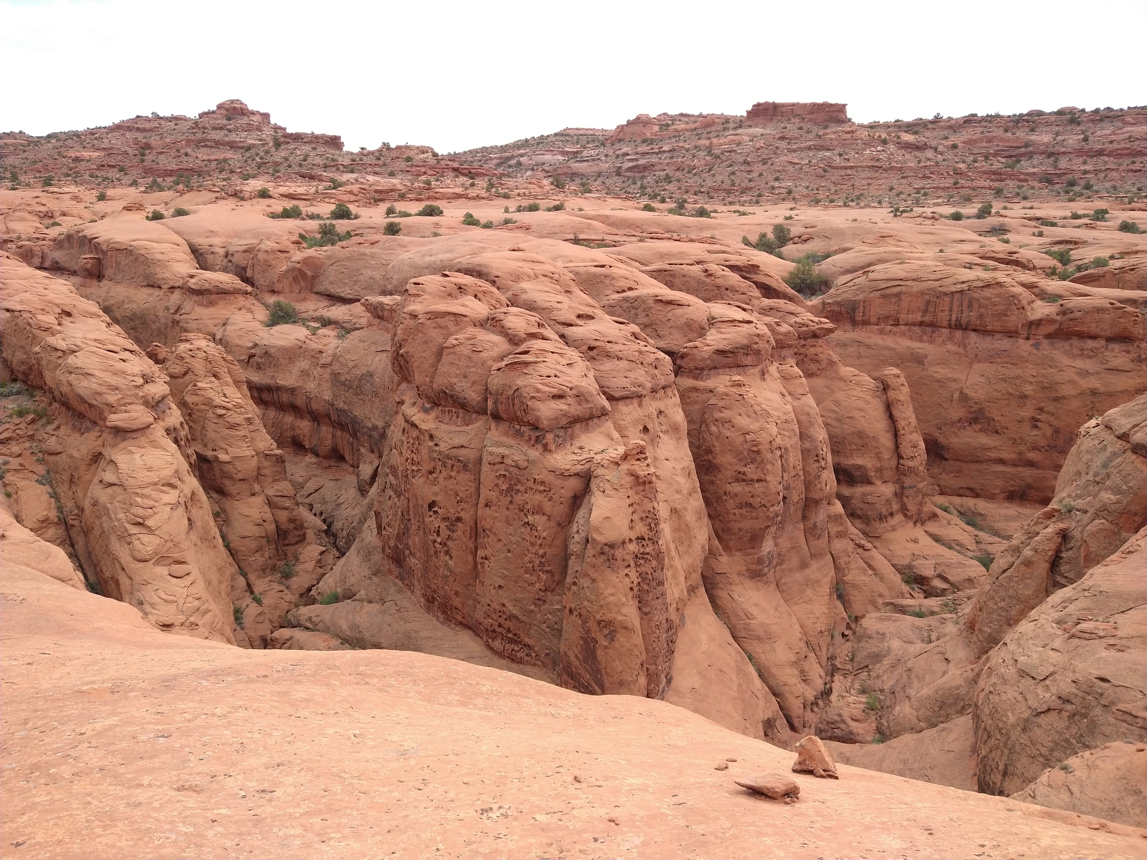
Rising early to beat the heat, we picked our way back upstream in search of an “obvious ramp” that would allow us to scramble up to the top of Baker Canyon. The ramp wasn’t as obvious as the description made it seem, but the large jug a few moves up was exactly as mentioned. We made our way up the slickrock following the path of least resistance until we reached the top of the canyon walls. We swung Northeast and looked for the ledges that would define Baker Canyon. We soon found the canyon as the Earth split the distant ground from us and we peered below and marveled at the unique pockets that dimpled its’ walls. We reached the confluence of the East and West forks of Baker. We would be doing the West fork, which was also dubbed “nasty ass” = “(N)ot (A)nother (S)queeze (T)hank (Y)ou, (A)nother (S)queeze (S)ucker”. Who names these canyons anyway?

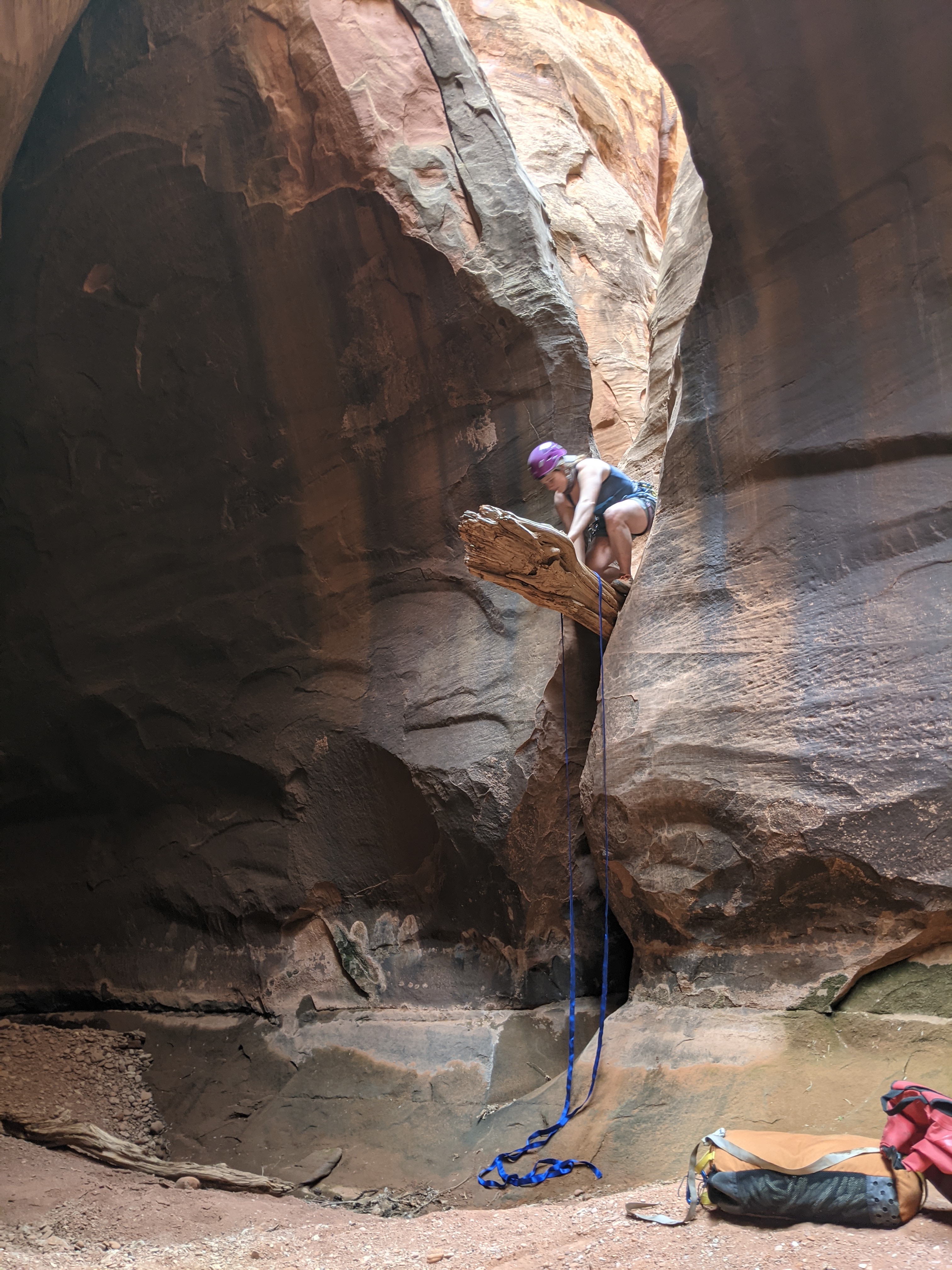
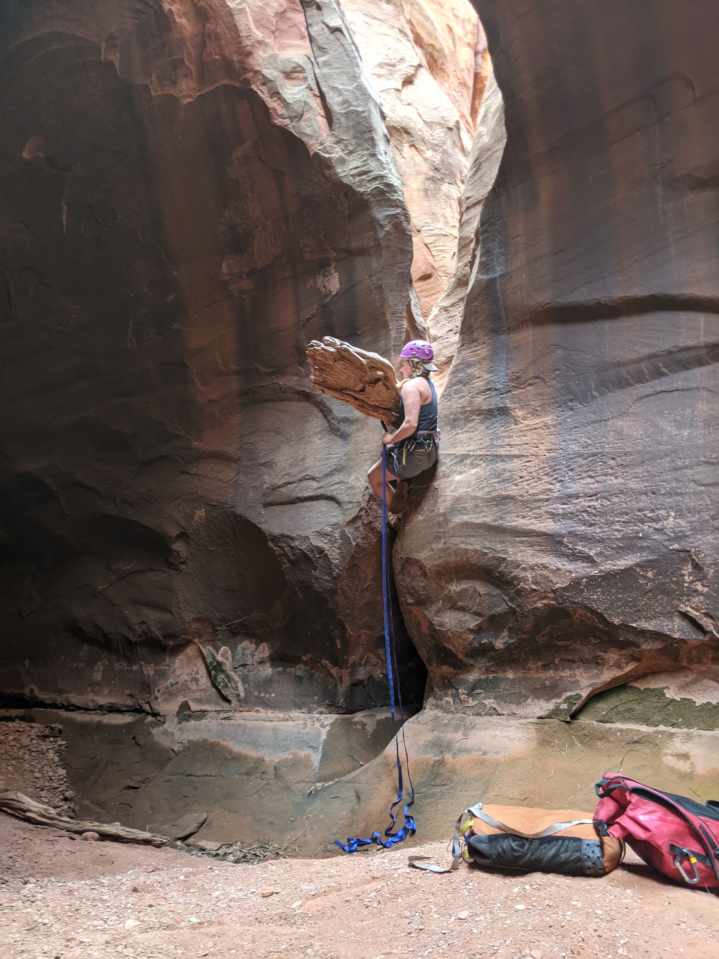
The canyon started with a dryfall (dry waterfall) that we could skirt around and downclimb. We took advantage of the shade from a dead tree to drink some water and snack before committing to the sunny approach. The route description recommended suiting up in our wetsuits from the start, but we had already learned from Neon Canyon that this was an exceptionally dry year. Ignoring the advisory, we moved forward and soon found the first hidden bolted rappel station above what should have been a pool of water. The pool would supposedly 12 feet deep, and if the first partner to descend found it deep enough, the second could jump in. Andre rappelled first, into the sandy, waterless pit and I soon followed suit. He would be taking lead today and I enjoyed going along for the ride, while keeping an eye on the rigging and techniques that I hoped to have taught him in Neon (which was his first technical canyon after all). Four more rappels followed, all less than 30 feet high. Once we reached the fifth rappel, we would have to exit the pothole (no longer a pool) via a tight squeeze. We laughed at each other’s contortions as we wiggled our way through.

Here though we were met with a new and intriguing obstacle – a log jutting out of a smooth wall that could not be downclimbed. We scoffed at rigging a rappel to descend only 15 or so feet, but also were too scared to jump it. So we looped a chunk of webbing (about 30 feet of flat “rope”) and edged our way out on the plank like log before doing a reverse pull-up down from the log before grabbing on to our hand-line and going hand over hand down.

Soon after we joined the East Fork of Baker, a canyon with more of a reputation and subsequent invitation to attempt the next time we’re here. We took some time to hike up and explore the stunning, dark East Baker Fork until we were stopped by a dryfall. We were captivated by it’s apparent depth and tightness in its slots and wondered if we could have, and should have, attempted the daunting brother of the West… next time.

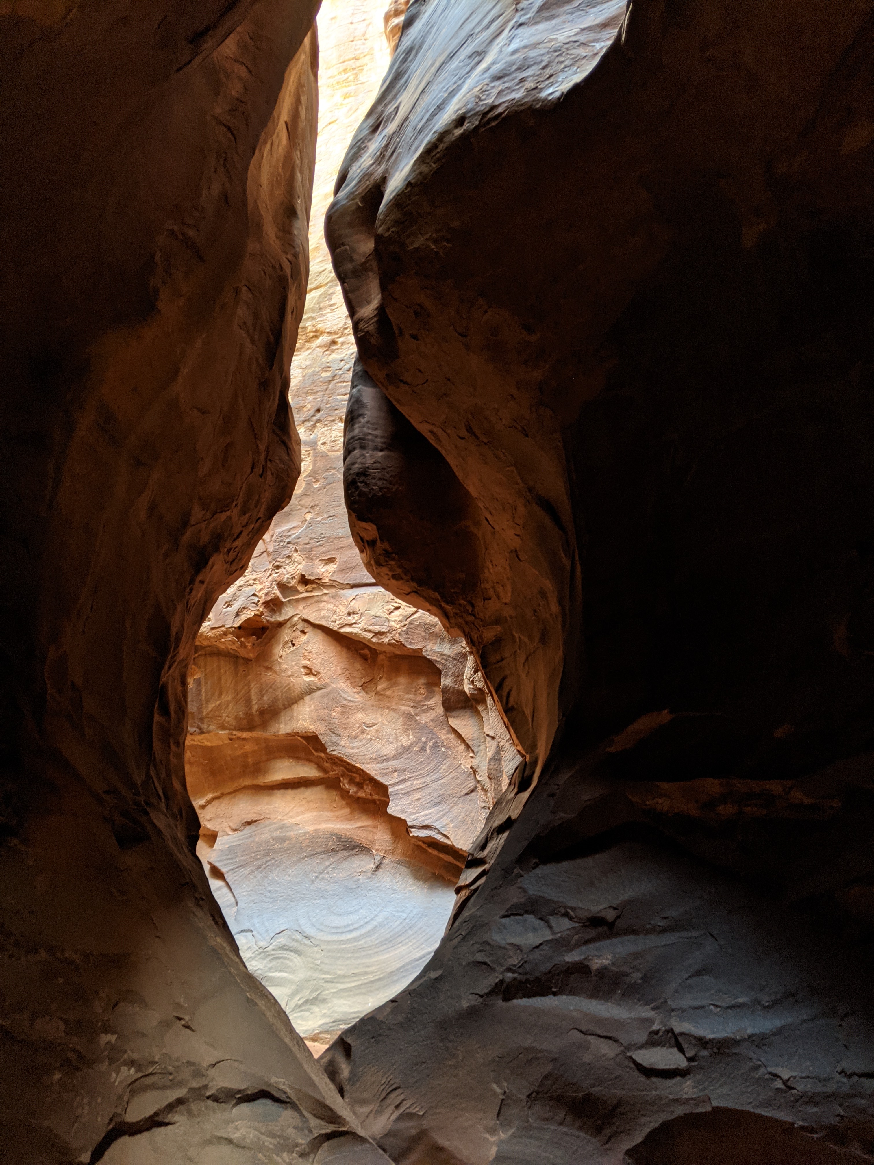

The fun wasn’t over yet though as the West and East confluences joined. The now whole canyon tightened back up and we were working downclimbs and pack passing in icy pools of dark water. We peered down the dark slots and tried to judge the depth of the stagnant water. There was a fair amount of water, but not deep enough to put on a wetsuit. We’d rig a rope and each take turns being the explorer as this role would mean rappelling or downclimbing in to the pothole of unknown depth first and then wading through to the end of it where we would have to make the decision of whether the other should follow and subsequently pull the rope behind us, making our choices even more committing. We had seen recent-ish foot-traffic though and as much as it killed the “explorer” vibe we had going on, if we saw remnants of footprints continue, we figured we could pull the rope and continue down. The water was so cold since it never gets touched by the sun, being so deep inside the canyon. At first this was a relief from the heat, but after a few seconds we hurried our progress as our feet and legs began to feel numb.
Finally we reached the last big rappel out of Baker – a beautiful 50 foot drop into a lush green oasis below. Just before we ended the canyon, we took a photo to provide with the trip report required for the American Alpine Club funds. From there, we hiked out the exit trail and back to our campsite, worked from the canyon and content from the day’s adventure. It was still warm being late afternoon so we decided to bathe in the river and lounge on the big red rocks lining a deep pool of water. Though the river was silty, our cleaniness was definitely improved as we washed away the sweat and sand that we collected throughout the trip so far. Back at camp we organized to make the next morning easier to pack up. For dinner we tried our couscous concoction of, well couscous, oven dried chickpeas, and for mine way too much dried chili peppers. Despite the spiciness the meal was still pretty bland and ended up being our least favorite dinner we packed.


Days 5-7:
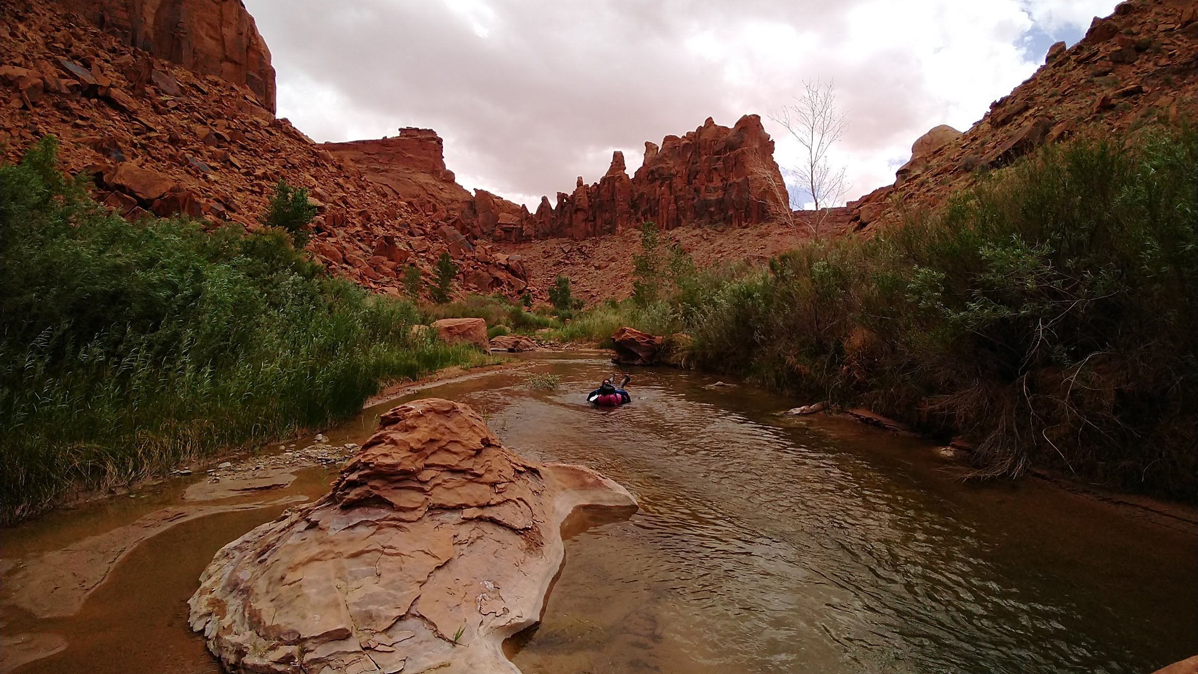
We realized our pace down the river would be slower than we had predicted, given the low flow. Neon and Baker Canyon were less than 10 miles down the river from the start and we had hoped to do 60 more miles within a week. Ringtail canyon and Top Chef canyon looked really cool and were on our list, but after much debate we decided to skip them and focus our progress on the river. We really didn’t want to hike back upstream the way we came, so we continued to work our way South – the only other option out of the canyon.
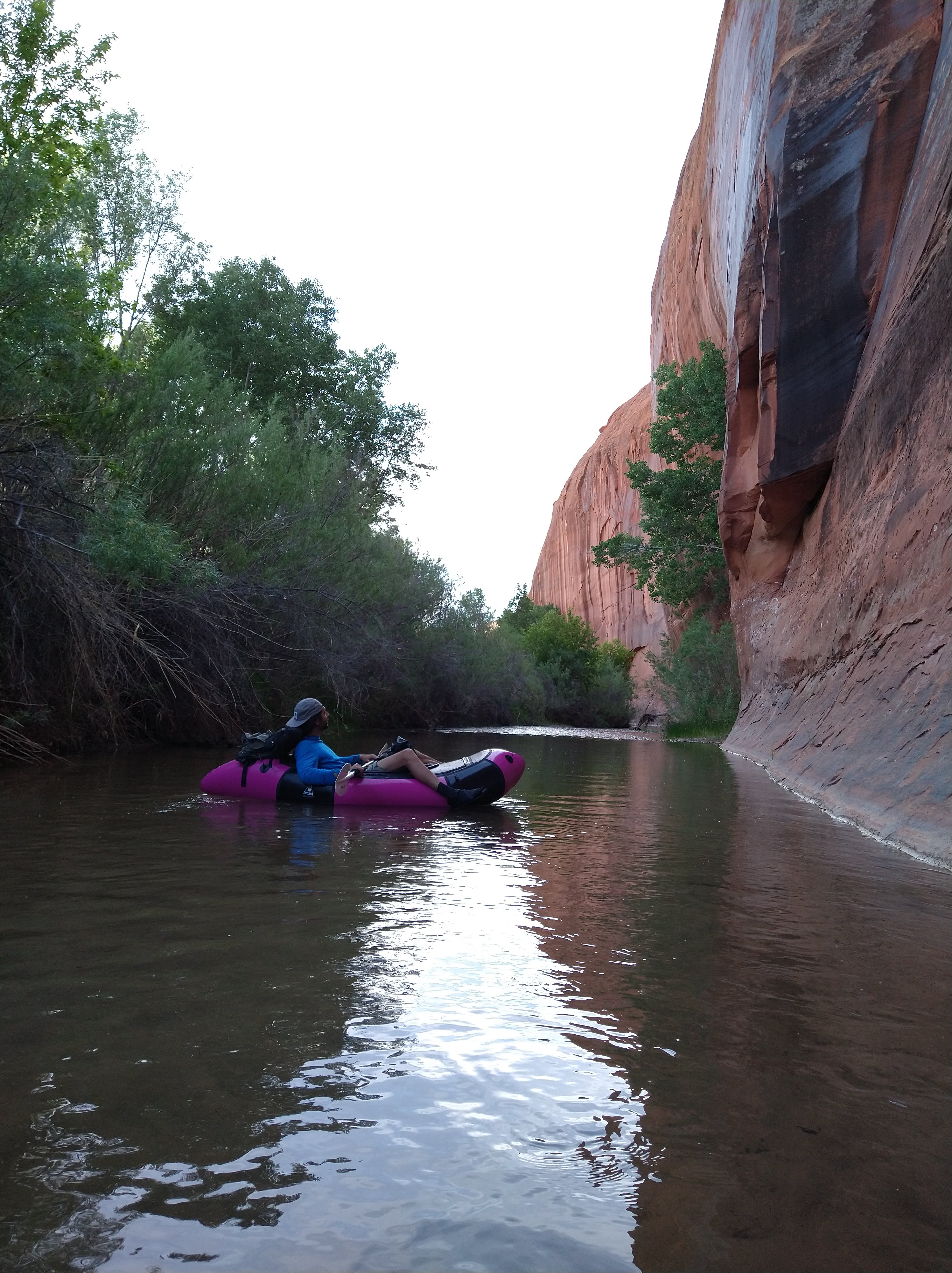
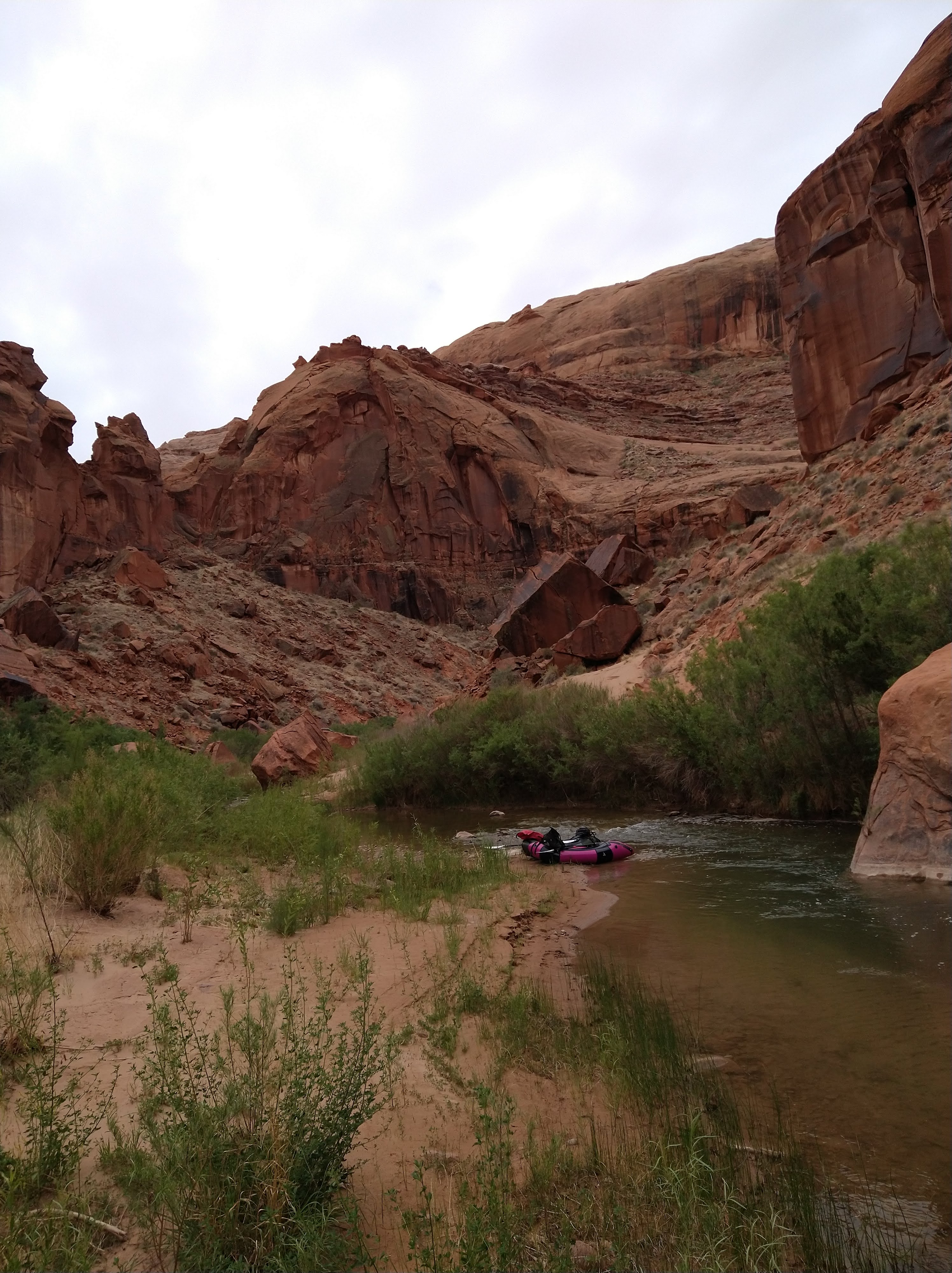
The next few days we would wake up early, cook some oatmeal, repack and inflate our rafts, help each other apply sunscreen, and paddle out… or walk, depending on the section of river we had set up camp. We found luck with finding stunning campsites below the huge looming walls of the canyon. Some had scrambles nearby where we would hang out after dinner and watch the sunset. Once darkness fell, we’d tuck in to the bivy and sleep to the sound of frogs in the river.
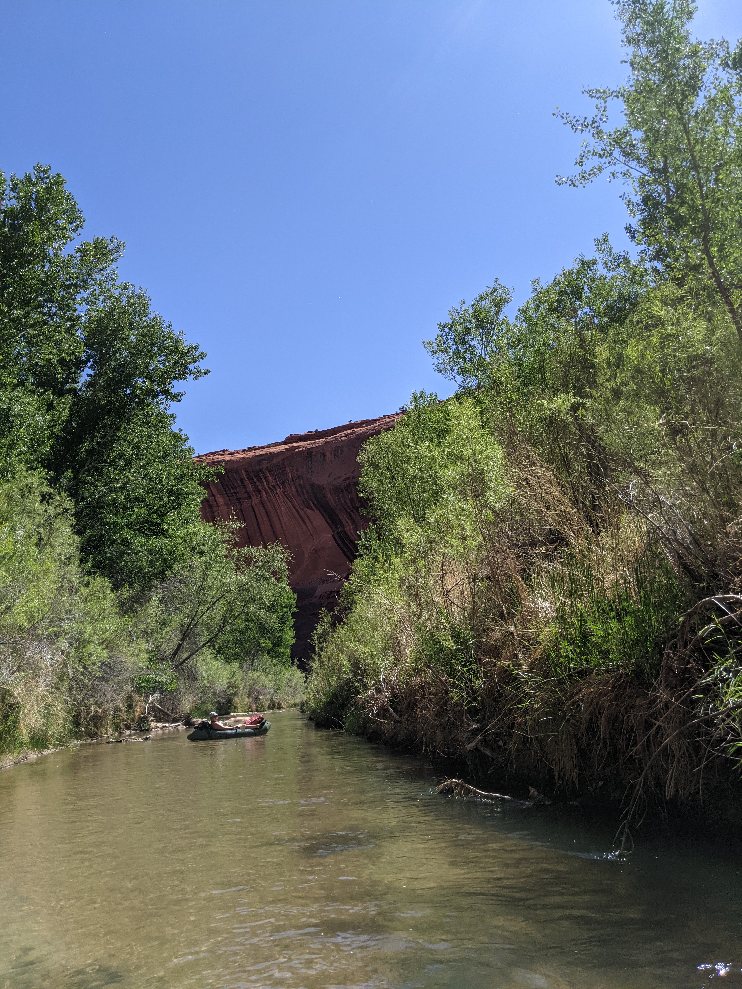


In the mornings we would try to paddle at least 3 miles before taking a break. This would take a couple of hours between scooting down shallow sections or walking our rafts, and occasionally hitting a deep enough channel to paddle. We tried everything to keep the boats from grounding in the shallow water: arching our backs and propping our arms and legs up to take as much weight out of the boat for it to float, sitting on top of the back of the raft, even going backwards seemed to help sometimes. The first break would involve a swim to cool off and some snacks and water. There’d be a few outbursts of laughter mixed with frustration, as we would check our progress on Caltopo.
Again, we’d aim for another 3 miles before a longer break with more snacks and a rest or nap to wait out the heat. Then would be the final push to go for as long as we could and find a spot to set up camp. We did around 10 miles a day and would end the day exhausted but in a new part of the river corridor. We never saw anyone else, it felt like we were the last two people in the world.


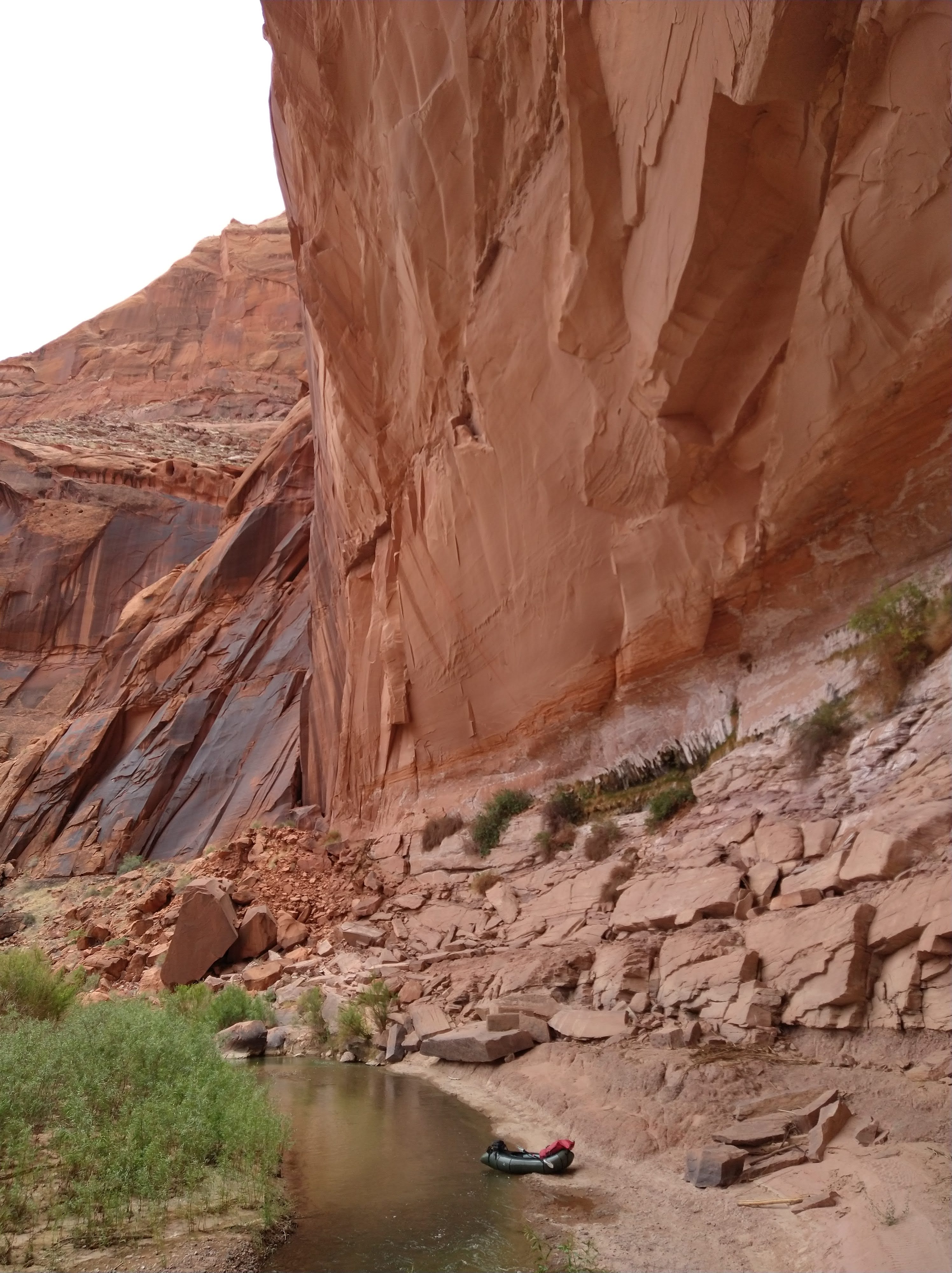
The weather had looked stable when we began the trip but little did we know a cold front was making its way through Utah, even bringing snow in the Northern part of the state. Day 7 began with a spattering of rain at 5 AM that roused us from our sleep to scramble and set up the rain fly. The rest of the day stayed moody with dark clouds and winds picking up around the bends of the river. The water, now not heated from the sun, remained cold throughout the day and we’d cringe whenever we had to hop out of the rafts and tug them along. The river was getting wider, which meant the water we were paddling was shallower after spreading out over more area. We figured this must be the hardest part and were hoping it could only get better from here.
The afternoon brought sun for about an hour making us hopeful for some warmth. It did indeed warm up, but pushing the warm air back in were strong winds. We’d paddle hard against the wind, which was coming upriver, but would either stay in place or be pushed backwards. There was no point in trying to move forward during the gusts (later we’d find out they were upwards of 40 mph wind speeds). We’d hear it coming, then paddle quickly to the side of the river and grab some cattails or whatever vegetation we could find and duck our heads into the wind to wait it out until the next calm. Water was being pushed backwards against the current in little whitecaps and dust blasted into our eyes, ears, nose, and mouth. Despite being sand blasted and beat up by the weather, we laughed, because what else really can you do at that point?

We finally reached our 10 mile goal where Fools Canyon met the Escalante; dust storms spun around us. I was not hopeful of finding any relief from the wind to camp, but soon Andre found a small groove of poplar trees to take shelter in. Dust still blew into our pot while we cooked and occasionally a big gust would dust the bivy and sleeping bags, but it worked. We splurged on the fancy dehydrated dinners that night, and finally had a moment to relax as the wind calmed and stars lit up the night sky.
Day 8:
The low flow and high winds coupled with the widening of the river and creeping fatigue weighed in on us as we approached Coyote Gulch. We could make it there today, and we could end the rafting part of our trip 20 miles early. I desperately wanted to paddle all the way to Lake Powell, but given the conditions it just didn’t make sense. I knew we could do it if we had to, but we could also stop fighting the Escalante and accept that we had gone a long way and did a really cool trip even if we didn’t finish the whole thing. On the map the river widened, which would mean it could braid and get even more shallow.
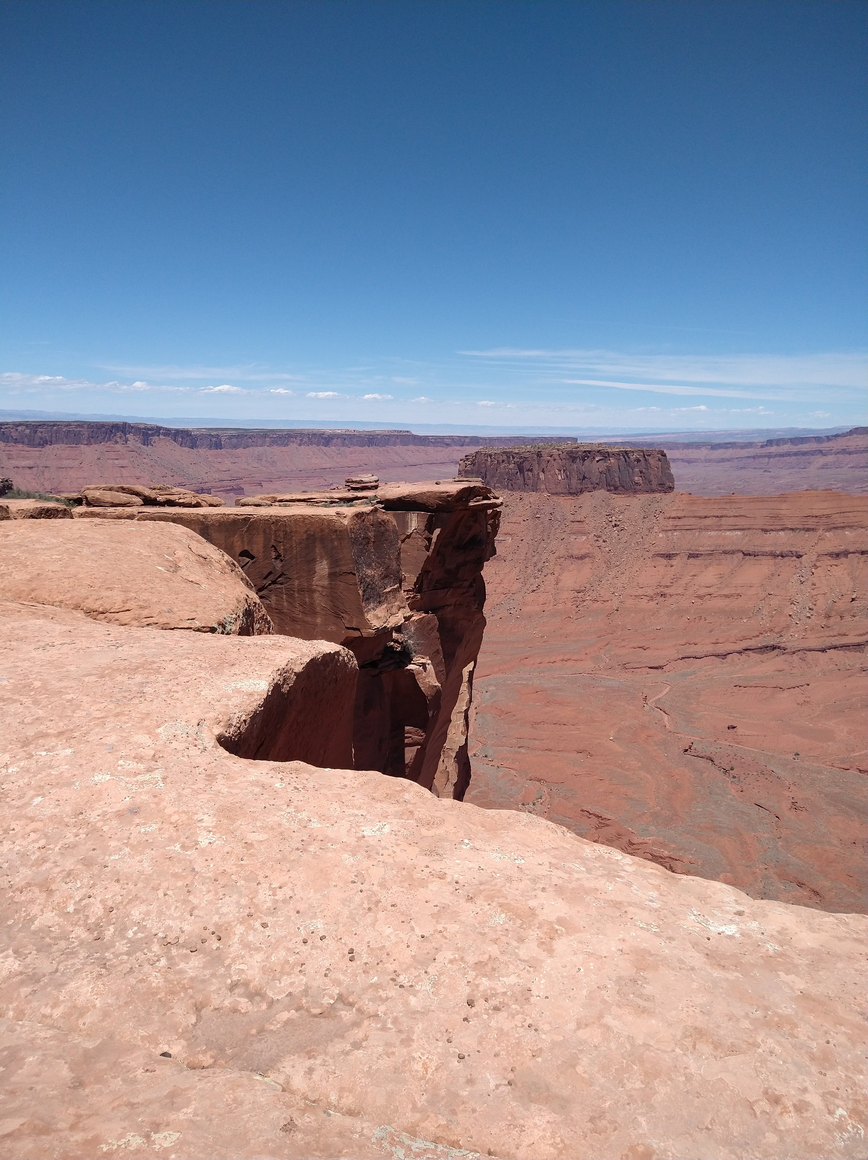
Down about the thought of ending early, but relieved to have a destination we’d reach that day, we paddled a bit slower and tried to take in some extra moments on the river. A huge bend revealed a beautiful amphitheater where we took a break to gawk at its massiveness. Further downstream, a loon exploded out of the water only to land a few hundred feet away. We followed it as it floated downstream, sometimes flying a bit ahead if we got too close. A fish, like a pretty big fish for the level of the river, startled me when my paddle almost touched it. It splashed upstream with its dorsal fin exposed above the water. We purposely grounded to take in Stephen’s Arch as it gaped open and exposed a peek of the sky beyond the canyon wall.

When we arrived at Coyote Gulch, I barely recognized it as the bubbling tributary I had hiked maybe 5 years ago down to this river. I had remembered walking in water throughout the whole gulch. Now, it was damp mud, unable to supply anything to the Escalante. We pulled out at the gulch and took another photo with the sign for the Live Your Dream grant. This was actually referenced quite a bit during the trip when one of us would ground our boat and ironically claim, “living the dream!”

We found a place along a large overhanging section of the canyon to set up camp. Soon our old pal the wind came along, stronger than ever, and we realized we were still not done working. We lashed the rafts together and put rocks in the bottom of one to create a wind break for the bivy. As soon as we were happy with our work and climbed into the bivy, the wind changed direction, completely. Wind now blasted downstream, towards us and were now upwind of the raft wind break. Too tired to bother, we pulled the sleeping bags over our heads and still tried to sleep.

Day 9:
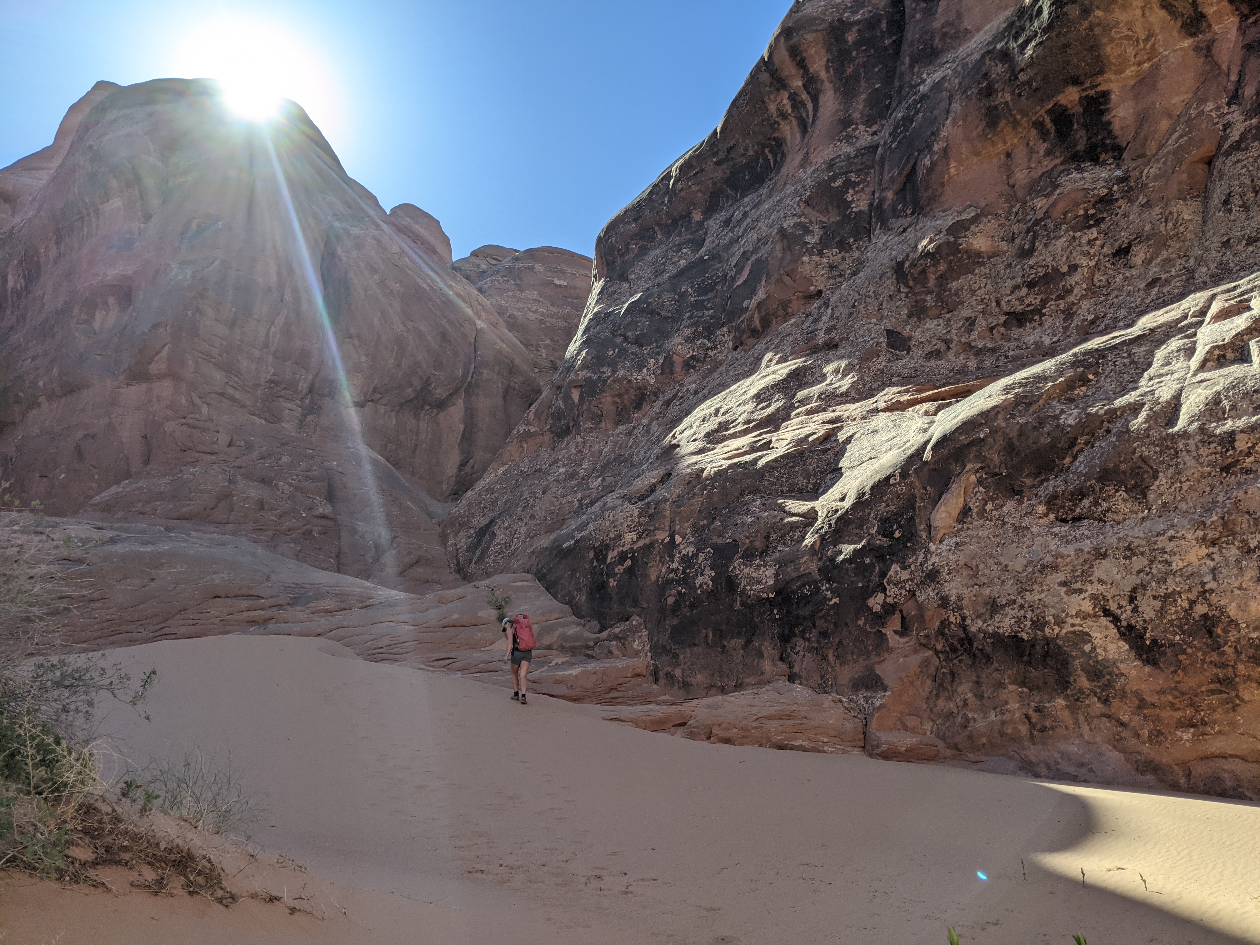
We woke up with sand in our teeth and irritated eyes the next morning. Though we’d be pulling out of the river early, this hike out of the canyon was longer than the original hole-in-the-rock exit trail we had planned to take. We rolled up our rafts and strapped them to the outside of our packs. Somehow they felt just as heavy, even though we had gone through the majority of our food. We didn’t want to hike the entire 7 miles out via the gulch so we opted for a more direct, and steeper, trail out of the gulch that would shave off nearly 4 miles. Looking at the topographic lines on the map, I knew we’d be in for a long slog. We gained the first few hundred feet pretty quickly on slickrock, but the next 400 hundred feet were plodding slowly up a “sand mountain.” One step forward would slide half way back. We weren’t in the shade of the canyon anymore and every drink we took reminded us there were no more places to refill now that we’d left the river. Not to mention we may still be needing to hike the ~30 miles back to the car, if we couldn’t convince a stranger to give us a lift.

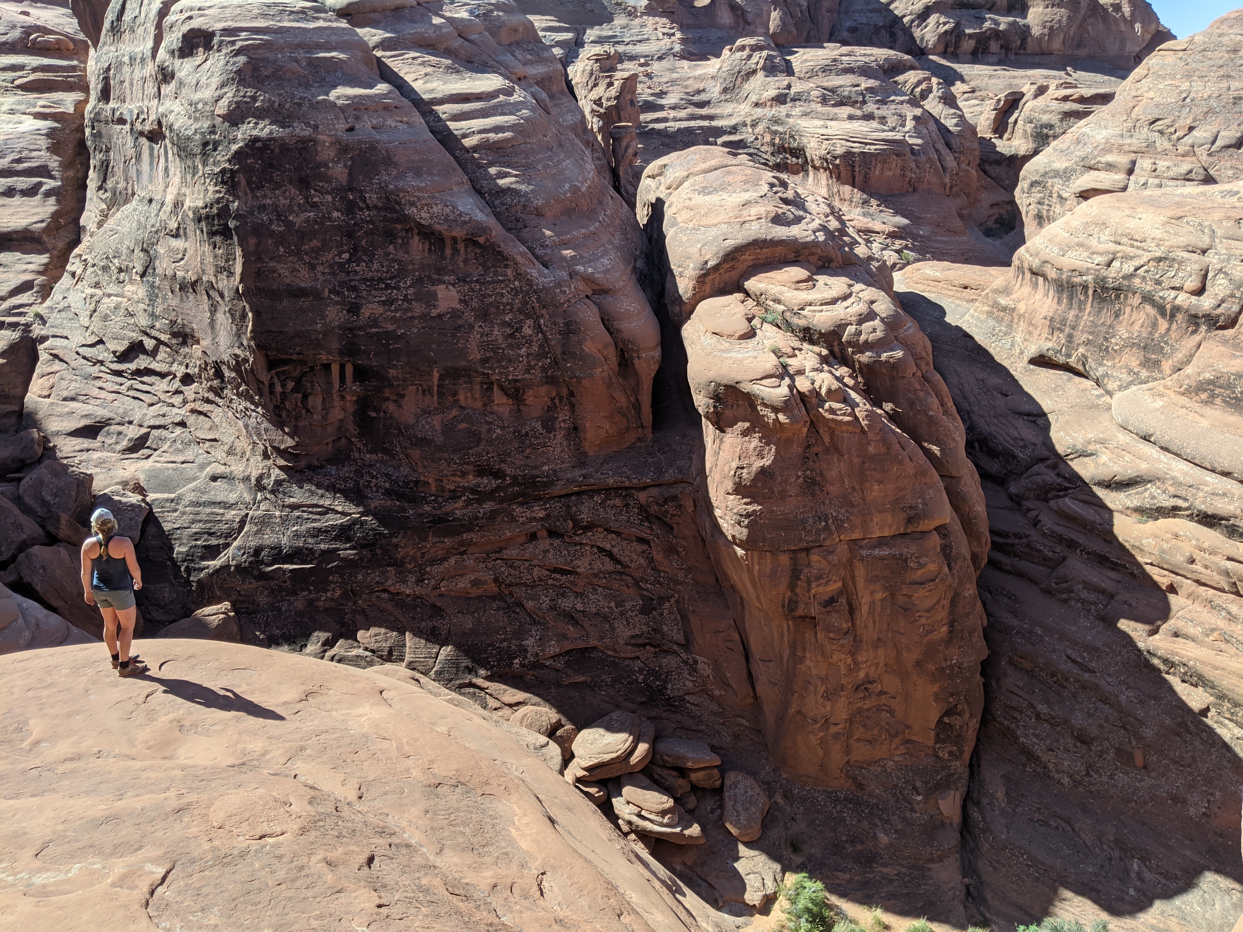
The sand mountain ended at a cliff band that would require a scramble. As we approached, a couple was headed down and lowering their packs with a rope. The scramble involved a squeeze we were told and soon the guy offered for us to use his rope and help haul our packs up. Andre joined the man at the top of the cliff while I chatted with his partner and tied the packs one at a time to the rope. It was weird trying to make small talk, something I hadn’t had to do in over a week. I talked a lot and asked a lot of questions, most likely overcompensating for my introverted nature. The guys struggled pulling our heavy packs up and over the ledges. The rope looked old and tattered and I really hoped the bags wouldn’t come crashing back down. When they saw we had paddles there was more explaining to do and they told us we were crazy, and awesome. The friendly encounter and chatter resupplied our energy levels and we lifted our bags back on without as much moaning. Once we gained the canyon bench, we skirted around sandy patches and tried to stay on the hard slick rock. It was still a few more hundred feet of elevation to the parkinglot and we took breaks together and individually. It was getting real hot too as now the cold front had been swept through.
At the parkinglot we plopped down next to our packs and tried to strategize how we’d get a ride down the road. There were a lot of pick up trucks so we were hopeful someone wouldn’t mind us tagging along with their gear in the back. A group of a dozen or so hikers emerged from the trail within 15 minutes and we thought we were in luck. I assigned Andre the task of smooth talking since he’s better at it. When he asked the group of early 20 somethings about a lift, they said they had a lot of stuff to pack, but would let us know. A few minutes later, all four cars/trucks they had piled into disappeared down the road… we got our answer.
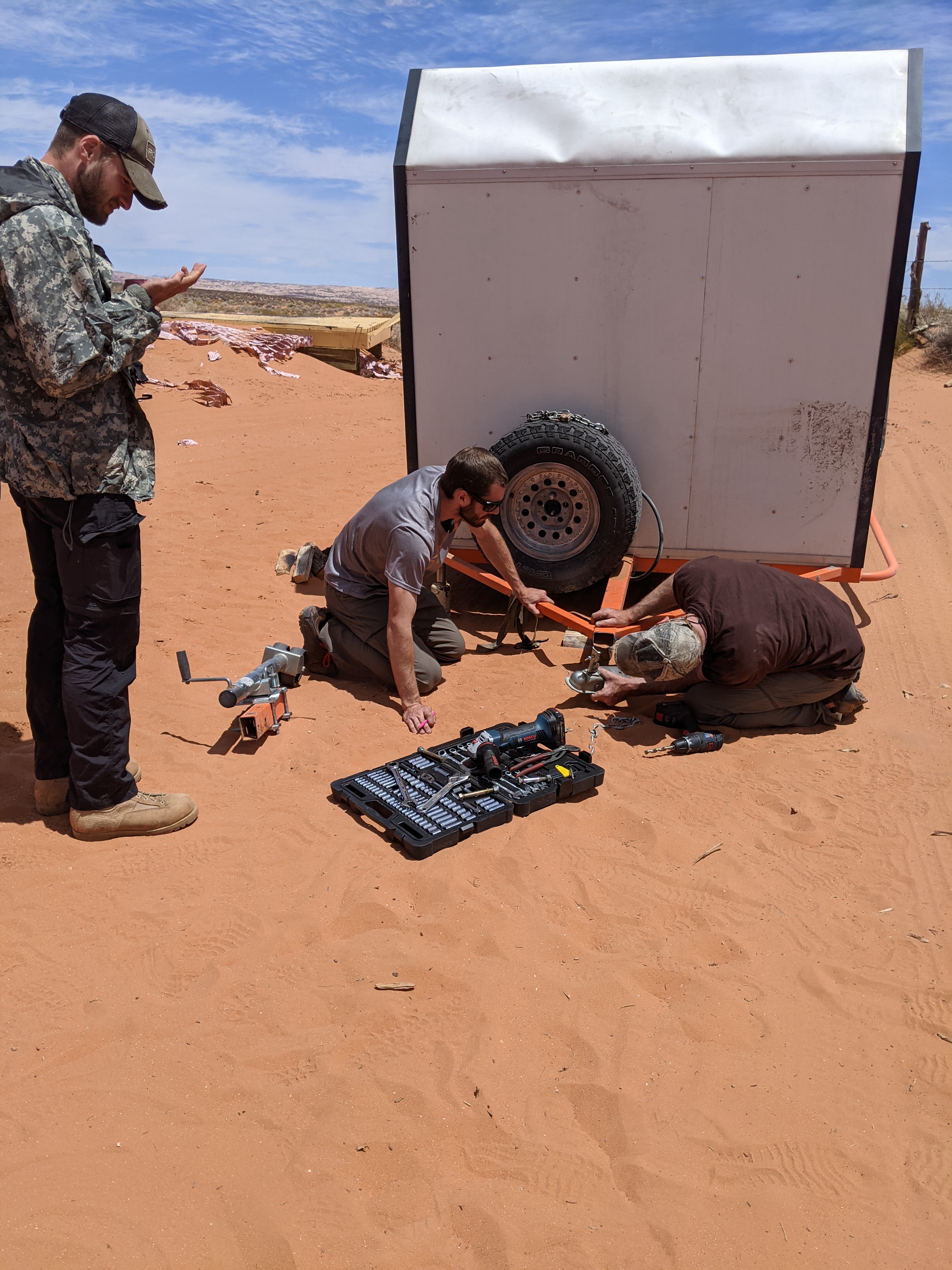
An older man walked in from the road and wandered around the lot, meandering over to us. He told us he lost his son and son’s girlfriend on the trail. He thought they knew which turn to take but apparently they had taken the wrong one and were now backcountry hiking to meet him at this parkinglot. We told him our predicament as well and he offered to give us a ride once the rest of his party showed up. We saw them long before they got there, slowly making progress in the sand and clearly exhausted. Some frustrated words were exchanged once they were in hearing distance and we could tell it had been a long day for them. Nevertheless the young couple was happy to help us out and we squeezed into the back seat of the huge Dodge truck. The truck had a camper built in the bed and was towing a trailer that was also outfitted. The road was deep and sandy here and we found out, once they started down the road, they felt like they didn’t have a choice but to try to send it since there was nowhere to turn around.
Since the rig was so heavy, in order not to get stuck in the sand, the son drove hard and fast down the road. The truck bounced and bucked as we hit the washboard ridges of sand in the road. Within the first mile of riding with them, something flew off the back at some point and the son realized the father forgot to securely attach one of the boards. They got it but returned with worse news… the trailer hitch had snapped, completely. The jarring was too great for whatever flex the trailer could have and now it was completely detached from the truck. Out came a huge battery, welder, and saw. They were from Pennsylvania and offroading was serious business up there, getting stuck was the point and to get yourself back out was the accomplishment. We held the nuts and bolts for them as they went to work. They decided they’d cut the actual hitch from the long stem that had broke and weld it on closer to where the joints of the trailer met. While we tried to help, the son took a snapchat video and was bursting with excitement – this was definitely his idea of a good time. We were captured in the video as he gave his social media update, “in the middle of nowhere, picked up these two hitch hikers, and broke my trailer…” followed by a whoop and a big smile.

Another truck came along and recognized us from the hike out. I remembered them too since they had asked about the paddles. The family assured us it was alright if we jumped ship and that it could take them upwards of 5 hours to get their trailer fixed. We hopped in to the next truck with the hiker, drove a few miles, and picked up his wife from the other trailhead. Apparently it was quite popular to leave a car at each trailhead to not have to hike the full 7 miles each way in the gulch. The couple was from Salt Lake City and described their weekend as a short adventure and break from their three kids. They were really friendly, but we felt like the Pennsylvania family was more similar to us. We rode with them for about 25 miles before they dropped us off at our final road, the 10 mile road to Egypt Canyon trailhead where the Xterra was parked. We thanked them a ton and hopped out.
Once out of sight from the cars, we stashed our packs under some bushes and grabbed a daypack with the rest of our water and some snacks. I didn’t want to jynx it by saying it out loud, but we were making incredible time. Even if we had to hike the full remaining 10 miles to the car, we would still get there before dark. Thoughts of even making it in time to drive out of the desert and find a cheap motel in the town of Escalante teased my mind. We set off at a quick pace and looked for our water stash along the side of the road. Like squirrels that lost their acorn stash, we zigzagged back and forth across the road. Was it a clump of trees or just a bush? Couldn’t we see a hill off in the distance when we stashed it? Well, I had peed on the side of the road while Andre stashed it. But why couldn’t I remember where I peed? Surely I was looking around for cars. I had tried to drop a point on our map in Caltopo but without reception it didn’t save. We were now wasting too much time and energy to justify the search. Someone must have seen it/our tracks to it and picked it up, or we were going absolutely crazy.
A few miles down the road a Subaru approached coming from the direction we were headed. He asked if we were alright given that no one would be walking this road unless for a reason. We confirmed we were and when he offered us some water, we dropped our pride and accepted it thankfully. We would have been alright, for sure thirsty, but now we wouldn’t have to conserve or worry. We thanked him and waved as he drove away. (The next day in town I recognized his Subaru in the parkuing lot as we waited for the Burr Trail Grill to open. He was confused at first when we approached, he said he didn’t recognize us without our sunglasses and hats on. Then we all ate burgers together and shared adventure stories and it was awesome.)
A few miles later up the road we heard a car coming from behind us. We waved excitedly and asked how much further they were going. It was an older couple, retirement age, and they said only for a mile or two longer. They were just doing a scouting trip to see if their Sedan could make it to the trailhead. No more than two miles it was but before we shut the back door he reached into a cooler and handed us a Coors Light to share. The beer was cold, it was good.

I could feel the sand in my approach shoes and the blisters forming during the last few miles of the walk. Determined to get to the end of the road, I ignored them and we pushed forward at a quick pace. The sign for the trailhead appeared and soon we could see the rental waiting just where we left it. At the car, I realized just how big the blisters were as we kicked off our shoes.
We drove back to our packs, loaded the car, then drove for the final leg of the washboard road back to town. I hung half way out of the passenger window waving my arms as we passed our Pennsylvania friends slowly driving their patched-up trailer to town as well. We met them at a gas station and learned that they also snapped the drive shaft of the truck, which they fixed with some barb wire from a fence nearby. A temporary fix for sure, but they hoped to make to Bryce Canyon within the next few days after taking it to a car shop. We lucked out and booked the last available room at The Cowboy Inn. We took extra long showers and watched the dirty water wash off of us and down the drain. We drank beers and ate potatoe chips, watched junk television, and lounged in bed. It felt well deserved.
Looking through the photos the next morning, we realized we did it. We hiked, canyoneered, rafted, and hitchhiked. Nine days packed full of adventure and challenges. The trip was intended to be hard, and it was. We got worked and worked together through canyon obstacles, long days paddling against the wind, and being smelly and dirty but not having a care in the world except the adventure we were on.
Extra shenanigans in Utah:
Since we pulled out of the river early and did not have to walk the 40ish miles back to the car, we had a few extra days on top of the days we had already planned to be in Moab. Talk of a rest day was quickly dismissed as we each offered suggestions for cool things to do. Andre had never been around Moab so I wanted to show him everything I could.
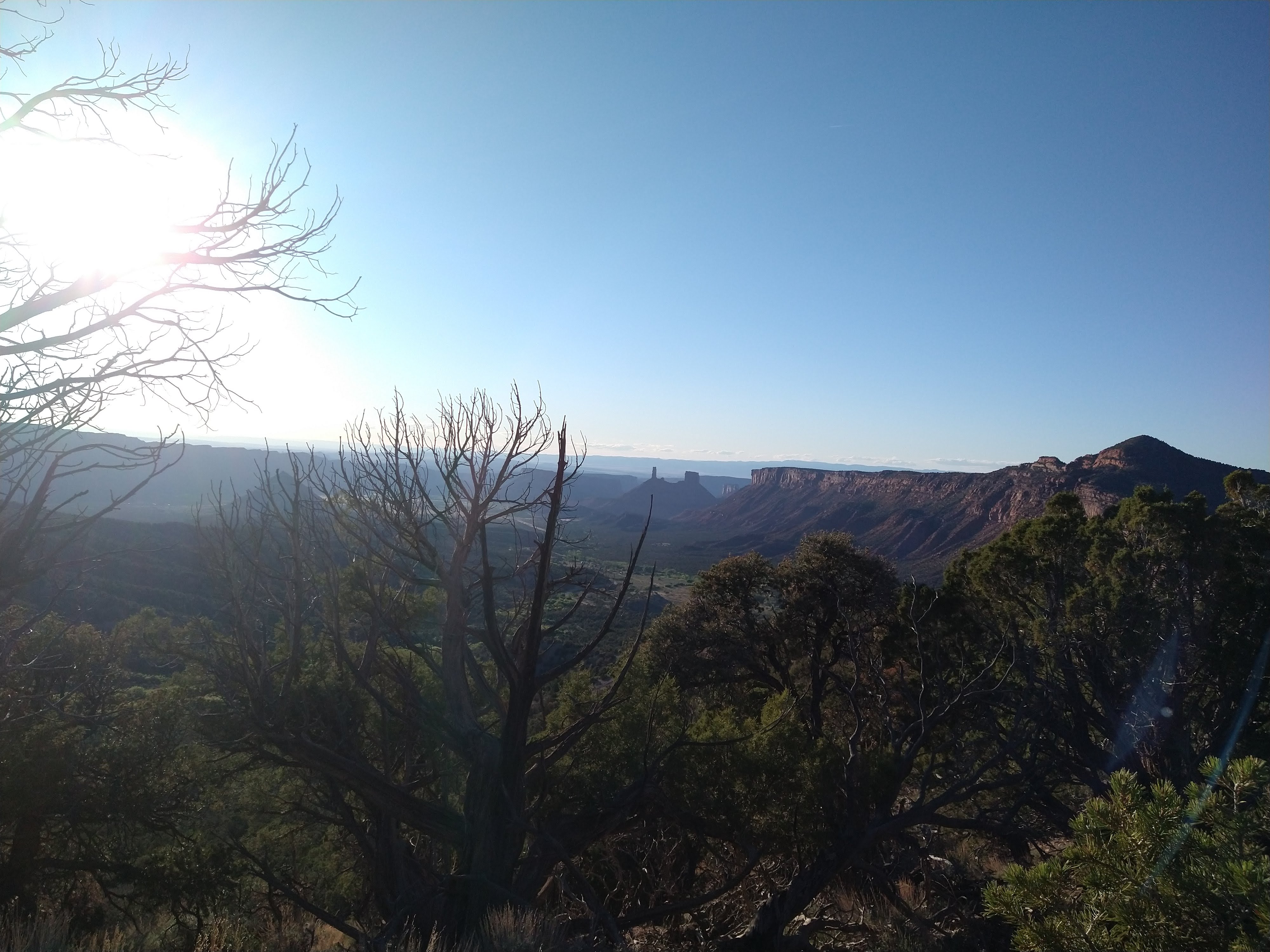
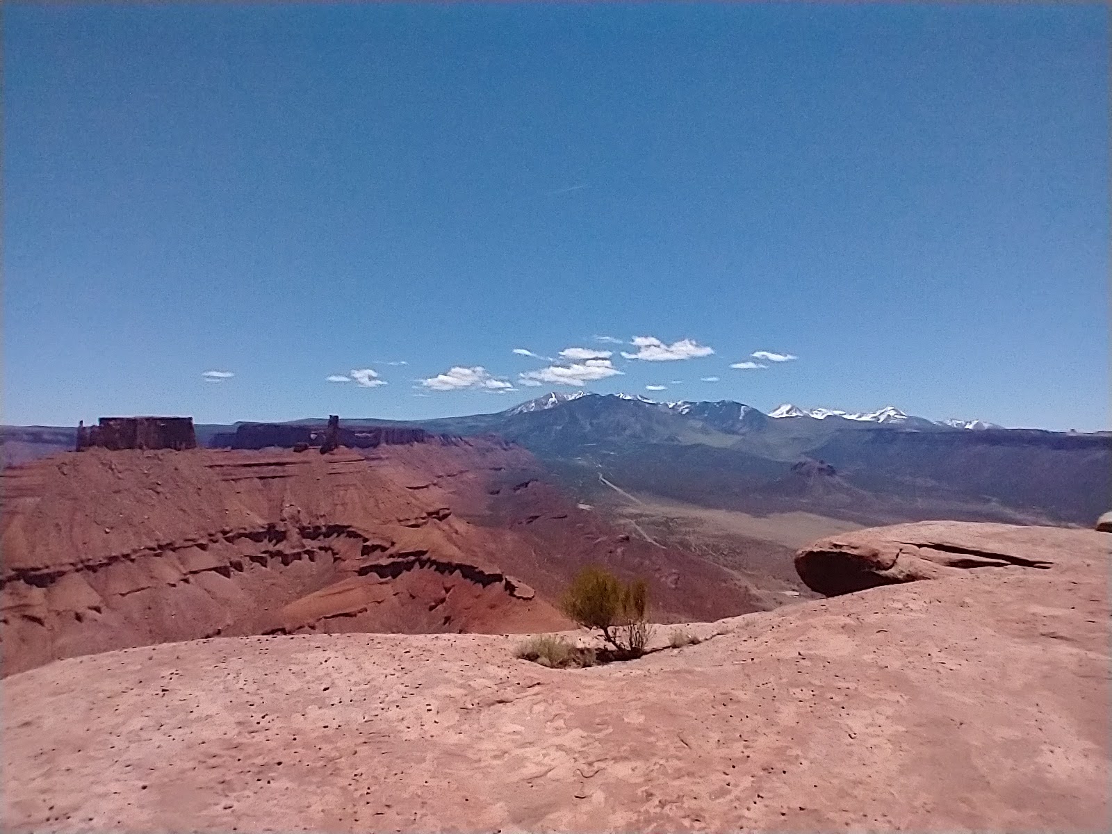
We drove through Dixie National Forest, way up high above the canyons, then snaked our way down into Moab. We drove through Arches National Park, then up into La Sal mountains to camp.


Over the next week we tried a sample of everything… We did a “redneck via ferrata” up Parriot Mesa in Castle Valley.
That night we camped near Looking Glass Arch and the next morning climbed the arch to set up a rope swing (which was so fun!!). That afternoon we went into town and got burgers, then drove to Willow Springs road to camp on BLM land and see all the different types of people that come to the desert.


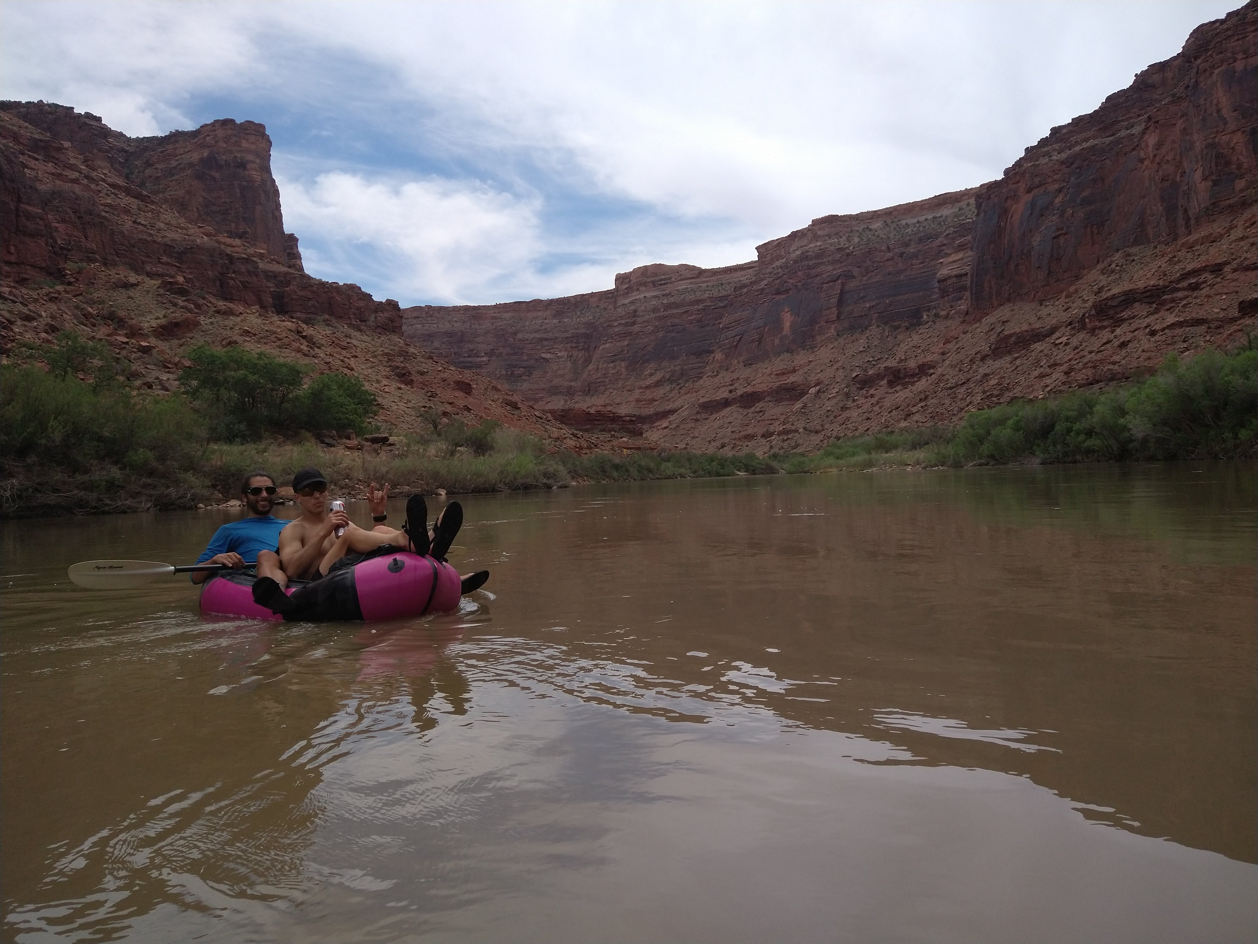
We followed the next day with a technical canyon/scramble, Elephant Butte, then swam in the Colorado River at a campground to wash and cool off.


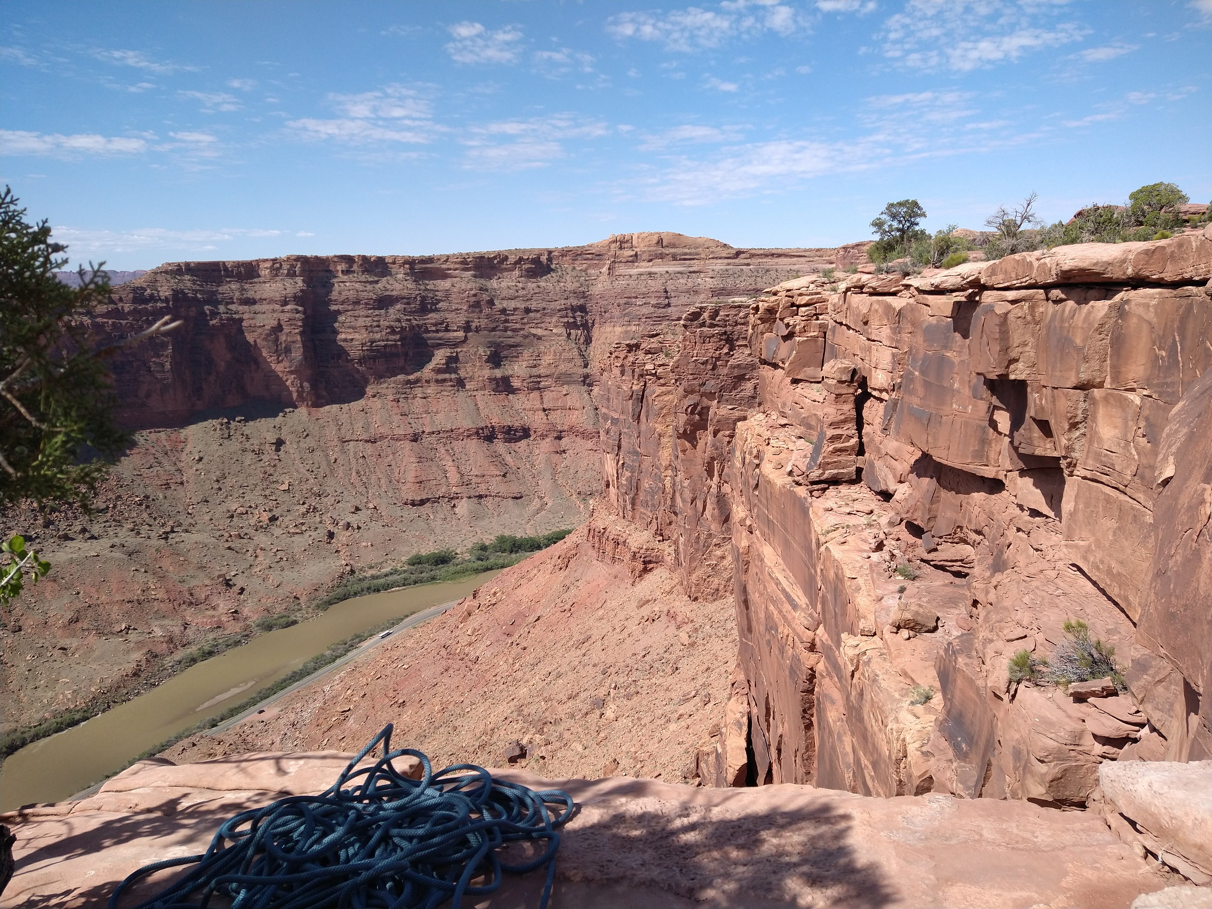
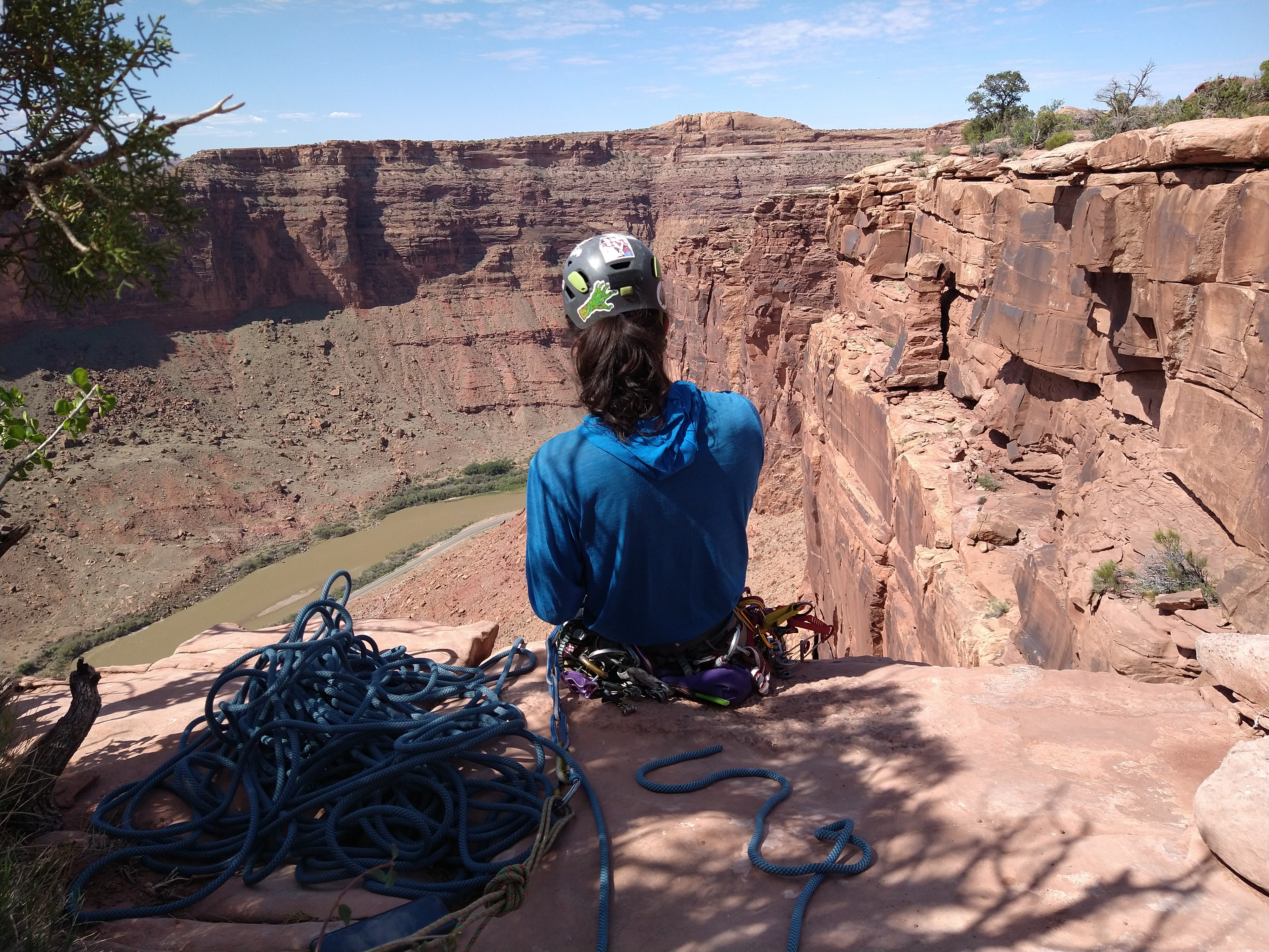
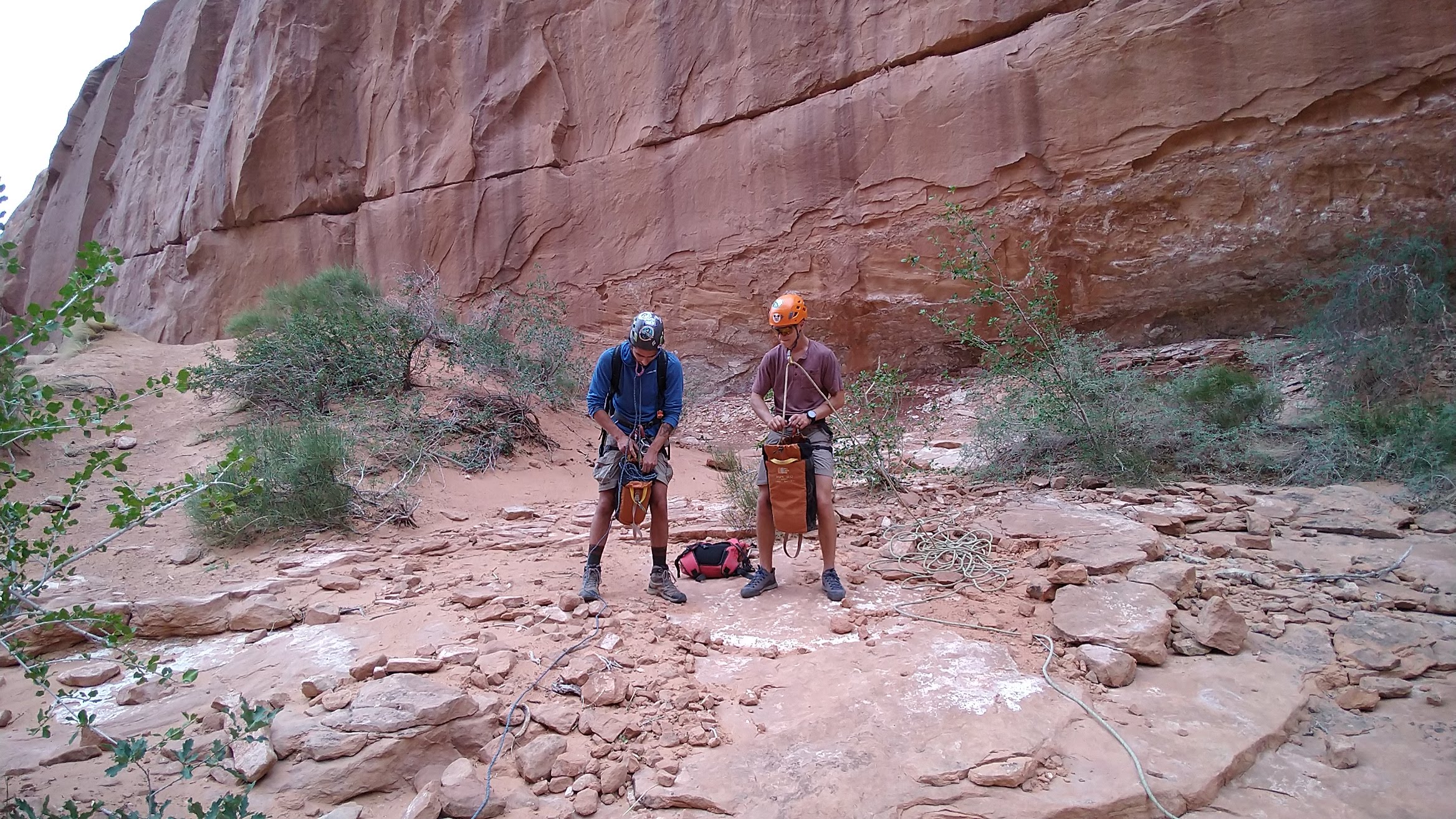
Climbing a route up a canyon wall was next and we swung leads on a classic 3 pitch climb, Terma, up in Utopia area above the Colorado River.

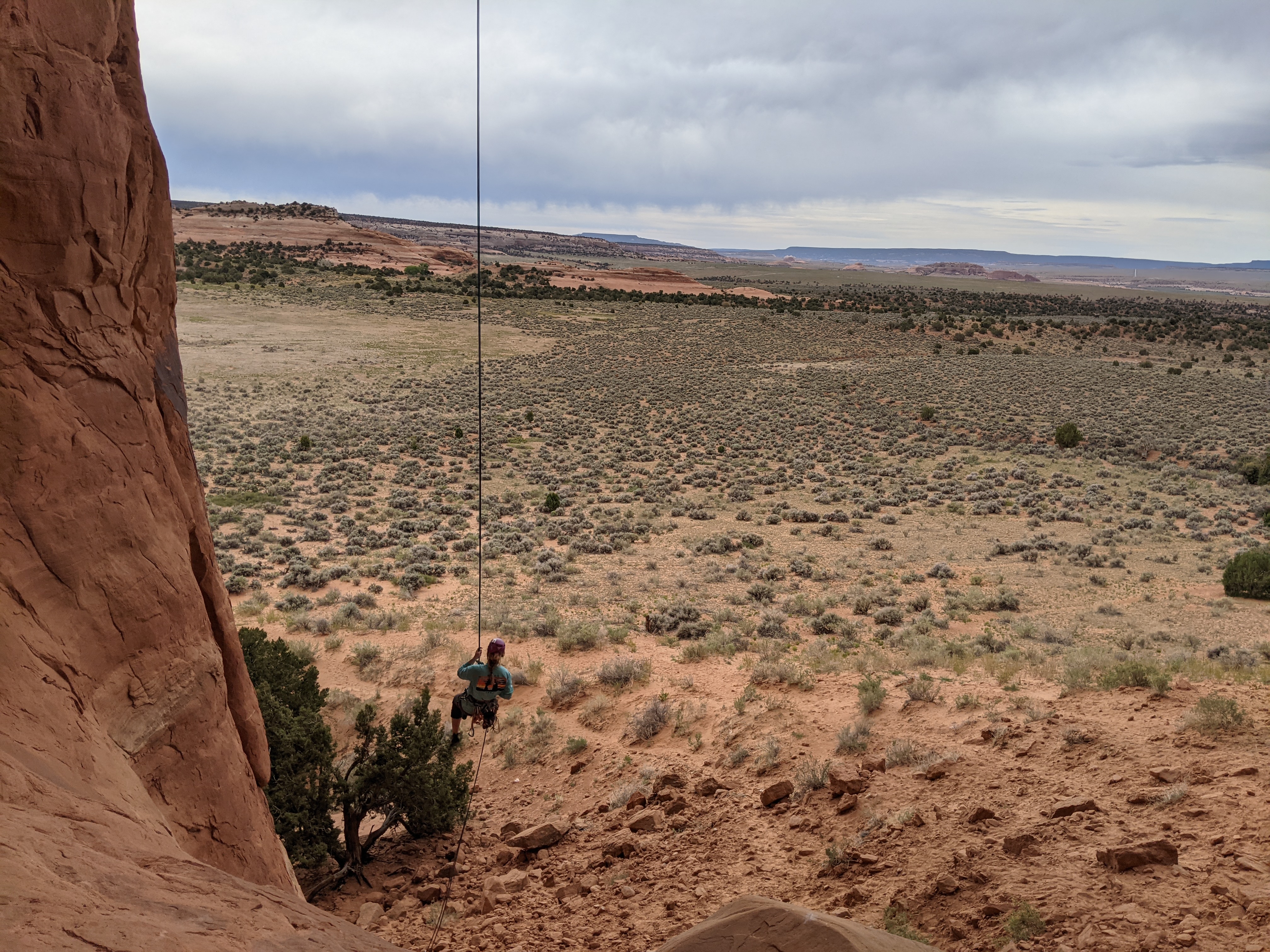
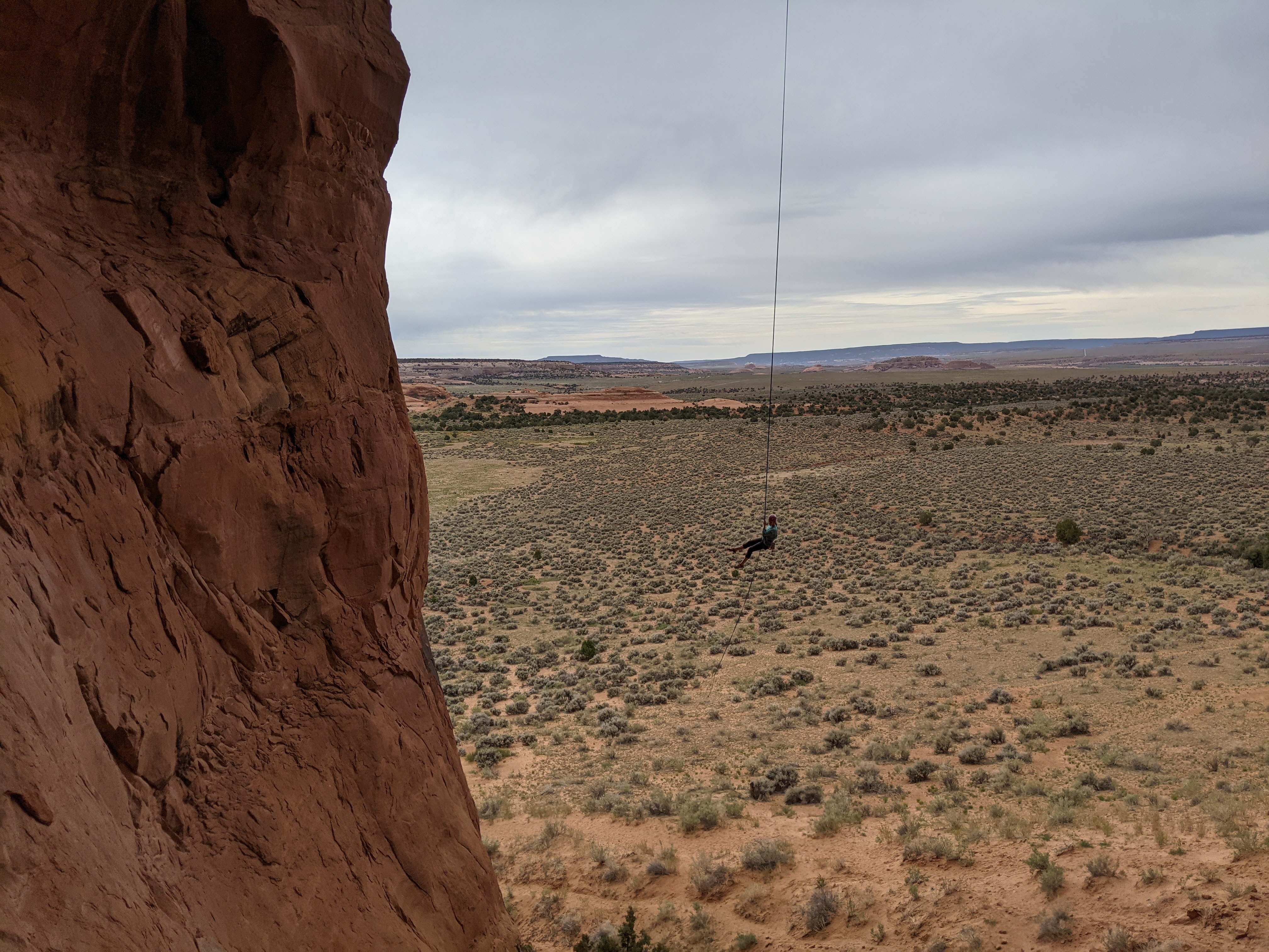
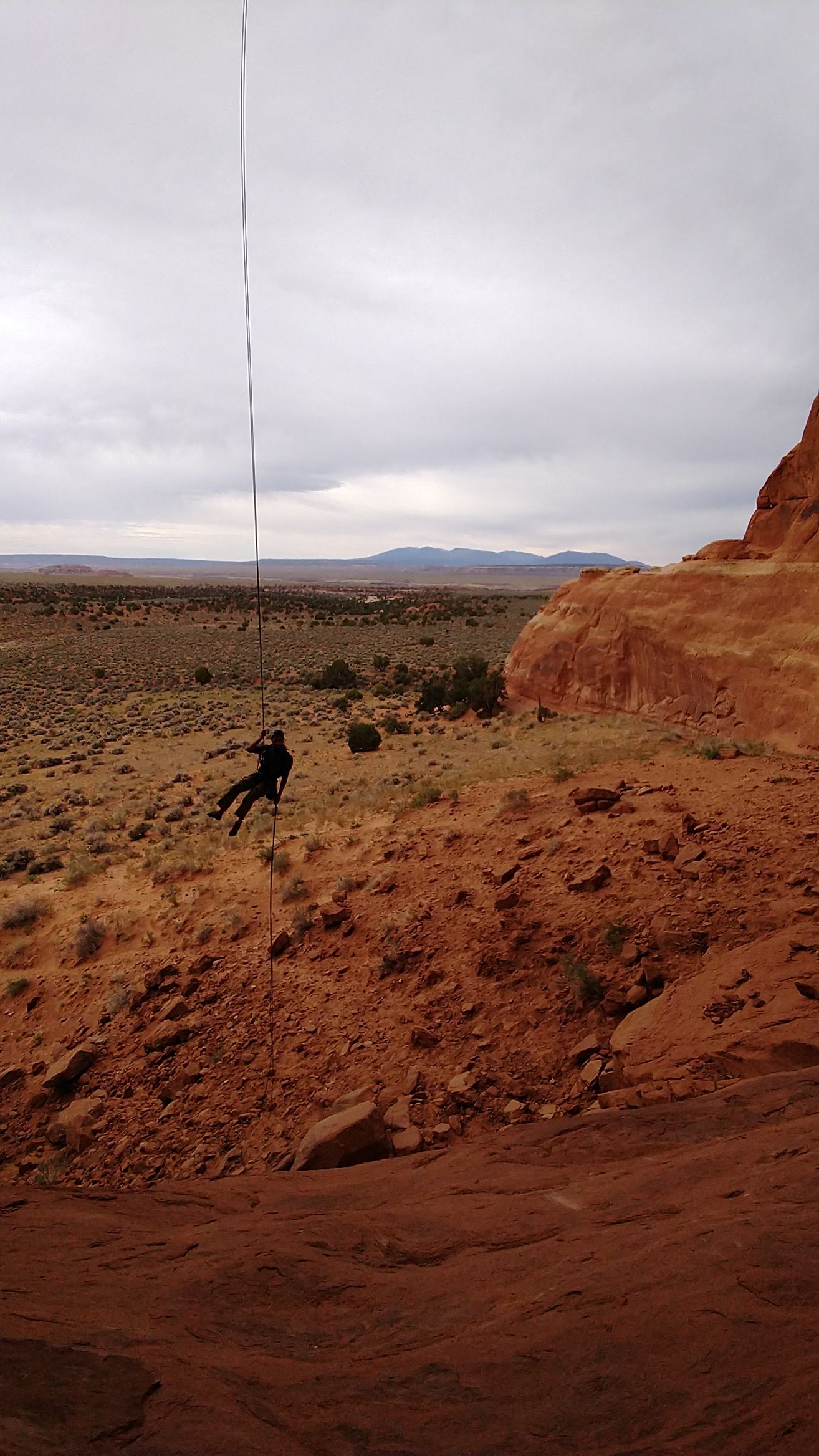
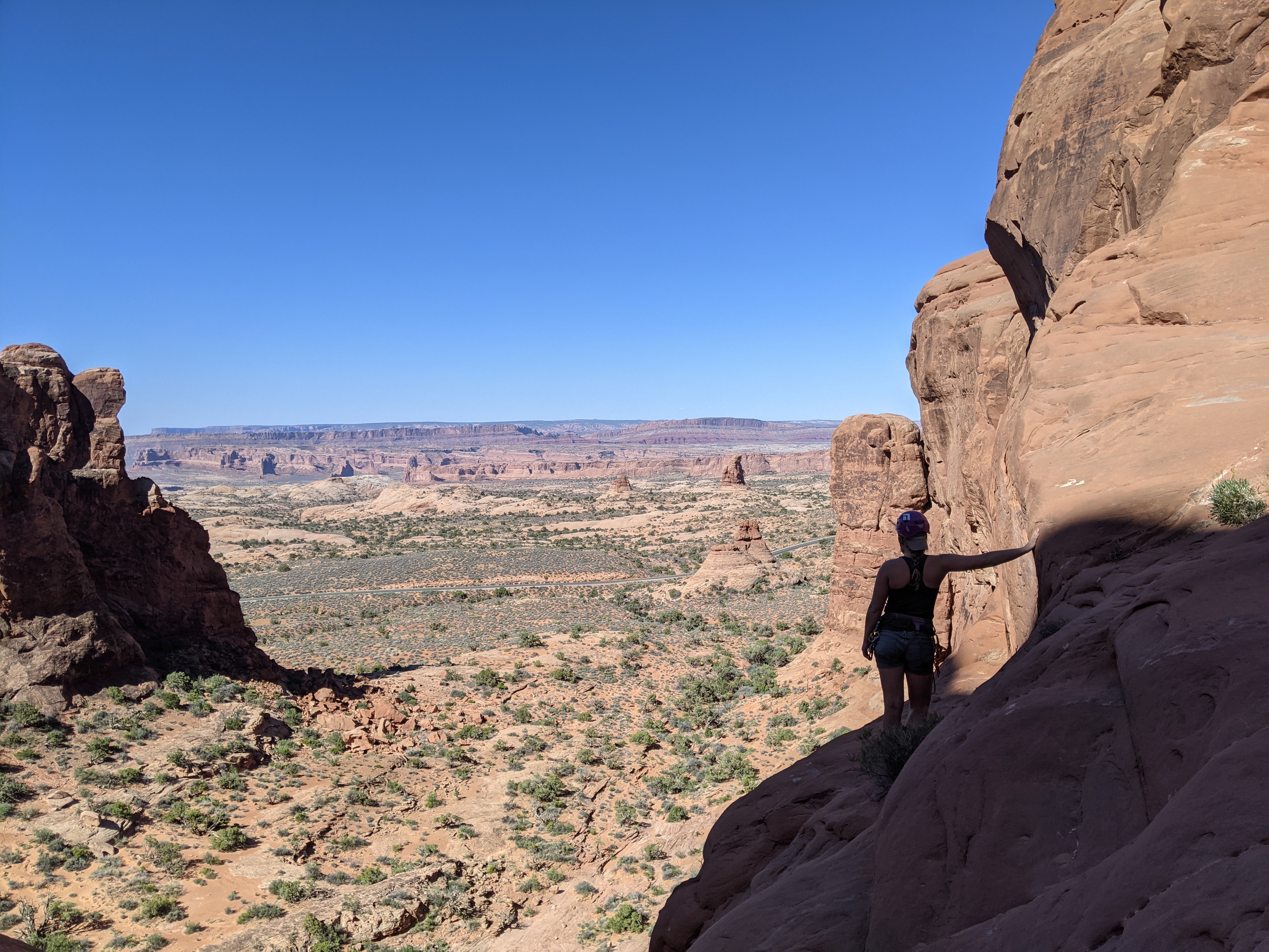
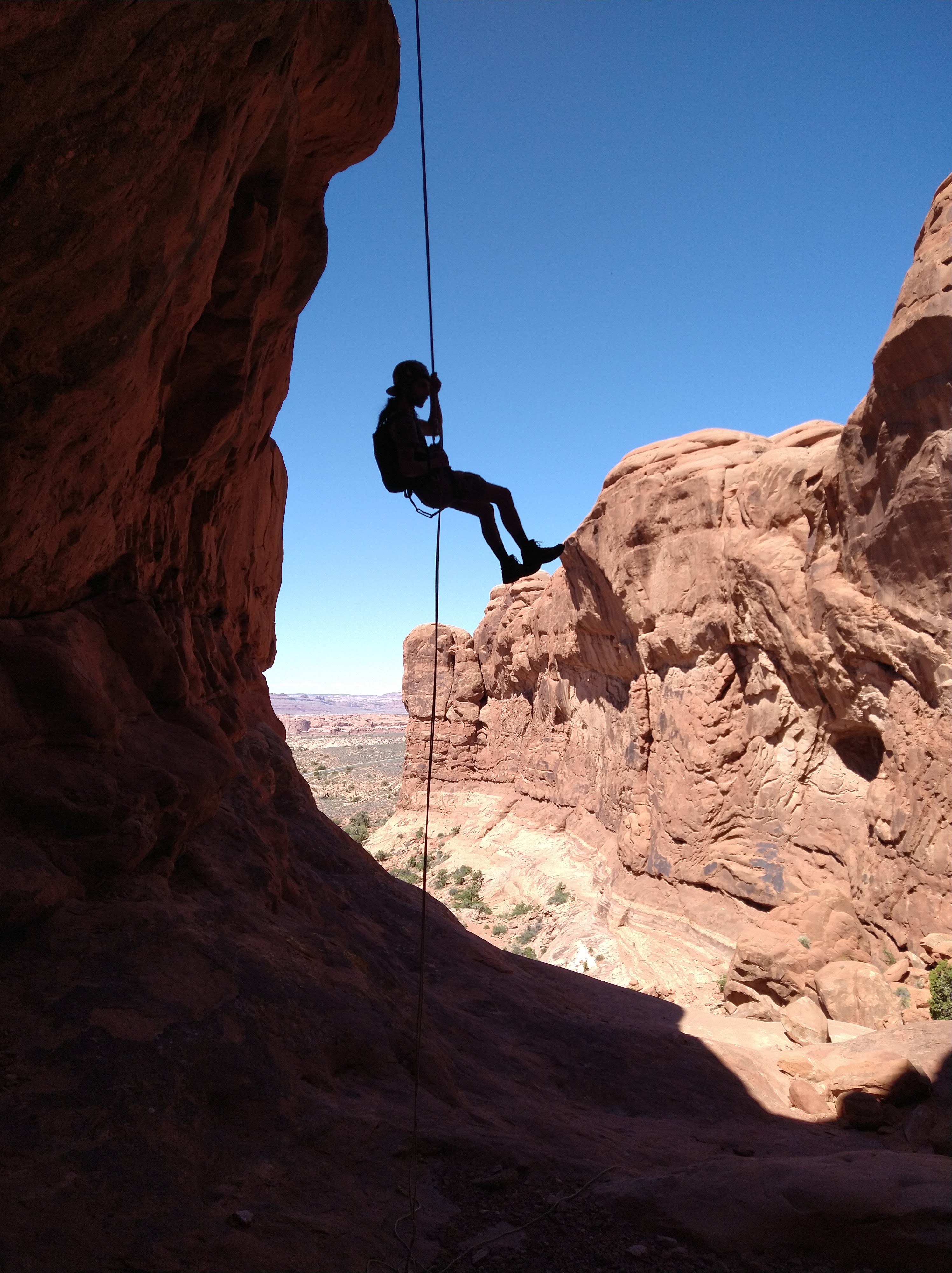
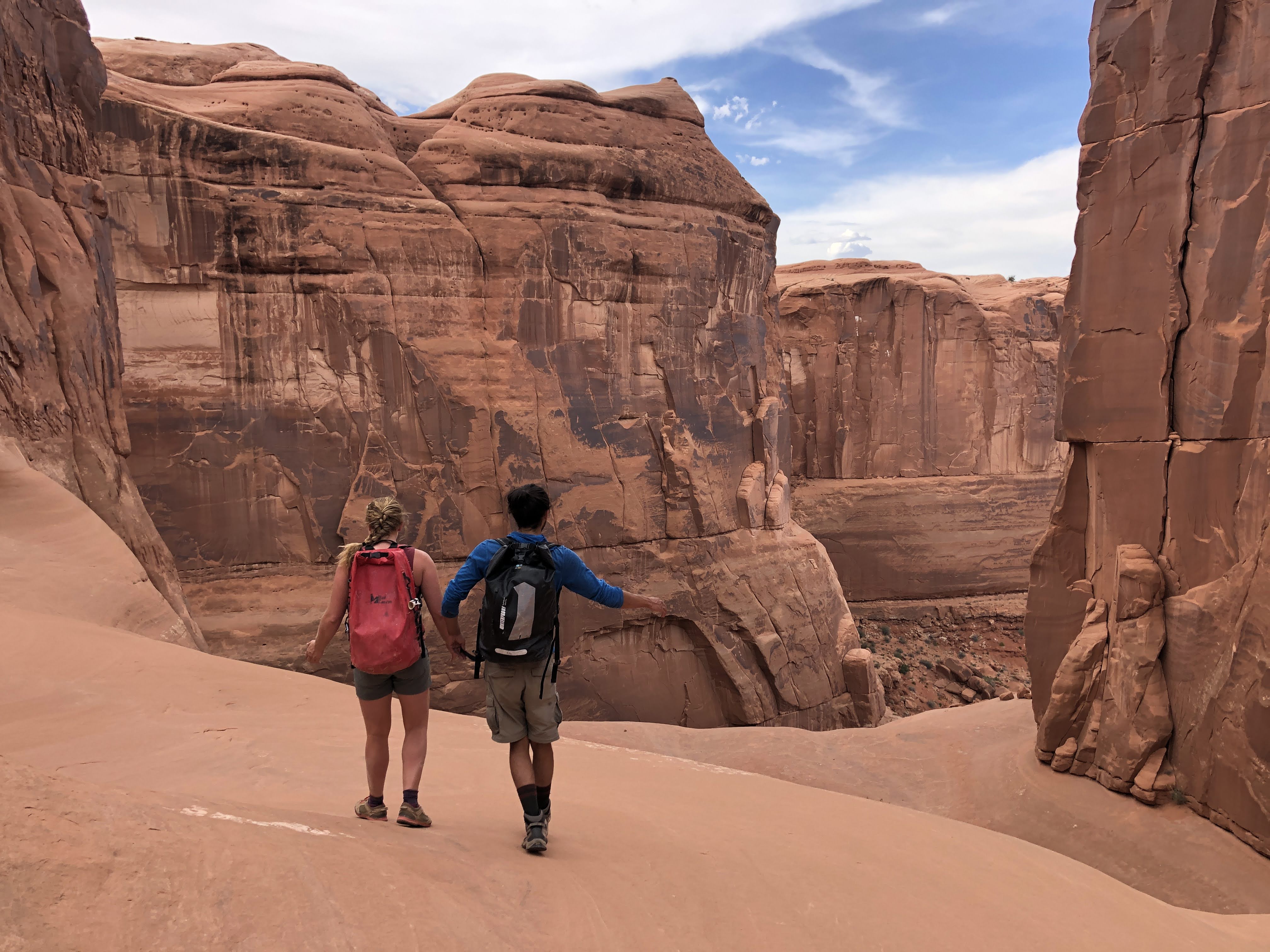
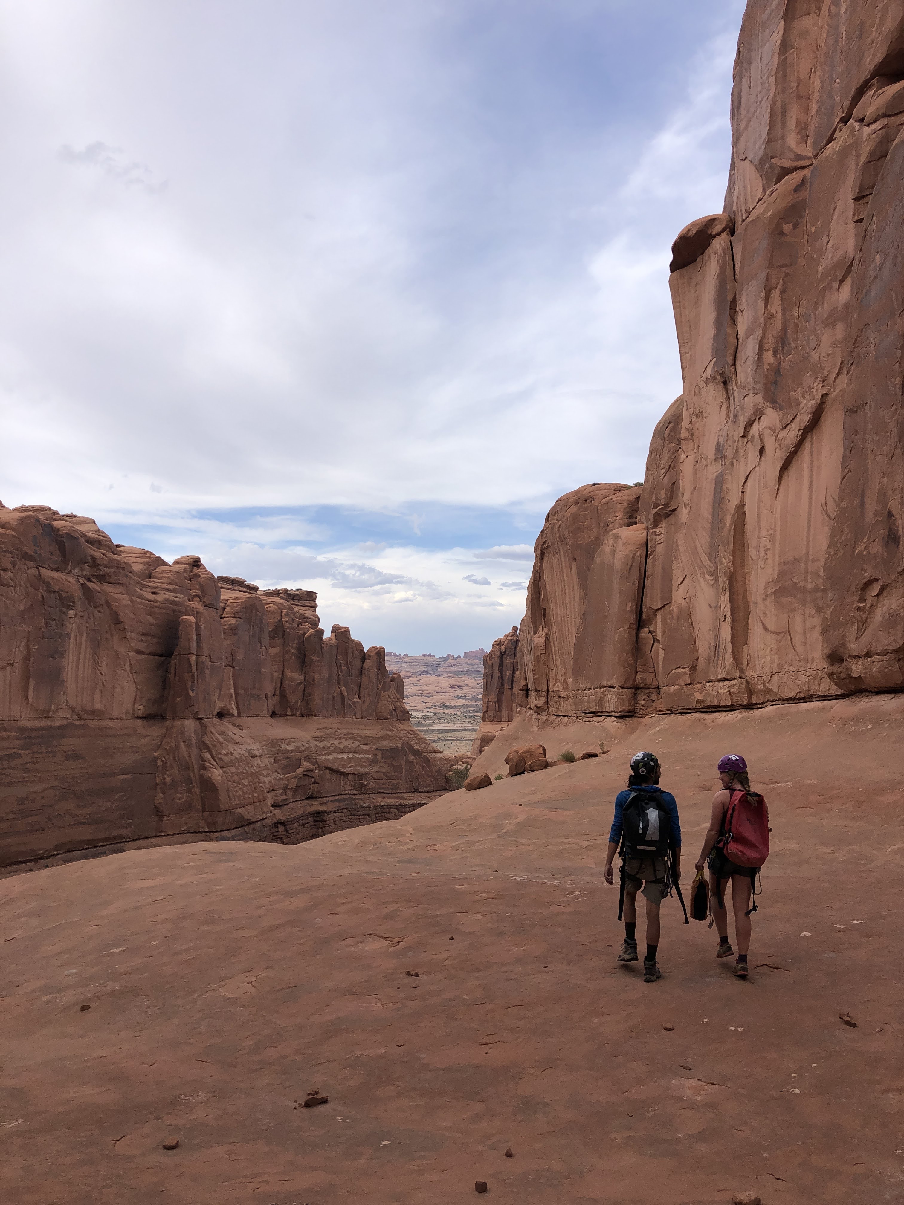
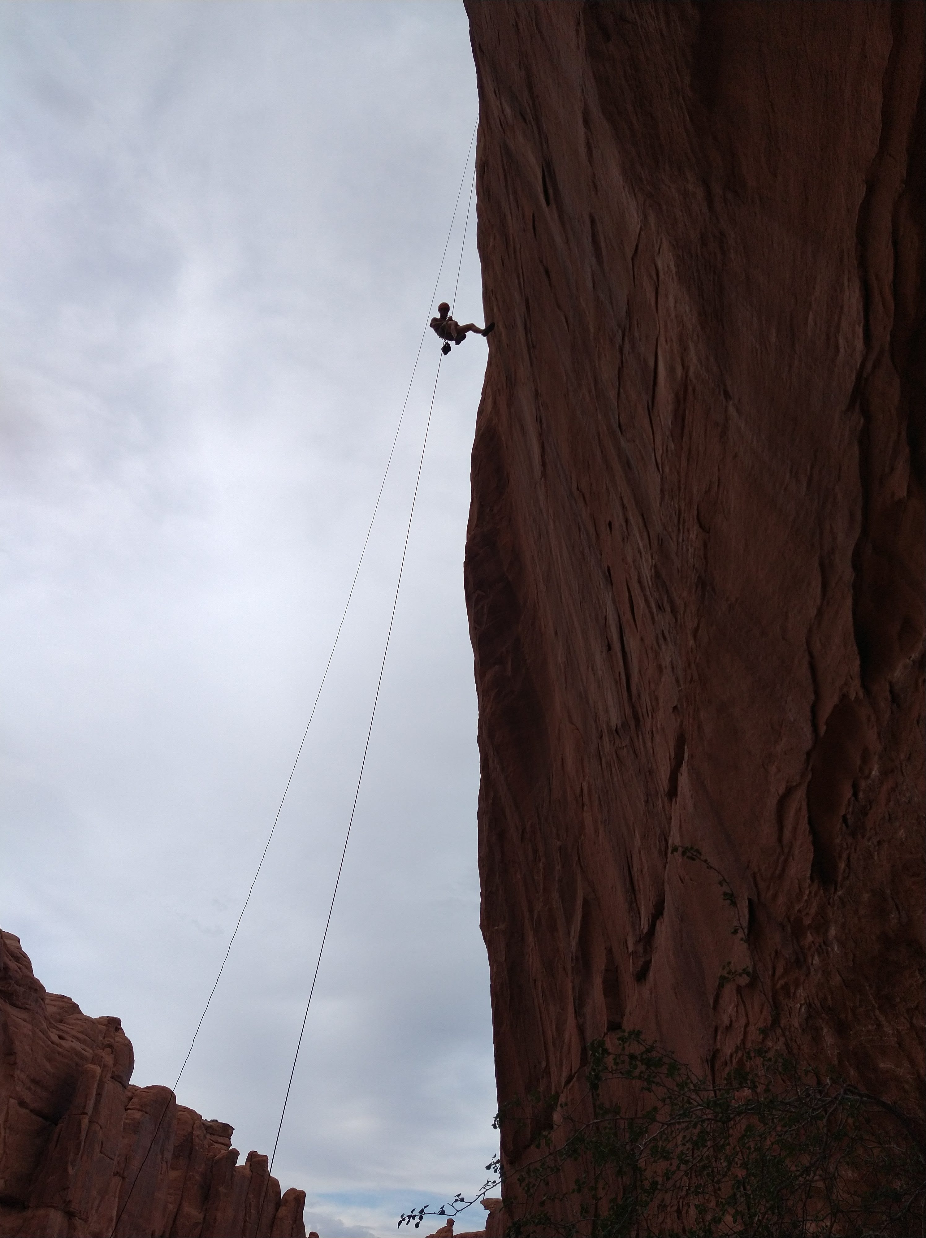
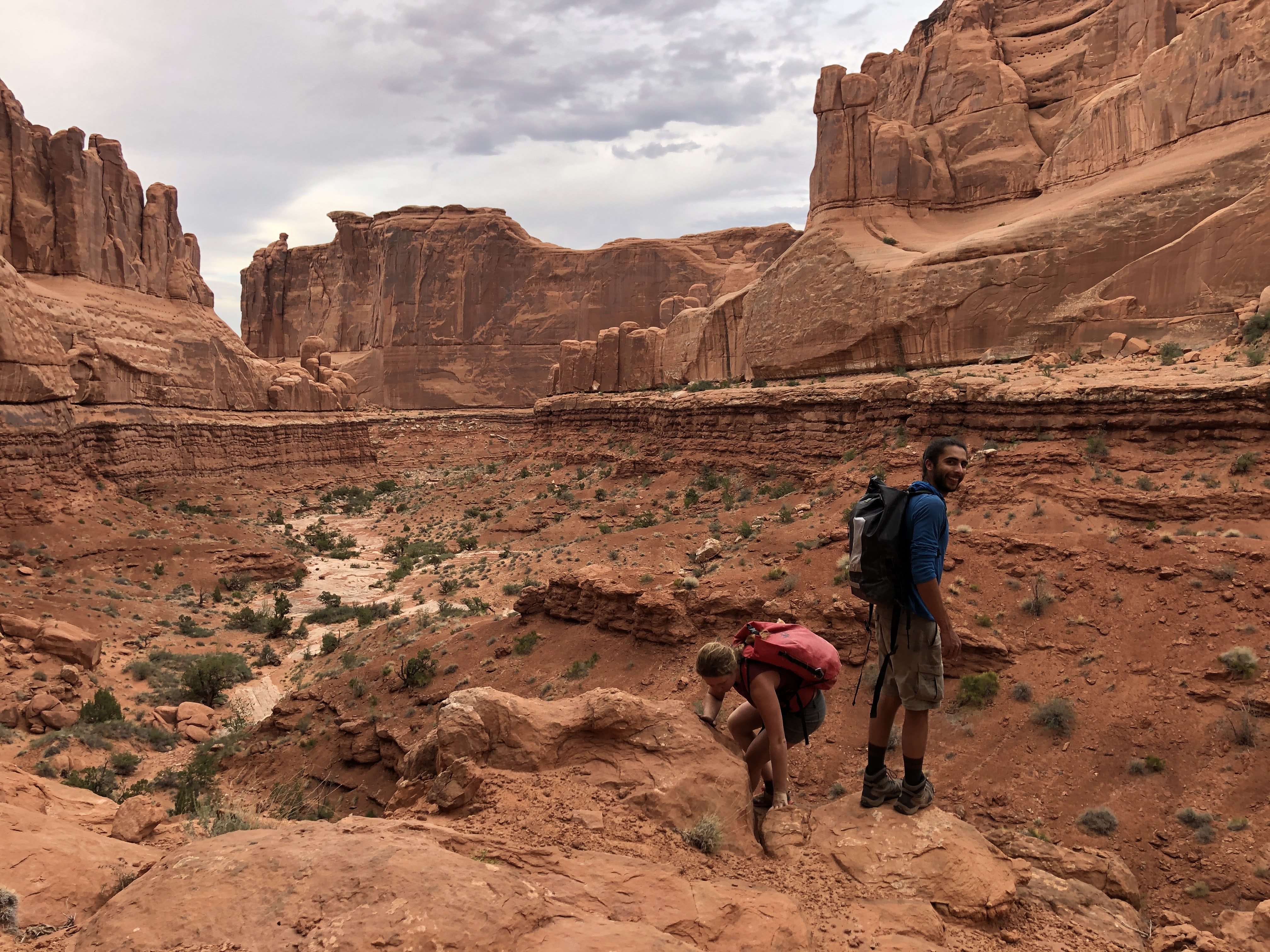
We camped at a rock formation called “the sphinx” and Andre’s friend, Rob, from Colorado came to play for the weekend. Saturday morning the three of us climbed the sphinx, a route that I had been wanting to do for years because it looked so fun. After the climb we spent the heat of the day rafting the Colorado River with the guys doubling up in Andre’s raft leaving me unable to stop laughing as I watched them ride the wave trains. In the evening I took them through Tierdrop Canyon in Arches and was pleased as I heard their expected excitement when we rappelled down the last big wall, at least 100 feet high.


We didn’t stop until we had to and only did I start packing around 10 PM the night before my flight. I’d leave the guys in Moab, who would do Six Shooter on Sunday and then they’d leave for Colorado for a week of more play. We packed in more adventures and fun into Moab and surroundings than I thought would be possible. It was a pretty great way to follow up the adventure from the expedition.

I read every word and can’t wait to get to the next part of your adventure! Like I said before, I may not understand all the terms about hiking and boating, but I love your descriptions of things you meet along the way. And may I say Kelly, you look SO happy! Love you, Aunt Pat
LikeLiked by 1 person