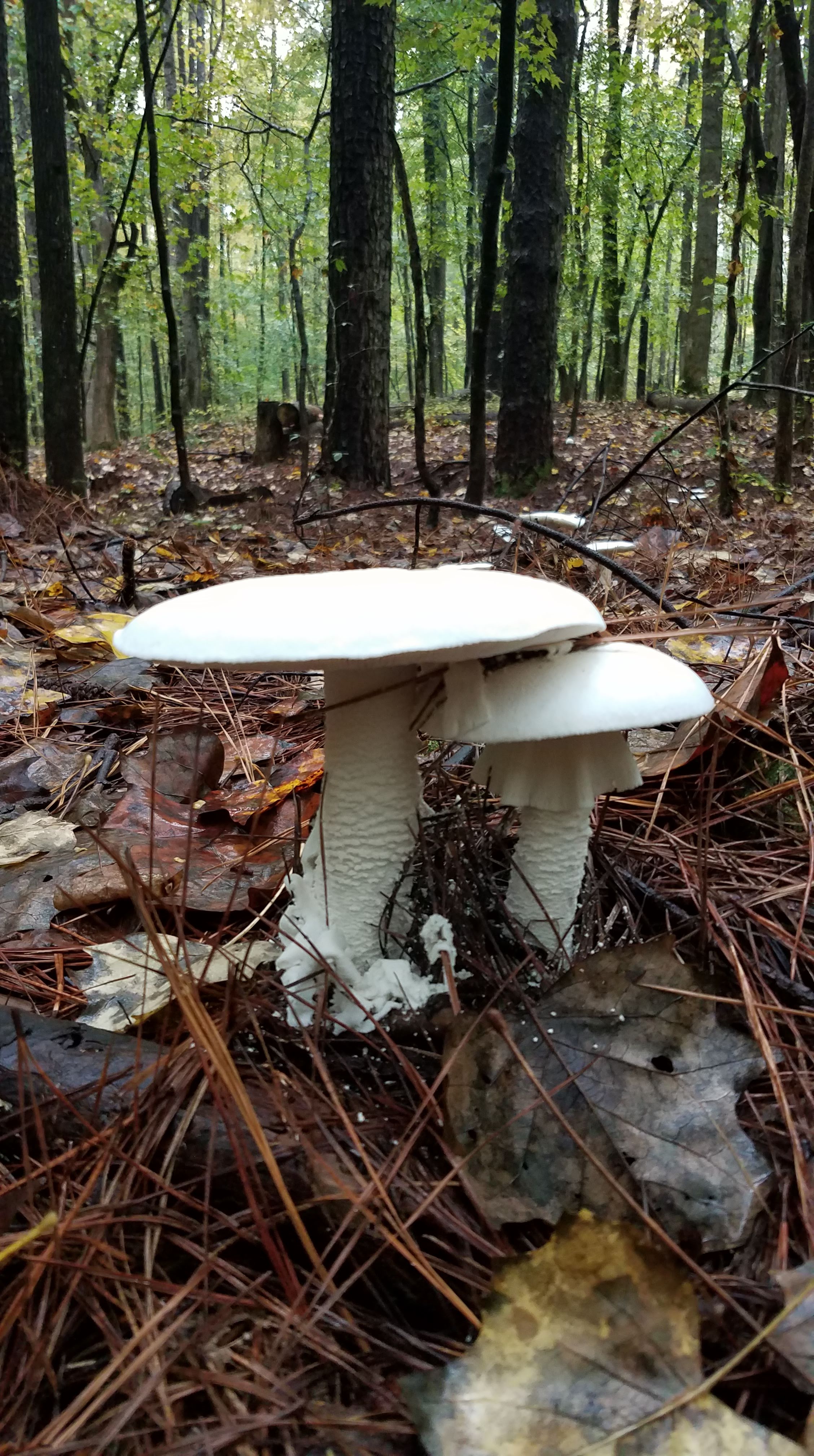
It’s been six months… I’m still here, and for another 6. I decided to delay my departure for Chile, something that took me nearly 70 miles of backpacking along the Outer Banks to settle upon. Last December, I was offered to extend my contract with Duke. As much as I wanted to hit the road and travel again, I decided to wait for a few reasons – some obvious, like the pandemic. I think my decision was the right one and despite not idling well, it makes sense to wait a little longer for the world to return to some normalcy, save up some more money, and explore the Southeast while I’m here.
The last 6 months have been chalk full of adventures. The mountains aren’t quite like the Cascades and it’s not as wild of a place as South Africa, but there are some gems here in the Southeast. Here are some bits of life from this experience so far.
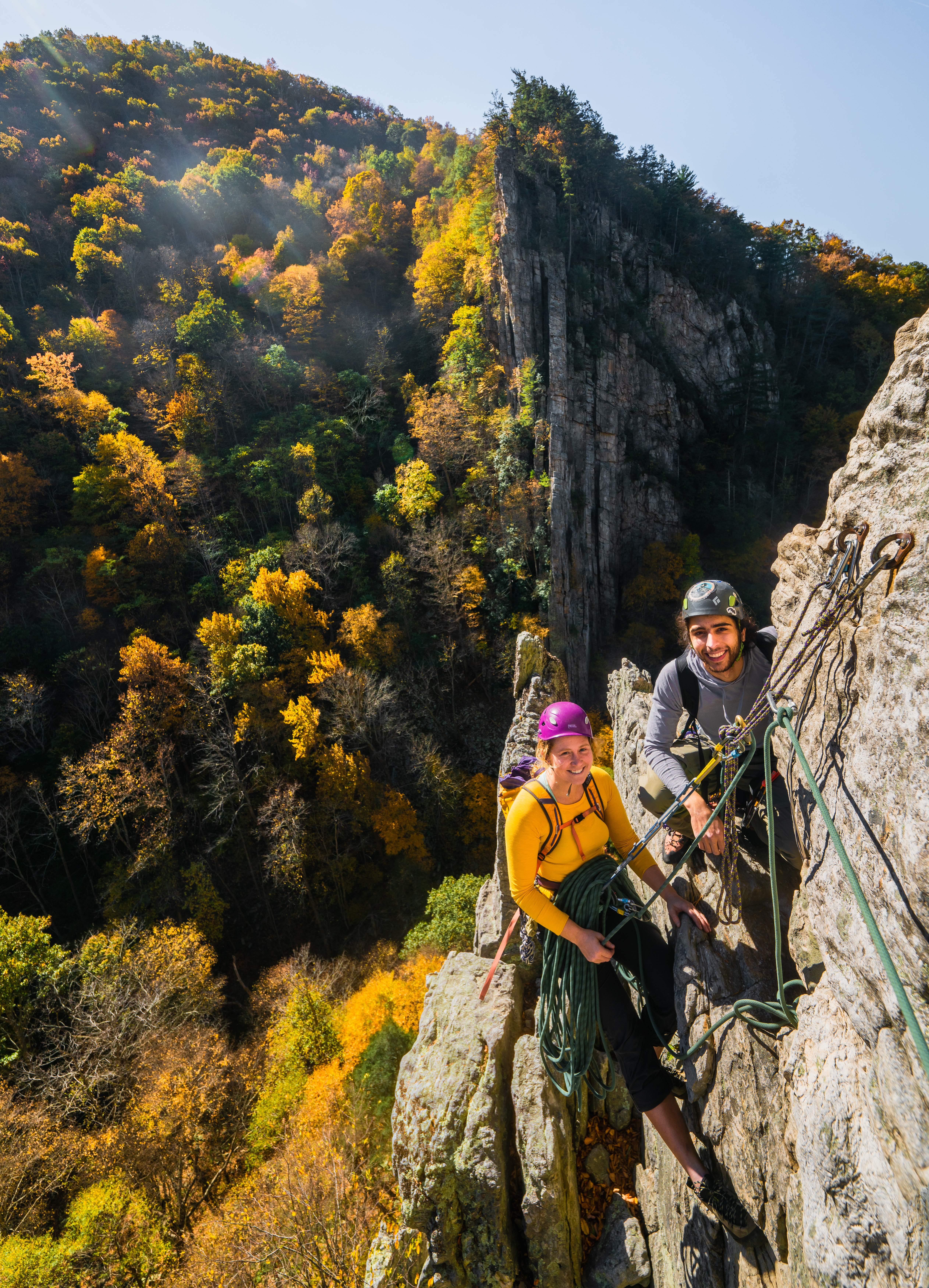
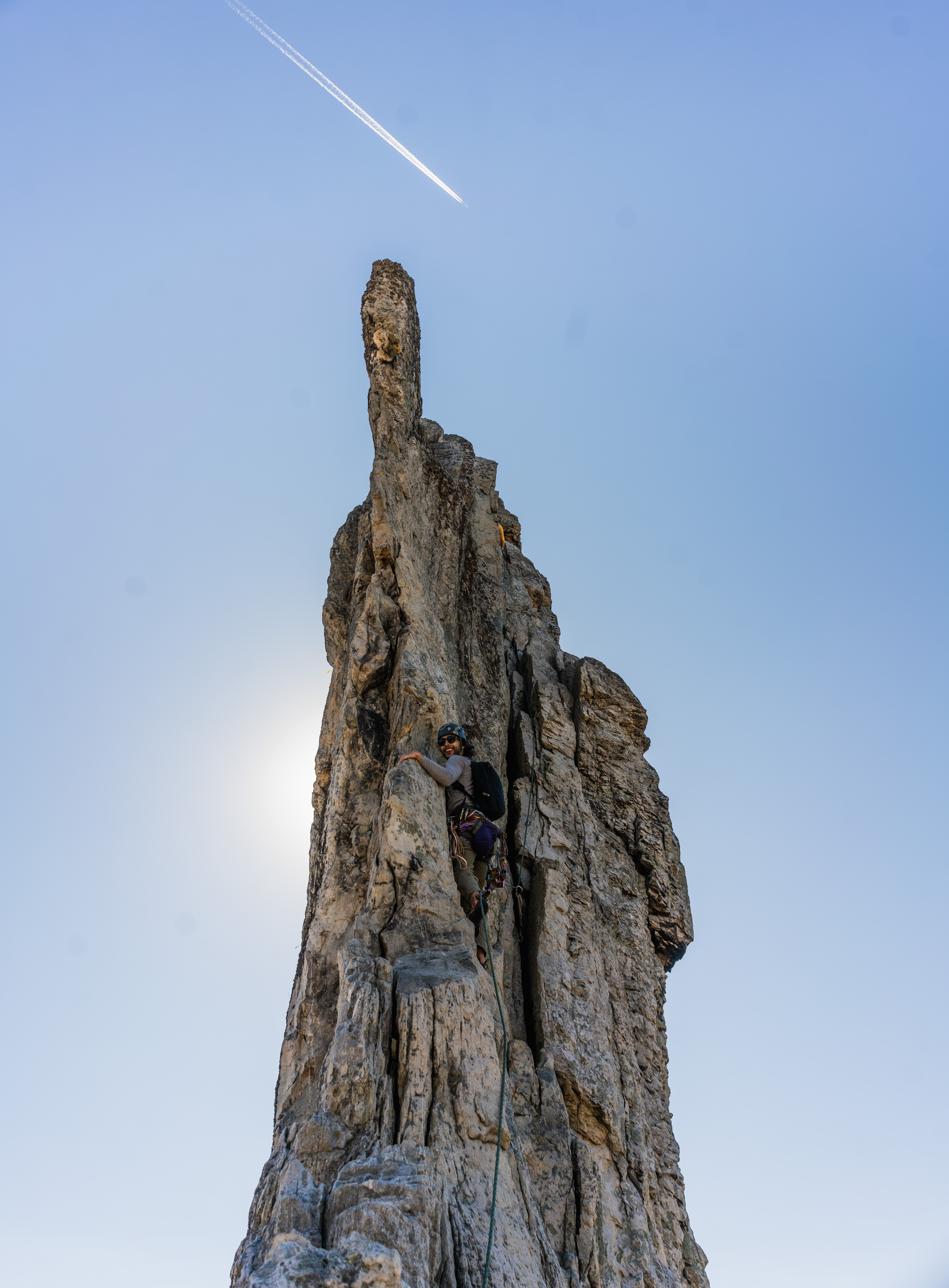
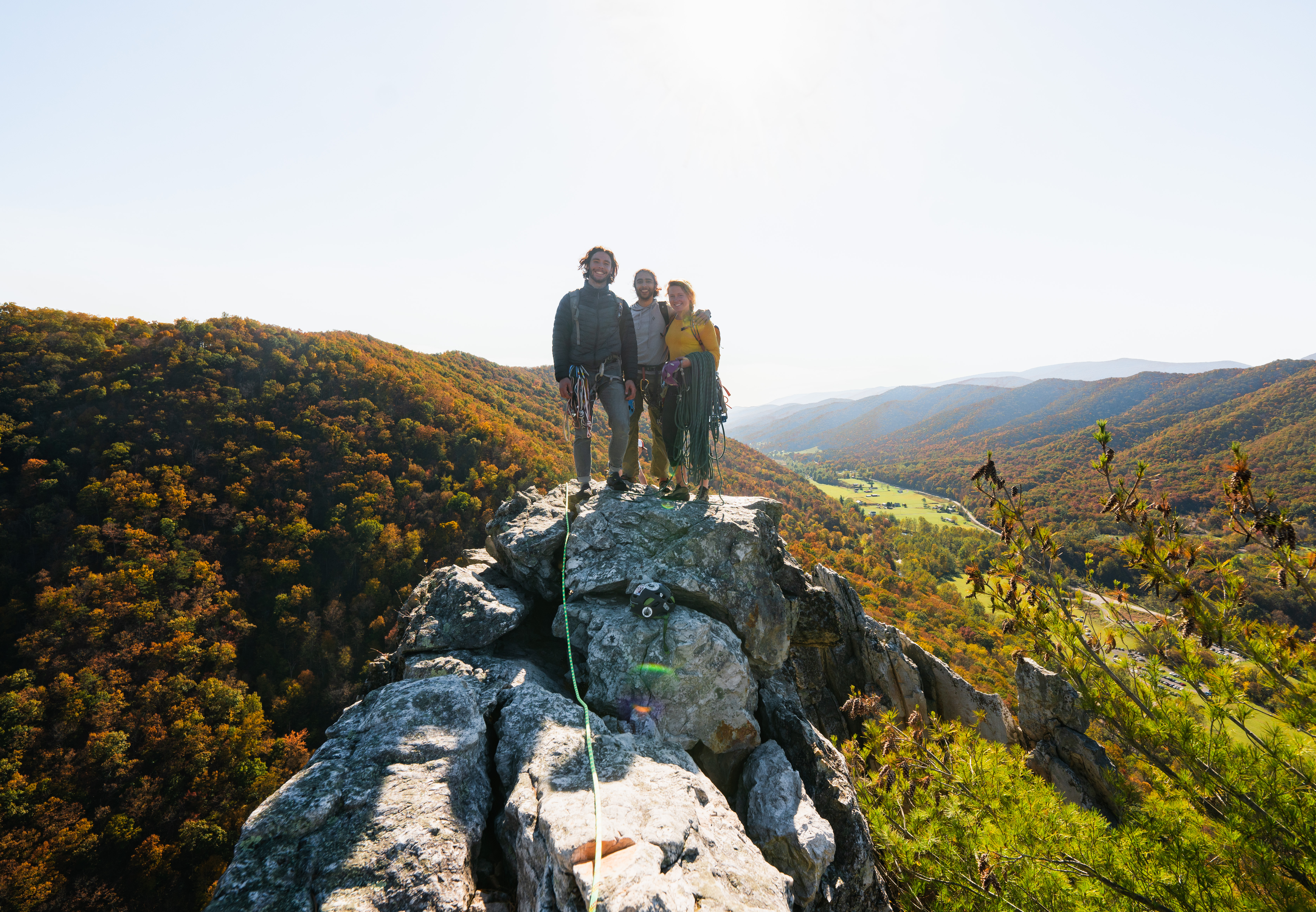
Seneca Rocks WV – October 2020
I met Andre through partner finder on Mountain Project the first weekend I was in Durham looking for an apartment. When I returned from my roadtrip, we agreed to meet up after work on a Monday to go night climbing at a local rock quarry. We rapped down in the dark, anchored in to the side of the cliff, and planned to climb our way back out. Not knowing where on the cliff we were or how far below the water was, I tried to imagine what the quarry looked like. On his lead out, a rock broke and soon I realized just how high off the water we were when I eventually heard it plunge in below. I caught his fall and only got grazed by the rock fall, so he continued up, I followed, and we were eventually back at the top of the quarry. Maybe it was not the best plan for a first climb together, but it was clear we were good climbing partners from the night’s shenanigans. A couple of weeks later, I tagged along on a climbing trip with him and his friend, Walker. We swung leads, had lots of laughs, and topped out on this ridiculous knife edge rock – Seneca Rock. Andre and I quickly became friends, then started dating soon after this trip. Since then we’ve been chasing each other up, down, and around North Carolina and I’m still not sure who is trying to keep up with who 🙂


The Great Arch, Stone Mountain NC – October 2020
Andre had organized a group to climb at Stone Mountain over Halloween weekend. The plan was to climb The Great Arch, a 3 pitch 5.5 crack climb that summited the mountain. I joined in on the plan and we decided to break into 2 groups – I’d lead the 2 girls (Hannah and Hailey), and he would lead his friend Phil, up the arch at midnight. We planned to wear costumes but it was quite a bit cooler than expected – my costume was a green onesie though so it ended up working out perfectly. Phil decided to be a cowboy and wore my hat (that is usually perched on my dashboard) on our day hike to the top to check out the descent hike – the hat also was present on the climb but clipped onto his backpack.
As the moon rose, we wrapped glow sticks around our wrists, necks, and ankles. After racking up, we made our way to the arch and set off up the first pitch. The boys led first and made their way up an awkward approach pitch to the actual climb. It was a wide offwidth crack and, perhaps inspired by the cowboy hat tagging along, they stuck one leg into the crack and rode it up the pitch. It was quite entertaining to watch in the light of our headlamps. I led the girls up next, which I must say we all climbed a bit more gracefully than the guys by using features on the face of the rock and laybacking the crack. Once on the tree ledge, we blasted off – my party following Andre’s. Climbing with glowsticks was super fun and made the climb feel surreal and dream like. We each barely placed gear and moved quickly up the slanted, back breaking, calf screaming pitches – the crack was so good but the slab was so…slabby! The night sky filled with clouds so we only had a few peeks at the full moon; it was super fun and probably the most memorable Halloween I’ve spent.


Duke University NC – November 2020
I ran my first MinIon sequencing run at Duke. This is the technology I’d like to use for my proposed study in Chile so it was really cool to be trained on it! The MinIon is a portable sequencing device that allows for real time long read sequencing of DNA. We are currently testing it in the lab to eventually be used at the Amboseli field station in Kenya to sequence baboon samples for questions about relatedness among individuals in the troops.
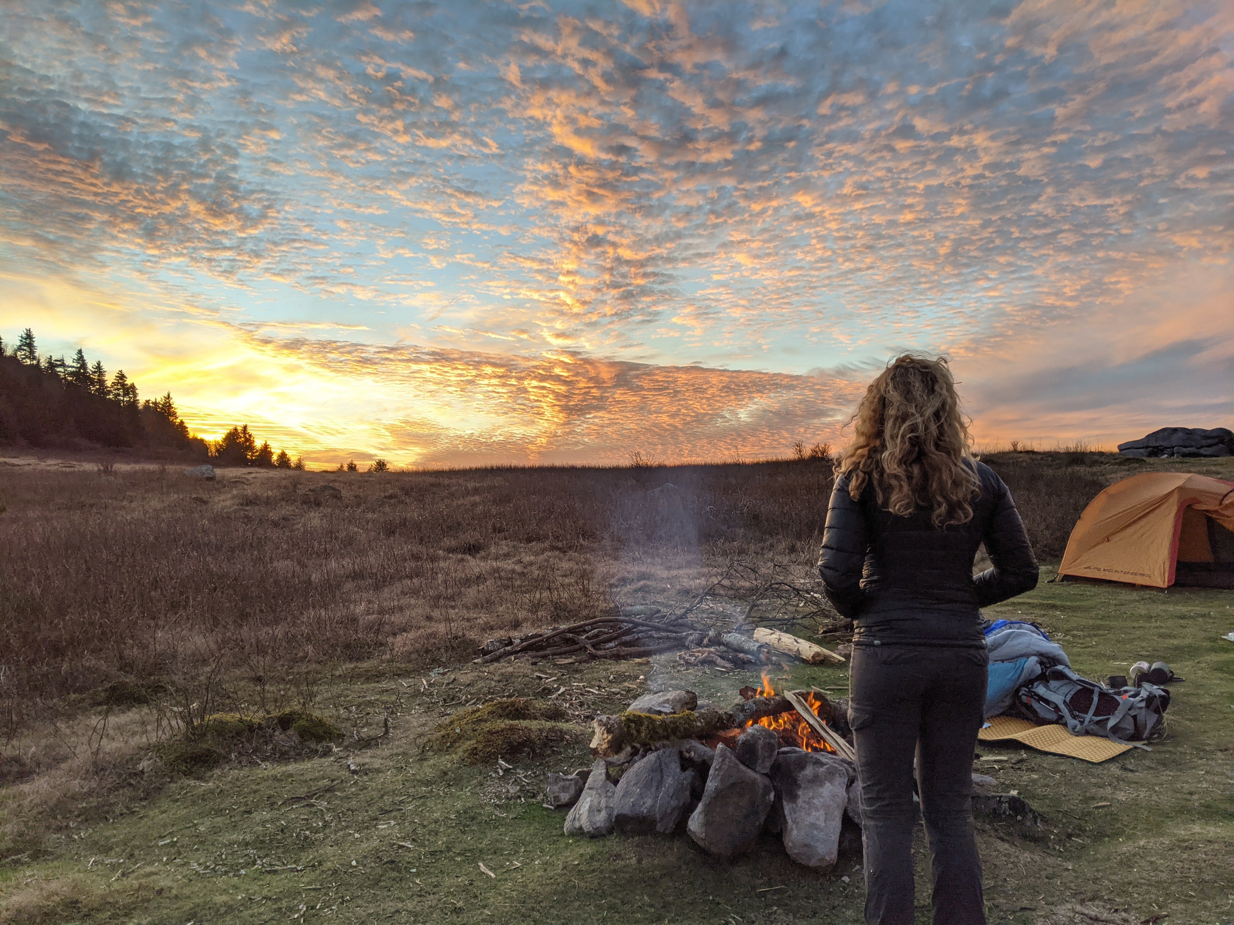
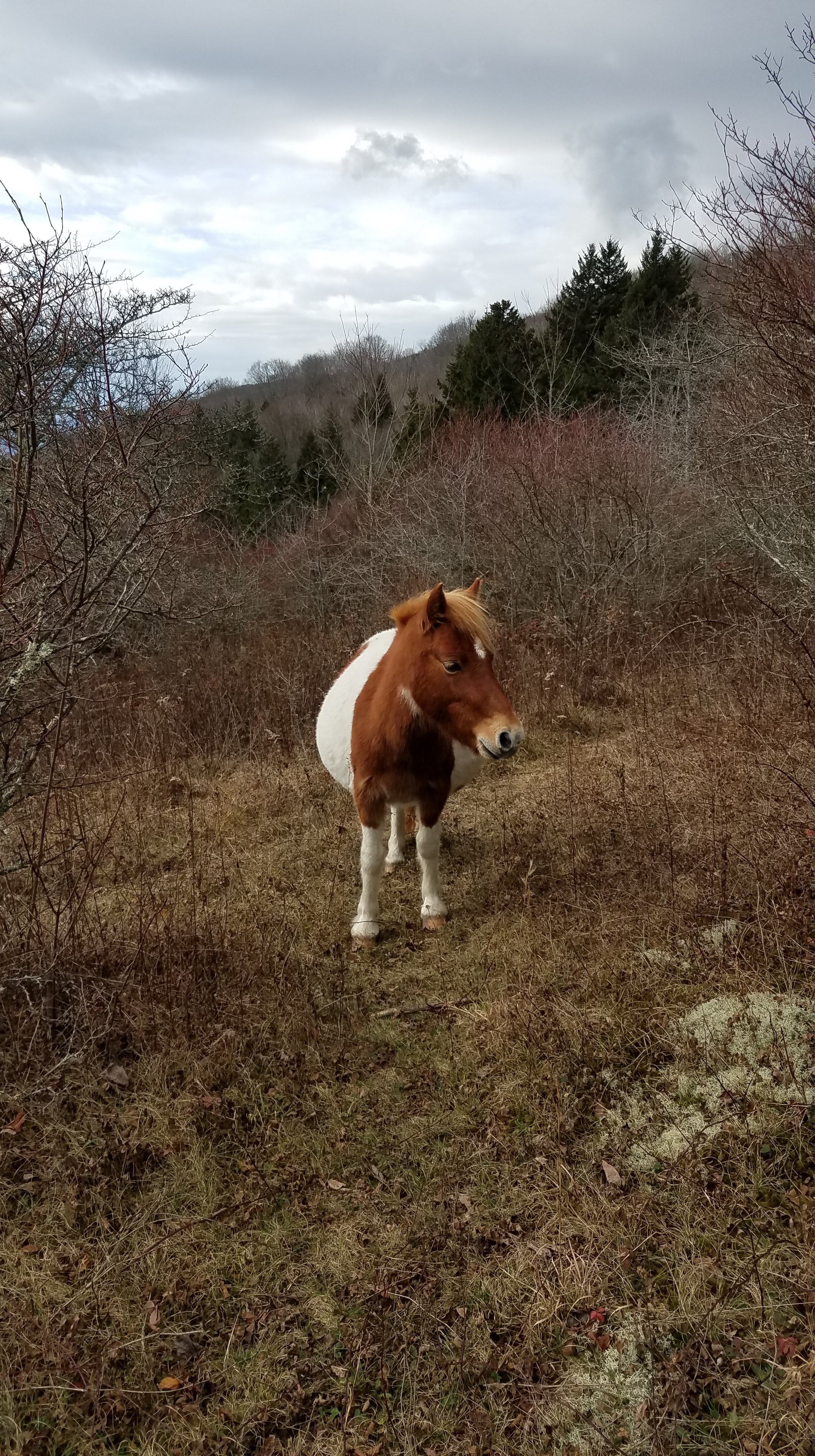
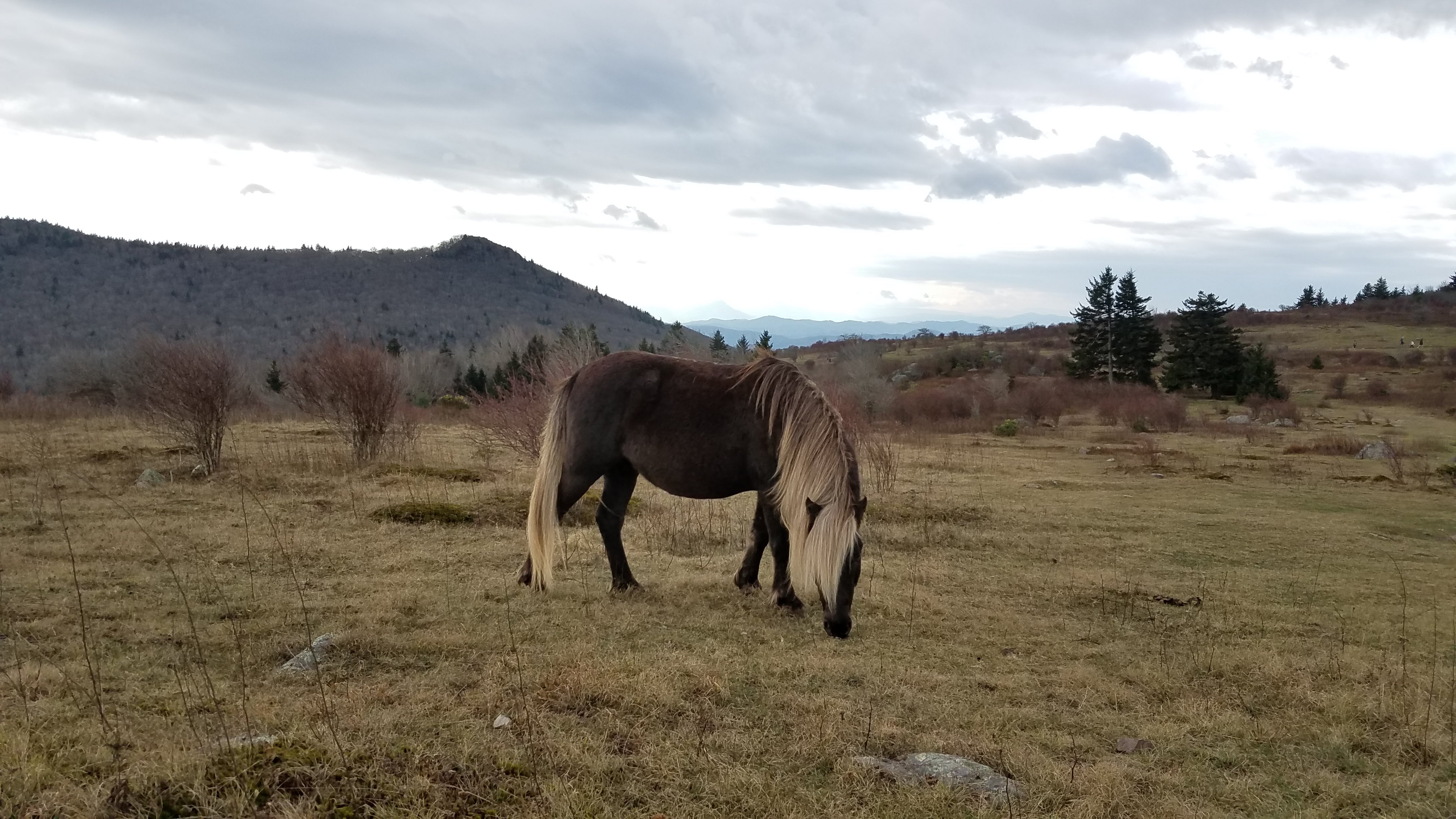
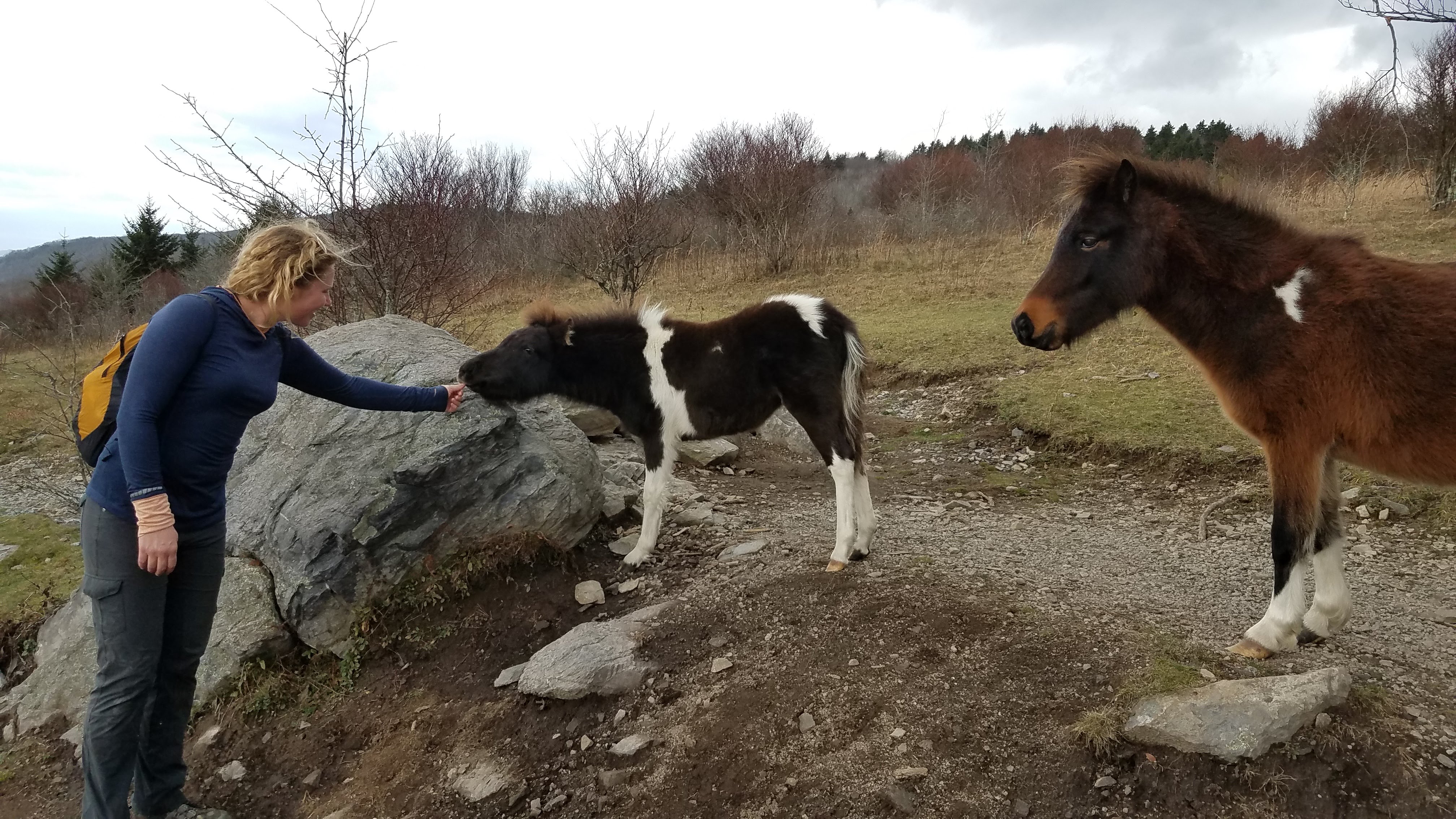
Grayson Highlands VA – November 2020
Taking a break from climbing, we headed for the hills of Virginia to backpack and look for the local wild ponies. Just before this trip, I suggested we watch the horror film “Backcountry” where a couple is stalked by a black bear (supposedly inspired by a true story). There were some uncanny similarities on this trip to the movie. We spent the first night in my van at the trailhead after driving up after work on Friday. Sometime in the middle of the night a pack of coyotes broke out howling – so close that we heard one run right along side the van! Coyotes were not a thing in Africa (and sadly I was never lucky enough to hear jackals howl), so to hear them that night was really cool.
The next day we loaded up our packs and hiked up to the ridge where we would be camping. After setting up camp, we ventured out to look for the ponies and summit Mount Rogers, the highest natural point in Virginia. We did not see ponies on this hike, though we looked high in the mountains and low in the valleys. That evening, while we were cooking our dinner at camp, a hunter hiked out of the woods and directly towards us. He set his gun next to the fire, introduced himself as Kelly, and proceeded to chat with us for a good half hour while we ate our meals. It was friendly, but odd, and reminded us of a scene from that horror flick – spooky!
That evening presented a stunner of a sunset that looked like starbursts were tossed into the sky. We built a big fire and laid out under the stars, no coyotes this time.

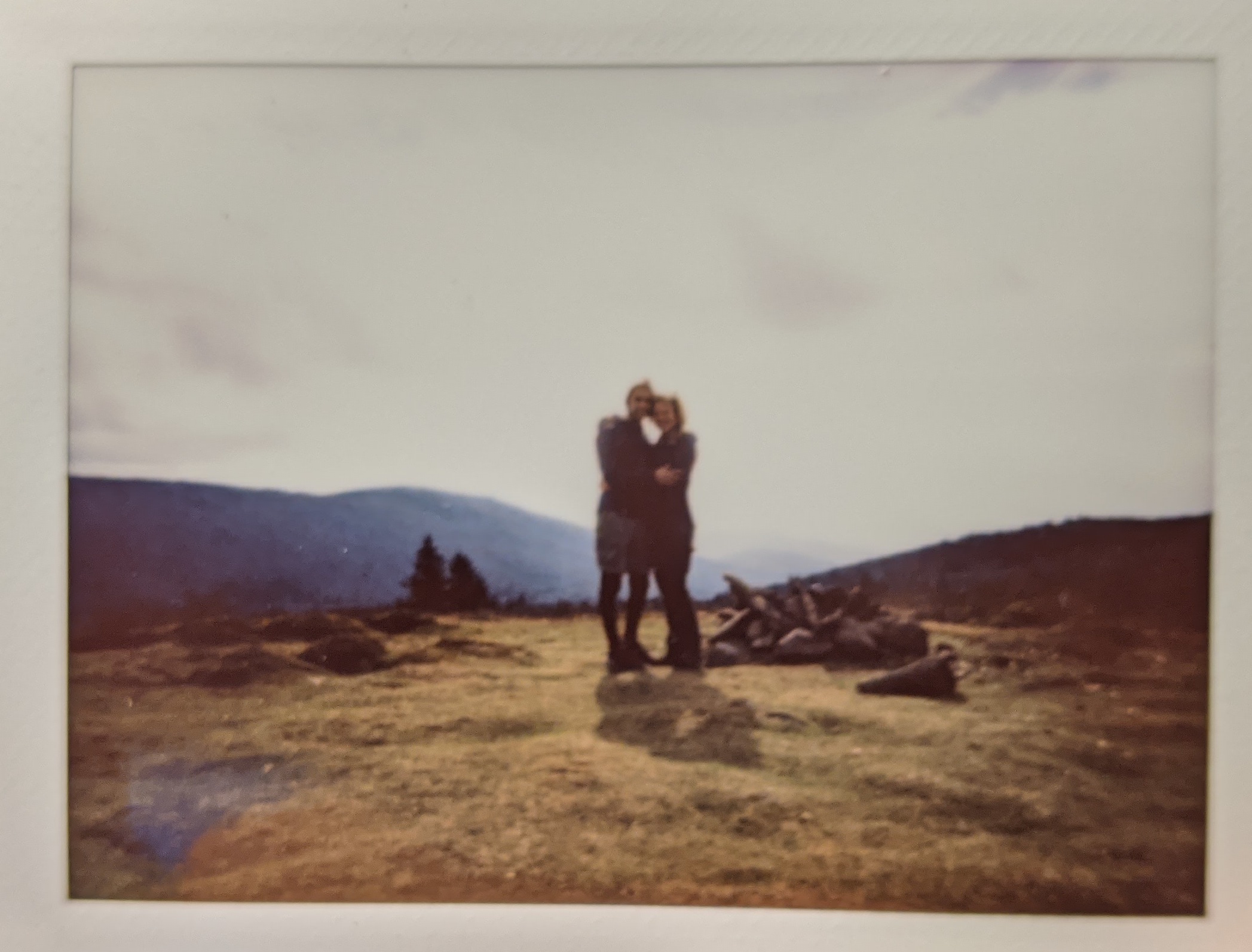
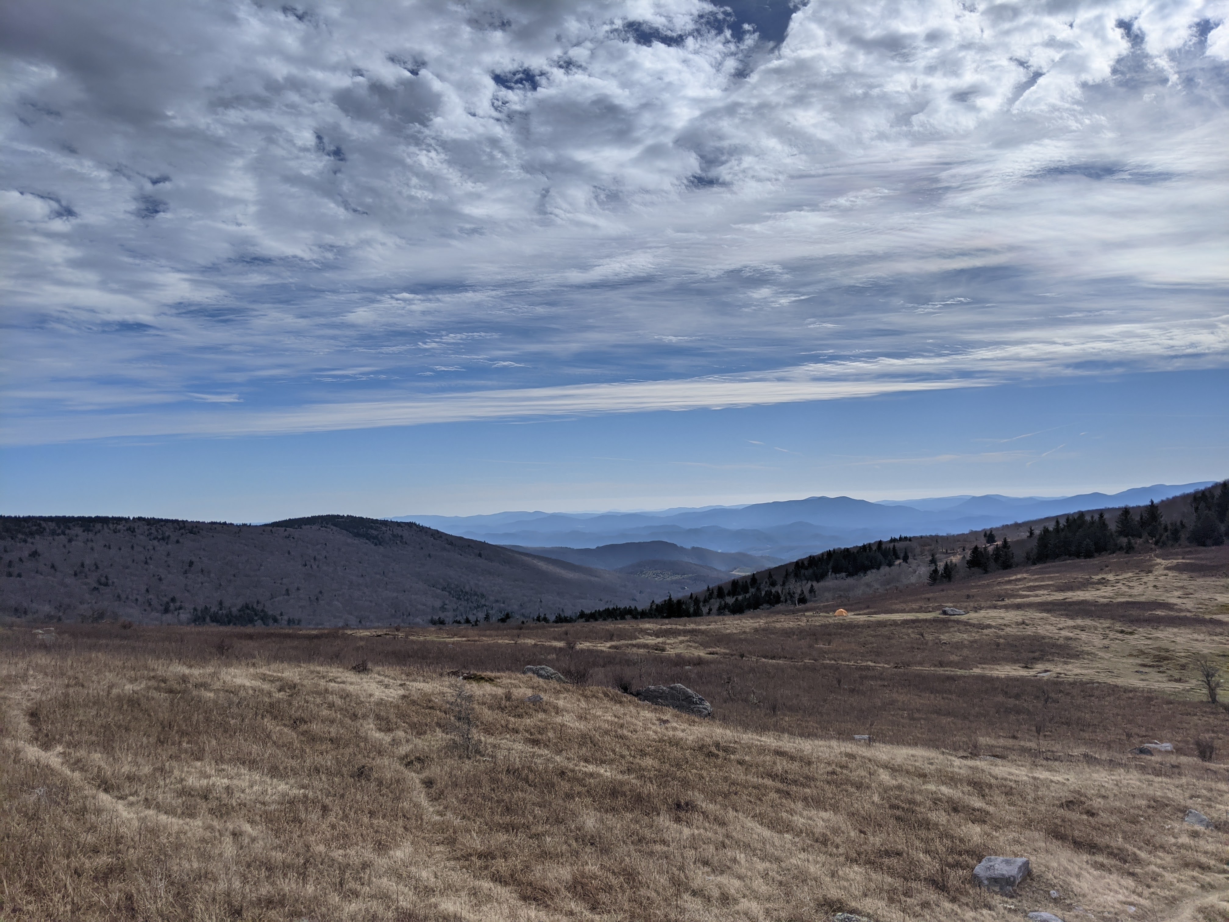
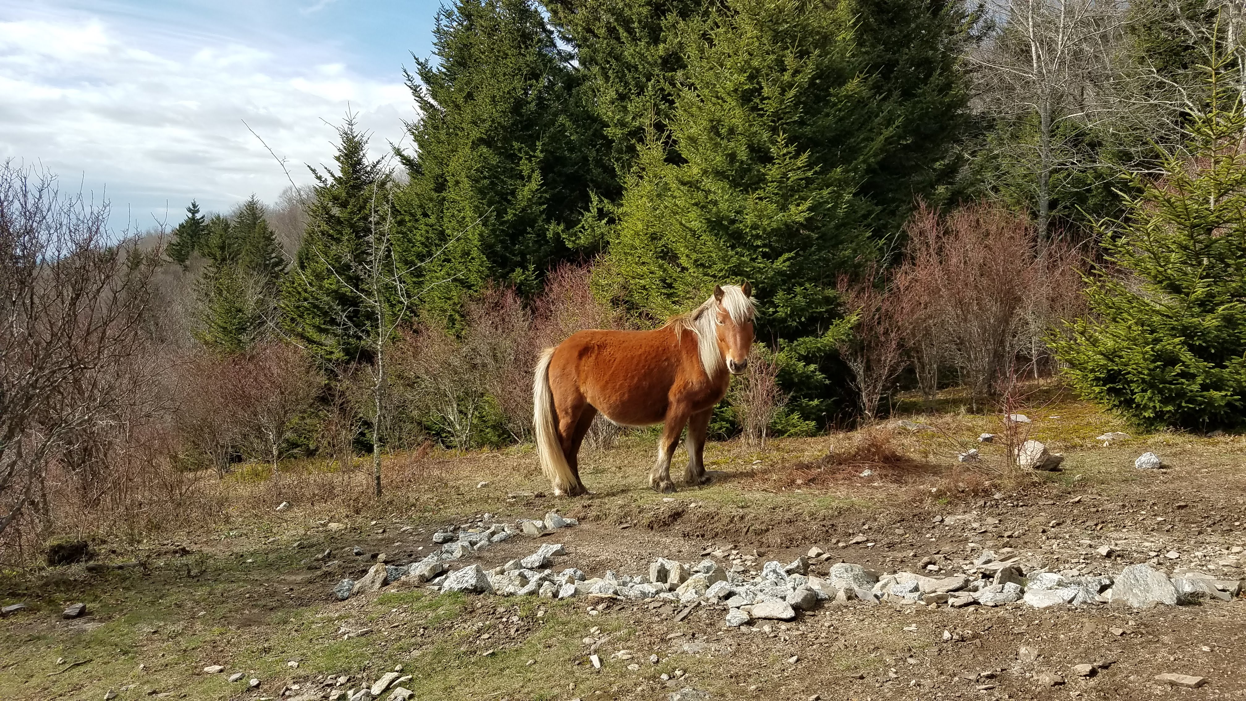
The next day we returned to Savannah and drove to an area known for bouldering in the highlands. We didn’t have a crash pad, but we did bring shoes so we could play on some of the easier boulders. Ponies filled the trails, and the fields, and dotted the hillsides afar. We had just camped on the other side of the ridge or we would have seen them the first day! They were adorable, as ponies are, and quite friendly despite being “wild.” Mission accomplished – we wrestled some peddles and saw some ponies.
Local Rocks NC – November 2020
A few November weekends were spent sampling the local crags – like Rumbling Bald near Asheville and New River Gorge on the border of West Virginia. These weekends involved taking a van (either mine or his), driving out on Friday night and finding a place to park and sleep, then climbing for the weekend. I for sure am more of a long multipitch climber where I like to leave the ground and other humans behind. But these crags were pretty fun too, even if they were busy.

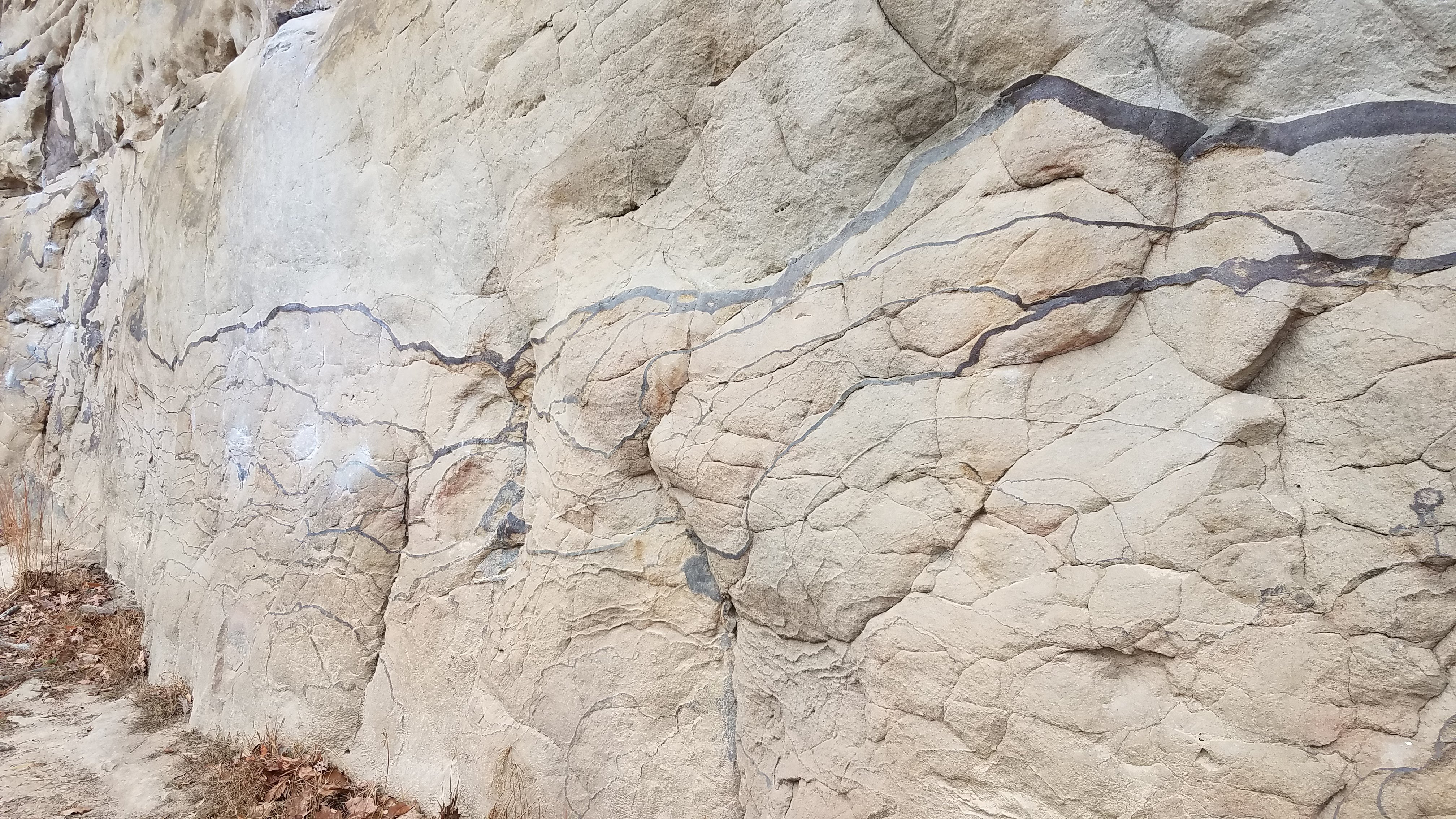
Linville Gorge NC – December 2020
My favorite place to climb has been in Linville Gorge, western North Carolina. The area sees fewer crowds and has lots of fun multipitch trad climbs. The approaches are long and can be somewhat obtuse to new visitors. On our first trip there together, we spent an entire day just scouting to get to the base of a classic, easy climb, “The Prow”. We had entered the gorge via the wrong gulley and bushwhacked our way through thorns and rhododendrons for hours before we finally found the base. We returned via the correct gully and noted our mistake for another try the next day. The prow was really fun to climb; we ended up simulclimbing most of it (Andre’s first simul!). I love this technique because you can lead until you literally run out of gear. The prow is the prominent airy block that has some incredible exposure, it was a super fun climb.
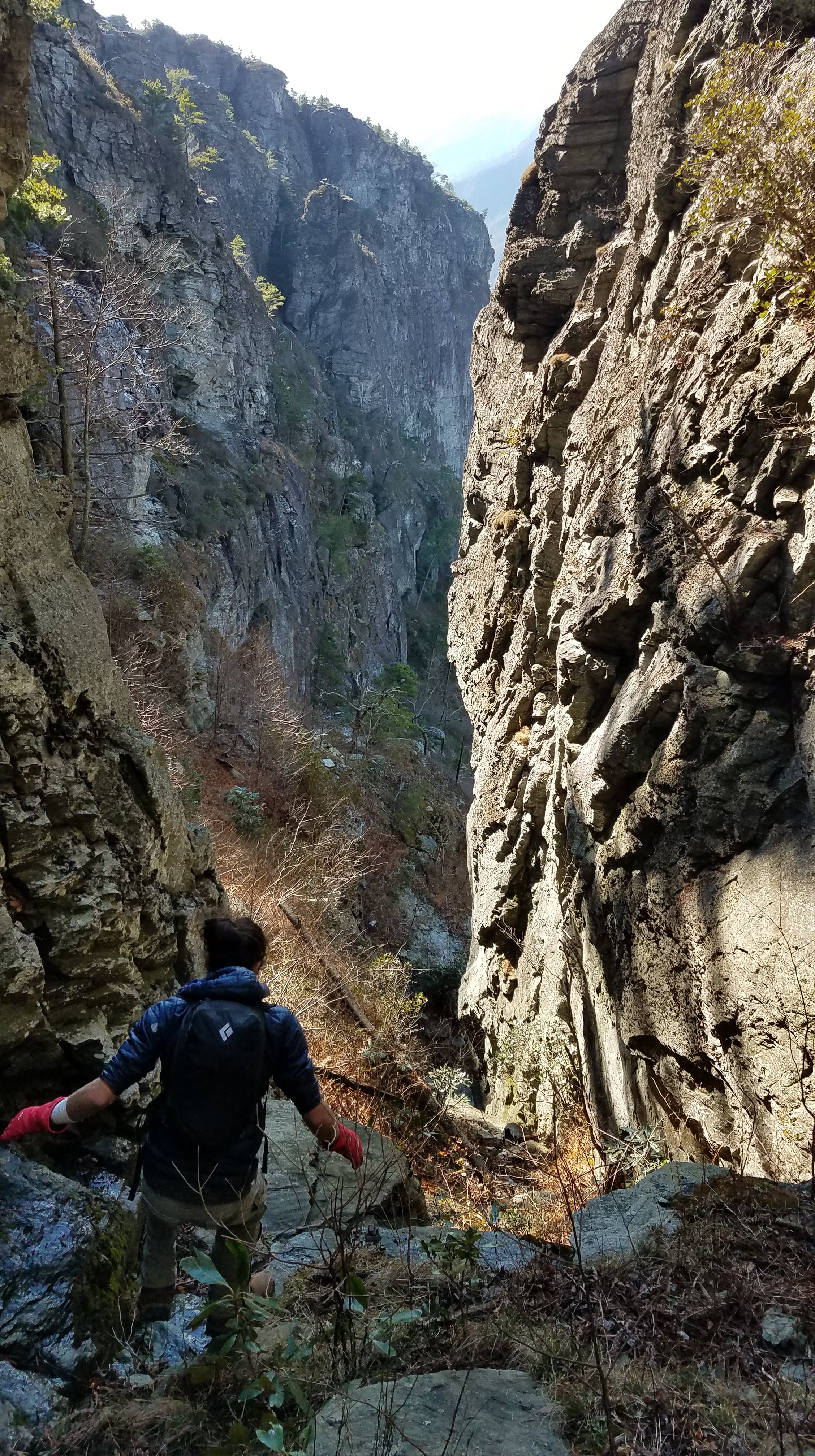


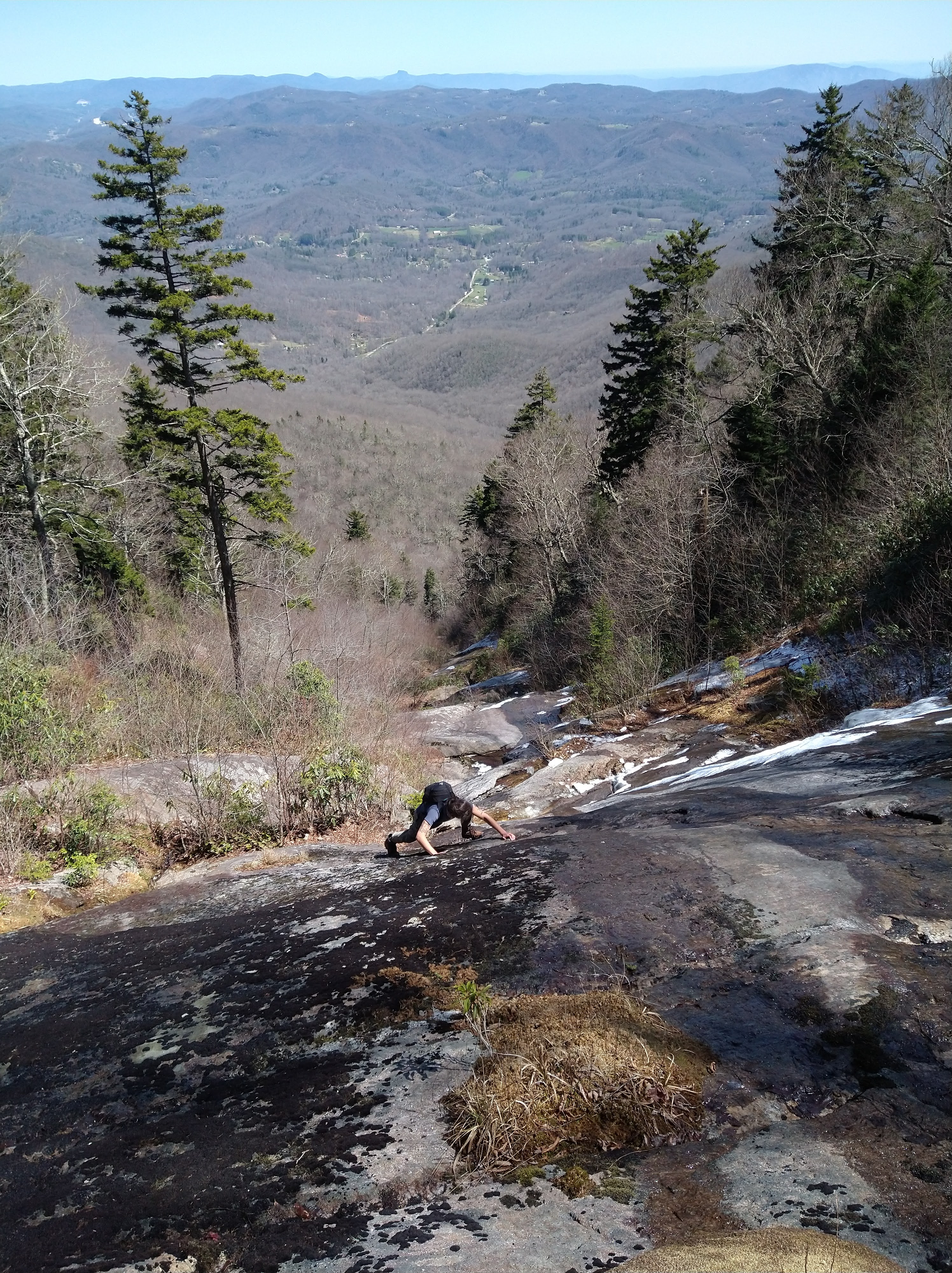
We returned to Linville again in December to climb a few more classics – CrackerJack and the Cave Route. CrackerJack involved a fun, tricky chimney that left us pretty dirty when we topped out. It was still quite cold being December but the rock had warmed up in the sun enough to enjoy an unusually quiet Table Rock. After CrackerJack, we set off on a route to the summit. This one though was in the shade and ice soon became an obstacle that we could not work around. I don’t remember which route we started on and which one we switched over to, but eventually we found the trail from the top out and clambered up to the summit to warm up. I’m really excited to return here this spring/summer (the road closed on the weekend we did these last climbs and just recently reopened). There’s an area even more remote than where we’ve been called ShortOff Mountain that has some really fun stuff.
Bat Study, Western North American Naturalist
A bat study that I worked on in Colorado a few years ago, and which has been getting bounced around between journals, was finally published in the Western North American Naturalist. I’m happy to finally have this one completed.
You can find the article here
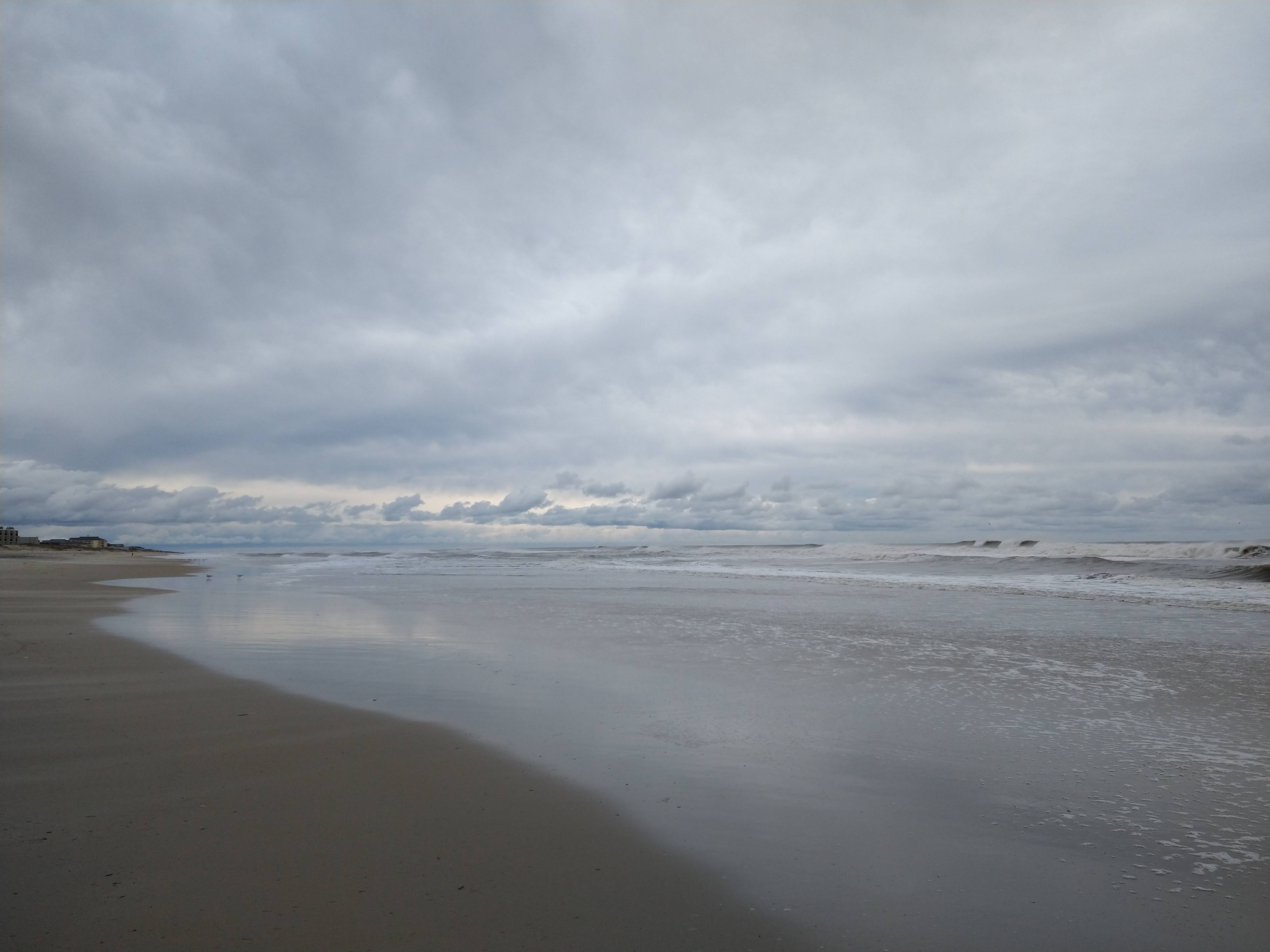
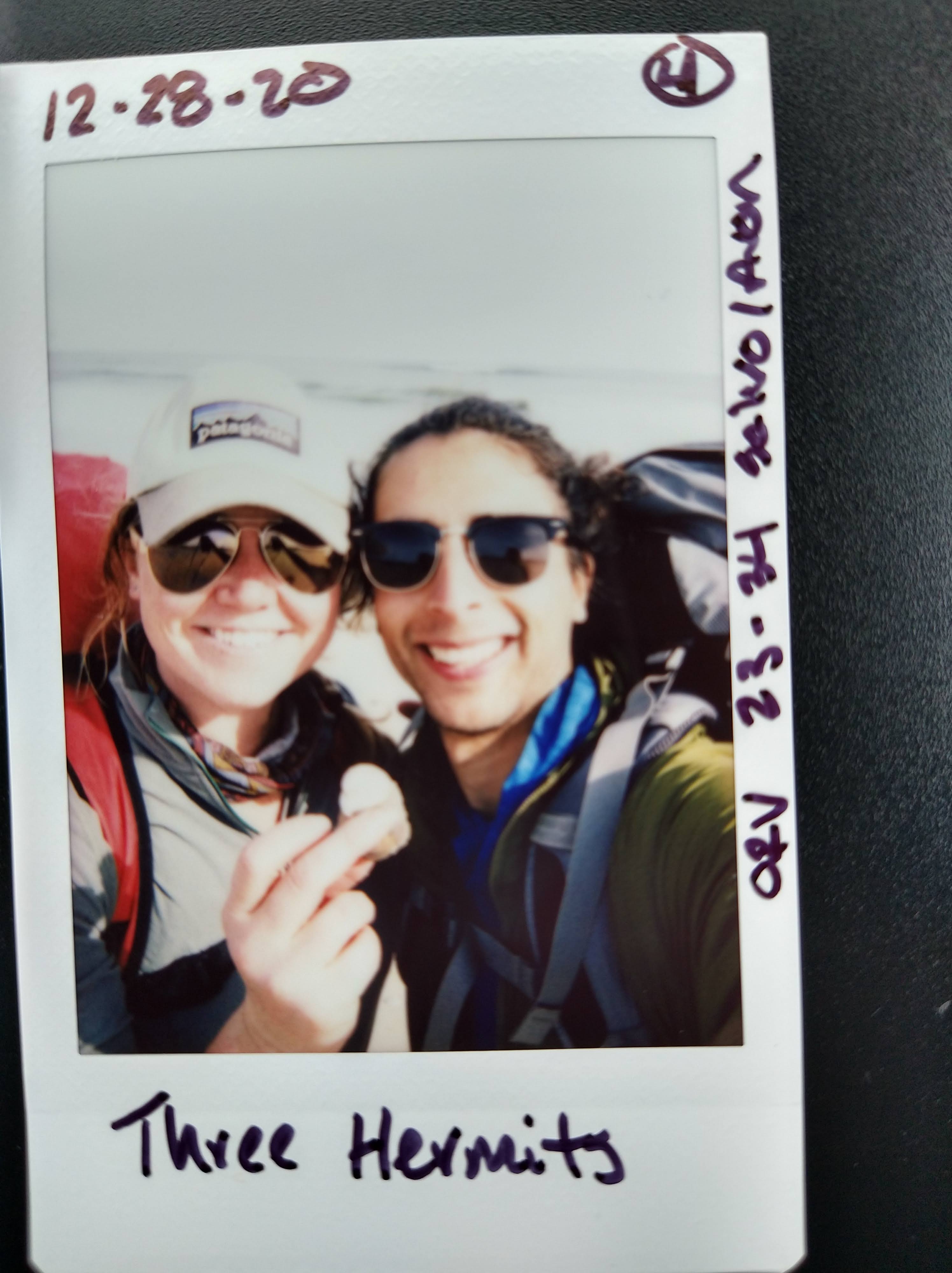
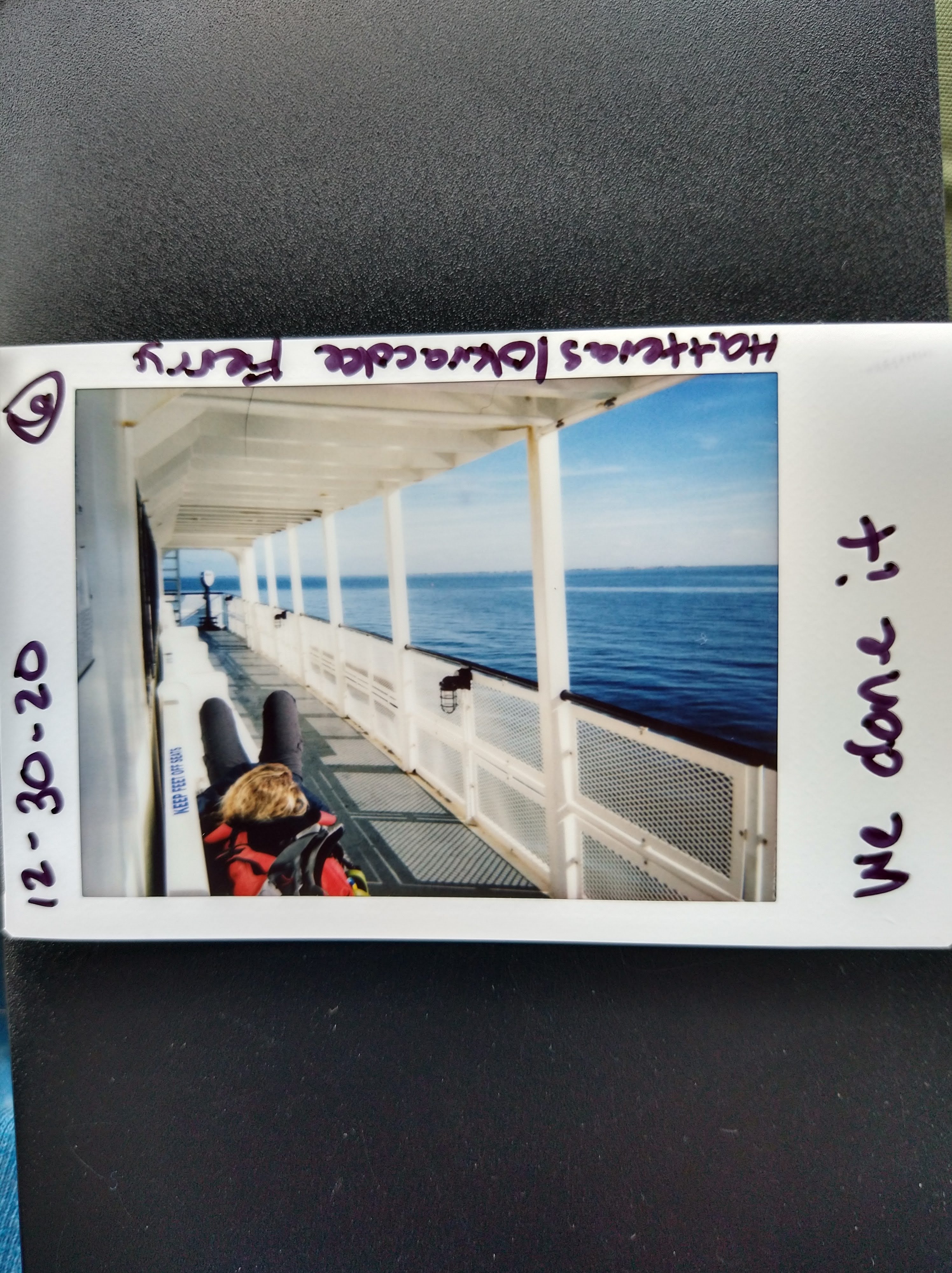
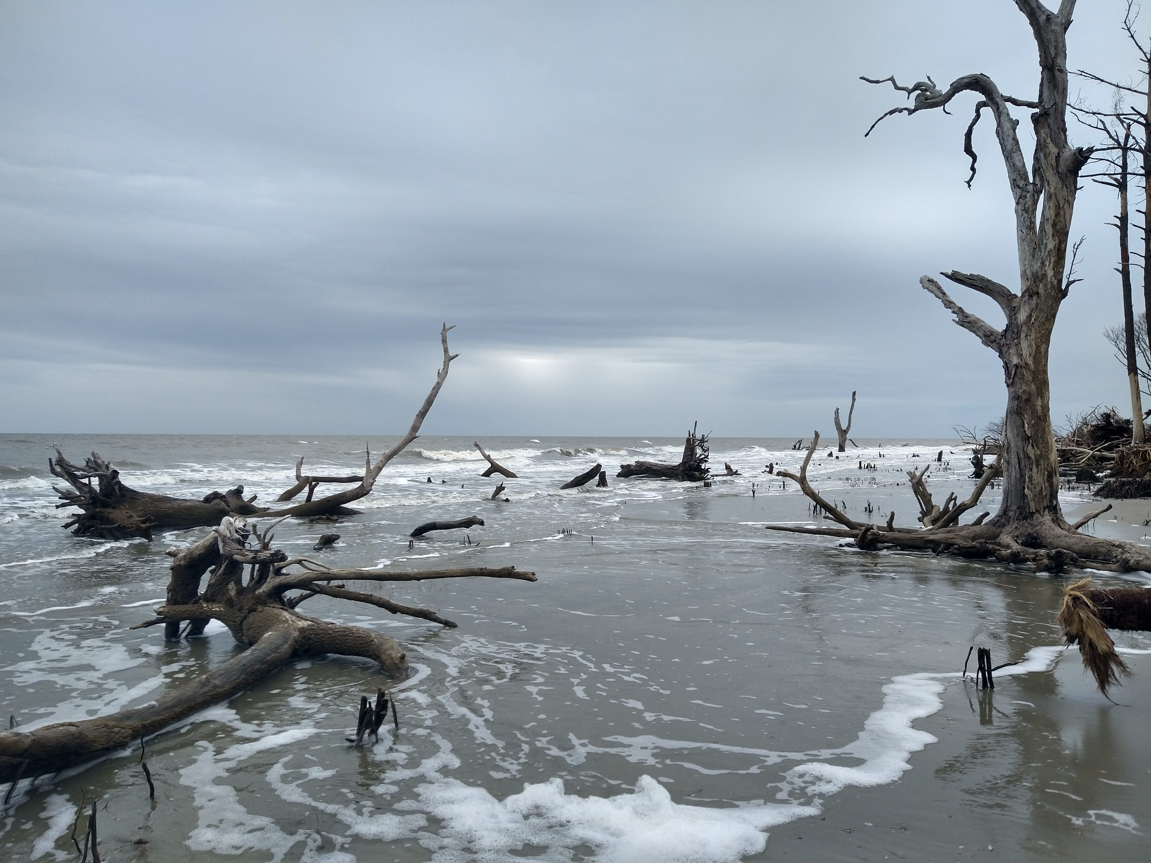
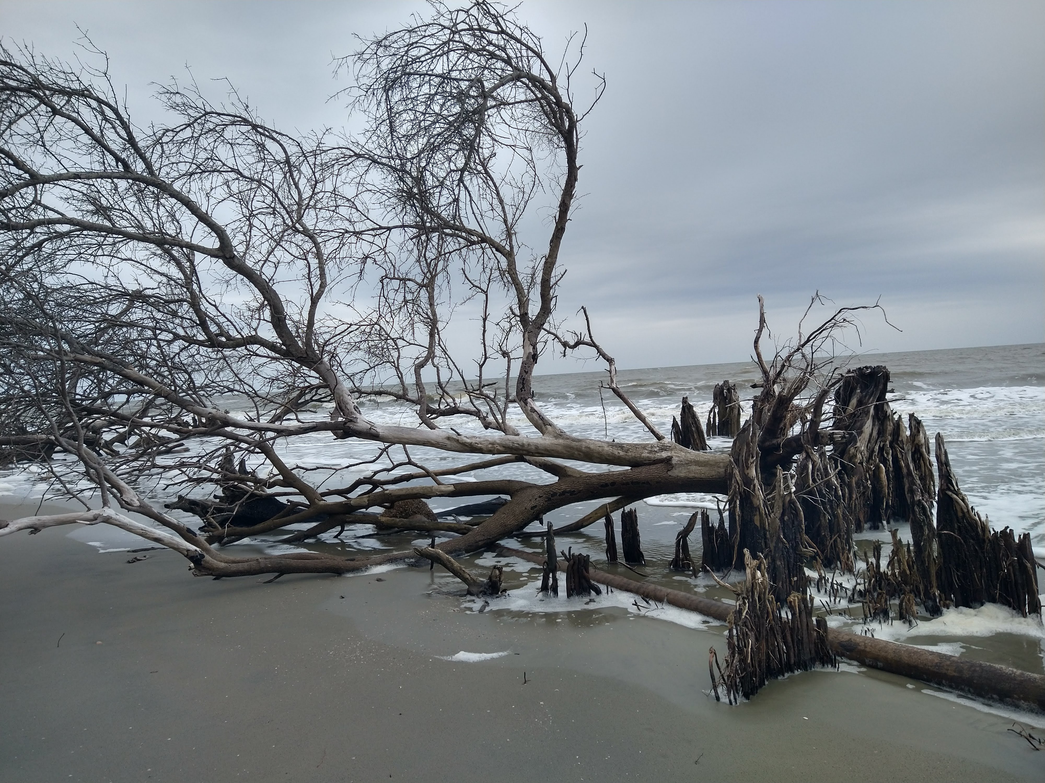
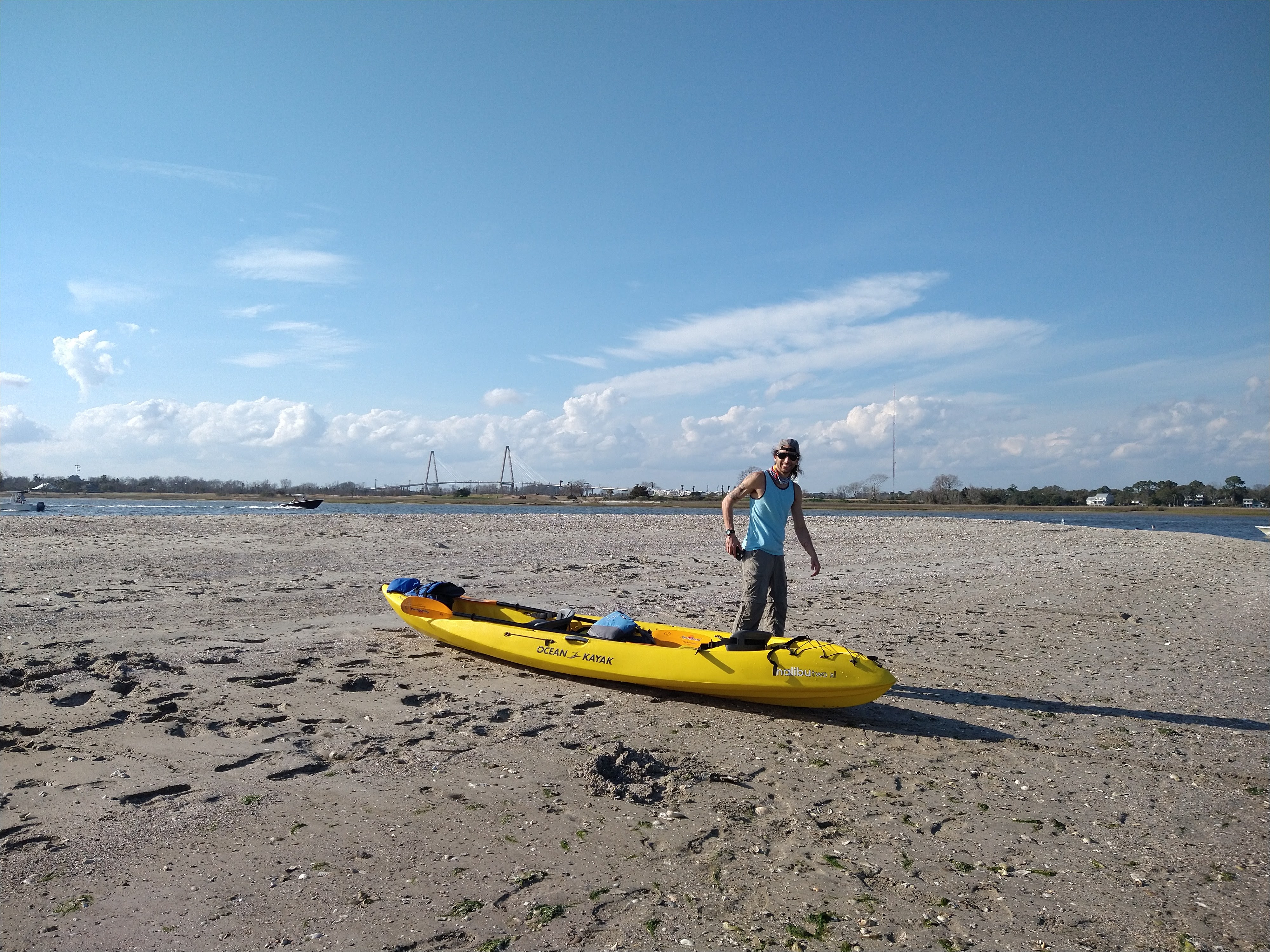
Outer Banks NC – December 2020
So you like long walks on the beach?
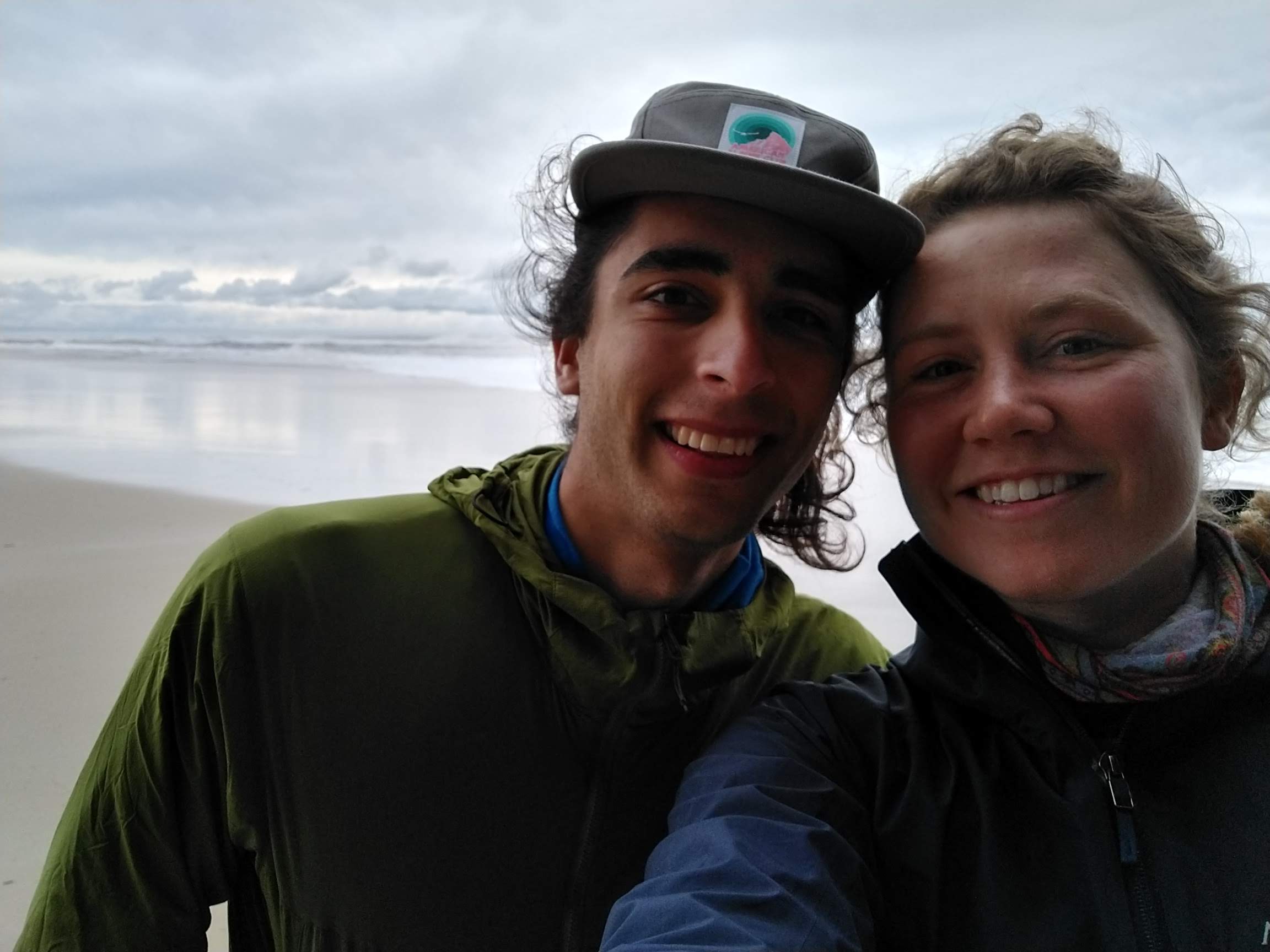
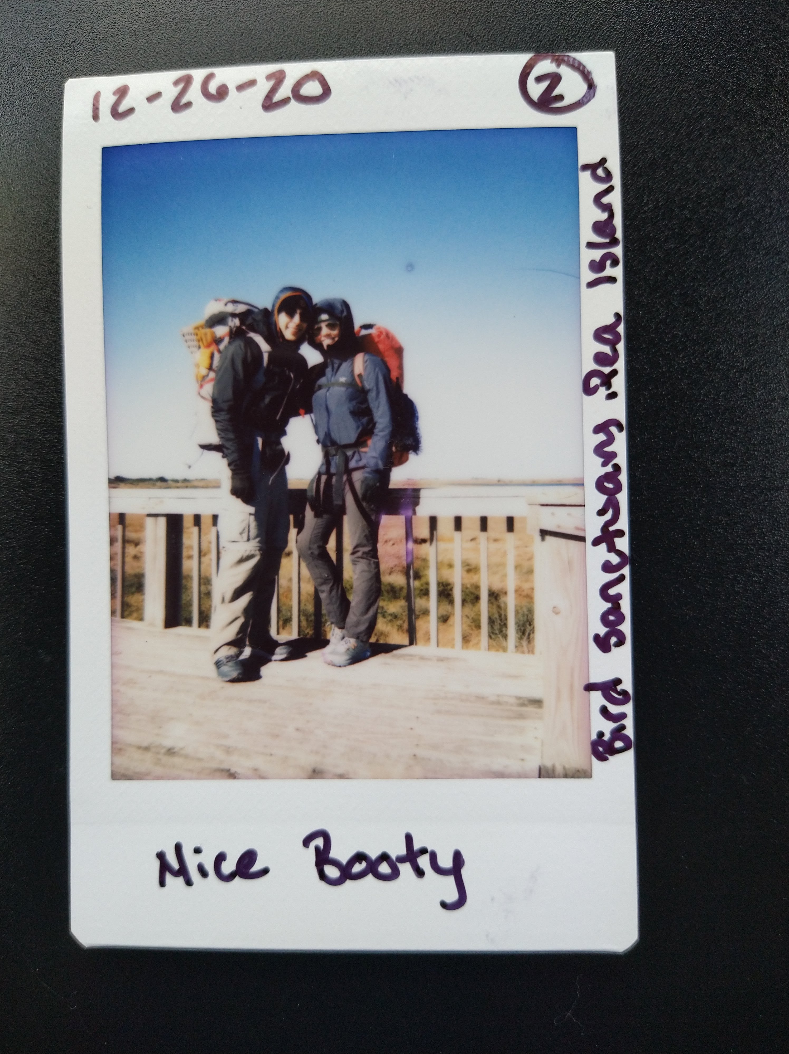
The mountains-to-sea trail stretches 1,175 miles from the Great Smokey Mountains to the Outer Banks, all within North Carolina. Often, hiking at various parks in the state, we’ve come across the white blazes that mark the trail. Christmas and New Year holidays fell just right to have a 10 day stretch of time off, while only using 2 days worth of accrued leave. Andre came up with the idea to hike the ~70 mile section of the MST that runs along Outer Banks (segment 17). I had just gotten the offer to extend my contract at Duke; a long walk on the beach seemed like a good way to mull it over.
Also, Andre’s brother’s girlfriend’s mother lives on Okracoke Island and our walk became a quest to deliver a small gift for her to give her son (aka Andre’s brother’s girlfriend’s brother).
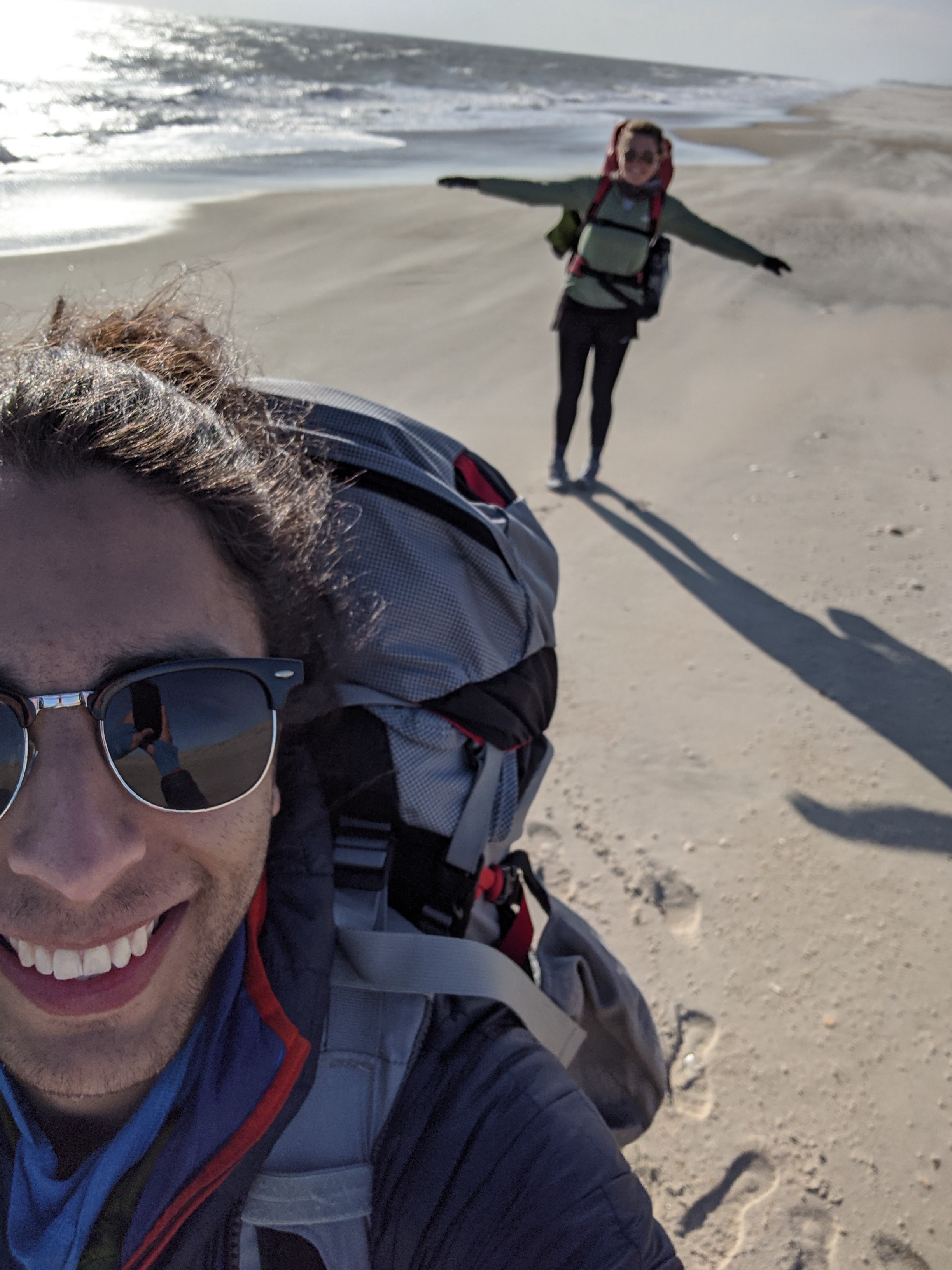
On December 25th we started our trek. We parked Andre’s van (named Wells) at his friend Hailey’s family house just North of our start. She dropped us off at the kite shop (near Jockey’s Ridge) and from there we began our walk. Our first day would be 13 miles to Inlet Campground where my good friend (and coworker) and her friend would meet us to camp. It was a gray and blustery first day and we went through a few rounds of adjustments from layering for the wind/rain, readjusting packs, and setting an efficient pace in the sand. I ended up using my canyoneering pack with the thought that if it did dump rain, we could put anything that needed to stay dry in my pack, since it’s waterproof. The pack ended up not being the best choice for back support/shoulder comfort under the straps for that duration of a backpacking trip, but it worked. We stopped at an old abandoned house perched in the sand closer to the sea from the rest for lunch, we wondered why someone would decide to build a house within the high tide area.
We saw a guy run out to surf, which is quite a Christmas tradition, and we saw a few families walking the beach. But definitely not any backpackers. Around mid afternoon we reached our campsite destination pretty worked – hiking in sand is kinda hard. Our friends met us in the evening and we shared a bottle of wine and some awesome food they brought. We joked that it felt like how the last night should feel with celebration and all this good food, not the first. Our next nights would not be as lush.


After we all woke up, they offered to drive us somewhere for breakfast, then across a bridge that we would have to cross to continue along the beach. We actually drove all the way back to where we started, got some breakfast at a place called “Wave Riders”, Andre purchased some gloves and a hat at a local 7/11, then we headed back South and over the bridge. After saying our goodbyes and giving hugs, Andre and I set off down the beach. We found a dead dolphin on the beach, then a decorated dead tree full of shells and decided to stop there for a snack.
Walking along the ocean was gorgeous. Some days we’d stop and watch dolphins riding the waves, just like in movies. They looked like they were having pure fun. We’d stop occasionally to pick up shells. I actually hauled a whelk shell from the beginning of the trip all the way to the end, bigger than my hand, to make into a light in my van once it’s powered up. We saw tons of sea birds. I enjoyed the calming sound of the waves and it helped to look out into the horizon to let my brain sort out my thoughts about staying in NC a bit longer.
We walked some miles along the ocean, then the trail cut over the road into a bird sanctuary. At the parking lot for the boardwalk Andre picked up what I thought looked like a case of floss only to find out they were actually a pair of air pods. We cleaned them with sanitizer, then stuck one in an ear each and were able to listen to music while we walked for the rest of the trip! It was quite a game changer to find this booty (treasure) on our trek.
We had ramen for dinner that night and camped between an apocalyptic looking bridge that stretched over sand instead of water, and the town of Rodanthe. After dinner we rinsed our dishes in the sea as would become our routine. The sky became what I could only describe in my notebook as a reverse sunset and the glassy blue waves shone under the moon. Most nights in the tent I spent writing about the day’s adventures as Andre played solitaire.

The next couple of days were long beach days. Often times the only markers for how far we’d walked would be if we passed a beach access point. When we were nearby towns we had a much better sense of how far we’d gone. The MST provides a nice guide with waypoints, there just aren’t a lot of waypoints along the beach.
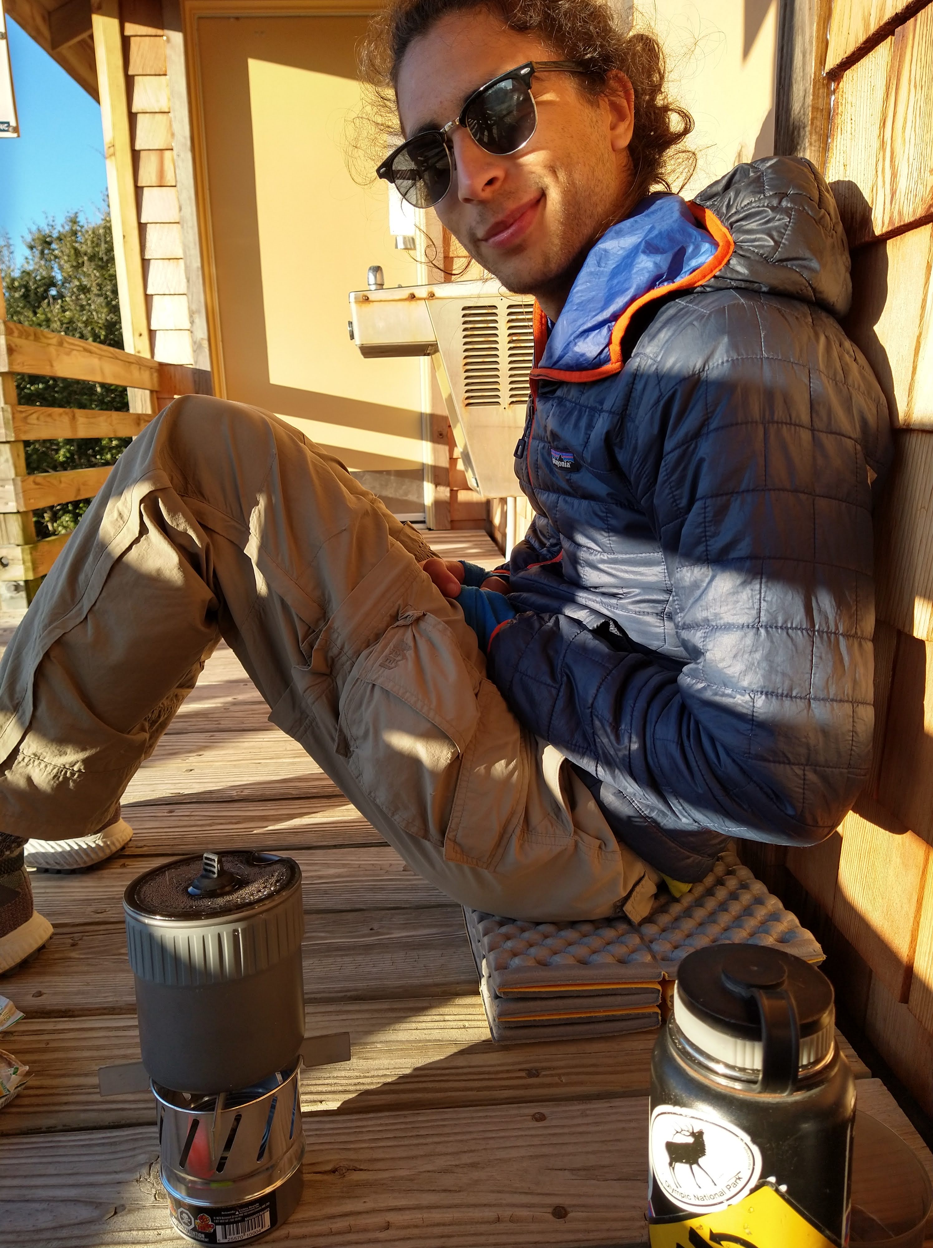
Sometimes the trail would dump us into a town, either if the beach access was closed or privately owned. This was cool for a backpacking trip because it meant we could restock on food or get easy food in town before continuing. Unfortunately no store sold isopro, which we ran out for cooking about half way through. We’d stop into small delis for coldcuts to have for lunch or if we passed through in the evening, we’d buy a beer or two to take down to the beach for sundowners.
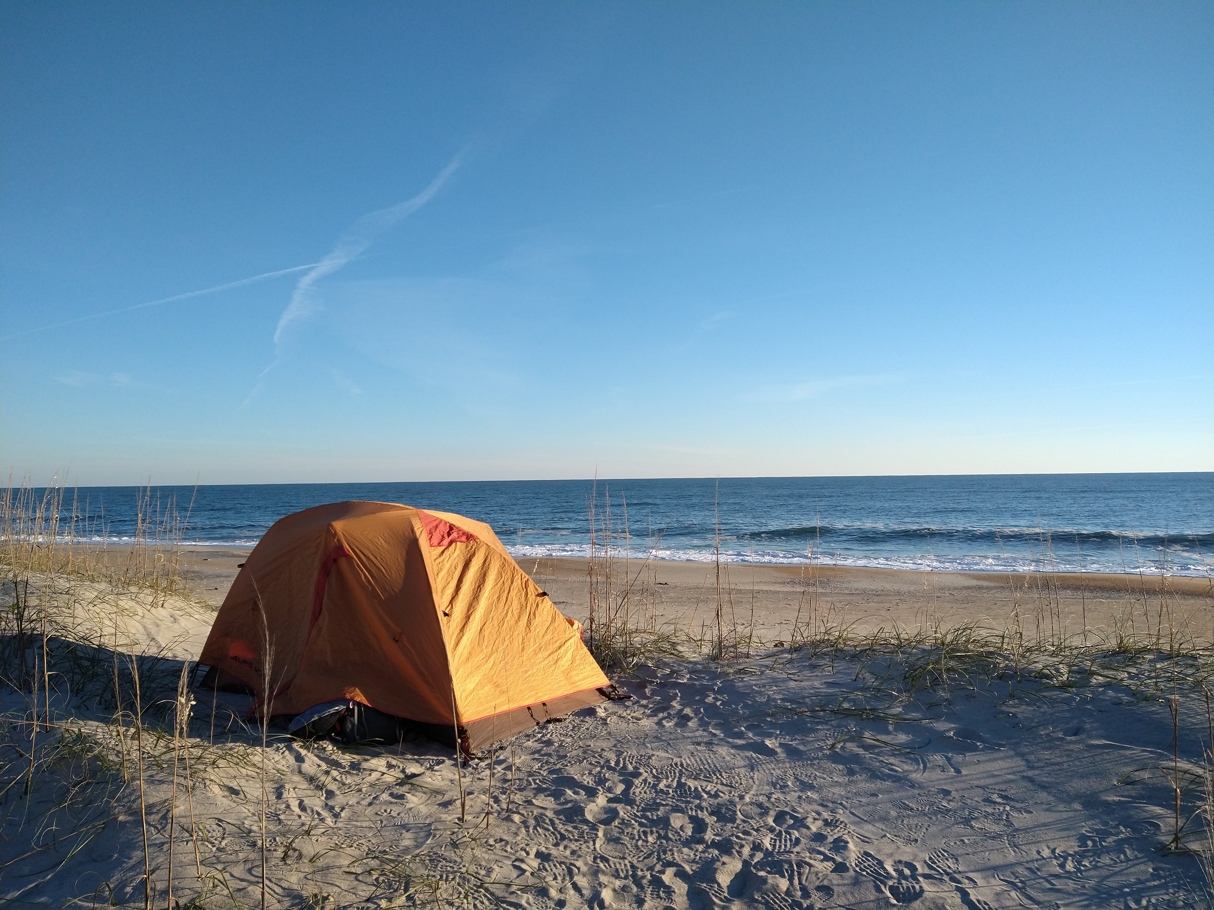

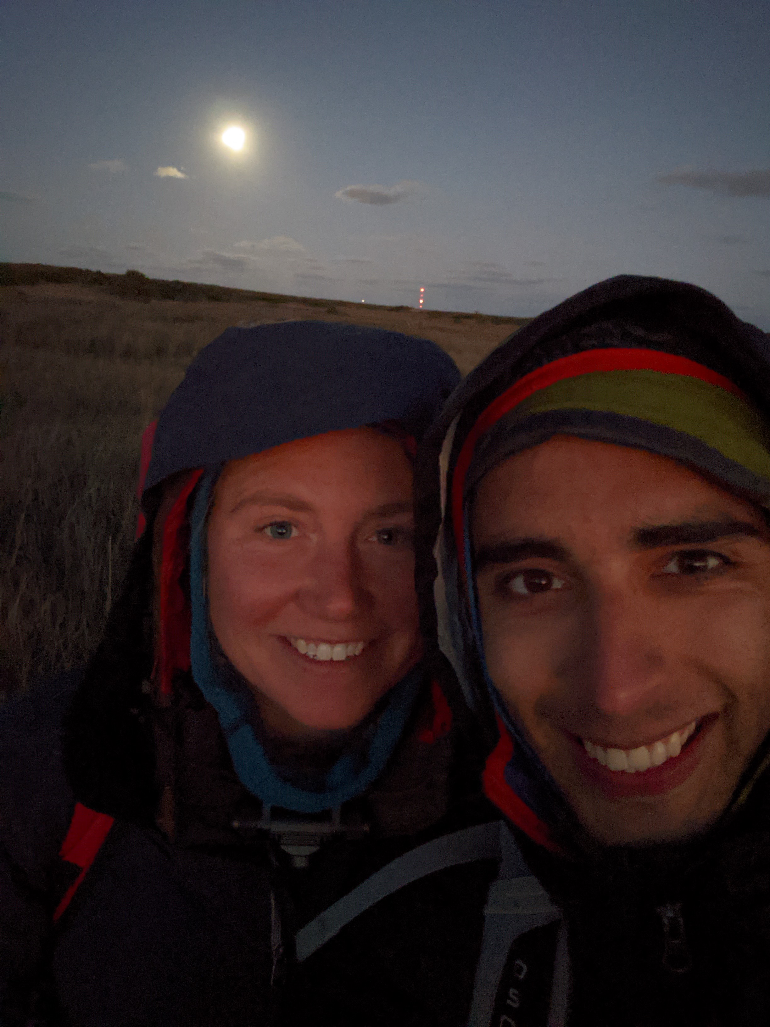
Our bodies got worked walking in sand all day. Walking South, the slope of the shoreline made it so our right foot hit higher on the beach than our left. My right knee was getting sore and Andre’s arches were bugging him so we tried walking barefoot on our way to Avon, ~5 miles barefoot. It definitely helped and just like the days prior, we fell into a rhythm of walking that ticked the miles away. It was the warmest day of the trip and we actually stripped down to tank tops at one point. We decided to treat ourselves to a real lunch and went to the Froggy Dog in Avon for burgers and beers. We had planned to camp at a campground nearby called the “Sands of Time,” just a half mile from the bar. But when we arrived it was very clearly closed. Luckily the tap was still on for water so we filled up and walked back to the main street of town. We continued to look for isopro but no stores carried it. We ended up purchasing a small emergency fuel stove for $12 – it never really got things hot. We camped up on a dune ridge that night. I noted in my notebook that the moon was nearly full and I could see Orions belt really clear.
This next day will continue to amaze me that it all happened within a single day, since it was really two days worth packed into one.
As we were packing up camp, a woman approached us on the beach. It was an area that there were a lot of fisherman so we weren’t too surprised to see people close by. She said she had seen us walking through a town farther North a few days ago and was wondering what we were doing. I don’t think this segment of the MST sees a lot of hikers, and especially not in the winter. We told her our plans to walk to the ferry and take it Okracoke. She went back to her truck and returned with some pecan sandy cookies and a baggie of jolly ranchers for our walk, pretty neat.
We started the walk with high winds that made cool patterns in the sand – it was almost mesmerizing. We had a full morning of walking, listening to an air pod each (Netherfriends was what we were listening to), working up an appetite and planning to head in the next town for some food. We saw a sign for smoothies in the town of Buxton and of course decided on buying some. From there we walked by the lighthouse and across the triangle of land that juts out from the island into the sea. We planned on camping at a campground in Frisco that night as advised on the MST segment 17 guide we were using. We arrived to a very empty campground, but with an unusual amount of walkers walking the roads. We set up our tent, cooked dinner on the lame stove that we had to buy in town, then brushed our teeth and prepared to crash into bed. Just then, a park ranger pulled up, stepped out of his truck, and turned on his chest camera making the situation feel super tense, at least to me. He told us we couldn’t camp there and that all campgrounds in Frisco were in fact closed. We asked if he knew of literally anywhere we could go as it was now dark and he shrugged – didn’t know, didn’t care, but we couldn’t stay there. We packed up, hit the beach again, and continued South under the moonlight. He had warned us we couldn’t camp in the dunes between Frisco and Hatteras, so we tried to think of other options. Hotels and motels were closed, no campgrounds, illegal to wild camp and we felt the threat that he would be looking for us if we tried. I thought to try AirBnb to see if something was available (around 8 PMish now) and there was a room at Seagull Motel being booked out. We paid more than we wanted, since we didn’t plan to lodge anyway but also because with covid there’s a cleaning fee for accommodations. Once we arrived at the room, the code to get in didn’t work so for the next half hour we phoned different numbers from the AirBnb site to finally get in. We figured we had done a 15 mile day, two sevenish mile days combined.
The last day was shorter than we originally planned, and sooner too since we covered more miles than expected each day. We walked from the motel to the ferry terminal only a couple of miles apart. We saw dolphins surfing the waves again, a pack of 3 at a time! From there we walked onto the ferry, rode it over to Okracoke Island… and then realized our mistake. As we approached in the ferry, the terminal did not look like how we imagined it when we looked at the map. There were no towns or buildings, just a dock. We soon realized that the ferry we thought we were going to was on the opposite side of the island, and where we were supposed to deliver our gift. We explained the situation over the phone to the string of relatives involved in receiving this gift and eventually the mother agreed to drive the 7 miles to us to receive the gift (which I think were a pair of socks), and give us one to give back to her daughter. We waited on the side of the road in a heap for her to arrive upon which she bestowed some awesome snack food for us, just when we ran out! I munched on dill pickles and Andre enjoyed the pistachios. We took the next ferry back, then got picked up by Hailey and returned to the van. Apparently her dad had been worried about us with the weather and what we had gotten ourselves into. That night we slept in Wells behind the kite shop and binge watched the office, snacked on cheezits, and drank some ciders.
We walked 67.9 miles in 6 days. I decided to stay on at Duke and live in NC for another 6 months.


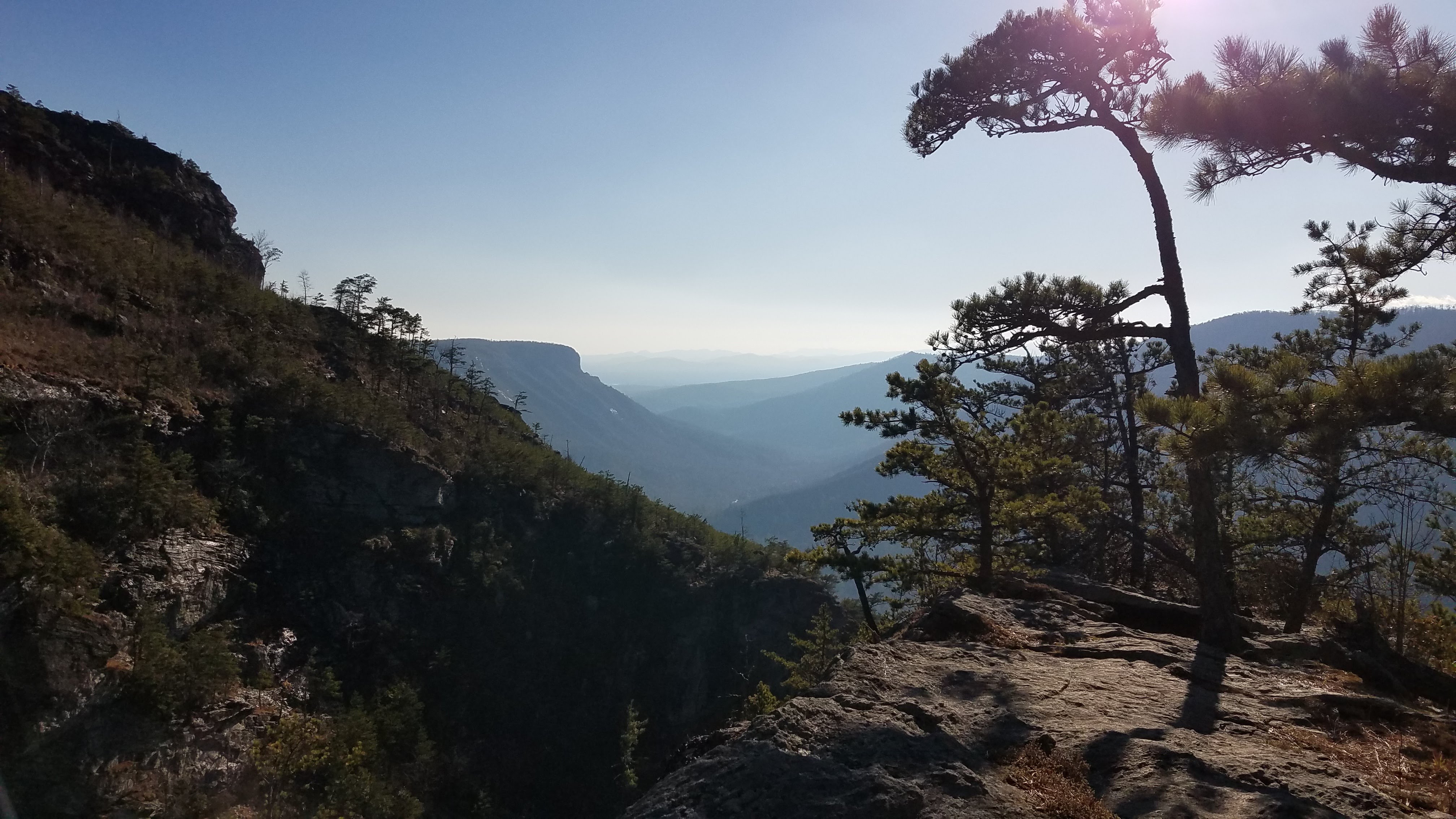
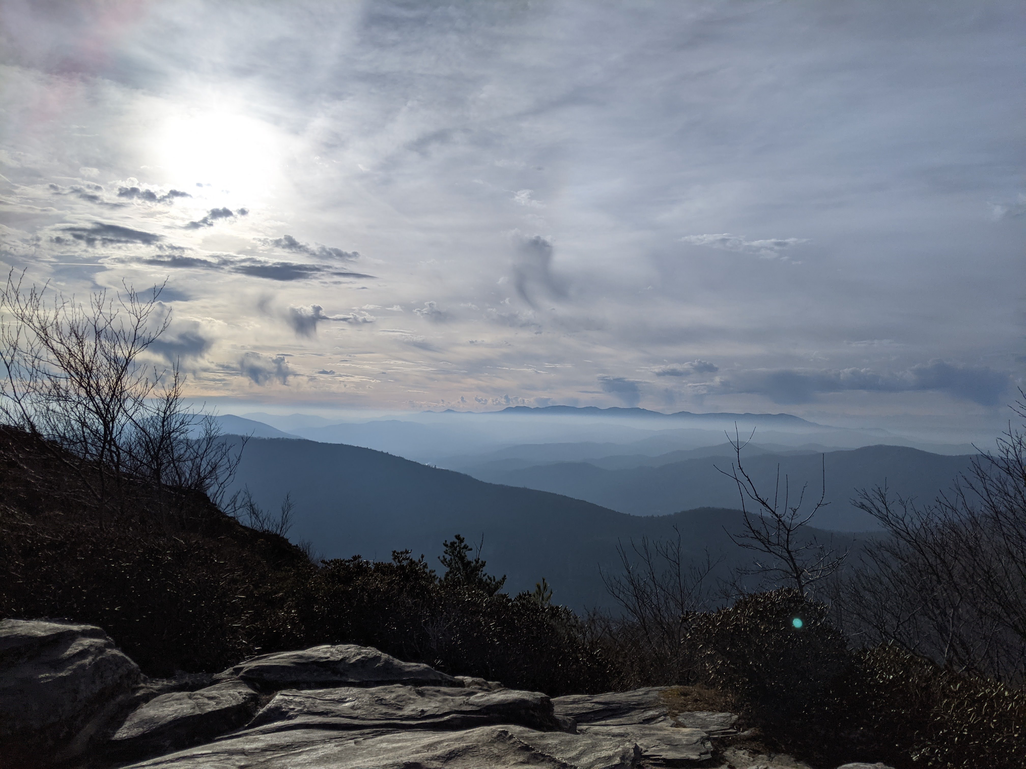
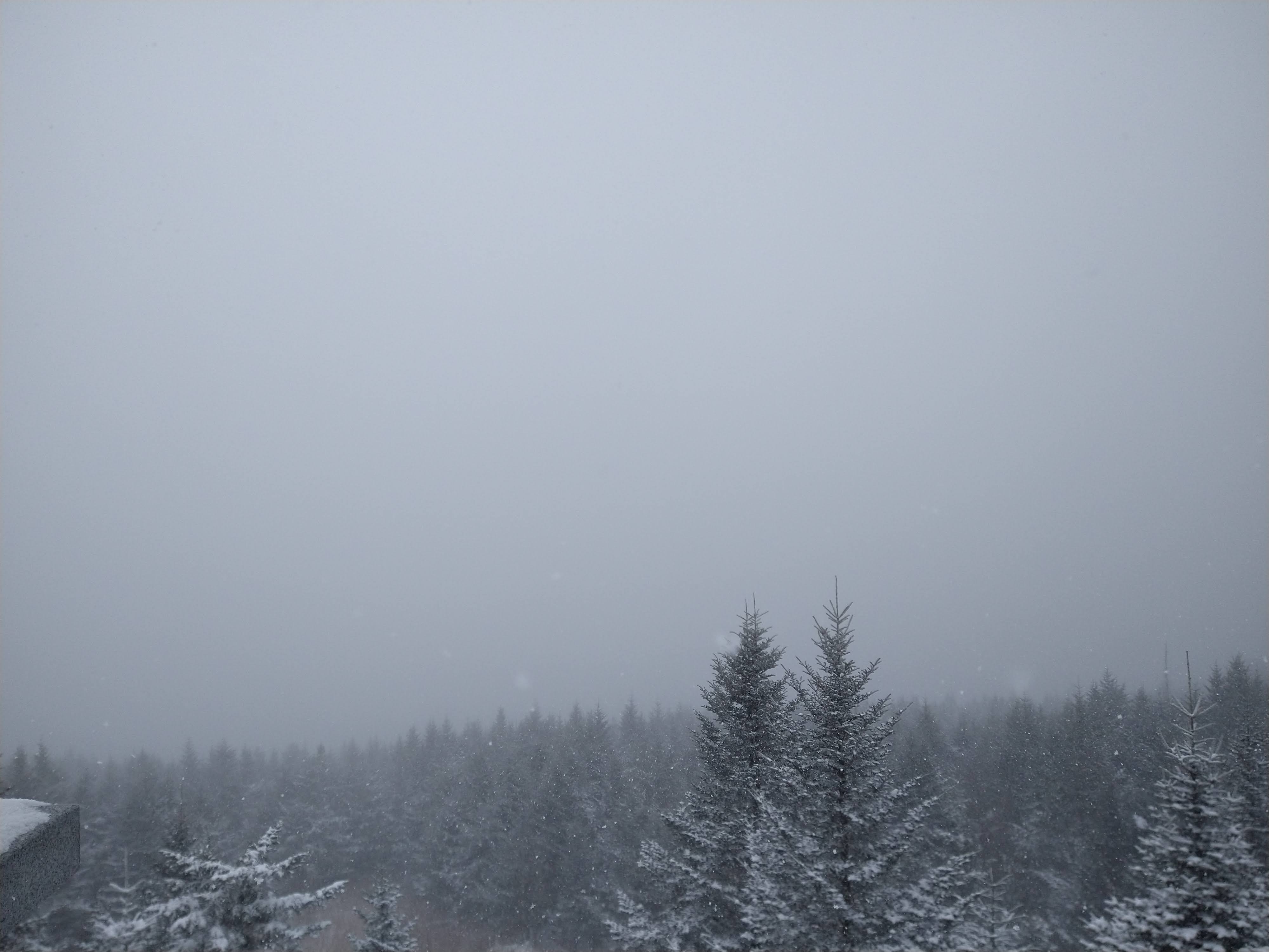
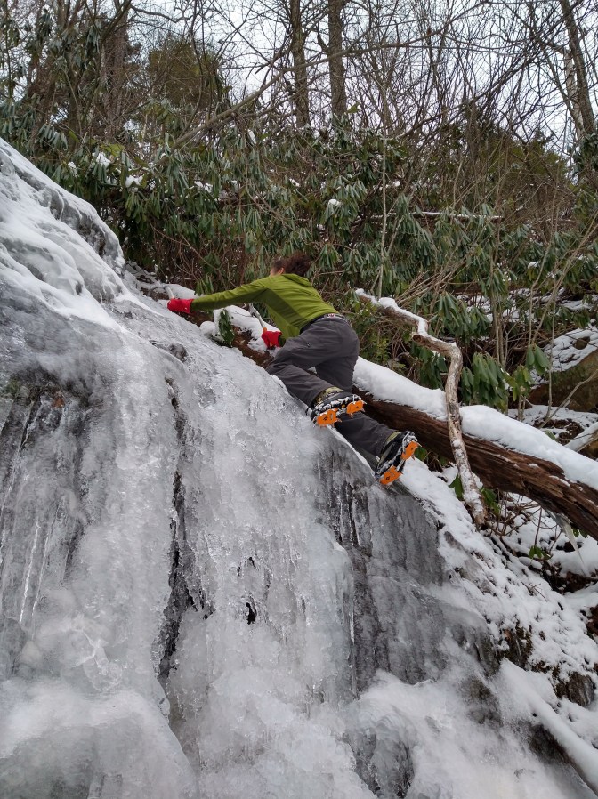
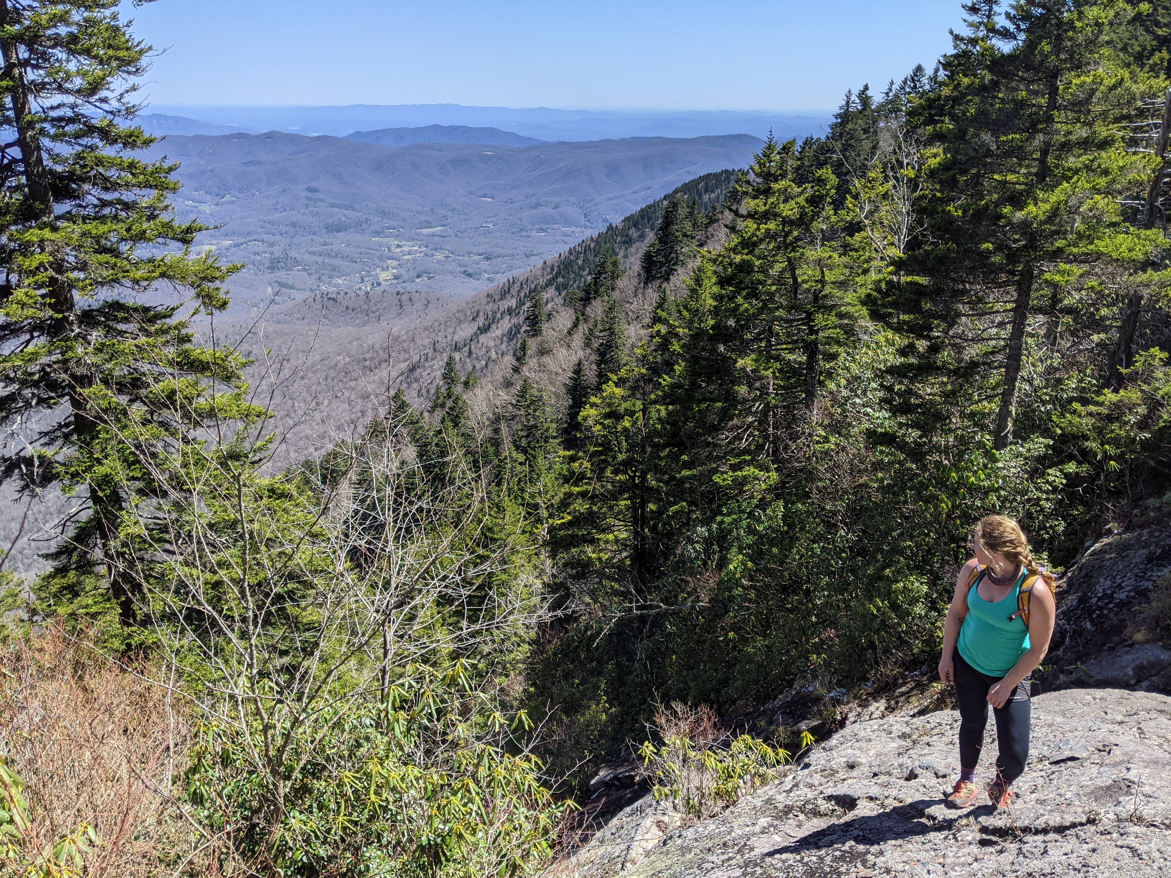
Mount Mitchell NC – January 2021
Mount Mitchell is the highest peak on the east of the Mississippi River. I decided if I live here I should probably hike it, though there is a road that goes all the way to the top in the summer. When I got to the summit this is what I saw – great views yeah?

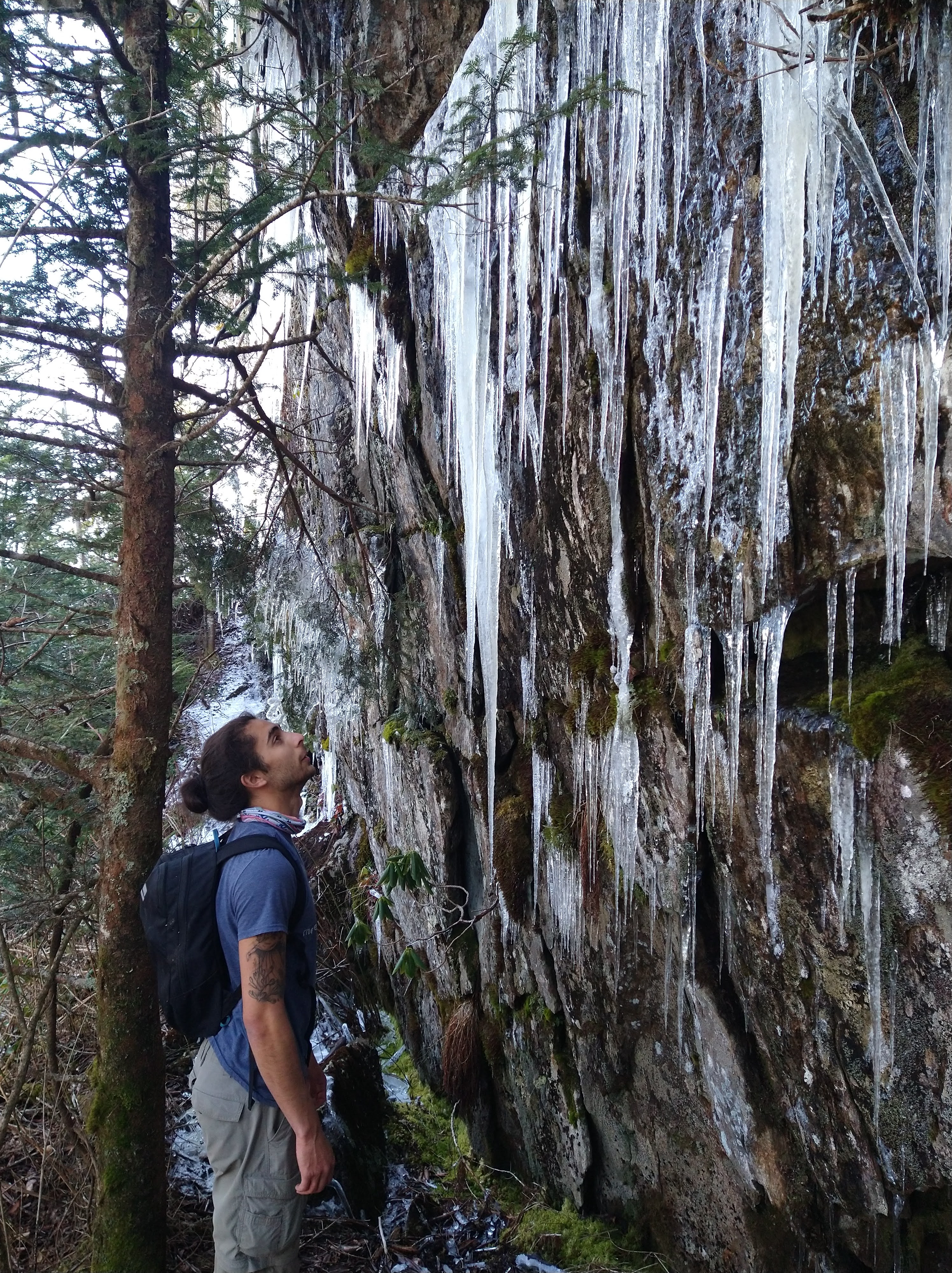
I met up with Andre at a rest area along US 40 after hiking Mount Mitchell; he had been cragging at Pilot Mountain. We wanted to try to ice climb a scramble on Black Mountain called left wishbone. Sunday morning we tried to find the base of the climb but ended up going into a drainage too far North (in hindsight) and were not able to do a proper climb, but we played with ice tools and screws on this little frozen waterfall.
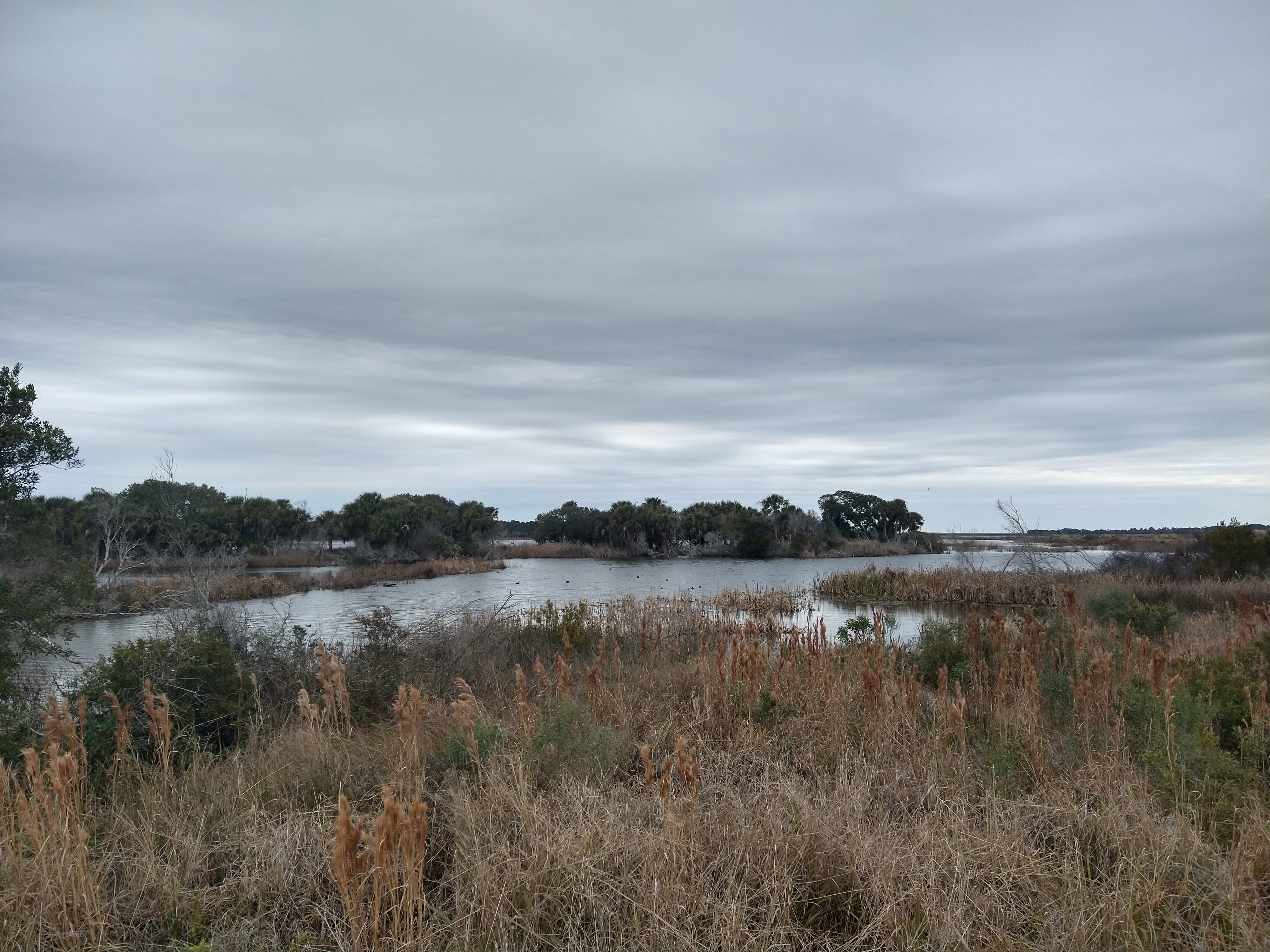
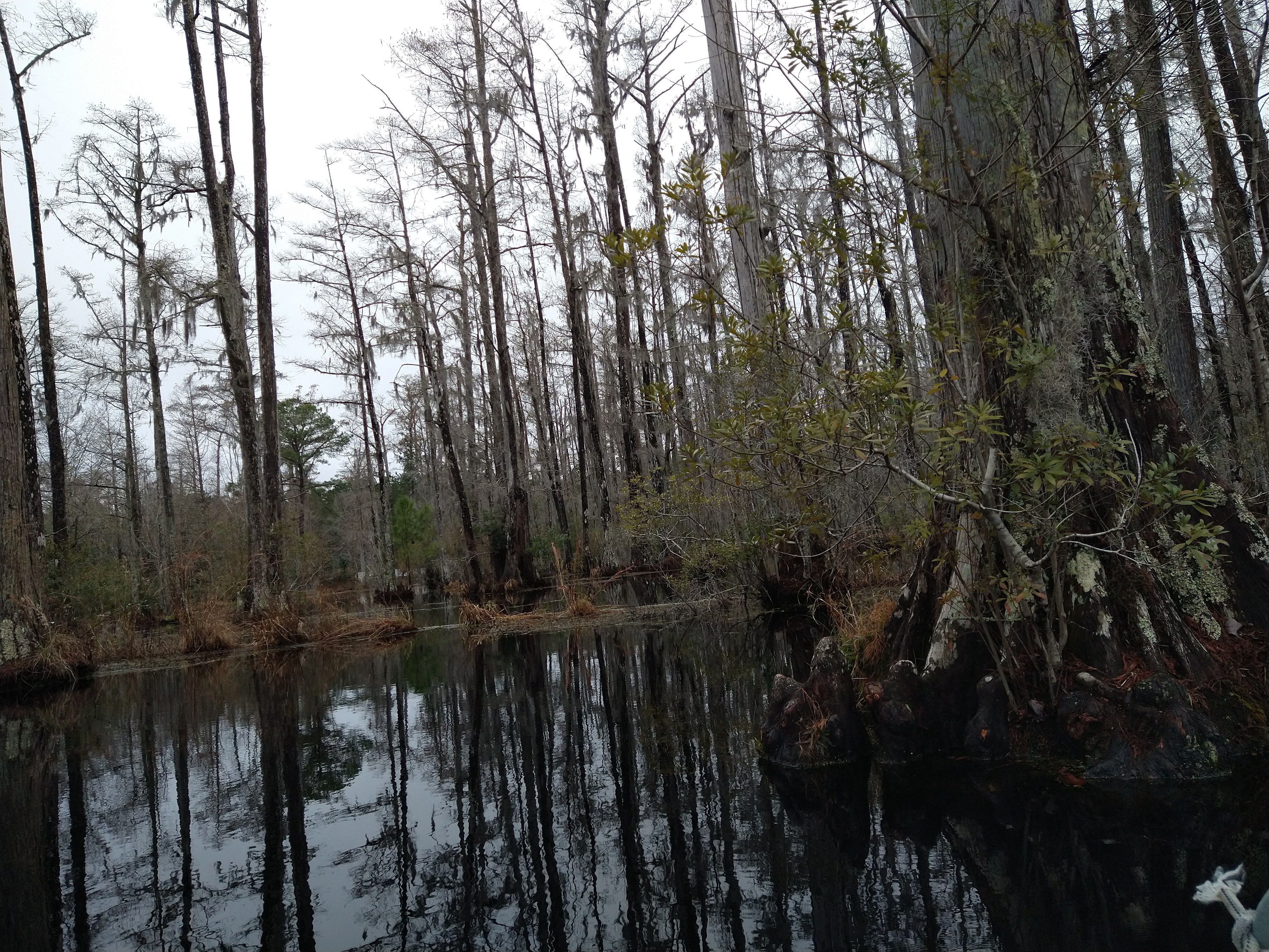
Bull Island SC – February 2021
I read about Bull Island off the coast of Charleston in South Carolina and decided I wanted to do a solo trip down there to check it out. I had an idea that I would want to paddle to the island but wanted to do this scouting trip first. I booked a ferry over and got dropped off into what felt like a lost marsh world to romp around. The captain of the ferry told the dozen or so passengers that we probably wouldn’t see any alligators because it was so cold. So that became my mission: to find the alligators (and of course ditch the crowd of people that I assumed would just hang out on the closest beach). I had about 4 hours of exploring time before I had to be back on the dock so I mapped out a loop of trails to explore and took off. I did indeed find 3 adult alligators on my wandering and made it to my destination of Boneyard Beach. This beach contains the remains of a maritime forest and they surely looked like bones of the forest in the tide. I decided I wanted to return to paddle the five or so miles from the mainland to the island and hike back to that beach, ideally for sunrise.


Cypress Gardens SC – February 2021
When looking for things to do nearby Charleston, I found this swamp where you can rent a small boat for $5 and look for alligators. The paddling scene in The Notebook was filmed here, though I didn’t see any of the white geese or swans or whatever was in the movie. The boats were a bit wide for one person to paddle so I had to slide along the bench while I paddled on either side. It was really cool paddling through the Cypress trees, I did not see any alligators.

Bull Island SC – February 2021
A plan was put into action to paddle out to the island. In the weeks between my first trip down there and when we decided to go, we dodged rainy weather and were able to get some climbing in at Stone Mountain and also embraced the rain and went on a very soggy hike in South Mountain Park to check out some waterfalls. The last weekend in February looked like ideal weather to attempt the plan.
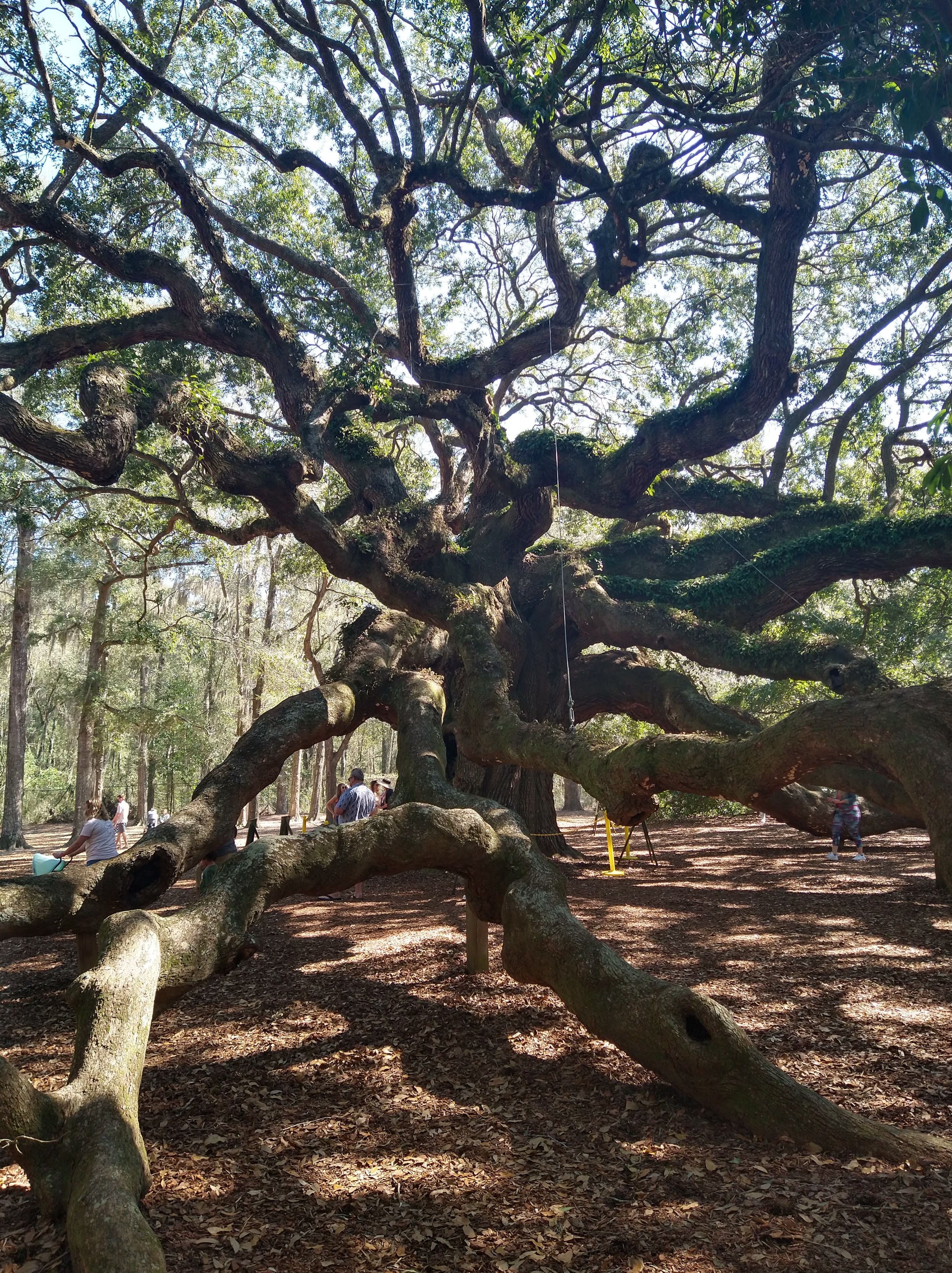
We stopped at this really cool tree: Angel Oak Tree. It’s considered to be the largest live oak tree and is estimated at being between 300 and 400 years old! The branches were so huge, they sprawled across the ground and reminded me of a gigantic octopus. A lot of the branches were hollow and some wooden posts had been set to support some of the decaying limbs.
I had imagined a tandem close-top sea kayak when I reserved the kayak online from the expedition company. They also offer guided trips there so when I told them my plan and that I’d like a tandem, I was surprised this is what I got. But we were determined to make it work. We took a practice paddle down Shem Creek and into the Hog Island Channel. The creek had lots of boats docked alongside and bars that were brimming with college aged kids. It was pretty scary to not see any masks and definitely not any social distancing. We were glad to be in the water away from everyone. Somehow Andre missed a dolphin charging through the water literally directly towards us. I thought it would be good if I was in the back to steer and he could be the motor in the front, our test trip was a success so we proceeded with the plan!
Getting the kayak on top of wells was a mission but eventually we got it securely fastened without it resting on the solar panels or vent fans. We camped in the same swamp I had found the few weeks before and had a nice fire while using the crashpad as a couch.

Our alarm went off at 3:30 AM and we were at the ferry terminal a little after 4AM. We had packed our bags the night before with snacks and water. We tossed them in and clipped the life jackets to the boat (the ferry captain had said if someone fell off the ferry, they would just need to stand up – the water was really shallow in the estuary). It was pitch dark, I had never really had to navigate a boat in the dark but eventually our eyes adjusted and we could make out the islands and channels we would be heading towards. The black night sky joined the inky, glassy water somewhere in front of us but it was impossible to tell where. The moon was setting and reflected perfectly in the estuary. It truly felt like we were paddling into an abyss. We couldn’t decide if it was frightening or incredible, or both.
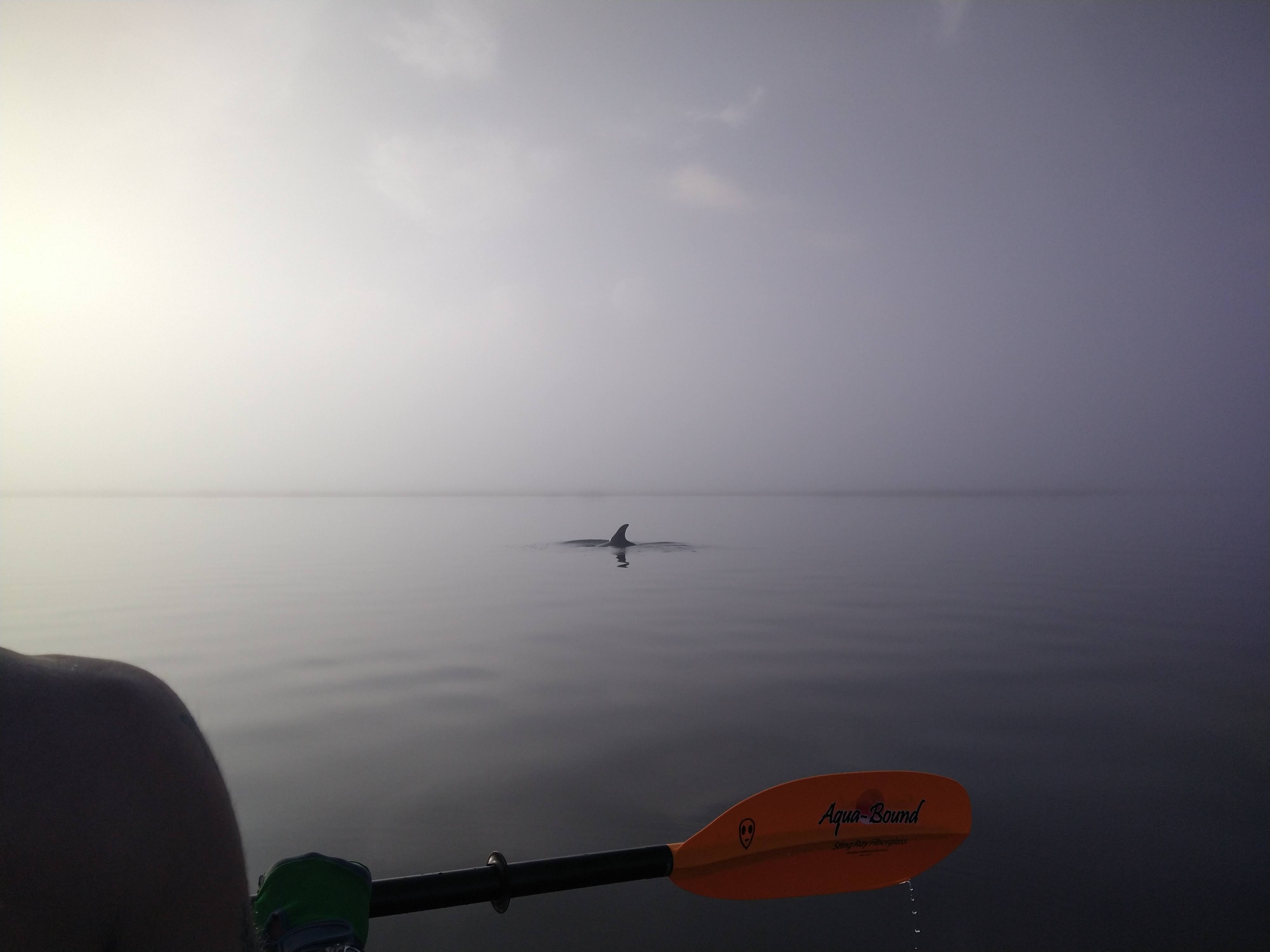
We made our way across the estuary leaving Sewee Bay and into the channel that the ferry had taken. We had a map of the ferry route to compare with where google maps tracked our location. The sky began to turn pink as we made our way through the first set of channels heading East and then South towards Hickory Bay. Before entering the bay, we saw a family of dolphins hunting in the channel. We were able to glide along the water and get close enough to hear them breathe on the surface. A young dolphin was paired up with an adult and you could distinctly hear each of them take a breath. It looked like the baby was mimicking the adult and learning how to hunt – truly incredible.
We got a little lost in Hickory Bay and did a complete lap within it before finding the exit channel. The sun was starting to rise so we knew we wouldn’t make it to Boneyard Beach in time for sunrise, which would be another 3 miles of hiking once we got to the island. The sunrise was beautiful from the kayak though, so it didn’t feel like we missed out.


The last channel that feeds into Summerhouse Creek was the most difficult on the way out. We’d be against the tides in both directions, which would make it tough but it didn’t seem to present a huge challenge while we were planning. The sun was so bright and the fog/mist was still hanging around at water level that it was impossible to see anything. Now it was as if we were paddling through bright blue sky! We fought our way against the tide and eventually made it to the ferry dock. We didn’t see evidence of anyone else there but I had brought my bike u-lock so we locked the kayak to the fence around the terminal.
We spent most of the day on Boneyard Beach. It started off foggy but soon was warm, sunny, and completely empty. We collected a few shells, marveled at the bones of trees, and took a quick dip in the ocean before making our way back across the island. As we hiked back, we ran into a group hiking out towards the beach. Two of the women had t-shirts with the expedition company we rented the kayak from. They asked if we paddled over in the open tandem kayak, and when we confirmed, they were surprised we did. The two women were guiding a family on kayaks to the island and a hike to boneyard beach; I’m sure they had more expedition style kayaks than our big, yellow, paddle-board sized one.
Paddling back was “a triumph of the human spirit” in Andre’s words. We were against the tide, as we were on the way out, but there was a strong wind coming off the shore. So much so that if we stopped paddling, we would get pushed backwards, back to the island and the sea. We fought our way through the current; our arms sort of went on autopilot to ignore the tiredness and soreness and keep pushing. Andre’s hat got tossed off from the wind requiring an extra effort to paddle back, get it (which almost flipped the boat since we went directly over the hat), and regain the distance we lost.
At some point we got the channels confused and came out too early into Sewee Bay. We could see houses across the bay and decided to go for it and paddle across. At one point we stopped paddling to take a quick break and were baffled why we were not being pushed backwards by the wind. Maybe we were pointed in the right direction or the bay was protected somehow? Wrong, we were beached. In thick mud that was like quicksand. Andre stuck a leg out to see if we could walk and pull the kayak back to deeper water but his leg just got sucked into the mud without any solid ground below. We considered waiting for high tide, but that would be hours from then and the boat was due back by 3 PM. We decided we had to paddle/dig our way back to the channel. We “paddled” through the soft mud that inevitably got flung up onto the boat and covering our bodies as well. Paddling the mud was harder than even paddling against the wind and tide and only slowly did we make progress in a big arc back to the deeper waters in the channel. Exhausted, we found where we went wrong and returned to the route we had taken out. We used every ounce of energy we had paddling back across the estuary and into the ferry terminal. The tide was so low that what was a wide entrance into the dock was now just wider than a ditch with thick mud exposed on either side. Somehow, a motorboat got stuck in the mud as the tide retreated. They did not look very happy sitting in complete sun on a beached boat.
After we pulled our boat out of the water and were considering how the heck we would get this mud covered slippery boat up onto the van and return it by 3 (it was about 2:30 PM at this point), we saw the guides and family return and load up their kayaks onto the trailer. We asked if we could just return the boat here, to them, if they were heading back to the headquarters. They agreed and we were thrilled to toss the muddy boat onto their trailer, what luck!

Stephens Gap, AL – March 2021
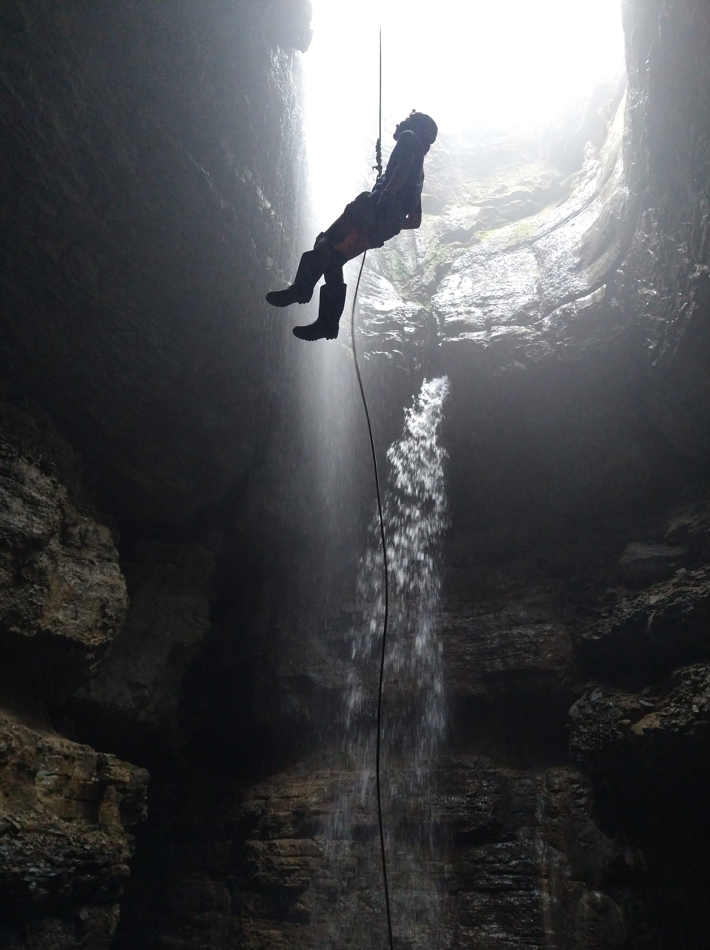
One thing that I really wanted to make happen in my time here was to go caving. The TAG (Tennessee, Alabama, Georgia) caves are the best in the country. I had done a little bit of caving in Pennsylvania and Colorado, then a couple of weeks of it in Cyprus, but it had been years since I’d been underground. We joined the local cave grotto to make connections, but actually meeting up to go proved to be difficult with covid. Eventually, after a few meetings and getting to know some people in the grotto, a string of friends of friends provided us with the opportunity to go. A member of the local grotto gave us contact info of an old member who had moved to Atlanta, GA. We reached out to him and he included a caver in our email chain, “B,” asking if he would be interested in a vertical cave in Alabama (near where B lives, and B is actually his name). Quickly plans were being put into place – I think it was about 4 days between the initial email and when we drove the 8 hours down that Friday to do it. B was clear with the level of skill required, the extra gear he had, which gear we would need to find/acquire before then, and that he could only do Saturday since he had “non-cave” plans on Sunday.
Our list of gear included: knee pads, a wetsuit, helmet, three water-proof helmet lights with fresh batteries, rubber gloves, rubber boots, a rack (caving rappel device), and a cave harness. We were able to borrow a rack from our connection in the local grotto, bought knee pads and rubber gloves at a Walmart on the way, I had a wetsuit, we used our climbing helmets and plethora of headlamps, and Andre had a tree climbing harness from his dad. We needed one “complete” set between the two of us since B had a set for one extra person.
We drove the 8 hours from Durham to Woodville, AL. B said he’d leave the gate to his driveway open and that we could just pull in whenever and sleep there. We arrived around 1 AM, parked in the driveway, and slept until around 6 AM (the time change tricked us). Around 7 AM, we heard a knock on the driver’s side of the van. We opened the sliding door (passenger side) and peered out ready to meet B. He came around the side and greeted us “good morning!” – he was probably around 60 yo, long hair in a ponytail, bushy beard, in a long sleeve, athletic shirt with a tie around his neck. We later learned he wears a different tie every day of the year he has so many. He invited us in for an omelet breakfast and soon the other 2 cavers joined (the couple from Atlanta) and we strategized and geared up for a good chunk of the morning.
The cave was a pull down trip, similar to canyoneering, where after each rappel we would pull the rope through and bring it with us to the next rappel. The route we would be doing involved 3 rappels through underground waterfalls that fed into a big chamber where we could hike out. Since it was a pull down trip, we would be doing a double rope rappel, which meant the rack that we borrowed would not work since it was too narrow. Also, the tree harness Andre brought wouldn’t work since the attachment point was in the back. The friend from Atlanta had a huge rack he had used to rappel in Yosemite, so they were able to frankenstein together an extra rack that B had bought the frame for on a caving trip in Mexico, but didn’t have enough bars to add to make it safe for the required amount of friction needed for the drops we were doing. B ended up using the Frankenstein rack and giving us his to use since the one we put together used the frame from Mexico and it had been welded to repair part of it. He also had an old harness for us to use. After a couple of hours of preparation, all five of us had a full set of gear and were ready to cave.
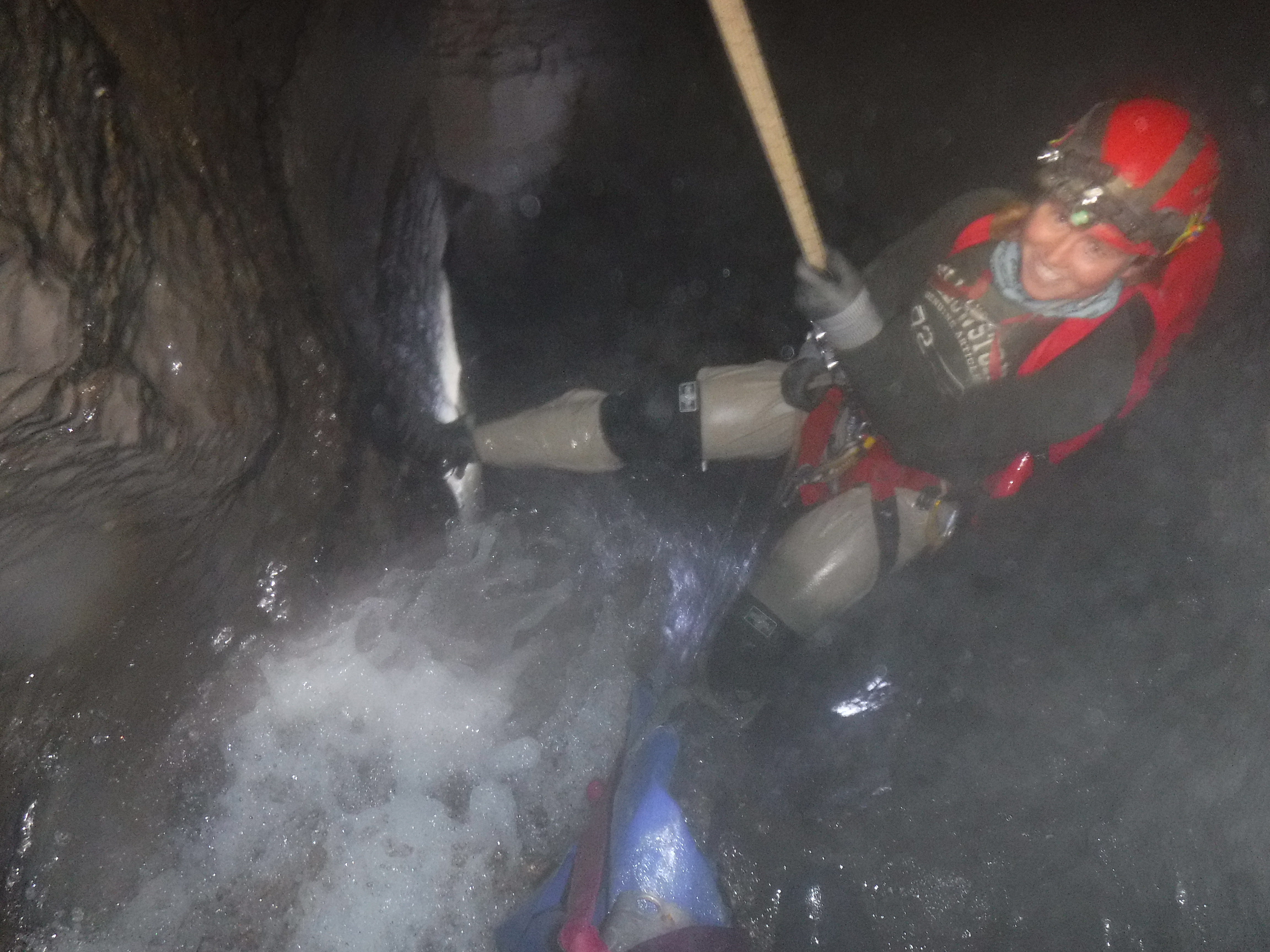
The cave was about half an hour from B’s place, then a mile or so walk from the trailhead. The cave opening was huge (where we would hike out), and lots of people visit the preserve to take picture of the large room – it really did look magical. We hiked up and around to the top of the cave where a stream feeds into the cave from the mountain. The entrance hole was just about body size. B took Andre and I through on one trip, then did a second round for the couple from Atlanta – they had forgotten something at the car and B didn’t seem to mind doing it twice. The first rappel was narrow through a crack in the ceiling of the cave, then it opened up before joining a waterfall. It was impossible not to get wet and I was real glad we had our wetsuits on.
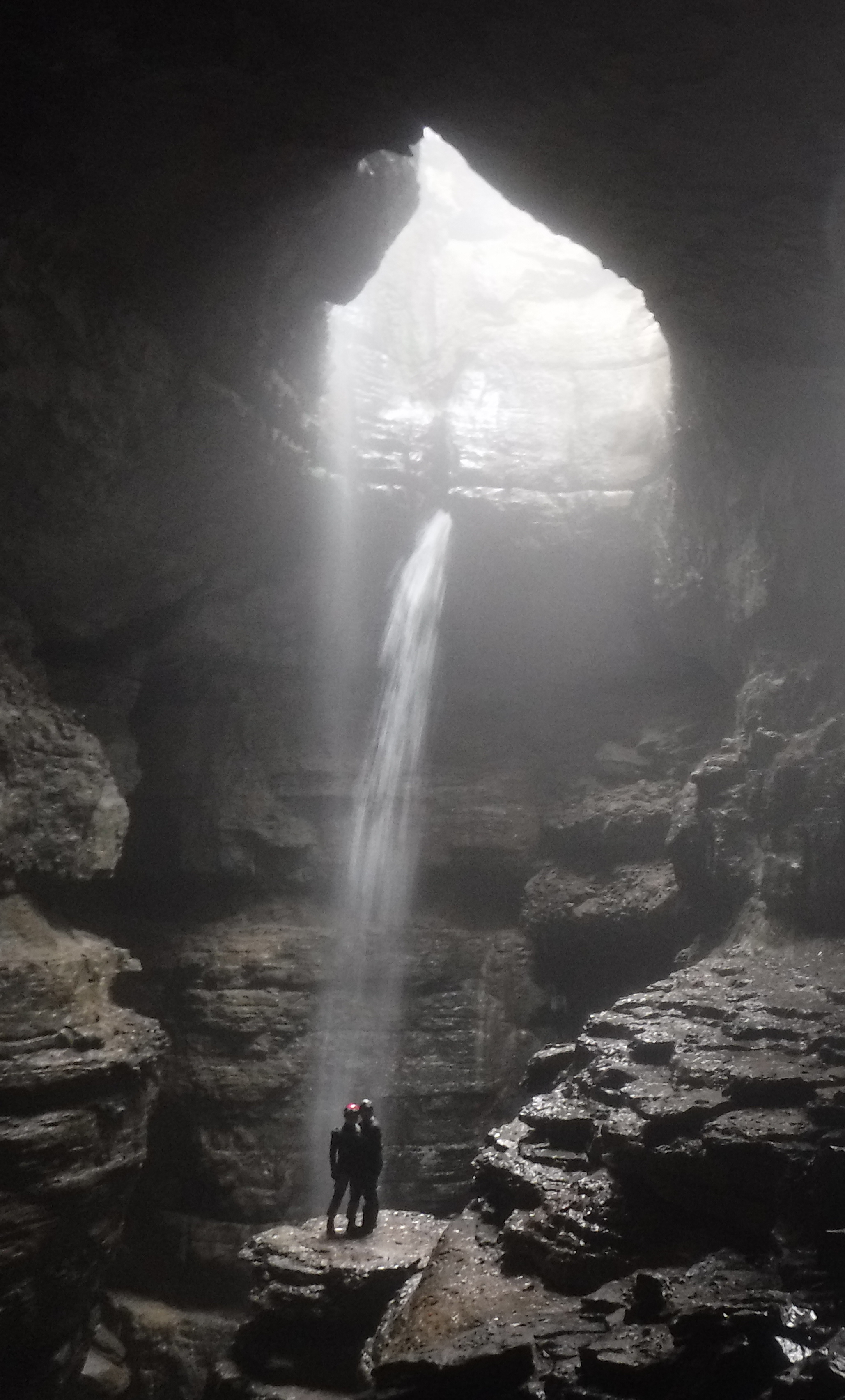
We rappelled through two more waterfalls with B leading the way. He always made sure we comfortable, safe, and having fun and was a super fun guy to be exploring underground with. We saw tons of mole crickets (which are kinda gross) and a bat. The last rappel dumped us into a huge room that was absolutely stunning. From there we followed the stream down into the main entrance of the cave where the rest of our group was waiting.

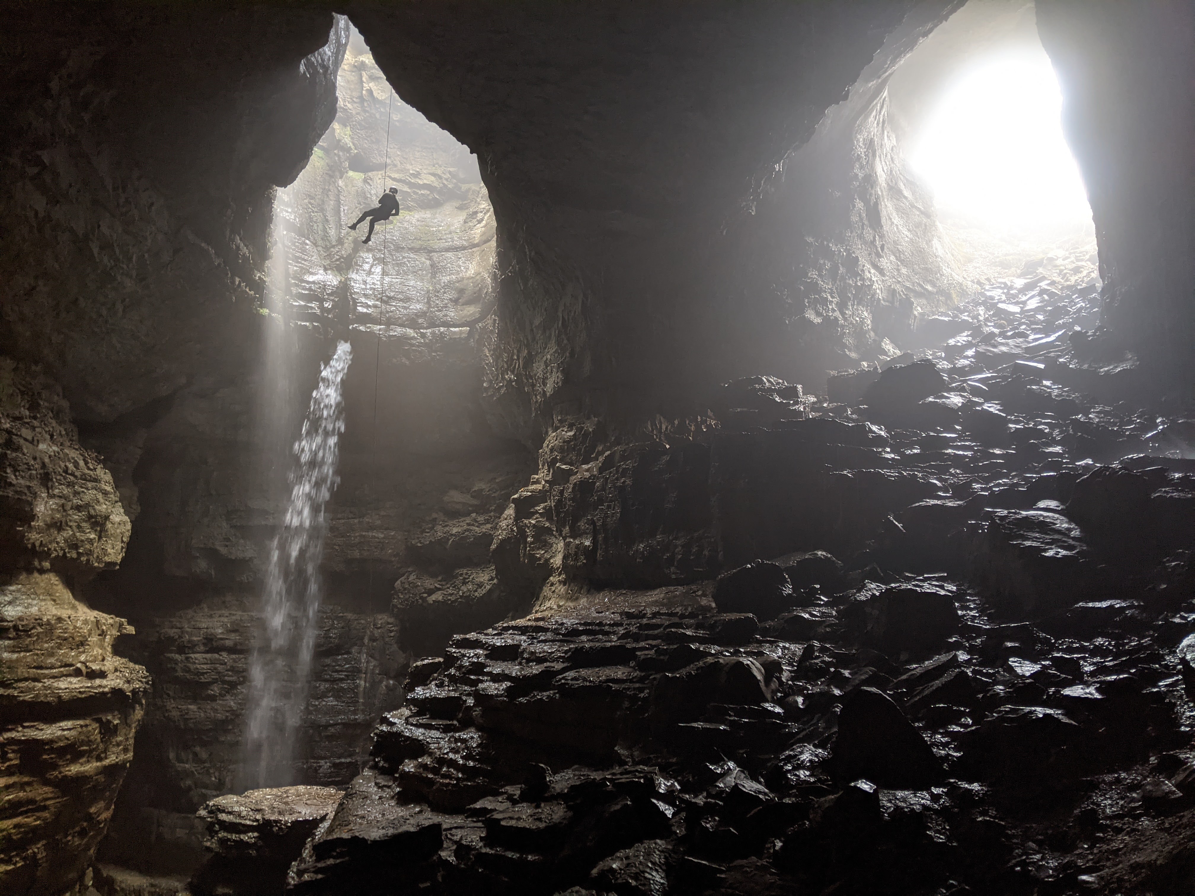
B rigged a rope off a tree by the entrance of the cave to teach/refresh us on bigger single rope rappels and on ascending the rope using the frog system. We each did a lap on the rope, then he left to guide the other 2 members of the group through the cave while Andre and I rigged the big rappel into the main chamber. We had to be careful because there was a pedestal of rock that we needed to land our rappel on, or if we missed it we would have to be prepared to frog back out; having just learned/refreshed on it we decided not to ascend something this deep without B around. We anchored the rope around a tree above the pit, then I hiked down and planned to grab the rope from the pedestal while Andre lowered it down the ~150 feet. I was able to grab the rope alright but it was still spooky reaching out over lower part of the pit and looking upwards towards the rope instead of down at my feet. Since rappelling with a rack was new for him, I stayed at the bottom of the rope and prepared to do a fireman’s belay if necessary. But, he was totally fine with the new technique and toured the chamber on his descent before landing on the pedestal. Once he was on it, I hiked up and out of the cave, and up to do the same rappel. It’s so cool to be suspended in the air and explore parts of the Earth that only bats and birds and small crawling things can experience. The chamber was massive! Andre got some cool shots from deeper inside the cave that I think truly captures the magic of the moment.
We lounged at the top of the cave waiting for the second round to finish, then the friend from Atlanta did a few rappels down into the main pit as well. Eventually, we packed up and hiked our way back to the trailhead. B really wanted us to stay for dinner, quesadillas he promised, but as much as we wanted to stay, we had planned to drive half way back that night to a climbing area in Georgia. We wanted a picture all together but B said he doesn’t like being photographed, but was happy to take some of us. I’m really excited to go caving with B again, he baited us suggesting some bigger drops for next time.
Mount Yonah, GA – March 2021
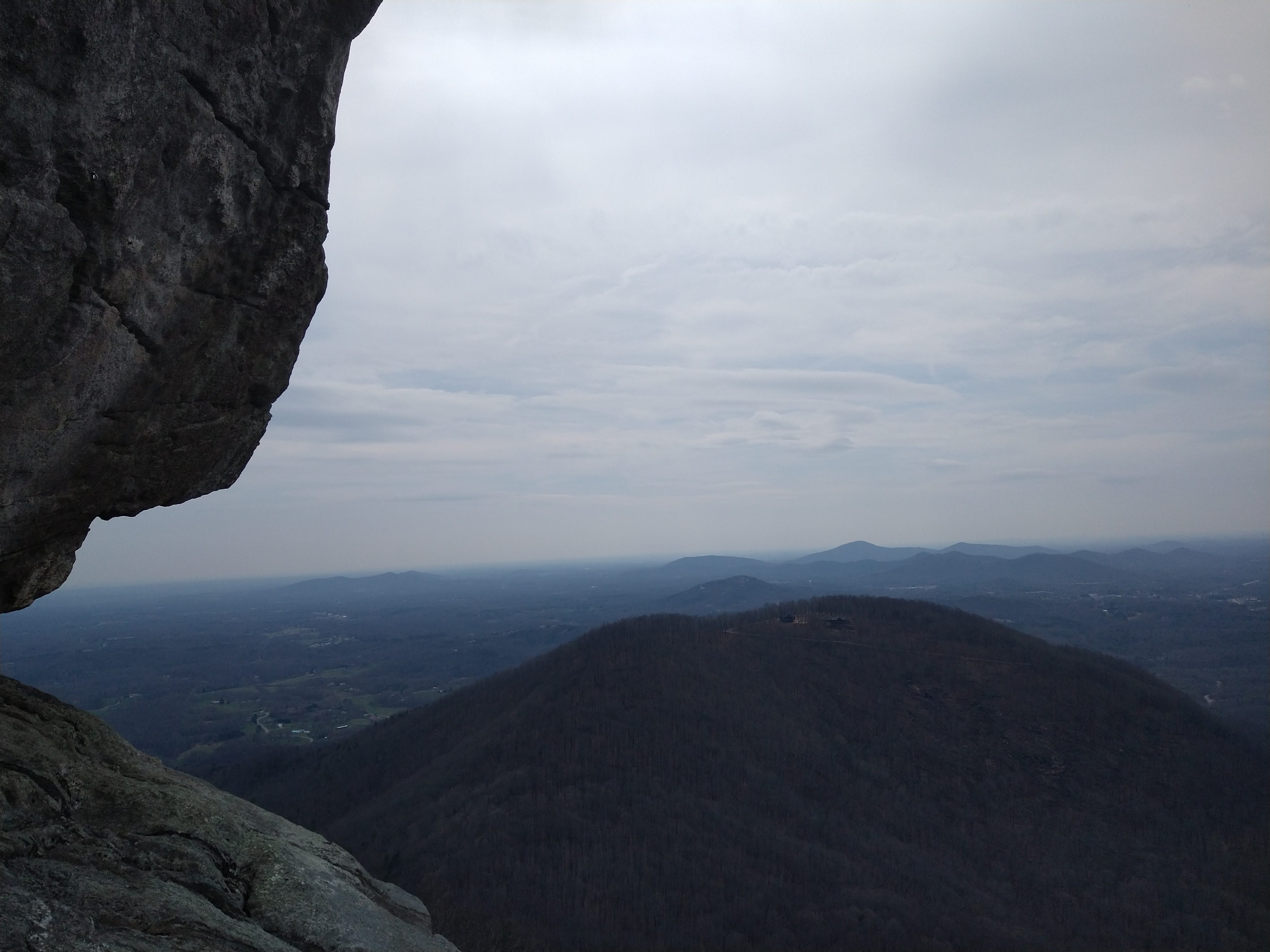
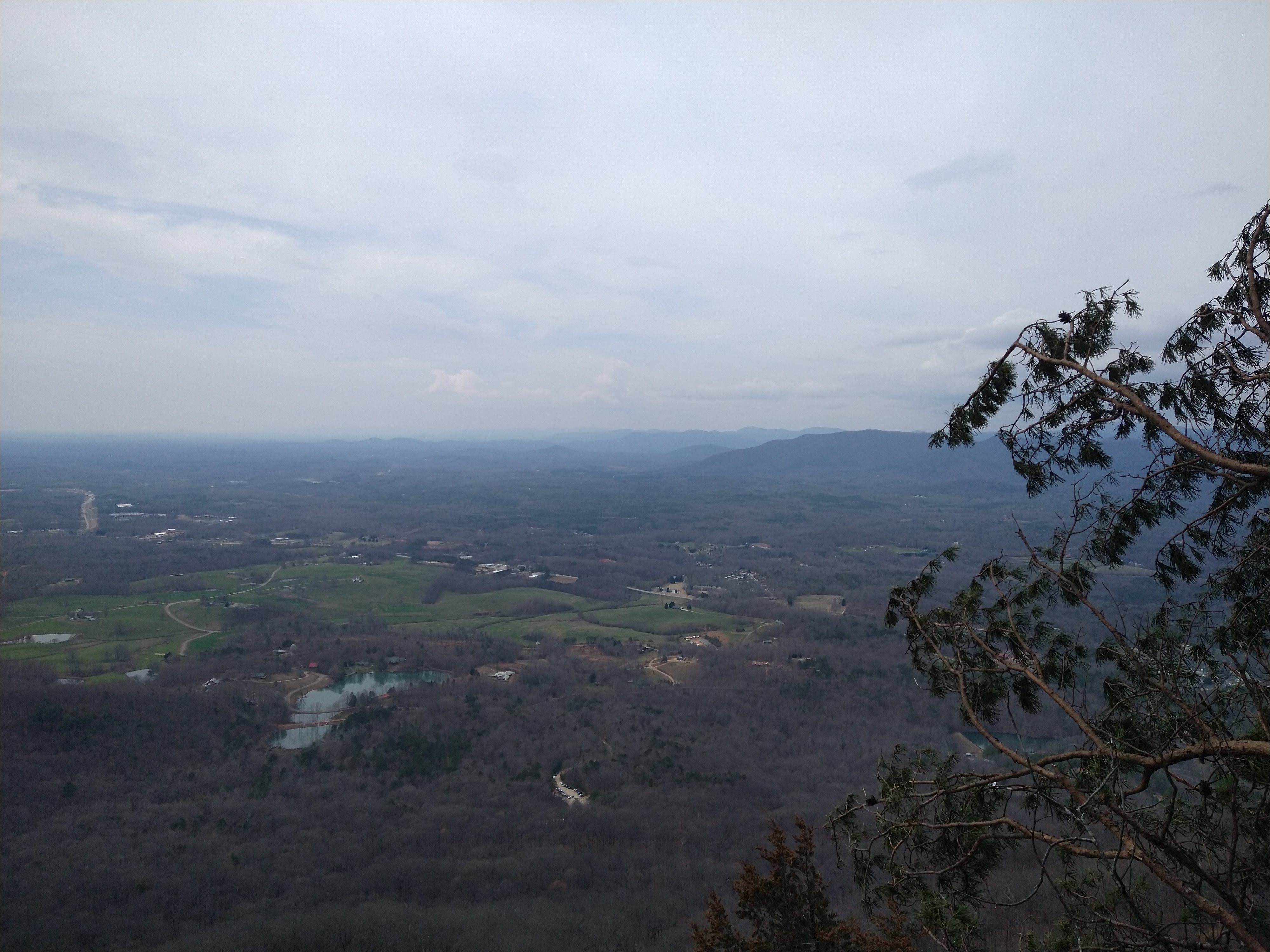
The next day we planned to do a multipitch climb, “Edges to Ledges”, on Mount Yohan in Georgia. We had slept at a Walmart nearby and made it to the trailhead within an hour that morning. The approach was long and bushwhacking up to the face. Andre led the first pitch but the anchors and second pitch weren’t clear, so he cut left and built an anchor and brought me up. We’re not sure where the climb was supposed to go, but the ledge was pretty neat. He led another single pitch mixed climb but then debris from the summit where hikers went started raining down. My least favorite was an energy drink that could have really hurt. We decided to head back since we still had a long drive ahead. On our hike down, we were congratulated by a blonde lady carrying a small dog in a pack. Apparently she thought we were part of the military, who trained there and which was evident by the explosion of bolts on some of the walls.
Looking Glass Rock, NC – March 2021
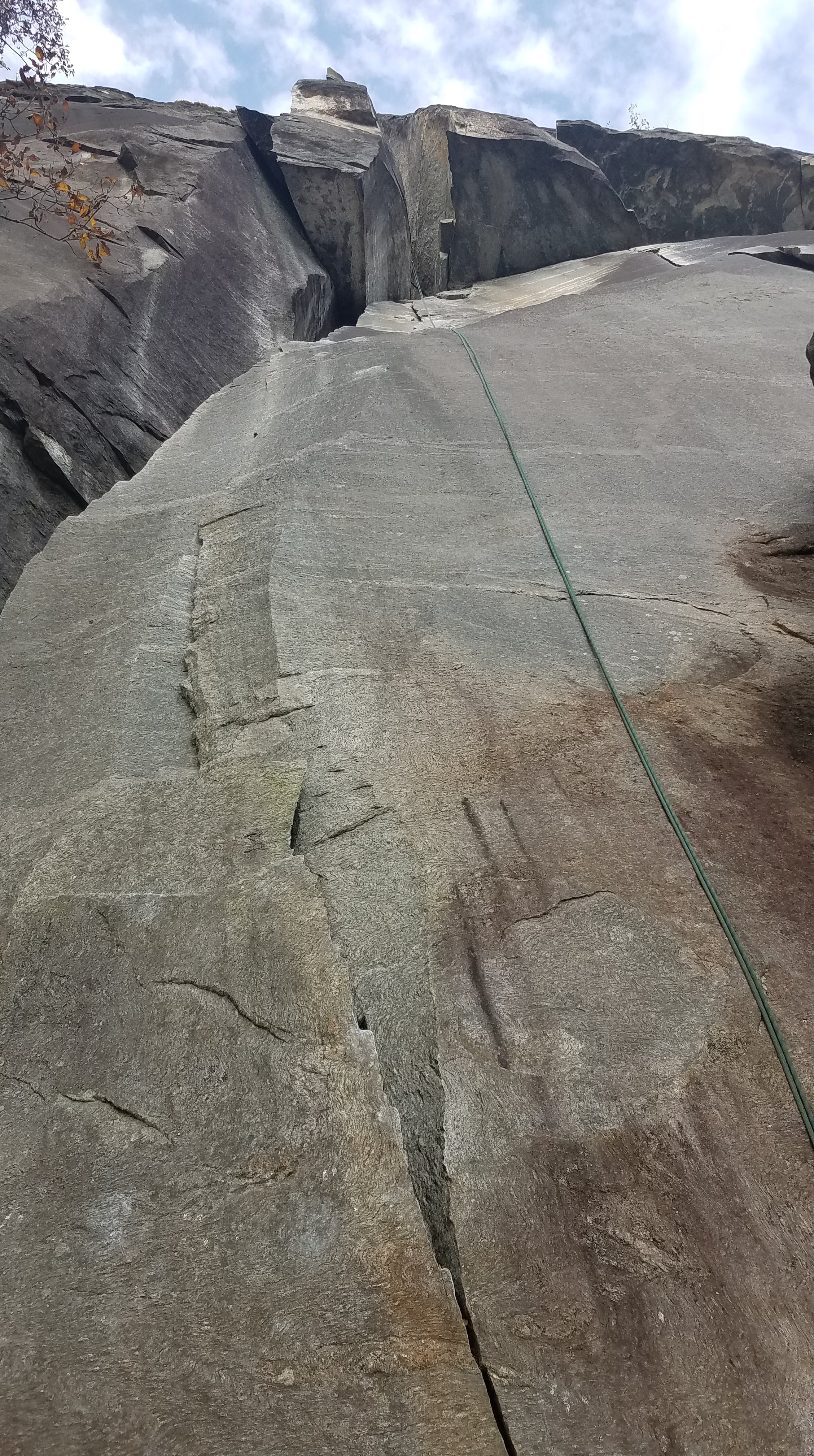
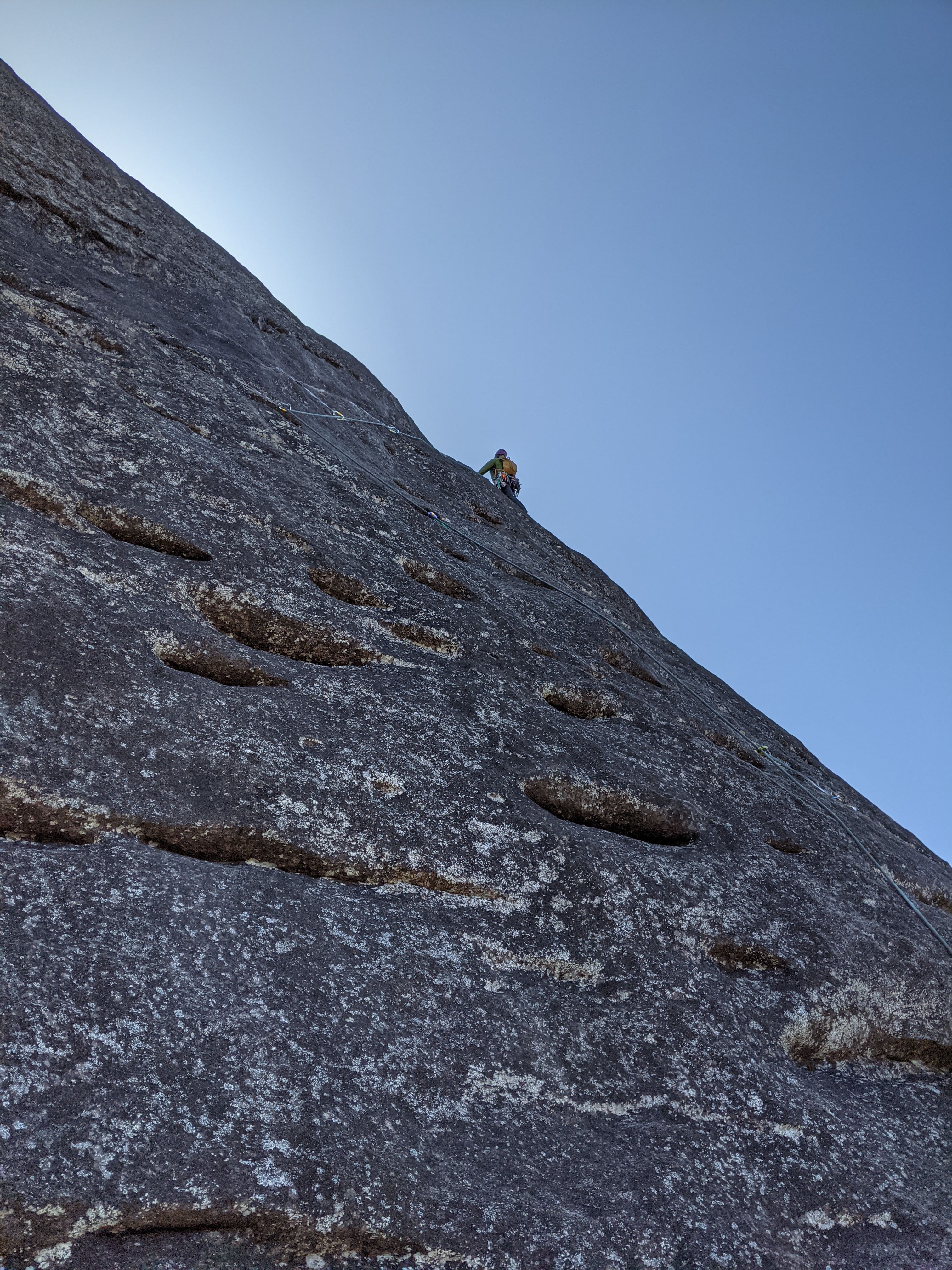
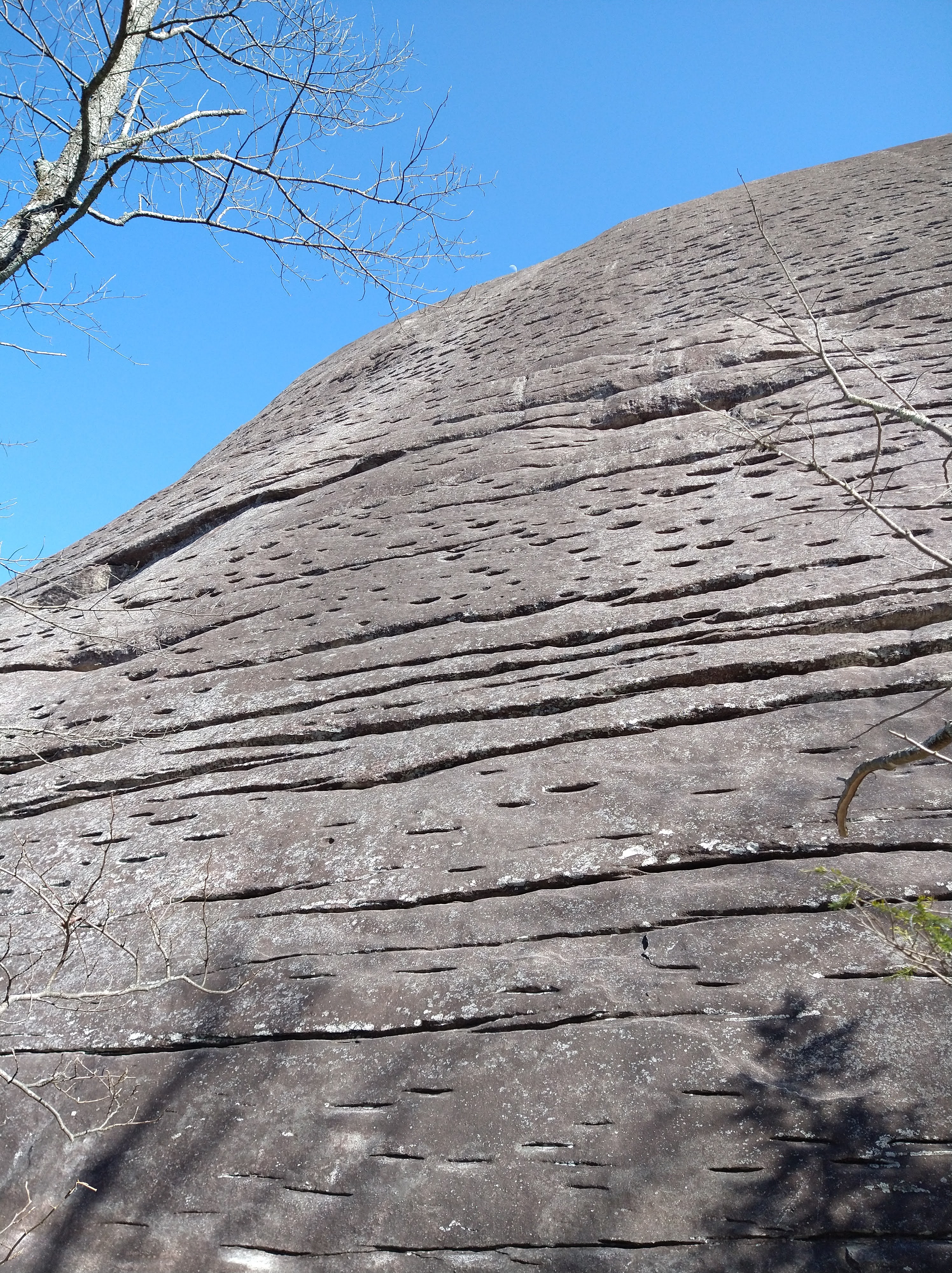
The Nose up looking glass rock is considered one of the best multipitch trad climbs of its grade (5.8) in the state. It has been on our list for awhile but since it’s up in the Pisgah Range, it was either icy or the road was closed through the winter. The road was still closed up to the trailhead when we decided to go, and it was sub-freezing temps the morning we started the approach, but it felt like it was doable while avoiding the anticipated late spring/early summer crowds. We had parked Wells at the trailhead the night before and hiked the 2.5 miles up the closed road the next morning to the trailhead, then the mile or so approach trail to the rock. Looking Glass rock is named so because of how water freezes in the “eyebrow” rock formations covering the rock and glistens in the sun. The eyebrows were so strange, I’ve never seen anything quite like them. From a distance they look like awesome underclings and places to place gear, but once you’re there the feature is shallow and flaring. I found feeling secure by placing my hand above the eyebrow and mantling up rather than doing an undercling. Some of the eyebrows were great to place gear though, especially tricams (which I learned how to place after the third pitch and it blew my mind).
The Nose is a 4 pitch climb. Andre started us off and could barely feel his hands when he reached the anchors, hooking his now frozen fingers onto any feature that he could visually confirm they were in fact holding. After joining him at the ledge above the first pitch, we had a shiver belay huddled up to try to get warm. The climb was North facing and we waited and watched as the sun slowly crept through the forest towards the rock. It was moving so slow though and we weren’t even sure it would eventually make it to us that low on the rock. I decided to begin the next pitch since I could see the sun hitting the rock at the end of it. Pitches 2 and 3 each had a crux move that people either loved or hated according to the mountain project reviews – if slab wasn’t your jam you’d probably hate it. We each led a pitch with an exciting move or two, then topped out at the “parking-lot,” which was a flat space on the rock just before the fourth pitch. Here is where I learned how to place a tricam and they are really cool pieces of passive gear!
The fourth pitch currently had a waterfall running over it from the ice melting from above so the last pitch sort of meandered around the eyebrows. I dodged ice patches at the top and was surprised it was still frozen where the sun hit. We hung out at the summit for a bit, then made our way down via a series of rappels. We had planned for a second multipitch route up, but after our shiver belay and general tiredness, we decided to head back down. This was a really fun route and my first exposure to “eyebrows!”


Outer Banks, NC – March 2021
As with the draw to the mountains, there is an equal and opposite pull to the sea. We loaded Savannah up with boogie boards and wetsuits and pointed her octopus mascot (octopus “skeleton” on the dash – a super cool gift from my friend/coworker for my birthday) East towards the sea. Corolla is a town North of Duck that can only be accessed by the beach, yet there are full blown huge beach houses up there. The paved road ends a few miles South of the town and people just drive along the beach to their sandy road and into their house driveway (or just drive along the beach for fun or to fish and whatnot). We read that there were wild horse up there and instead of paying for a caravan to guide us there, decided to park Sav in town and walk the beach to the town and look for the horses.
A couple miles down the beach we watched as the touring caravans pulled into unnamed sand roads, and assumed there were horses back there. We cut over from the sea to one of the roads and walked the sandy off-road paths into the shrubby forest. Horse tracks were everywhere, but so were tire tracks. As we tracked the fresh tracks I felt bad for the horses that were being shuffled around by tourists like us, and also vehicles. We followed the tracks but never saw the horses, and even at one point saw horse tracks covering our own footprints as we circled back. I kind of liked how these “ghost” horses eluded us, even while walking right over our own path.
On our way back we were tired and not super stoked to walk what so many other people just drive. We entertained the idea of hitch hiking the beach back to town since so many people drove it anyway – but with the rule that we would only hitch a ride in the back of a truck. Andre stuck his thumb out at literally the very first truck we saw heading our way. The white pick-up (maybe a Tundra?) slowed to a stop, the window rolled down, and the first thing we saw inside was a badge on the arm of the driver. “Oh,” Andre said out loud but then without missing a beat explained that we were just trying to hitch a ride to the end of the beach. The policeman asked where we had parked and we gave him the closest legal parking space since I technically parked Savannah in the lot of an abandoned building. He knew the gas station nearby and told us to hop in the back of the truck. We suffered through outbursts of laughter which were luckily masked by the buffs we had pulled up over our face. We felt like he gave us a ride as well as he dodged and passed other people driving along the beach and even drove into the tide! He dropped us off at the gas station where we thanked him and waved and headed into the station, as if we had business there, then returned to Savannah.

OBX NC – March 2021
The next day we pulled out the boogie boards and for the first time in my life I tried boogie boarding and had so much fun catching the waves. I’m really, really excited to start surfing!
Black Mountain NC – April 2021
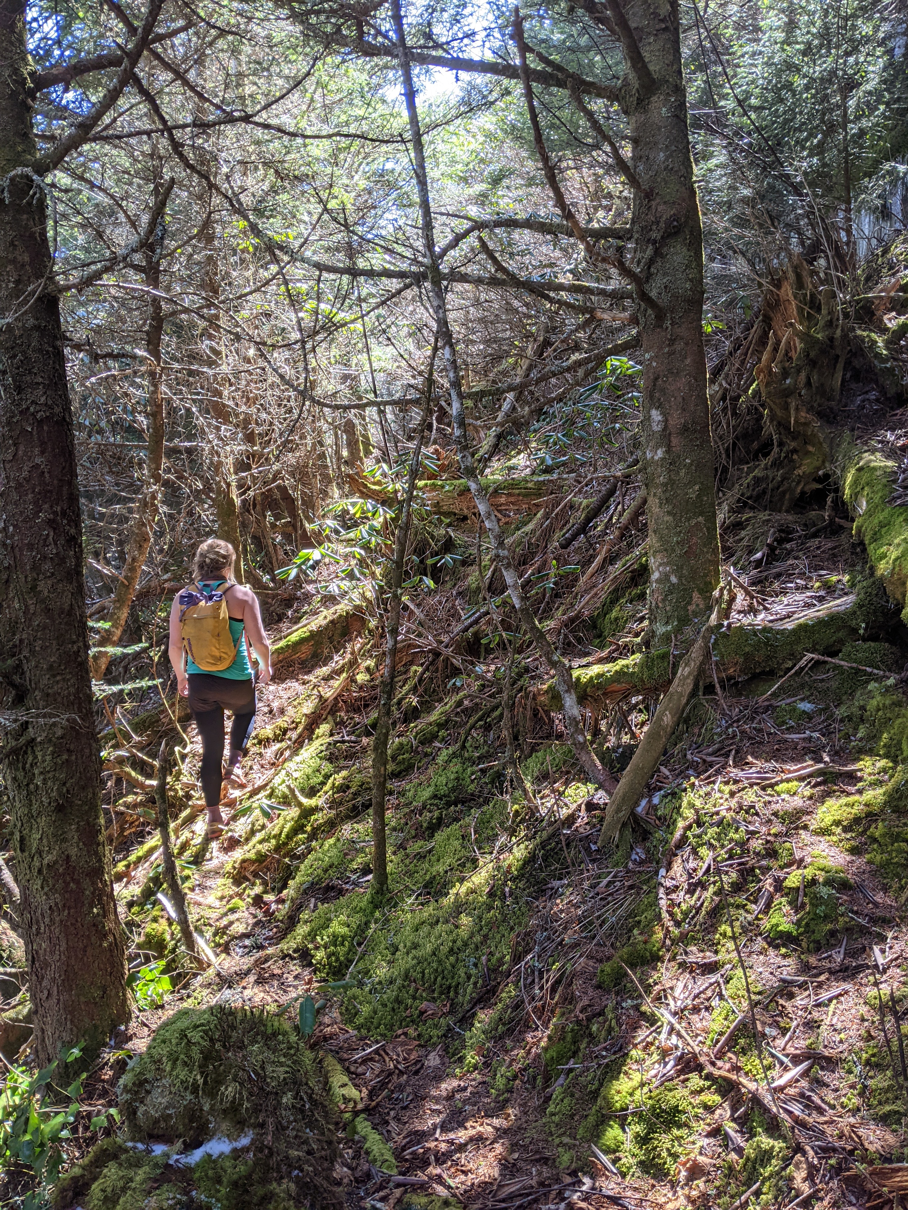
We returned to the left wishbone scramble that we had attempted to ice climb a few months before. We now had waypoints on a Caltopo map, a better idea of the approach, and of course, no snow. We parked on the blue ridge highway the night before and planned to have an early start/eat lots of food for dinner the night before and breakfast the morning of. The approach hike was just how we remembered it and soon we found the drainage that we had bypassed the trip before. We boulder hopped, and log hopped, up the approach as the description in mountain project had mentioned before seeing the scar in the mountain jut up to Celob’s Knob. A flood/rock slide had made this scar only a few decades ago so it was a relatively new scramble, yet deemed the best in the state.
The scramble was a lot of fun and had some spicy slab moves made all the more exciting since it was still wet/icy. We “swung leads” even though it was a scramble, but there is something to be said about the mental game of leading another whether you’re attached by a rope or not. Eventually we finished the scrambling and started the rhodo bushwhacking before we hit the main trail back down to the lot. We, again, over planned our weekend by assuming we’d have enough energy to check out the approach to ShortOff mountain the next day, but instead slept in at the blue mountain overlook and hammocked the next day.

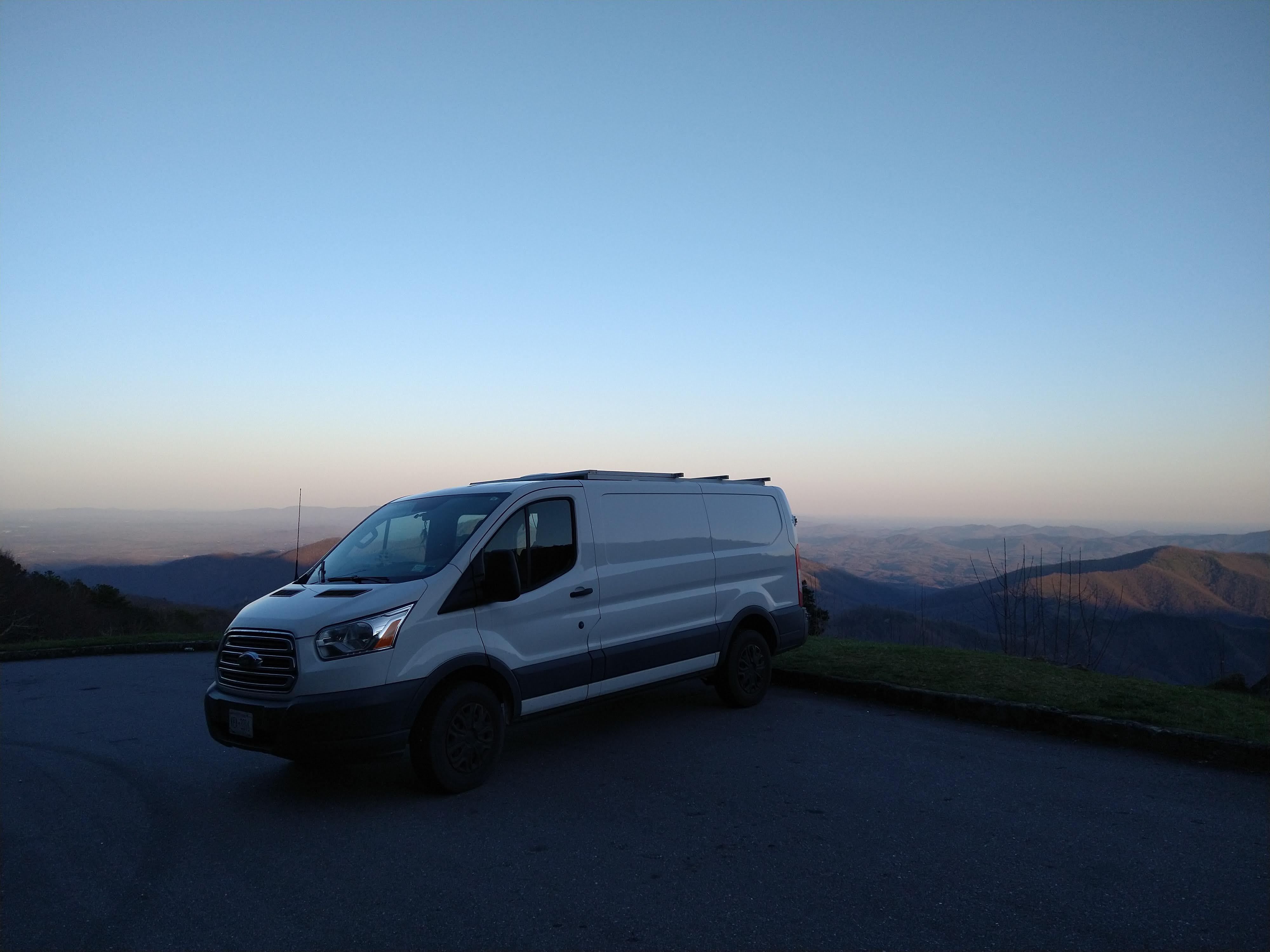
After my initial 6 months of paying rent in Durham, I decided not to renew the lease on my apartment so I’m officially vanning it from here on out – and I love it. I love waking up with the birds as I’m usually parked near the forest or sometimes I’ll splurge and get a campsite by the lake. I’ve installed solar panels and am just finishing up the wiring (with the help of Andre and his dad) to power up Savannah. I’ve already downsized a lot and it’s helpful to figure all this out before I start my trip down to Chile this fall. Til then, more adventures are to be had here.

I won’t pretend to understand all the “jargon” about your climbs (after all, the highest mountain I ever climbed was Haystack Mountain, in Vermont !!) and caving etc., but I read every single word and cannot tell you how much I enjoy and wait for more posts!! You are one amazing young lady, Miss Kel Kel. So impressed with your article on bats that was published! I’m sure your sister and brother-in-law are glad you’re staying a while longer in NC; not to mention your Mom and Dad. Looking forward to hearing more adventures and more about Andre. Love you, Kelly – stay safe!
LikeLiked by 1 person
Duuude! Kelly such great stories and pictures. I like Andre…looks like a happy dude.
keep finding those misty mountain peaks cuz
________________________________
LikeLike