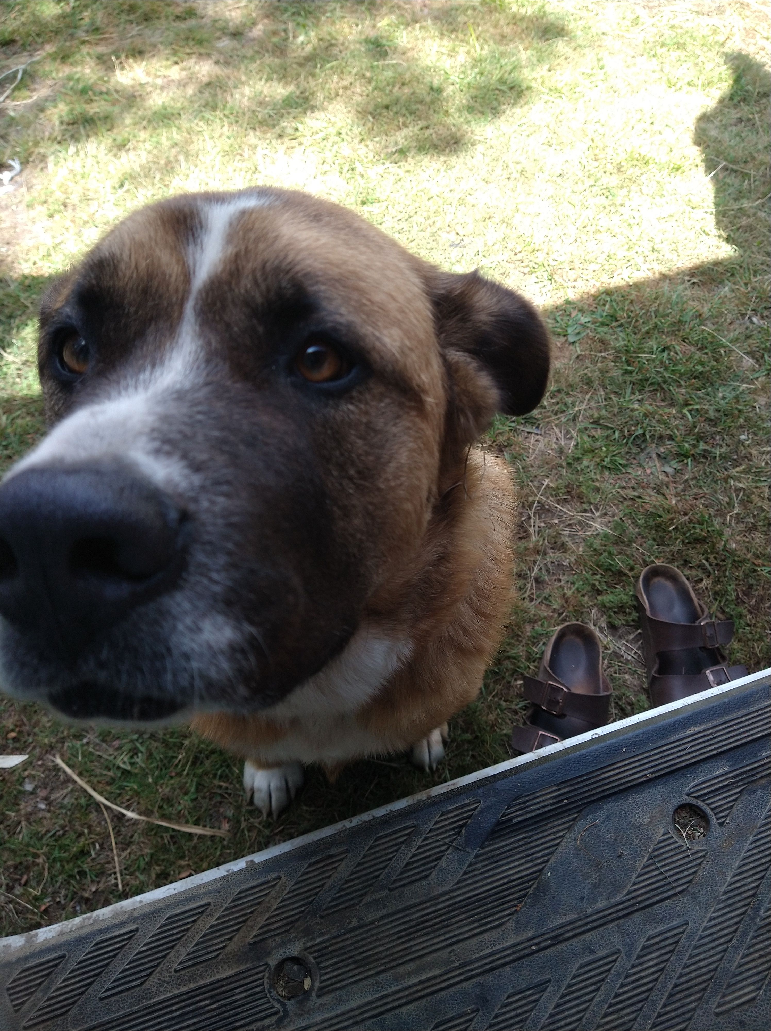
I drove South after the Cochamo planning to make my way to Coyhaique where a friend had worked for a bit and may know some people who I could connect and play outside with. I drove the 2 hours South from Cochamo to Hornopiren, a small coastal town where I would then catch a ferry South, since the road ends here. Once there, I realized the ferry was quite small and was already booked up for the next couple of days. I purchased a ticket, then found a campground nearby to relax and wait. I had been feeling a bit off, and two massive dogs at this campground seemed to pick that up and hang around with me for the days I was there. I swear it was as if they knew I needed a good laugh as they would lounge upside down, wink at me, then twist dramatically to the side or wag their big tails, beating them against the Earth. They were pretty stinky, or I just may have let them hop into the van and sleep with me.


When the day came to catch the ferry, I waited in a small pull-off near the harbor, watching the tide rise, then fall, as the geese timed their swims. I saw some local ponies make a breakaway from a nearby farm and gallop in front of Savannah on their way to town as their owner chased after them. Luckily I had reception, and saw the notification that my ferry would leave 4 hours earlier than the scheduled 10 PM departure. I made moves even earlier to get into line, and was positioned to be the third car on the boat (which could hold probably about 30 cars).

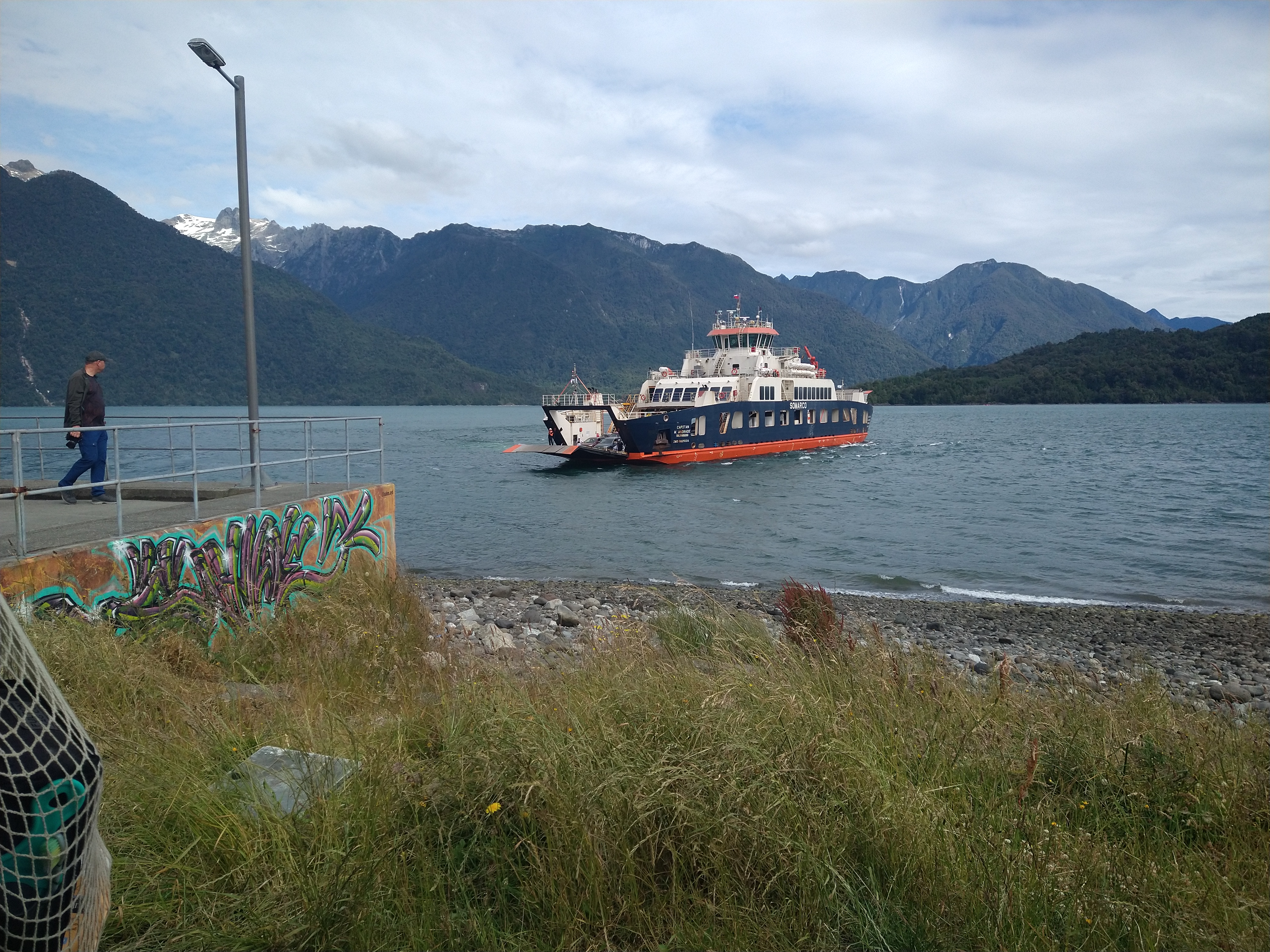
For how much the ticket office receptionist went into detail about my ticket, assuming (accurately) that I was a clueless gringa, she failed to mention one important piece of information for my next journey… the fact that I would be transferring to a different ferry halfway to my destination. Thus, once Savannah hauled her big butt onto the ferry, I parked her, put the emergency brake on, and began to venture around the ferry and explore the upper deck. I hung my legs off the side of the balcony and watched as the ship passed massive mountains and islands in the bay. The little mountain islands were pretty cool and I wondered what kinds of animals inhabited them. Eventually, the boat stopped in a small port with no town in sight. I checked the map on my phone and saw that we were quite far from Puerto Gonzalez, my final destination, so I continued to lounge on the balcony and take in the sunset (now around 10 PM). I thought it was strange how many cars were disembarking from the boat… how odd since there wasn’t anything here and we were so far from the final port. Eventually I saw the ferry workers start to point at Savannah, then up at me. I jumped to my feet and shouted, “Necessito salir?” (Do I need to leave?), where they then replied “Claro!” (Clearly!). I was so embarrassed and flushed, I went to run down the steps but slid on the slickness from the sea. My butt skated down about 5 steps before I slung my arm around the railing grinding myself to a halt. One of the ferry workers ran over to help me but I was laughing so hard I don’t think he could understand my outbursts of “Lo siento, lo siento! Todo bien! Voy a salir!”

Having been one of the first ones on the boat, I was now the last off and racing after the other cars since I didn’t know where we were all going now to get the second boat. I could see the brake lights in the distance as Sav rattled over the washboard road through the jungle of a place where they dropped us off. Eventually I caught up to the line, made it on the second boat, and finally reached the final destination of Puerto Gonzalez. Exhausted and a little bruised up from my slip, I found a pull off on the side of the road and slept soundly until the morning.
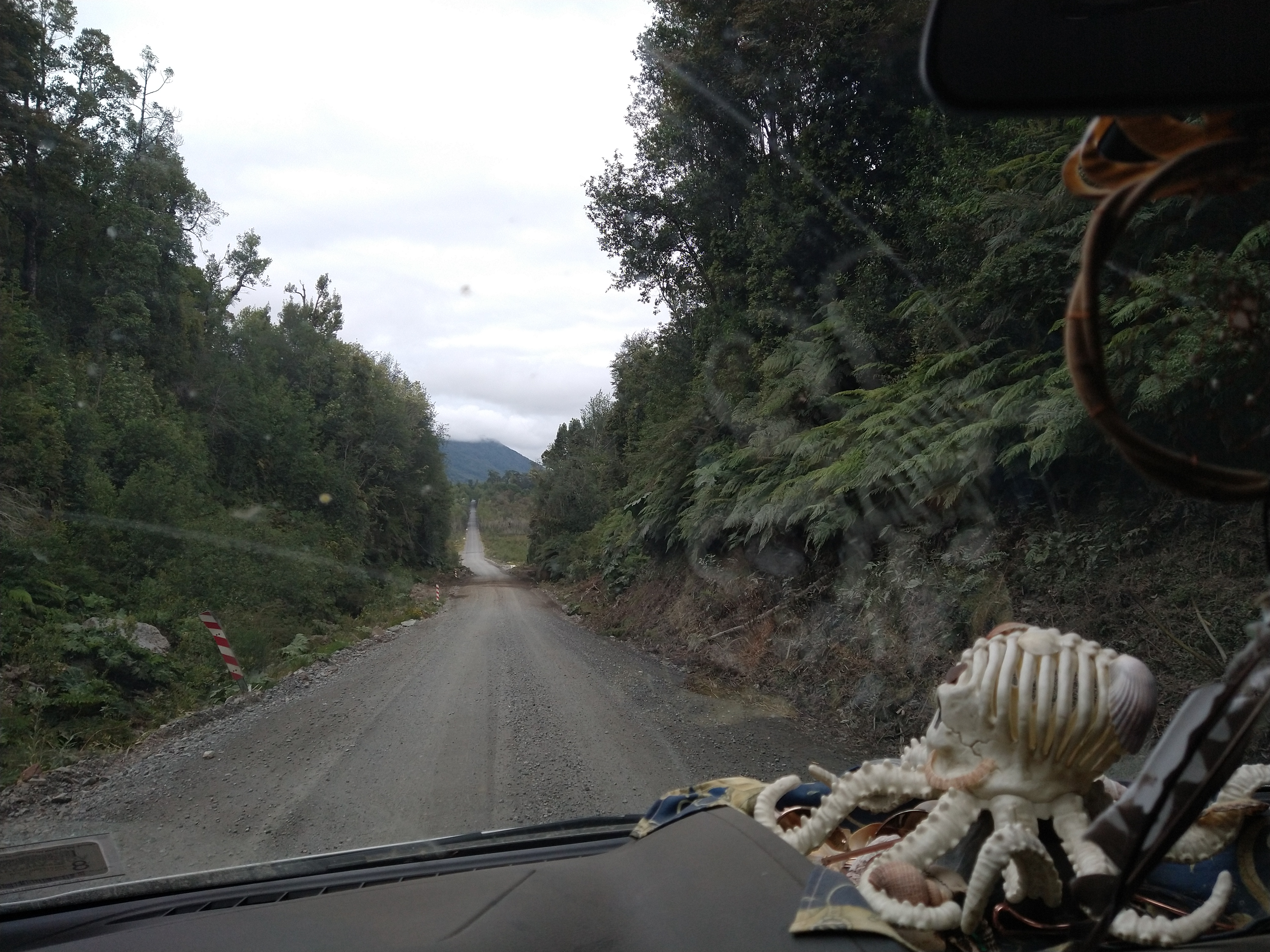

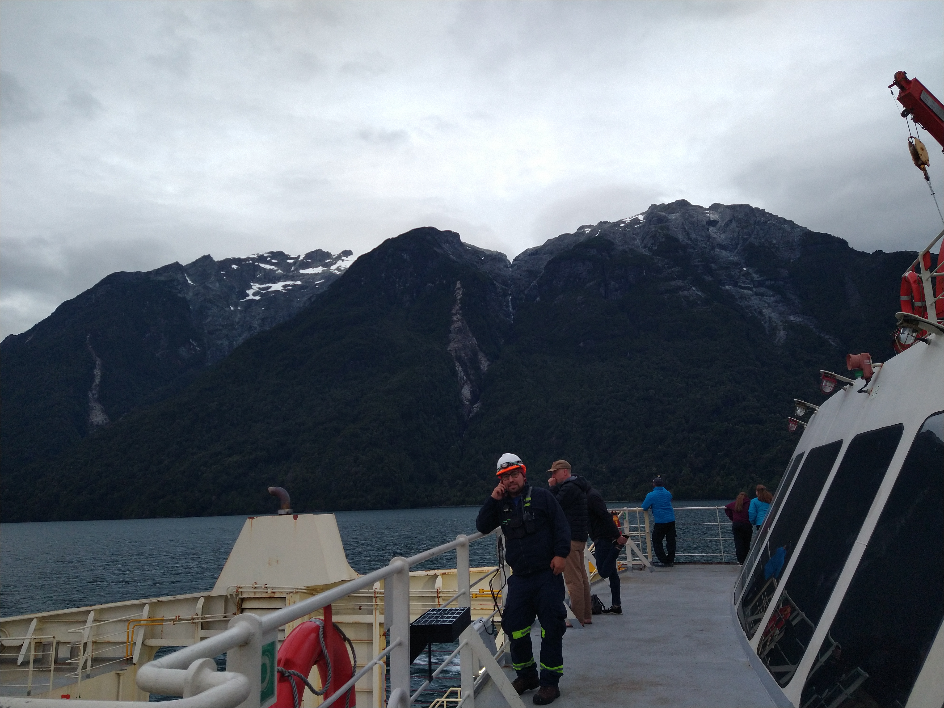
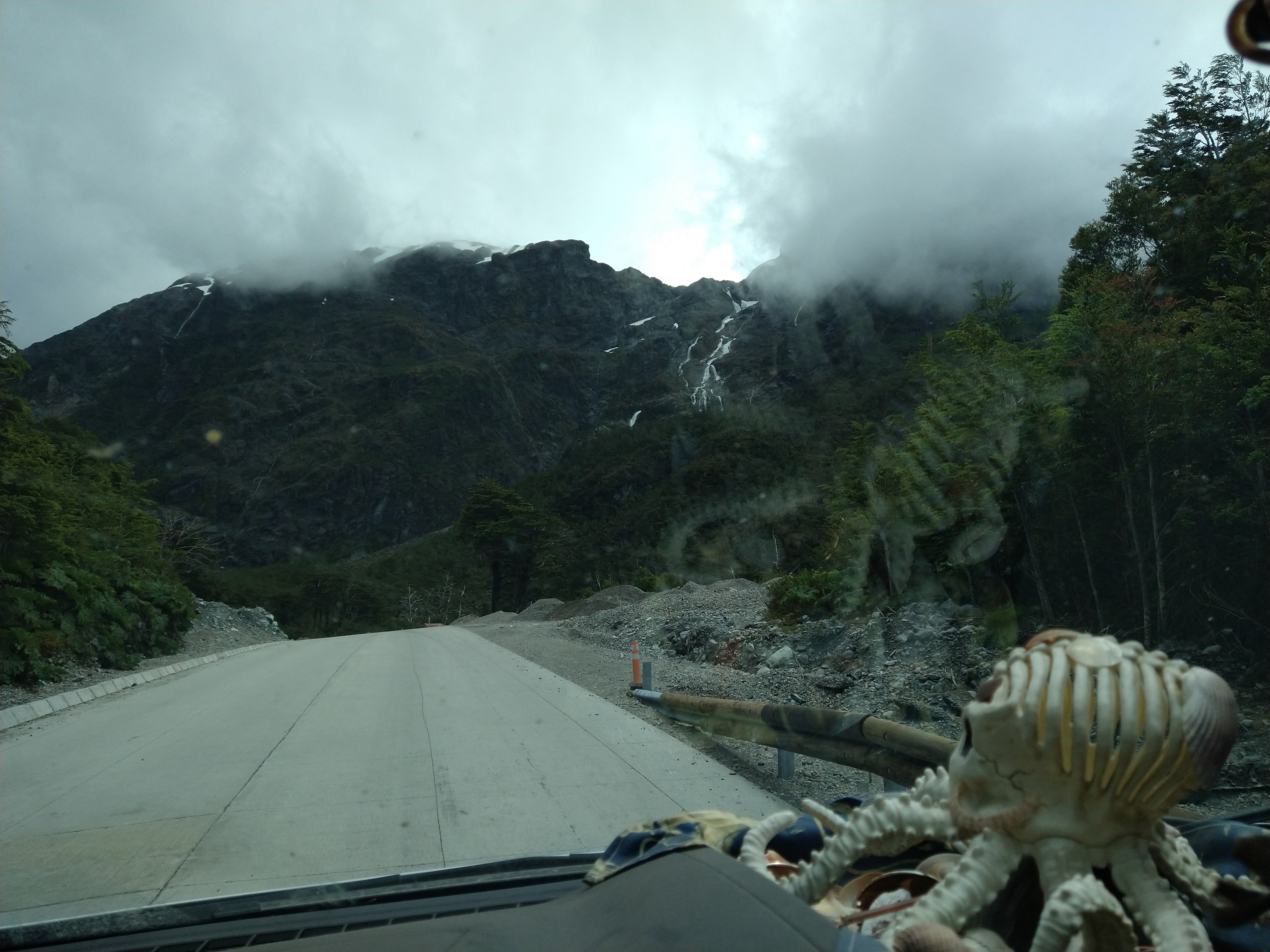
The next day would be a long drive from Gonzalez down to Coyhaique. Google maps predicted about 7 hours, but as soon as the pavement disappeared and the rough washboard road started, I knew I was in for another long day of driving. I found some good tunes though and soon got into the groove of chugging along the roads trying to minimize the loosening of Sav’s nuts and bolts as we bumped along. I had failed to notice a big pass that I would need to go over in Parque Nacional Queulat. The road got rougher, and more muddy from the recent rains, as the switchbacks got tighter. The views of glacial covered, massive mountains were incredible, which helped disarm my stress of whether Savannah could make it or not. It was one of those roads though that once you start, you’re kinda committed, as there was no space to turn around and backing back down the curves would be an absolute nightmare. I queued the appropriate playlist to try to feel like Sav and I were invincible and pushed upwards. It was an interesting mix of landscape with these huge glaciers and peaks amongst thick, dense, jungle-like forest. Eventually, we snaked our way to the top, then began a long coast back down the other side. Here I saw waterfalls bigger than I had ever seen before, sourced from the mountain glaciers. The cascades were more like vertical white-water rivers that crashed down the slabs of the mountains. Now paved, it felt like Savannah was a rollercoaster cart racing down and through the mountain valleys.


Eventually the road flattened and I was introduced to the Patagonian wind. I felt for the cyclists riding the Carretera Austral (HW 7) as even Savannah was shaken from the force of the wind. I did stop on the side of the road here to cook up some lunch, and at times it felt like someone ran up and gave Savannah a shove – the force was that impactful and jarring.
I’ve hitchhiked a fair number of times and try to look for opportunities to extend the favor to others. Though, unfortunately, it is a bit different traveling alone, as a woman, in a foreign country. I saw a man hitching on the side of the road near a bus station on HW 7. I slowed down a bit to get a good look at him (never hit my brakes though) before deciding it wasn’t worth the risk. We had made eye contact though and, awkwardly, I just waved as I hit the gas and sped on by… my bad. He was at a bus station though so I’m sure he got to wherever he was hoping to go.
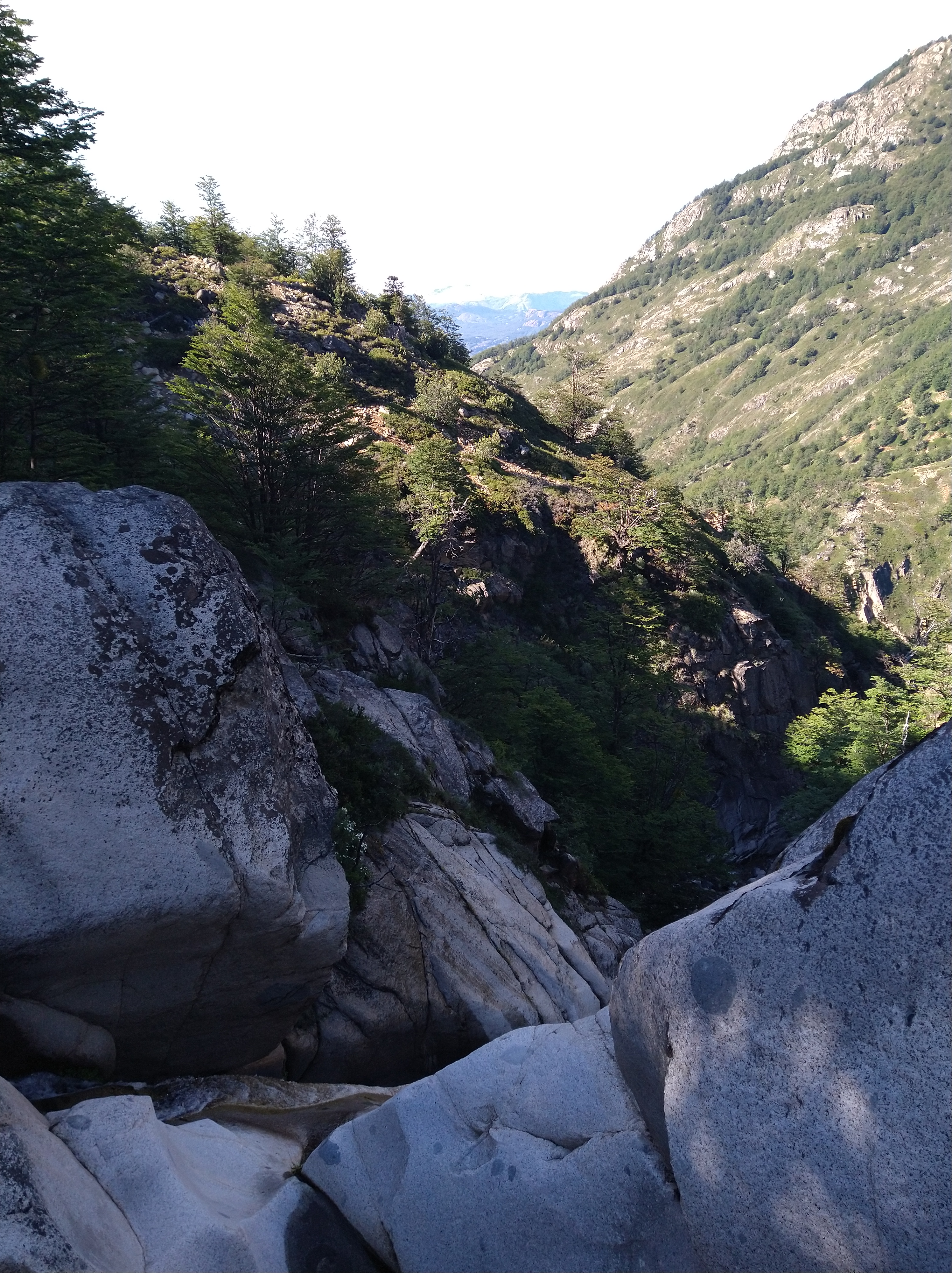
I took a slight detour from HW 7, after reading a sign that it turns to dirt again, took a shortcut to HW 240, then drove a twisty, beautiful road along the Simpson River until being spat out into the valley where Coyhaique sits. The town was much larger than I expected, and I was happy to have had arranged a place to park Savannah rather than navigate through the city looking for a place to stay. I had reached out to a hostel from iOverlander that looked like they had a big enough driveway/garden area to park Sav. Since I didn’t really know the city, I didn’t want to risk parking on side streets in town. The woman running the hostel was incredibly kind and moved her vehicle out of the driveway for me to squeeze in. It was probably the tightest driveway Savannah has ever snuck her way into and she was parked next to the little kid’s play truck.

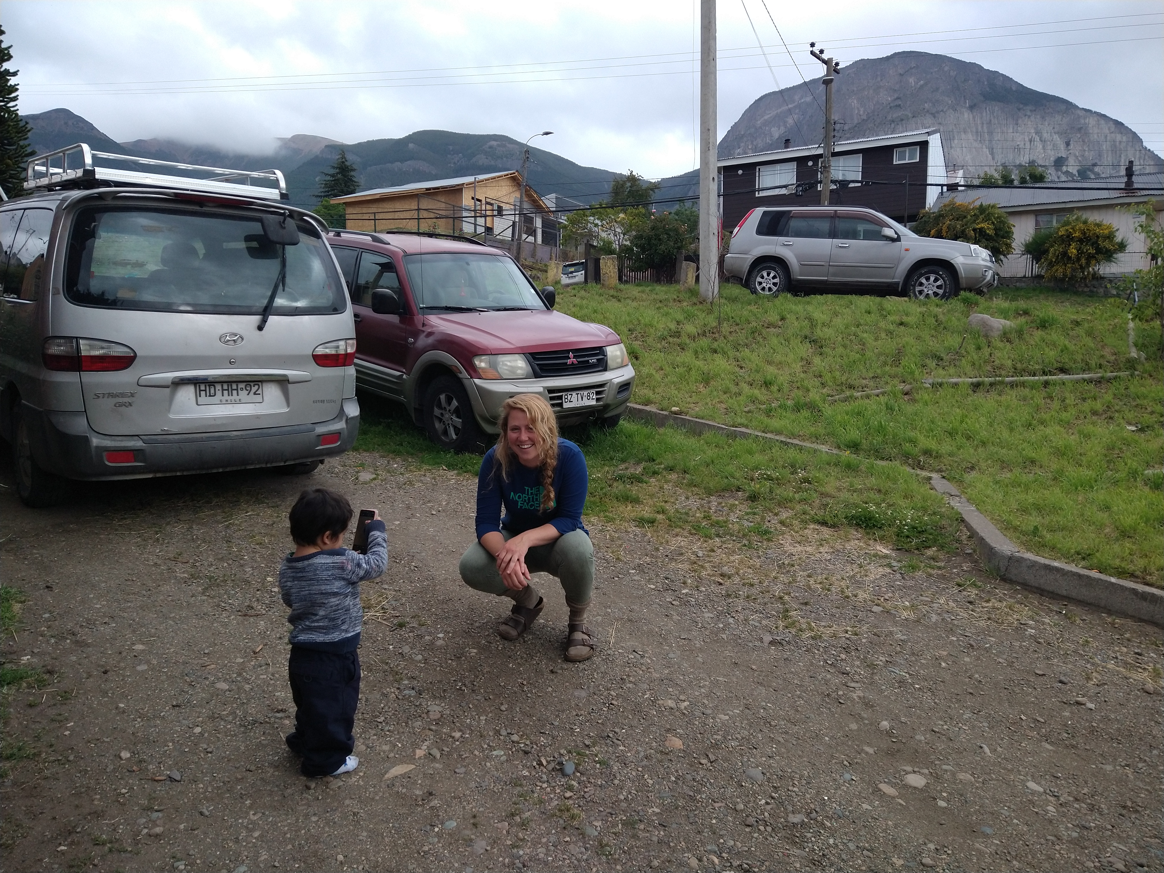
Soon the woman running the hostel, Stephie, and her two kids, were peeking into Savannah. I ended up spending quite a bit of time with the family over the next couple of days. I couldn’t really understand the kids at all, but Stephie and I could understand each other pretty well while we shared parts of our lives and how we ended up where we were. The little boy was especially interested in me and Savannah and kept trying to take photos of us, though most were probably of his thumb.

Hanging around the family was wholesome and I had a little kitchen and shower to use in the hostel. Eventually though, that little driveway felt a bit too small for Sav and I, so we headed to a campground on the outskirts of town. I worked remotely from the campground that week trying to organize how to get the rest of the supplies we’d need down to Lima from the states, how we would hire nurses through the medical school there in Lima, and what our new timeline looked like given the political unrest in Peru. Some progress was made, but a lot is still unknown as Peru is still in a state of emergency due to ongoing protests and violence.
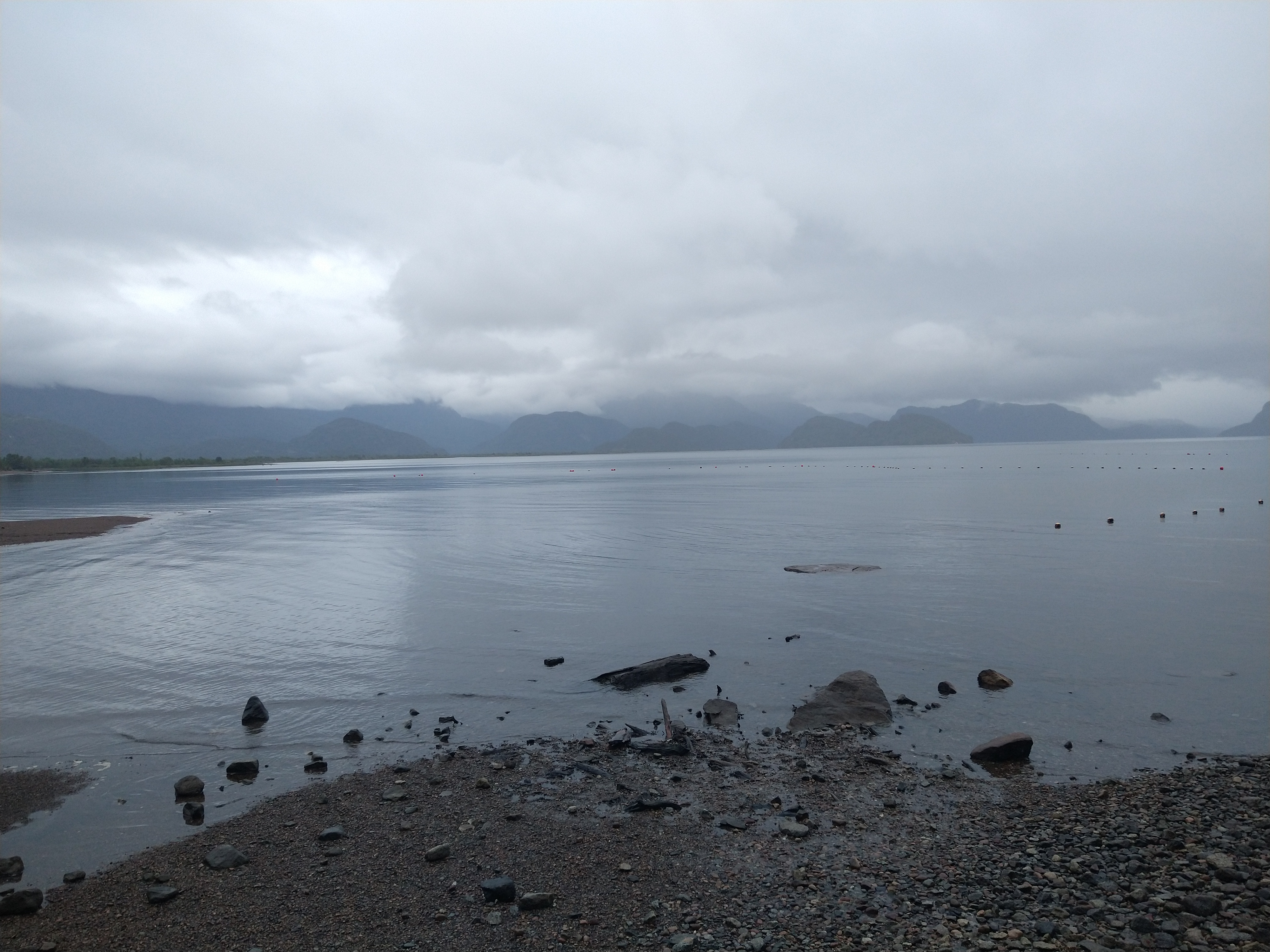
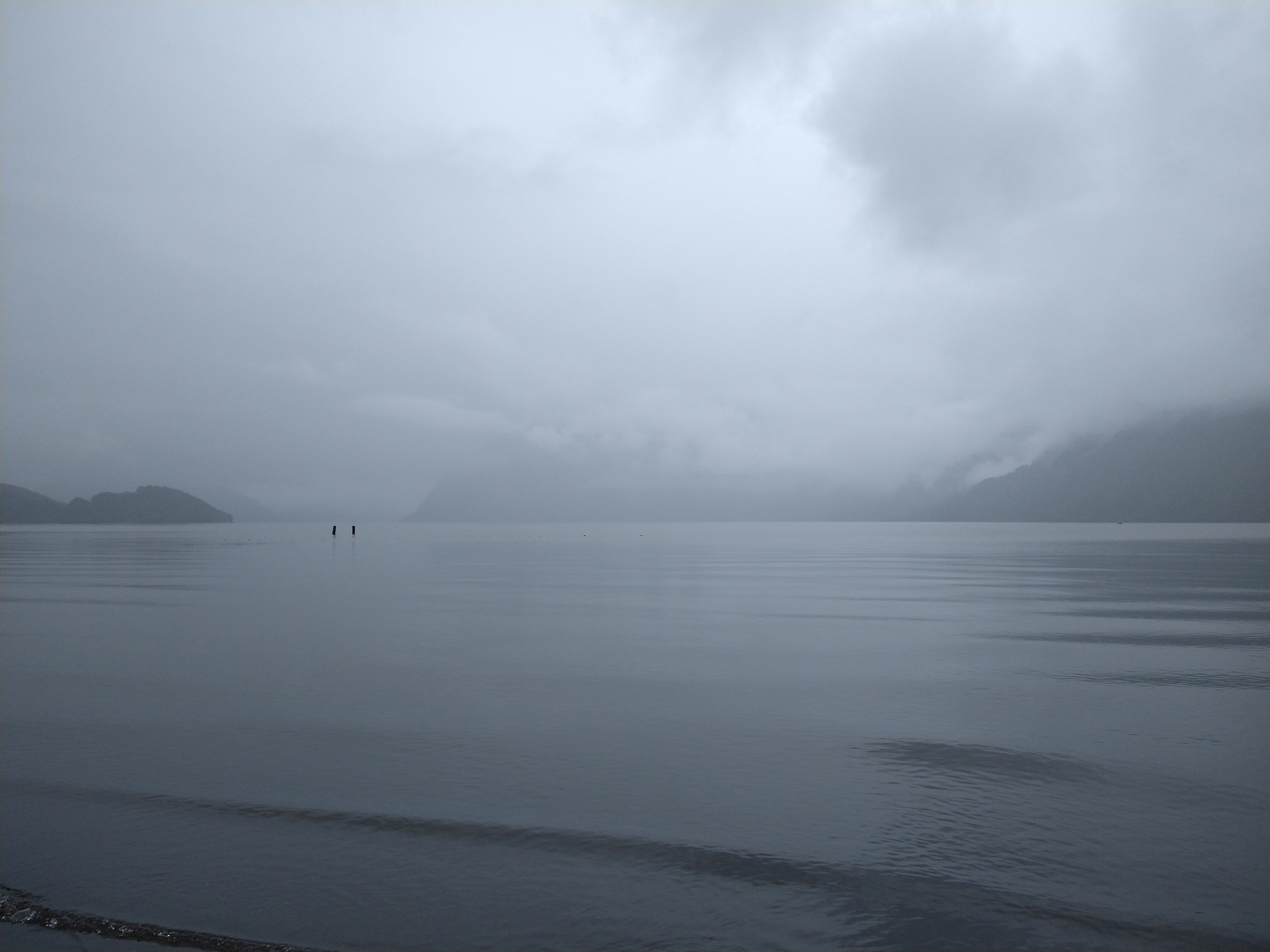
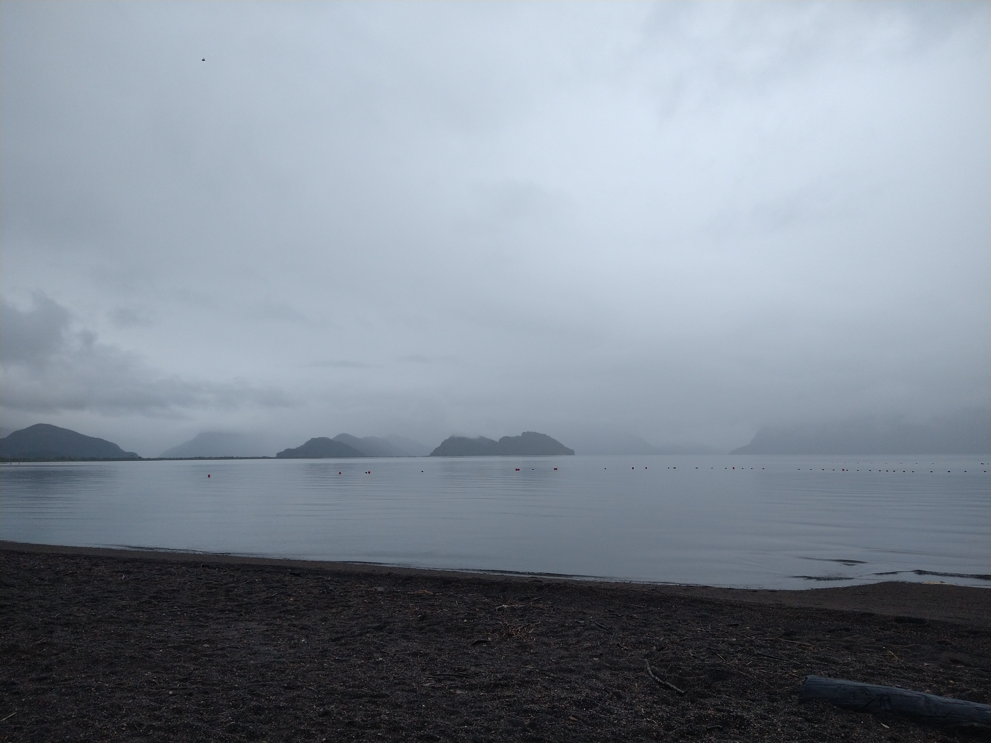
I took a quick trip to Puerto Aysen, actually back up North and West from Coyhaique. I decided that if I’d probably be continuing due South, whether before or after working in Peru, I should make sure to go and say hi to the sea first up there. It was a gloomy, foggy day, and the most perfect time to visit the fjord. The clouds gave the islands an eerie, mystical look, and contrasted the stillness of the water. I could see fishing boats miles and miles away looking like they were sitting on glass. I walked the beach, occasionally greeted with some light rain. Waterfalls trickled from the clouds, from a mysterious world above that I could not see. Everything was silent, except for some gentle lapping on the shore.


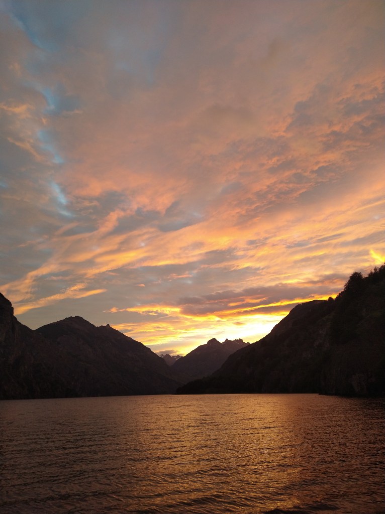
I ended up making a few trips into town, and tried to meet people. I hit it off with an American guy working for NOLS who had just come off a trip from the Northern Patagonian Ice Field. I was still unsure when I would be deployed to Peru and he didn’t have a ticket back to the states yet, so we decided to head down to Cerro Castillo for some backpacking. We camped at Lake Paloma on the way down and watched one of the most spectacular sunsets I’ve seen in Chile so far. The colors of the sky changed for hours as different layers of clouds lit up from the setting sun. It seemed that there were so many different textures of clouds, it was surreal.
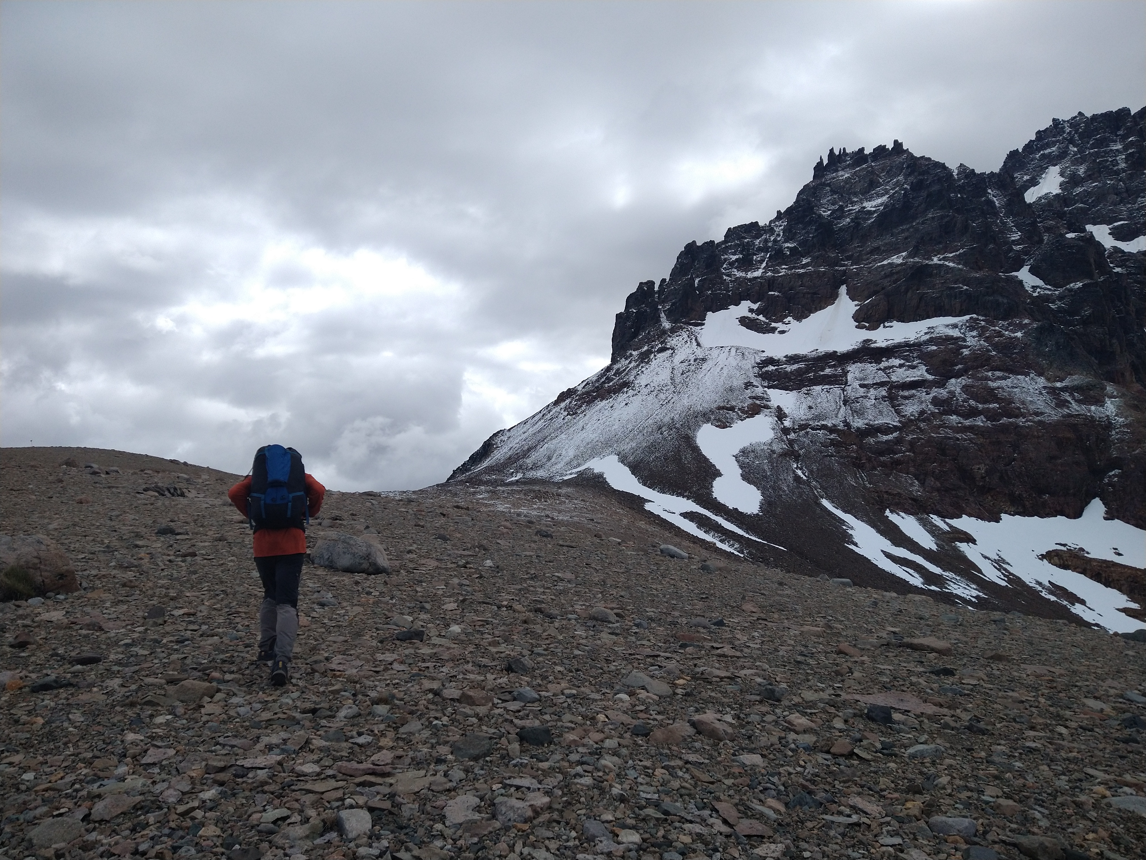
Usually while driving into Villa Castillo on Route 7, (supposedly) you can see the big, spiky mountains in Cerro Castillo National Park. As we rolled in on a gloomy day though, I wouldn’t have known there were any mountains to be seen and would’ve guessed we were descending into a foggy valley. When the rain broke the next morning, I was stunned at how spectacular the cerro was. We moved Savannah to as close to the trailhead as we could get before the road turned into 4×4, then walked the remaining few kilometers to the trailhead. We’d only be able to be up there for 2 days since I had a meeting to get back to the next day. But we hoped to see as much of the park as we could and planned to double up on some single day stretches.

The national park is on private property, or controlled by private sectors or something like that, so the entry fee was steep: 30 luca (30,000 Chilean pesos, so about $30 USD) if you wanted to camp overnight. We had to fill out a bunch of paperwork, get a ticket, sign in a book, and tell them exactly where we planned to camp even though we didn’t really know yet. Finally freed and granted access to the park, we trekked up the switchback trails through the forest and up the ridge to Laguna Castillo. Before reaching the ridge, we ran into another checkpoint that requested our tickets and asked again about our plans. Instead of camping at the usual Day 1 campground, at el bosque (the forest), we decided to do the Day 2 trail as well and go up and over the pass to the next campsite. Apparently in the afternoon the wind tends to be stronger up there, and the checkpoint guy was not very happy with our plan. This was a bit awkward, as this 20 yo kid in sweatpants and gage earrings was telling two 30ish yo adults that we should not continue our plans despite what experience we may have. After a few rounds of questions and responses, we realized he actually couldn’t restrict us from doing it so we said thanks for the advise and continued on our way. About a half hour later, we topped out at the ridge to enjoy the view of the lagoon.
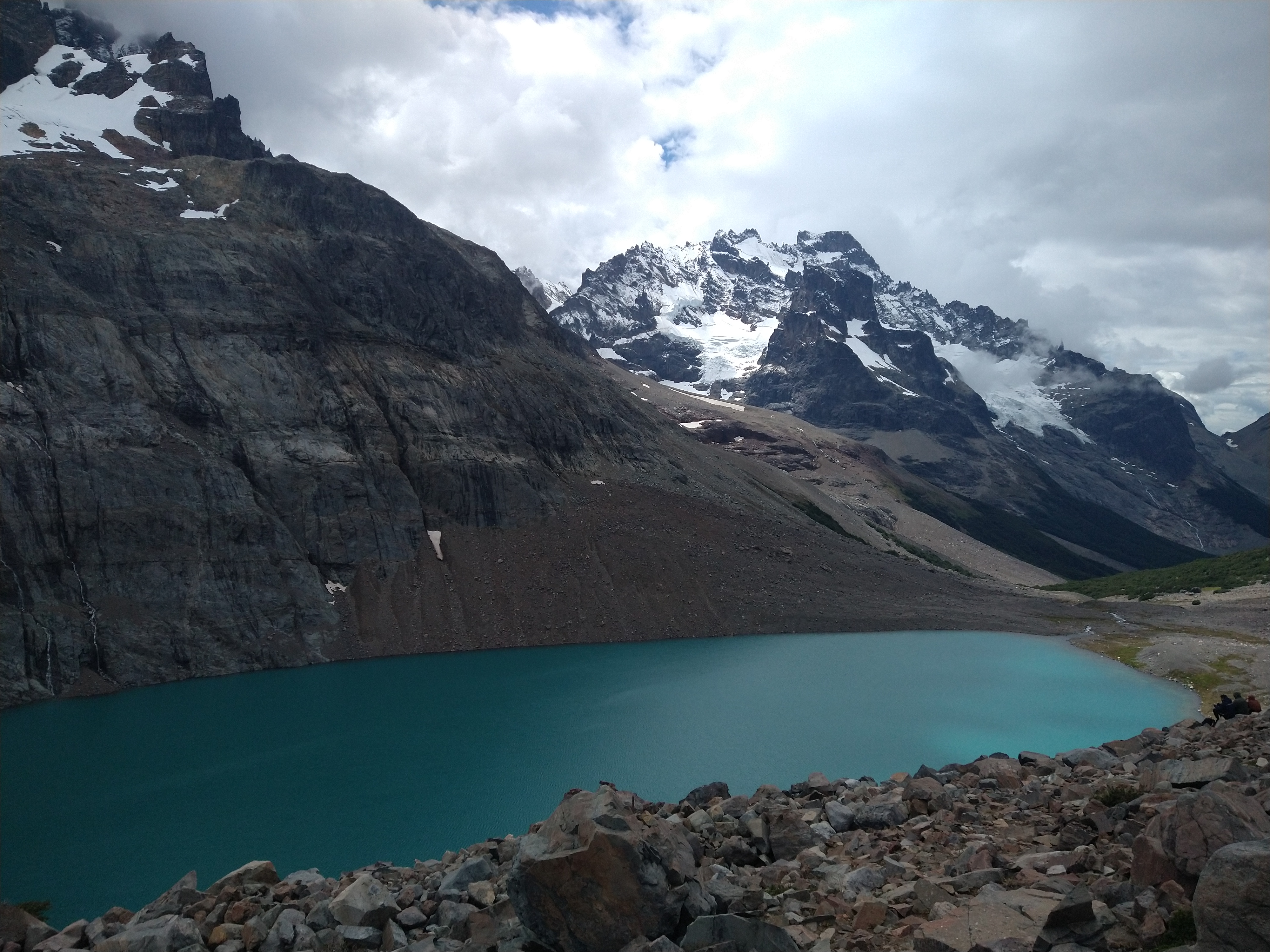

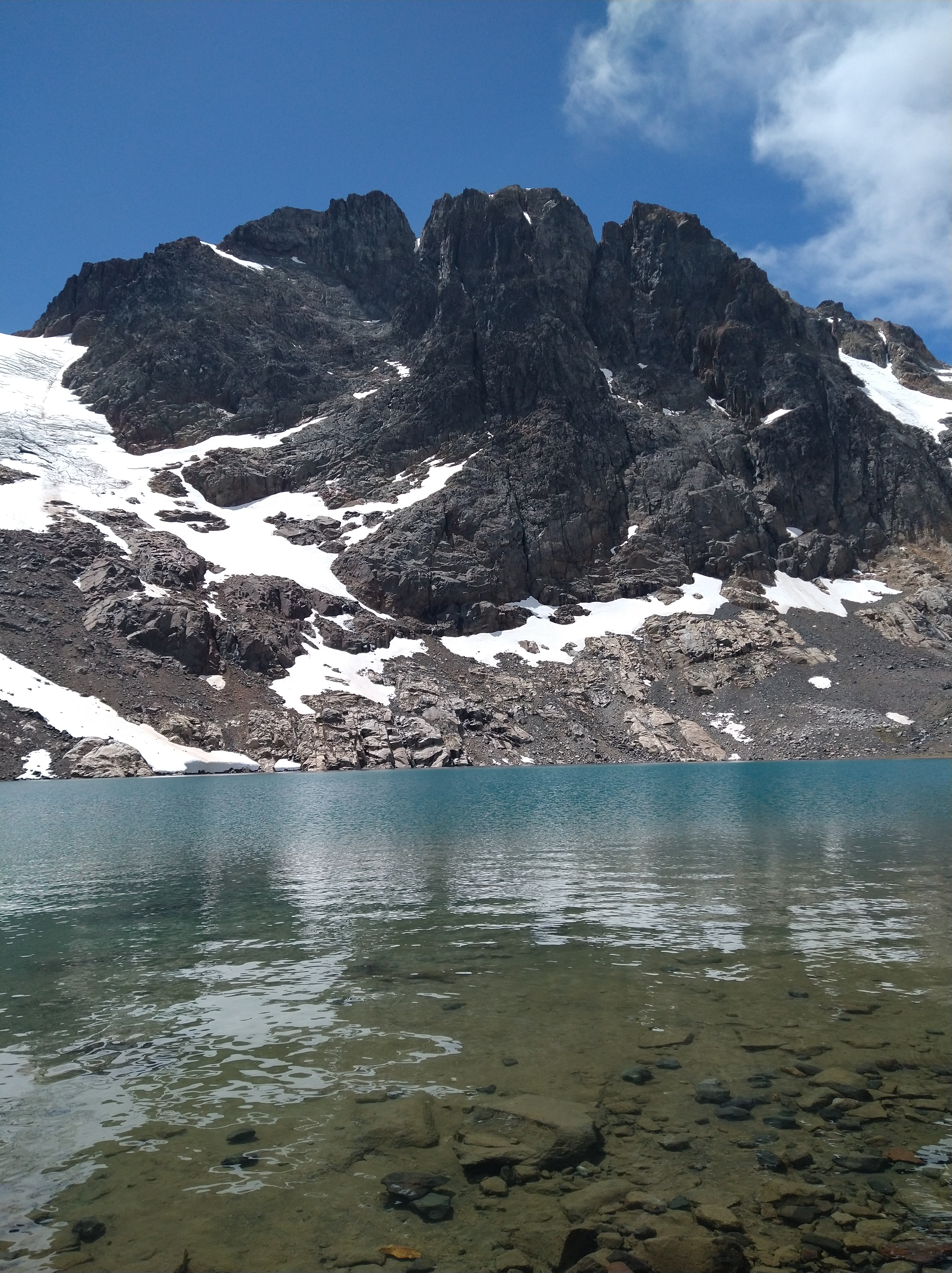
Cerro Castillo towered above the lagoon. The glacier was quite small and riddled with crevasses. There were some “dirt slides” down the glacier and cascades of water trickled down into the turquoise lagoon. We marveled about how deep the lagoon must be and wondered how it formed there. The spires were spiky and oddly shaped and we guessed it must be wind erosion. My friend pointed out a snow ramp that is the only access to the true summit of the cerro and it looked crazy steep. Bundled up against the wind, we snacked and chatted and gawked at the mountain.
We ended up making it up and over the pass in no time and never encountered the dangerous wind that the young checkpoint guy warned us about. The pass was big and rounded, not like a ridge, so we weren’t really sure where the danger was after all, even if it was windy. Soon, we were back down the other side and at our campsite. We set up camp, then found a fun stream to follow down to a waterfall. We played Farkle at the top of the falls and sipped on mate tea while the sun set.
The next day we did a day hike up to Duff Lagoon, about 5 or 6 kilometers up the valley from camp. We had wanted to give Cerro Chocolate a try, a scrambly, maybe climby, big peak up there, but with my time crunch with my meetings and a short weather window we had decided not to bring the gear on this trip and just scout it out. It did indeed look super fun to do, and involved a glacier crossing with some steep looking scramble sections. Another time for sure as it looked like a blast. The lagoon itself sat right up near another pass and reflected the same pretty blue as Laguna Castillo. It was protected from the wind and we could lounge around a bit and sunbathe in the alpine.


Soon though, that meeting was a bug in my brain and we made our way back down to camp, stopped by another checkpoint to make sure we still had this little piece of paper ticket. Then we packed up camp, I took a birdbath in the stream, and we made our way down. Before exiting the park, we had to sign out and surrender our ticket. It all seemed a bit overkill and yet disorganized at the same time. We had seen dogs on the trail and were wondering when that regulation would kick in since dogs can have a huge impact on the fragile ecosystem up there. It felt like a bit too much regulation and hand holding in some aspects, and no regulation whatsoever with maybe some more important restrictions a park should have. Nevertheless, despite feeling a bit micromanaged up there, it was a beautiful place and a fun and chill backpacking trip. After coming back into town we cooked up a ton of food and enjoyed some beers.
We said our “see ya later’s” today as I dropped him back off in Coyhaique. I’m so grateful for all of the cool people I’ve been able to meet along the way on this trip. After our conversations this week, I feel even more inspired to chase after it and explore all parts of this world while appreciating the opportunity to be able do so. Perhaps our paths will cross again for another adventure, who knows. For now, I’m making a plan of where to wait until I can go and work in Peru. I have a plan ready to be deployed for once I’m able to go (i.e. where to park Savannah, a flight from here in Coyhaique to Santiago to pick up some supplies, then flying from there to Lima to start work). I’m also finalizing some forms to travel with the Navy around the Cape Horn Biosphere for once I make it down there in March/April. It feels like a good balance of work hard, play hard right now, though I do wish there weren’t so many unknowns… but so it goes, it will all work out one way or another.
Updated camp map, here!
On repeat (again) lately – Rio Grande, Freedom Fry

The pictures are amazing! I don’t know if I mentioned that as soon as I finish reading your blogs, I check maps to see where all the places are that you mention. I think I’ve got my computer problem solved so I’m looking forward to more adventures you have …. and mentally going along with you. Be careful and stay safe, Kelly! Love you, Aunt Pat
LikeLiked by 1 person