
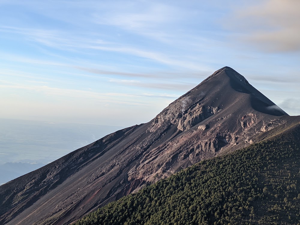
Acatenango is a stratovolcano in Guatemala, just outside of Antigua. A stratovolcano, or composite volcano, is a conical volcano built of many layers of hardened lava. There are two main peaks on Acatenango – Pico Mayor (the highest peak around 13,000 feet) and Yepocapa. Acatenango is joined with Volcan de Fuego, and collectively the complex is called La Horqueta. The only “recent” known eruptions on Acatenango date back to the early 20th century between 1924 and 1927, and then again in 1972. In prehistoric time, Acatenango erupted numerously. Volcan de Fuego on the other hand, is constantly active. There were a few big eruptions in 2018, but recently there have only been small gas and ash eruptions every 20 minutes. However upon my research just now, apparently beginning in September of this year the volcano had erupted due to increased seismic activity and sent ash plumes thousands of feet into the air, releasing lava flows down its slopes and the eruption is currently ongoing… perhaps we witnessed this volcano at a more active age than usual!
Hiking Acatenango was a priority for us in our travels through Guatemala. We read lots of trip reports of bloggers who paid for a guide to bring them up the volcano but since that’s not really our jam, we figured out how to do it on our own (which wasn’t really that hard). We decided to leave the van safely tucked away at the hostel in Antigua, so our first obstacle was figuring out the “chicken bus” system to get up to La Soledad, the town at the foot of the volcano. We figured out that we had to take one bus from Antigua to Parramos, then switch to another bus there to take to La Soledad. The buses here are decked out. Picture a school bus with a crazy paint job, lifted body, roof rack, and apparently no governor for a speed cap because these things fly. We packed our bags early in the morning of departure and walked from the hostel to the lot of buses. We weren’t sure if there was a schedule or how we would find the right bus. Just before we reached the main lot though, we noticed a bus parked and running with Parramos painted on the visor of the windshield. No sooner did we hop on the bus did it take off, what perfect timing!

Once we left Antigua and hit the main stretch of road, the driver rocketed along the twists and turns to Parramos. We had to clutch our packs on our laps for them not to fly off. The bus driver knew we were looking for the bus to Acatenango and, as we left, gave us directions to the next bus in town. We still got a little confused and had to ask around, but eventually we made it to the right stop and waited for the bus to La Soledad. The rides were about half an hour each and it felt fun being on an old school bus racing around the mountains. Each ride cost us about $3 USD too which wasn’t bad at all. I did wonder if they ever crashed though as it seemed like luck that it stayed on the road, didn’t crash into other drivers, and didn’t tip over with how fast we careened around the turns.
We hopped off right at the trailhead and we were soon shlepping our packs up a loose dirt path. It really did feel like one step forward and half a step back as we ascended through corn fields on this well used path. About a half mile up, we hit the first restaurant/break area. We didn’t hang around long though and continued on to the fee station. Another couple of corn/wildflower fields and more silty trail, we reached the fee station. You’d think there was a party going on with how many people were loitering around – we could hear the crowd minutes before we arrived. We paid 50 quetzales each (~$7 USD each) to enter and filled out our information on the forms. Once we left the station, we were relatively alone on the trail again. Clouds creeped through the trees and the environment reminded me of hiking along the Columbia River in Oregon. We were sweating hiking uphill but once we would stop to take a break, we’d get a chill from the fog and cool temperature. We ran into a few guided groups and one woman being brought up the volcano on a horse. At another restaurant/break area we saw a couple of horses loaded up with gear to bring to the basecamp sites. There were also some really cute dogs.


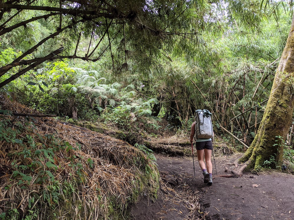
We switchbacked our way up on damp soil. We hypothesized that the side of the volcano that we were hiking up didn’t get a lot of sun and was still wet from the rain a few days before. We read a sign along the way about a beetle that was responsible for killing off the pine trees on the volcano; apparently once the tree was infected it would die within 90 days. Evidence of this was everywhere as we neared 11,000 feet.

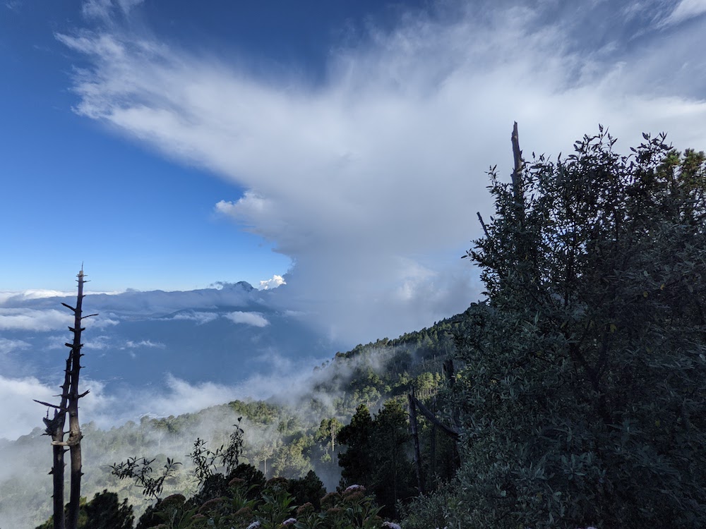
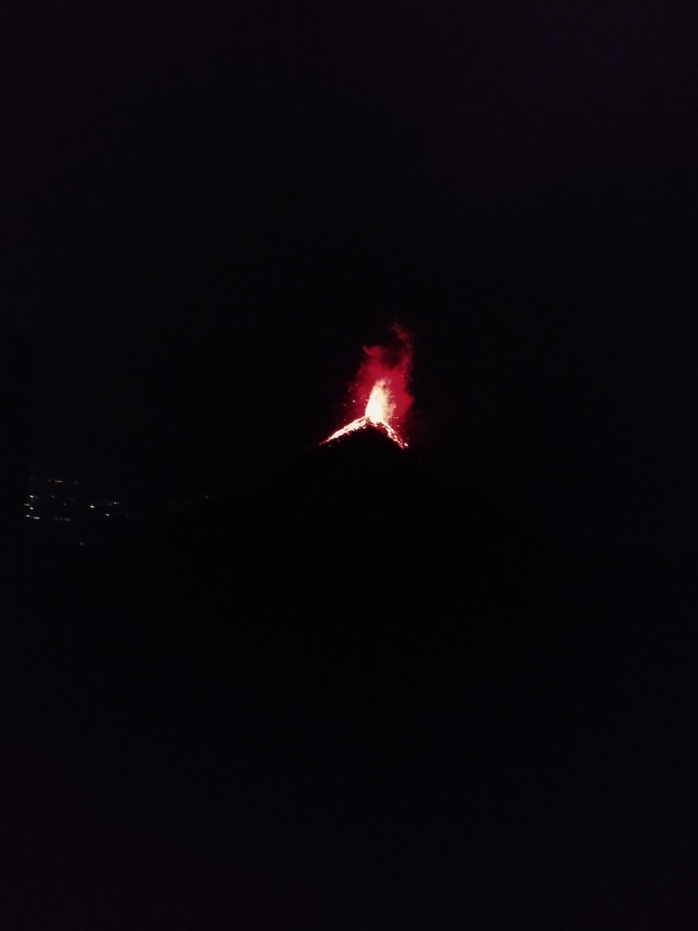
Eventually, after we gained most of the elevation, the trail flattened out and skirted around the summit of the volcano. That night we would be sleeping on the South side of the volcano to watch (and hear) Fuego erupt. We heard the eruptions before we saw them but were shocked and stoked to see lava and smoke spewing out the top of Fuego. Any tiredness from the hike up was numbed with this new excitement. We skirted the rest of Acatenango and sought out a place to camp and watch the show.

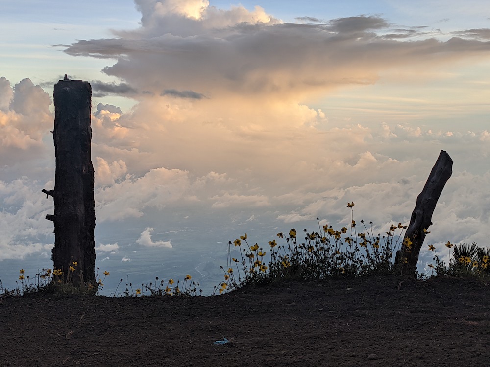
It was clear that guiding companies “owned” most of the South side of Acatenango and we hiked through pretty much the whole designated base camp area before finally finding a place we could pitch our tent. And it was at an established basecamp… As we were hiking up, two men (guides) asked us in Spanish if we were planning to hike all the way to the top to camp. We laughed with them at the joke and said we were looking for a place to set up camp. They offered for us to set up there, alongside their permanent tents for guided groups. It seemed like they offered it for free but we paid them a bit of cash anyway. It was a flat, raked spot with an incredible view of Fuego. They checked in on us regularly asking if all was good and we weren’t too cold. It was quite chilly up there and apparently in 2017 six people died from hypothermia camping on the summit of Acatenango, so regulations are stricter now (though we were never interrogated if we were equipped to camp there without a guide).


We watched Fuego erupt into dusk, each time was exciting and surreal. We hoped to get some night shots of the eruptions but the guided group was pretty active with head lamps so we decided to “nap” for a couple hours and wake up when everyone else was asleep. Andre passed out at around 7 PM but I couldn’t find sleep with the constant eruptions. Not that they were annoyingly loud, but loud enough to peak my interest and open my eyes to watch the lava. At around 10 PM I did wake Andre up to take some night photos. After that, we drifted in and out of sleep until an extra loud eruption went off at 2 AM. I sat upright from sleep for this one to watch but then heard a resulting dog fight, which then woke Andre up. Maybe the eruption scared a dog who was asleep and then he attacked his friend? Unclear, but it was super intense for a few minutes and I was nervous since our tent door was open so that we could watch the eruptions. I really hoped the dogs wouldn’t bring their fight into our tent. Eventually they did calm down, Andre went back to sleep, and I continued watching the eruptions til dawn. Here is a link with videos of the eruptions.


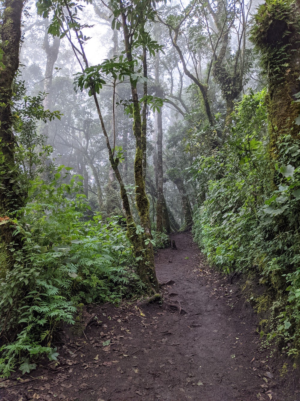
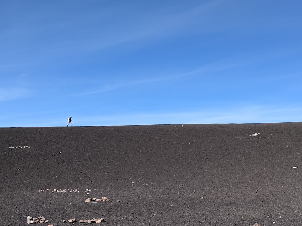
The guided tours advertise a sunrise summit of Acatenango to watch Fuego. We decided not to make this part of our solo itinerary and watched the sunrise from the tent. We roused around 7 AM and packed up, then started trekking up to the summit. From basecamp, the trail to the summit was even more silty and steep. We sloshed around the loose rocks for about an hour and half as we tried to gain ~1200 feet . The last stretch to the caldera was especially slow with super deep silt that felt like you weren’t going anywhere.


The caldera looked ominous and a bit spooky, especially after reading that the last eruption was only a few decades ago. It was smaller than I had imagined, and we ended up walking around the rim of the dormant volcano in maybe 10 minutes of hiking. There was evidence of bivy sites in the center of the caldera and where the half dozen people died a few years ago. We first rested at the Southern summit (the lower one) to watch Fuego erupt through the clouds. Then we skirted (well I skirted, Andre walked through the center) the caldera to the high summit. It was really trippy to imagine this as a once active volcano. Our legs were screaming from the hike.


Once our summit fill was quenched, we began the long trek down. Andre’s boots are well past their expiration date and he slid down most of the loose gravel without having any tread. We took a different trail down and passed many more horses and porters lugging up supplies for guided tours. Sleeping pads, jugs of water, crates of food, tents… all had to make their way up to the basecamp below the summit. I’ve been curious about what breed of horse we’ve seen – they’re small and don’t appear to be very strong but obviously they are to be work horses on the volcano.

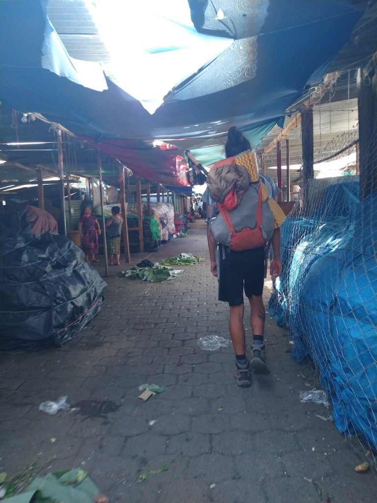
Once at the base, we barely had time to catch our breath and rest our shaky legs when the chicken bus to Parramos pulled up. We hopped in, rode the roller coaster to town, hopped off, then back on the other one to Antigua. Finally there, Andre led us through a maze of an underground marketplace before we popped back out to the street and walked the rest of the way to the hostel.
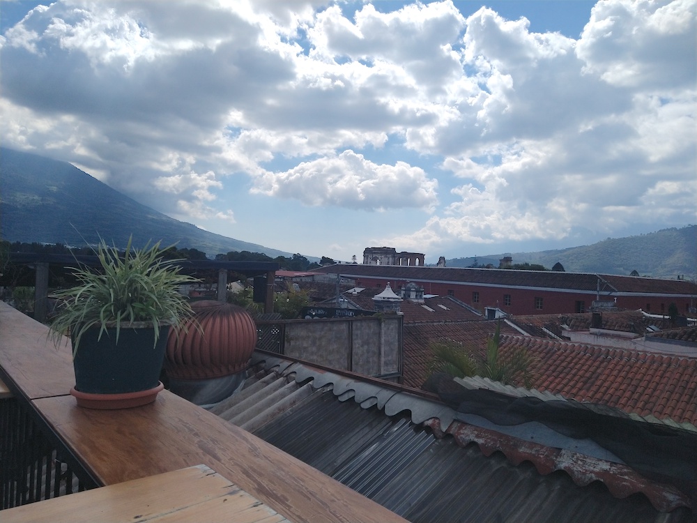
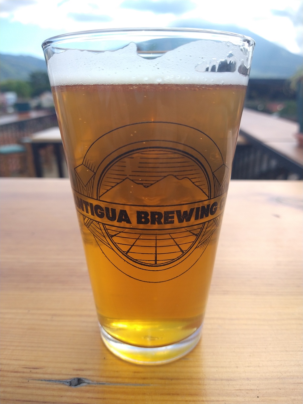
Yesterday we took a much needed rest day. We slept in, showered, grabbed a beer and lunch at a local brewery, accidentally ordered 3 servings of frozen yogurt, and sat on our butts watching the volcano erupt from the hostel. Today we set off for El Salvador!

Andre’s post here!
Updated map of campsites, here 🙂

Wow! Trekking up a volcano, camping and watching a volcano spew smoke and ash and fire is not something I would do on a Saturday … but I am SO glad you did! The pictures are amazing. And watching your trek south on the map showing your progress is great! I can’t believe how far you are away from home. As usual … stay safe!
LikeLiked by 1 person