Iztaccihuatl is a dormant volcanic mountain on the outskirts of Amecameca, Mexico. It is Mexico’s third largest at 17,160 feet, after Pico de Orizaba (18,491 ft) and Popocatépetl (17,802 ft). It is also the seventh highest peak in North America. We had read that some people use this mountain as training for Denali, but we were pretty happy with just making it our objective in and of itself. There are four snow-capped peaks which depict the head, breast, knees, and feet, of “the white woman.”
In Aztec mythology, Iztaccihuatl was a princess who fell in love with one of her father’s warriors, Popocatépetl (also name of the second highest nearby volcano which can be seen hiking up Iztaccihuatl). The emperor sent him to war promising him that Iztaccihuatl would be his wife when he returned. Iztaccihuatl was falsely told that Popocatépetl died in battle, and, believing this news, died in grief. When Popocatépetl did return and found his love had died, he took her body outside of Tenochtitlan (now Mexico City) and kneeled by her grave. The gods turned them into mountains and covered them in snow. Popocatépetl became an active volcano, raining fire in rage of the loss of his beloved. In Nahuatl, Iztaccihuatl means “white woman” since the mountain resembles a woman lying on her back covered in snow. It is sometimes nicknamed La Mujer Dormida, meaning “the sleeping woman.”
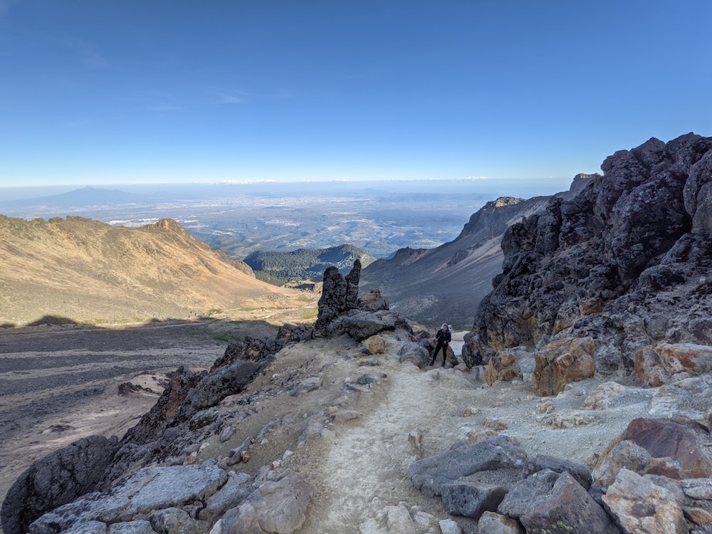
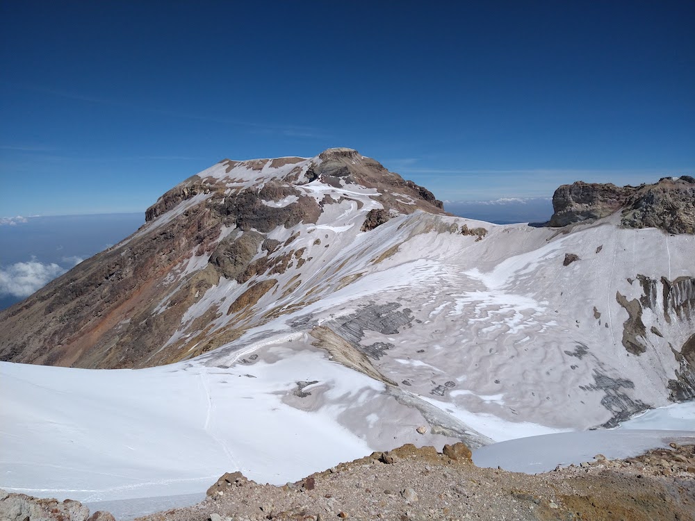
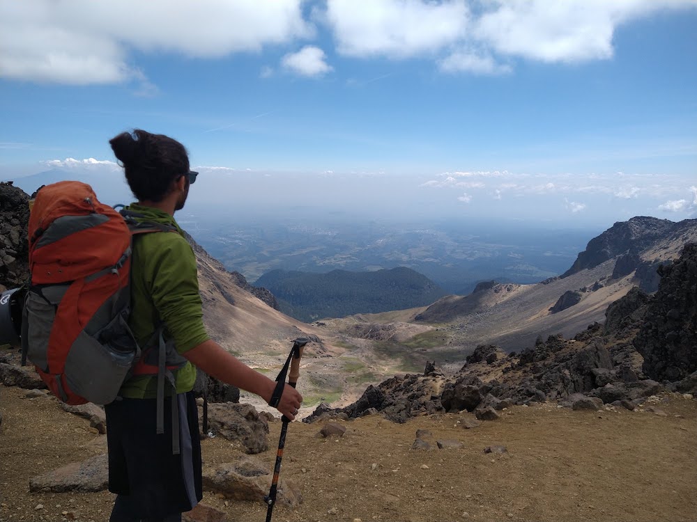
Below: Iztaccihuatl on the left and Popocatépetl on the right (seen from Iztaccihuatl)


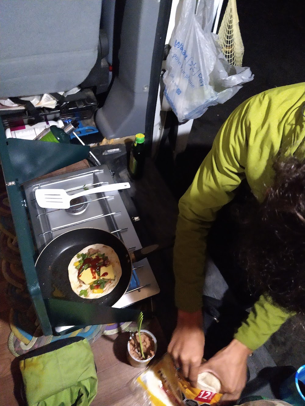
We decided to do the standard route called La Arista del Sol (the ridge of the sun) over the course of two days while passing through the area. Since we were not acclimatized at all to high altitude, we decided to break up the 9 mile round trip into two days, with spending one night at around 15,500 feet in a hut called Grupo de los Cien. We had to purchase permits at the park headquarters (200 pesos), which was closed by the time we arrived at Amecameca (see here for the reason for delay), so we camped along the road up to the mountain. That night we made a bunch of quesadillas for our meals/snacks for our trek.

We arrived at the park headquarters around 11 AM the next morning after driving up the winding road to about 13,000 feet – Amecameca is at 8,000 feet. When we arrived to the bumpy, rocky road that left the main road to the park headquarters, it appeared they were still closed. But soon after we peeked into the doors, the “abierto” sign was put up and we filled out our permit to spend two days on the mountain. We entered our return time as 4 PM the next day. We were surprised to see a trailer for state police which was buzzing with policemen driving around on four wheelers. We drove over to where the road began for the park and one of the park workers opened the gate for us – we realized why we needed to specify a return time (to be let back out).
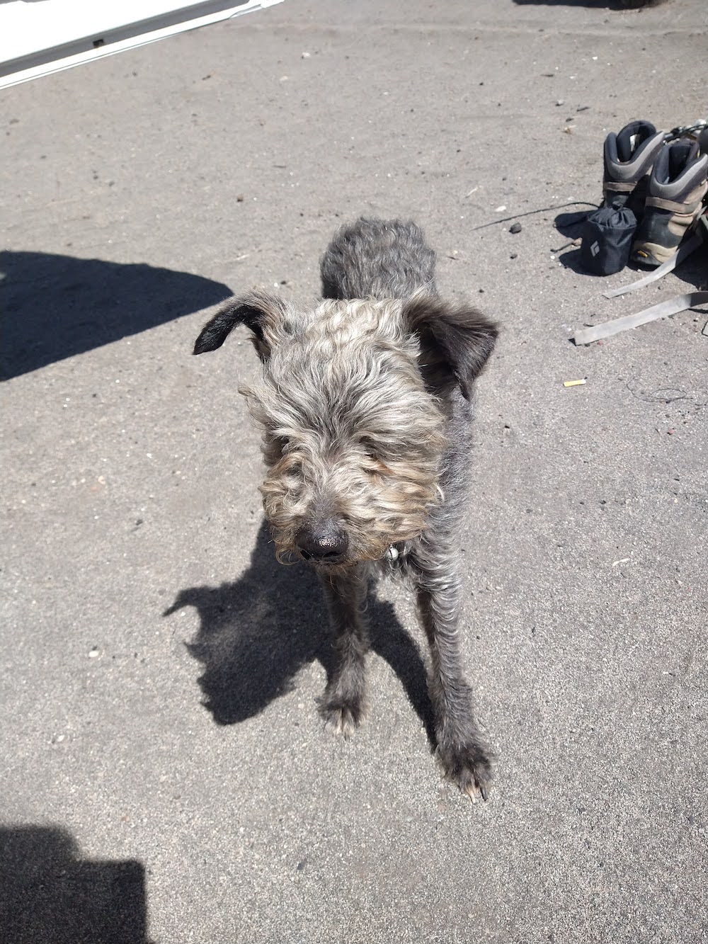
The road up to the trailhead was rutted, silty, and rocky, and I drove Savannah with white knuckles hoping nothing would break. We read that all vehicles could make it up to the trailhead, and while I agree that all could, I’m not sure that all should. Finally up there, after about an hour of navigating the dirt road, we split up to complete our tasks before heading out. Andre cooked us up some eggs for breakfast while I sorted our gear for the trip. We met a stray dog at breakfast and were told by a driver waiting on some hikers at the trailhead that “a very bad man” left him up here. There is no natural food or water anywhere around the trailhead. We shared some of our eggs and snacks with the dog, gave him some water, and very nearly adopted him into our van family. But… it’s not the time or place to take in a dog… maybe in Chile. It seems like it will be difficult enough just getting two humans across the borders in a van. Hopefully someone will take this guy in.
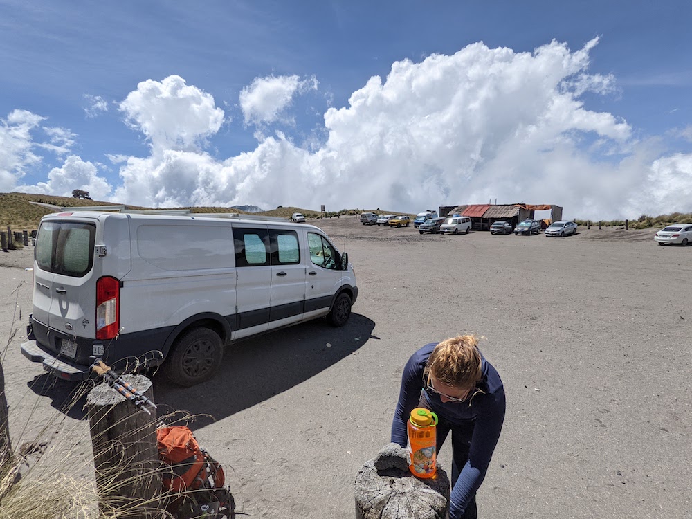
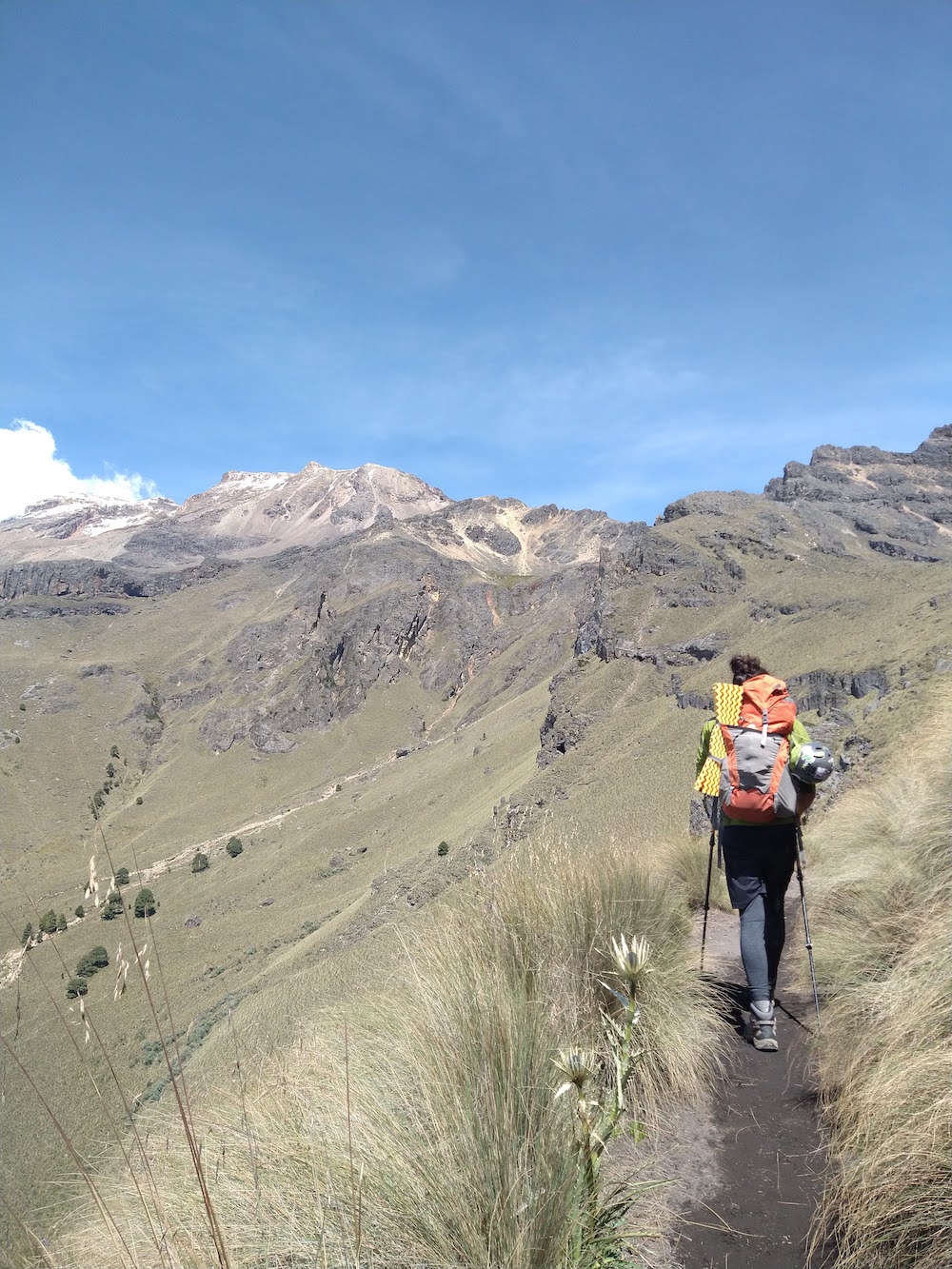
The parking area was around 13,000 feet and I was already feeling the altitude while packing up. Once we had our overnight gear, microspikes, helmet, layers, and lots of water packed up, we headed up at a slow pace. It would be about 2.5 miles to the hut and over 2,000 feet of gain. I think I felt the altitude more than Andre, or he pushed through it better than me, but I took a lot of breaks on the way up. On our way, three “mountain police” passed us coming down and we wondered what the reason was for so many police – it didn’t appear to be on state borders of Mexico, perhaps for overdue climbers?
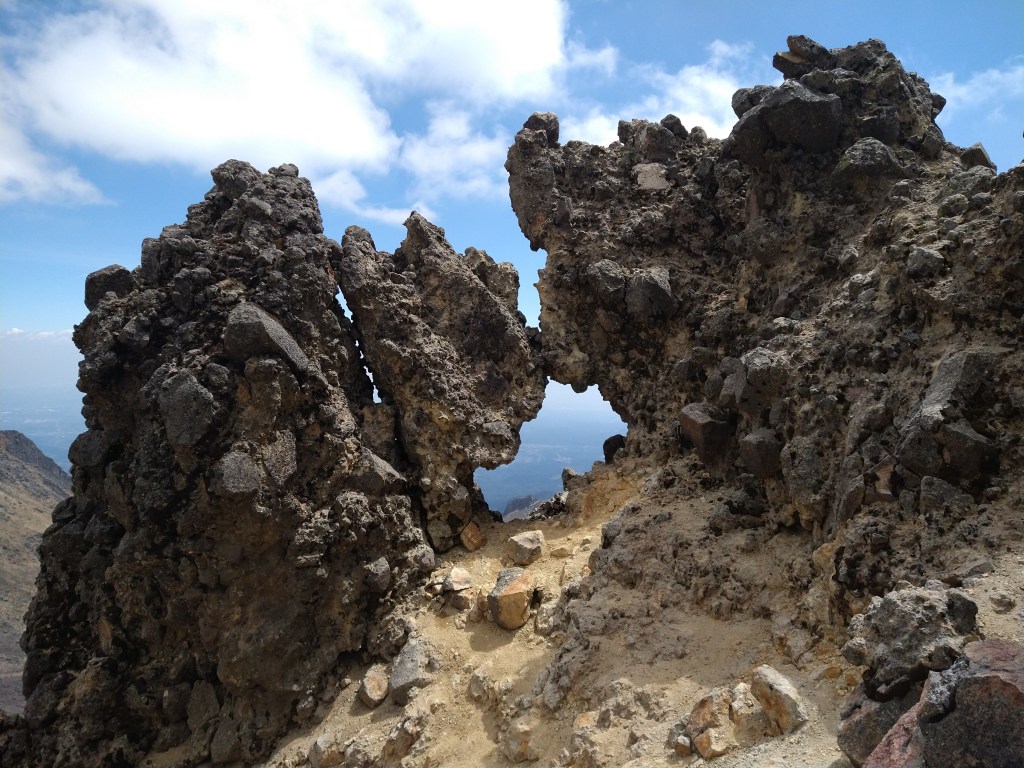
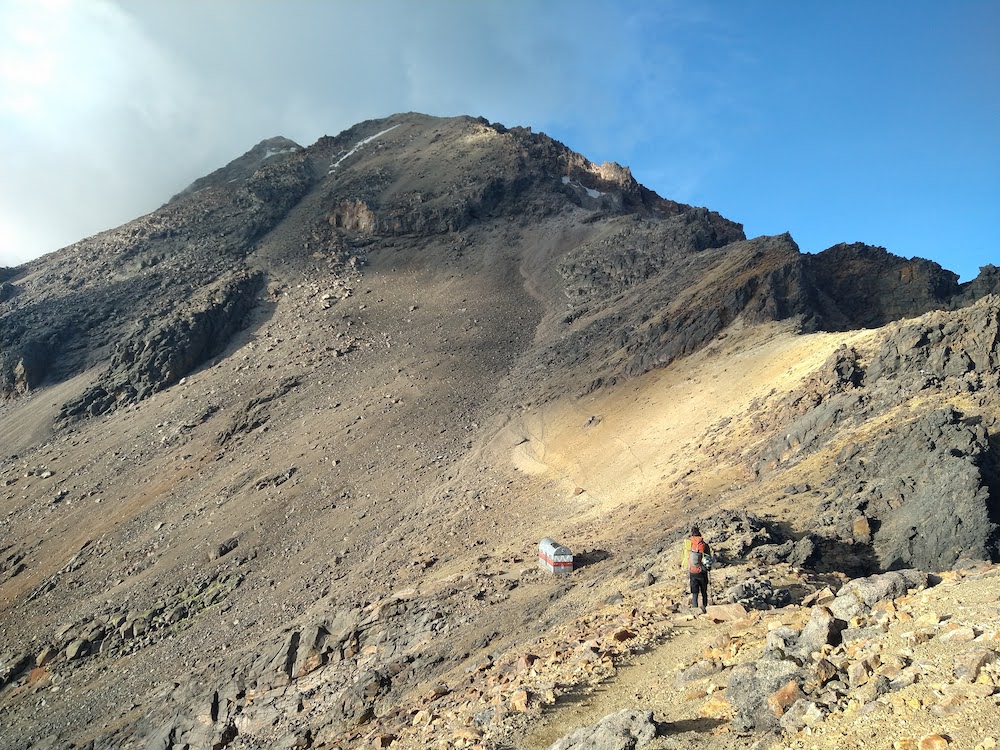
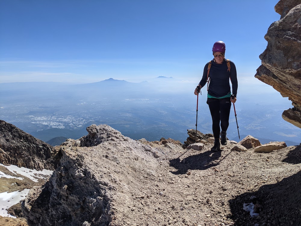
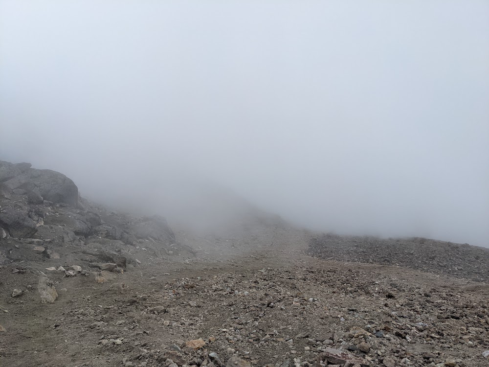
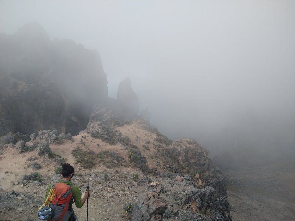
We did get off route at one point and ended up having to scramble down a small cliffside back to the trail, which definitely was a bummer in the moment to lose some of our elevation gain. Around the “feet” of the mountain, we took a break and watched some wild clouds roll into the valleys below – we were starting to hike above the clouds. I fashioned my buff to protect my eyes since aviators aren’t quite the ideal mountaineering eyewear.
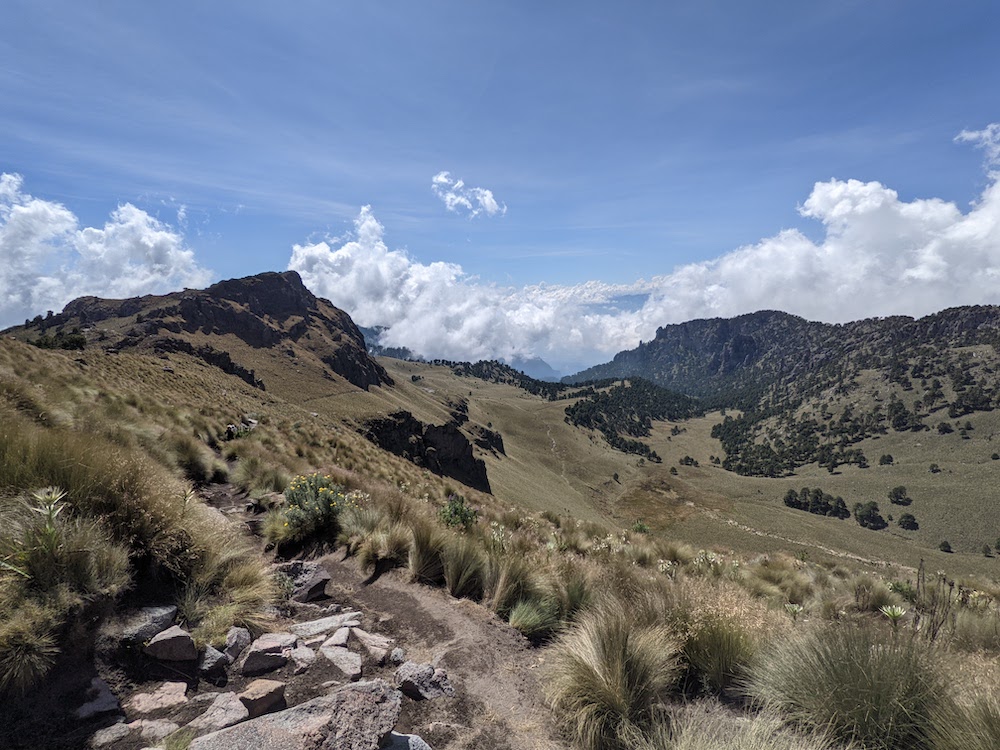
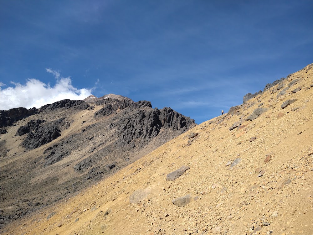
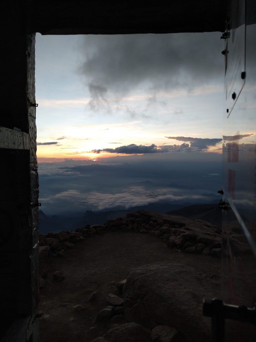
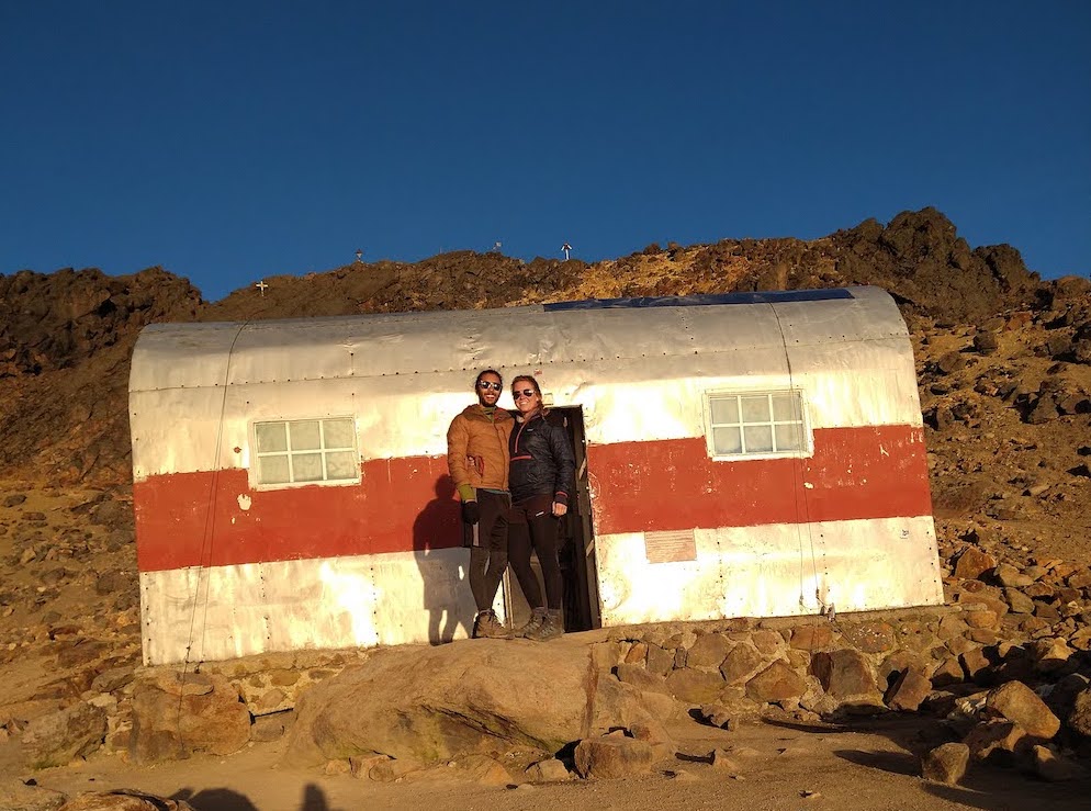
The next section was a punchy, loose scree slope that seemed to take way too long to overcome. We knew the hut must be getting close and would likely be just over the ridge. We heard cows in the valleys below and were surprised they would wander up this high to graze – I guess they really didn’t want to become a burger. Finally, over the ridge, we saw the hut, as well as the trail beyond that we would be hiking up the next morning. By now we both had headaches and felt a bit nauseous. But we forced down some of our ‘dillas and set up a bunk to get some much needed rest. At this point we were the only ones in the hut, and despite a musty smell, it was cozy and warm compared to the dropping temp outside. We snuggled into our sleeping bags after I took some photos of the sunset out the door of the hut, it was really beautiful.


It took a few hours for our heart rates to slow down before we could fall asleep. It was a bit alarming how much harder it had to work with less oxygen up there, but finally sleep found us. But not long after (~1:30 AM), the first group of hikers arrived. The door crashed open and three people piled into the bottom bunks. They didn’t seem to care we were sleeping while they spoke loudly and organized gear, but I guess if you’re aiming to gun it up to the summit in one shot, every minute counts. We pretended to stay asleep and I only caught some of their conversation, but soon two out of the three left and I heard the one that stayed behind fight off a mouse that had been rooting around at the base of the hut.
A bit more sleep was able to be found before the next, larger group came crashing in at around 4:30 AM. This must have been a group of 4 or more and they were even louder and sounded like they had a lot of hardware. We had read that there would some snow fields to cross but nothing more than microspikes would really be necessary. We heard pounding of what I think were ice axes, and some sounded like they were being pounded on the bottom of our bunk. Half the group left, but two stayed behind while it sounded like one man was having a really hard time with the altitude as he groaned. I think they ended up going down. We drifted in and out of sleep until they left. I had a few stress dreams but then a good one of riding my old horse, Raven, through the forest.
We should have gotten up with the first alarm, at the crack of dawn. But we still weren’t feeling great and decided to get another hour of sleep. Around 8 AM we packed our bags and had a quick conversation with the guy that stayed behind from the first group of three. He was a guide but his headlamp died on the way up to the hut so he couldn’t proceed with the other guide and client. He said he had actually never been past the hut before. He offered us some snacks, but we declined having plenty of our own and not much of an appetite. He suggested we check out the Sumidero Canyon in Chiapas, which was actually on our list! We exchanged names, his was Daniel, and he wished us luck on our ascent.
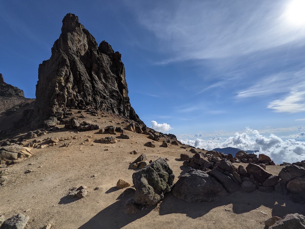
We felt better than we had the day before, but still the going was slow. I tried to walk as slow as possible to keep my heart rate under chaotic so I wouldn’t have to stop to catch my breath as much. I could feel my legs get stiffer the higher we climbed. We managed to tackle the 1,000 feet scree/scramble up from the hut in about 2 hours. We rested at this point, where there used to be another hut, but now was just a pile of rubble. We came across the first glacier of the hike and a tiny lake at the bottom of it.
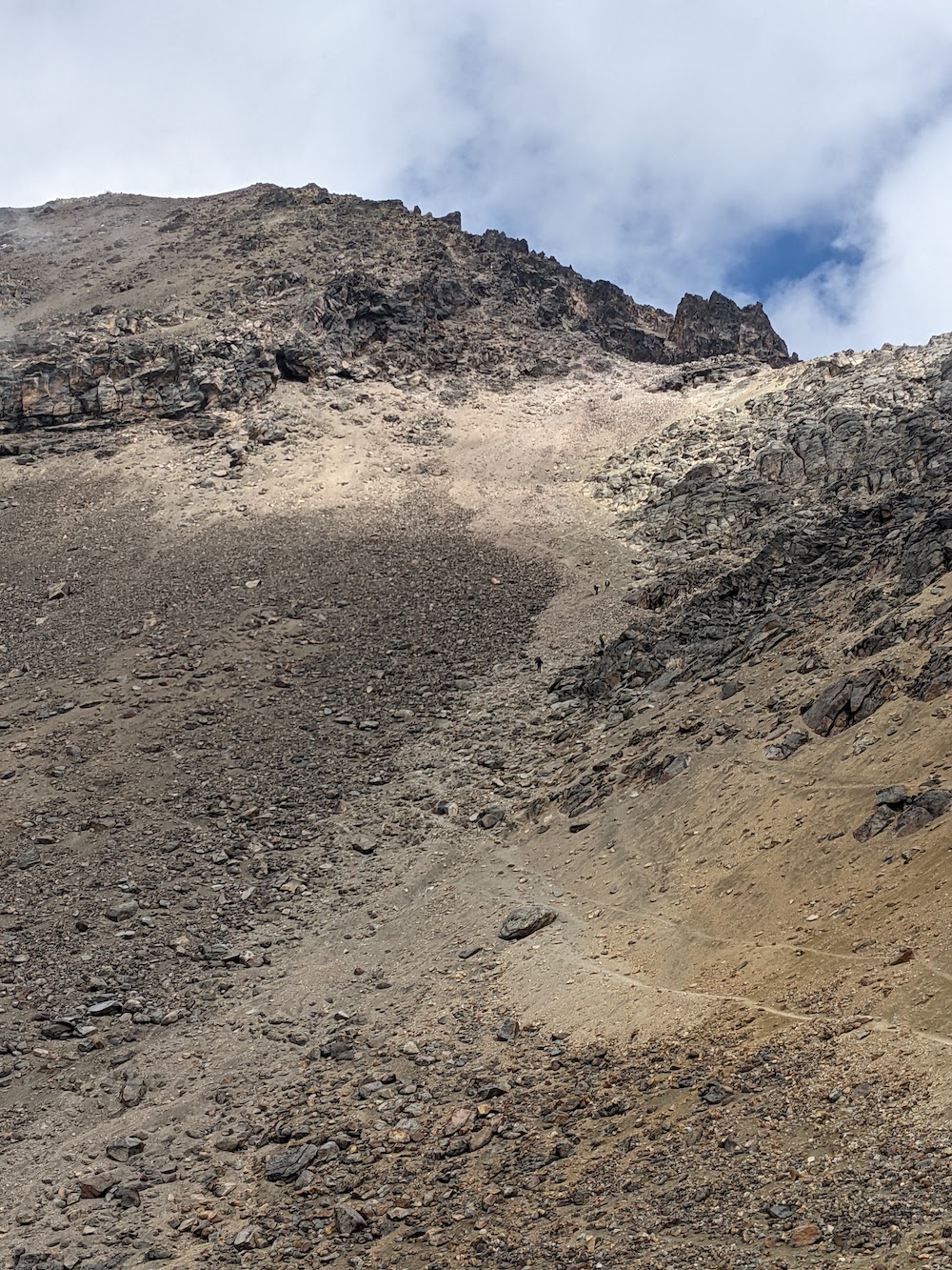

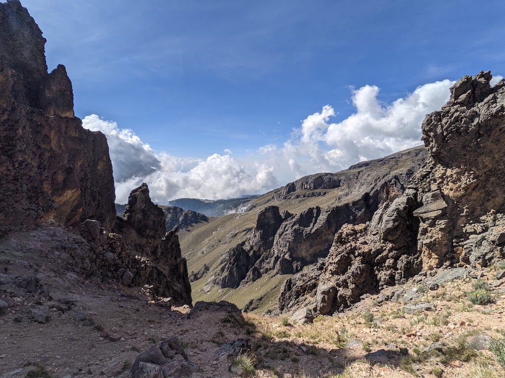
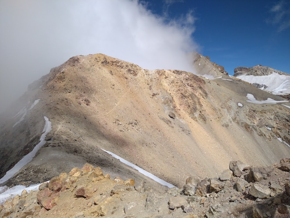
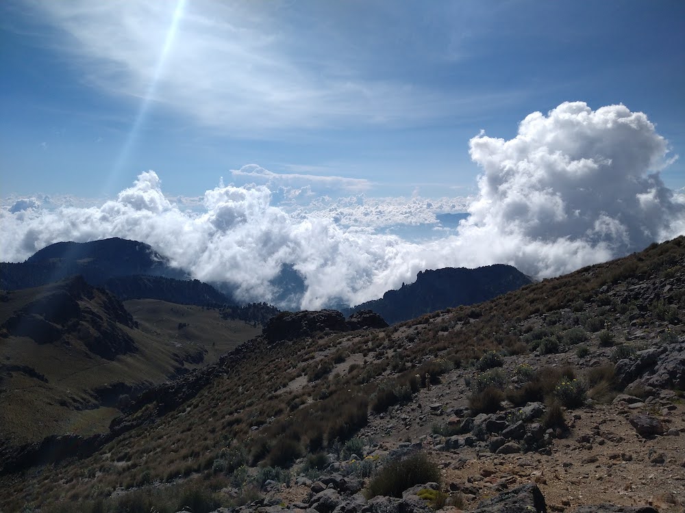
Summitpost and Caltopo differ from what they distinguish the “knees” of the route as – according to summitpost, we were there where the delapitated hut was, but caltopo said we still had a few hundred feet to gain. It was 10:30 AM and we had to start thinking about a turn-around time. Many trip reports reported near white-out conditions after noon up there, and we had seen the clouds move in during the afternoon the day before. We were also concerned about the 4 PM return time we submitted in our permits. A rescue initiated for us was not something we were willing to gamble. And, given our last run in with the police, it didn’t seem ideal to have a reason to be in trouble – being on the mountain longer than we said we would be.
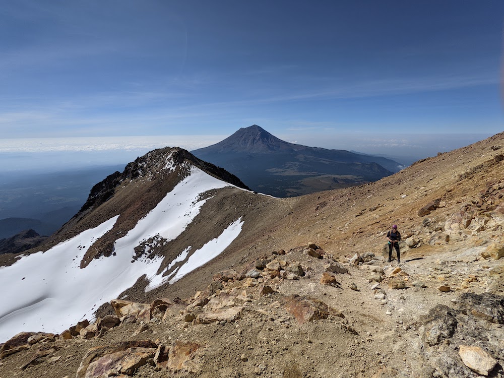
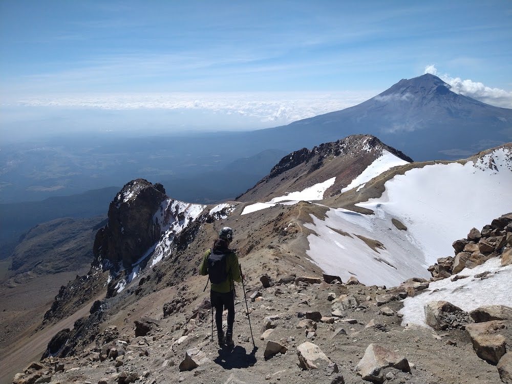
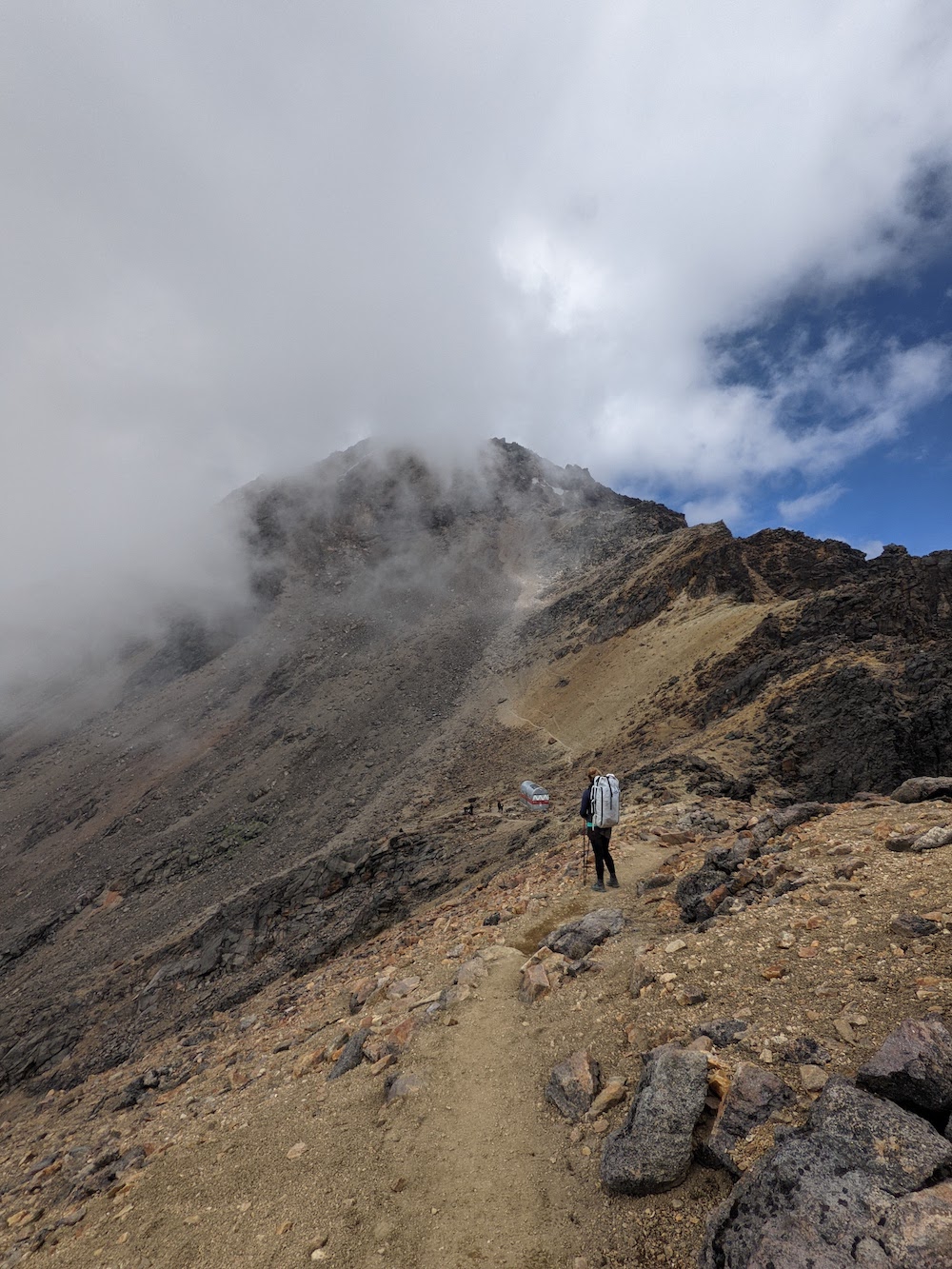
We decided to push on for another hour and see where it got us. We traversed a scree slope, then followed a ridge up and around what Caltopo reported as the knees. We were on a peak at about 16,800 feet high here. While we were moving, we felt pretty lousy with pounding headaches and some dizziness, but at least when we sat still we could enjoy the surroundings. We could see the rest of the route clearly as the trail across the snowfield would traverse the “stomach” and eventually lead up to the “breast”. The “breast” was the high point at 17,159 feet. In the distance, we could see another party at the true summit and were sorely tempted to go for it. We knew we’d be safe on the snowfield with our gear and the weather looked like it would hold. We’d probably be slow since we would have to lose 200 feet and then regain 500 feet over the course of about a mile and a half, but we knew we could physically do it. In the end though, we did decide to turn around since we didn’t properly set ourselves up to summit – we should have woken up earlier and/or put a later time out on our permit to not have to worry about the mountain police.
Sad not to hit the high point, but pretty proud of where we got, we headed back down. Prior to this trip Andre’s highest hike had been ~13,000 feet and it had been a long time since I was hiking 14,000 foot peaks in Colorado. Getting this high on our own, while we noticed most other groups were guided, and for only the 200 peso entrance fee, we didn’t feel too disappointed.
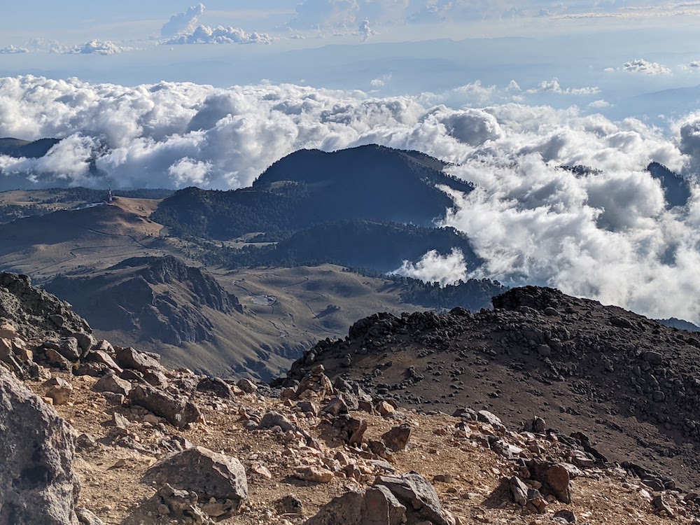
We crossed back across the scree field to the remains of the hut when the clouds started moving in. The trail seemed pretty straight forward on the way up but as it grew more foggy we had to pay attention to where it looked like we had come up that morning. Quite quickly we retraced our steps back to the scramble and down to the hut. As we broke through the clouds, we saw lots of people around the hut. We gathered our big packs (we had packed small daypacks in our big packs for the summit), that we stashed in the the hut with our sleeping bags, pads, and sleeping clothes. I was a little worried if they would still be there after a feverish dream the night before in the hut that all of our things were stolen. But they were there, secretly stashed in the top bunk. We hung around for a bit and people watched – there seemed to be some local day hikers, a very affectionate European couple, and some people equipped for a summit. We were surprised with the prospective summiters given how late in the day it was, around 1 PM at this point.

Leaving the clouds behind, we hiked up and over the ridge, then back down the trail to the “feet.” The valleys below were in some beautiful dapple light, Andre pointed out, and the cows were still there. Our headaches persisted but gradually became less bothersome as we descended back down to 13,000 feet. Andre was having some issues with keeping his feet under him on the loose gravel dirt and we decided before the next attempt at something like this, we should get him some new boots. We arrived back at the gate minutes before 4 PM. Andre went to find someone who could open the gate for us while I crawled under Savannah to see if anything broke (luckily not).

That night Andre treated us to a 350 peso ($17) hotel room in Amecameca, our first paid room of the trip. We enjoyed unlimited hot water, wifi, takeout food, and beers in the cool, clean room (crazy that this cheap of a room was nicer than most “cheap” rooms in the states). We sort of just stumbled upon this volcano hike and we’re pretty happy we decided to go for it.
We are now heading South, unsure of what our next adventure will be. We were hoping to find climbing in the canyon in Chiapas that Daniel, the guide in the hut, had recommended and that we had our eyes on. But we’re having trouble tracking down routes in the area that aren’t exclusive to the guiding companies that operate there. There are also the cenotes (sinkholes) on the Yucatan Peninsula that we’d really like to see. Perhaps we’ll do both. Right now we’re parked in a 24 hour lot of a gas station among truckers and it’s about 90 degrees outside. Not all camp spots can be as scenic as the hut 😉
Andre’s post here!
Updated campsite link, here 🙂

What you do in a day, I might be able to manage in a month! Just saying…
Enjoying every bit of your journey with you. It is awesome what you two can pack in to one day. I’ll bet the headaches and racing hearts were not fun but were certainly evidence of a great climb. Congratulations … and I’m always waiting for more.
LikeLike