A Desolate Park
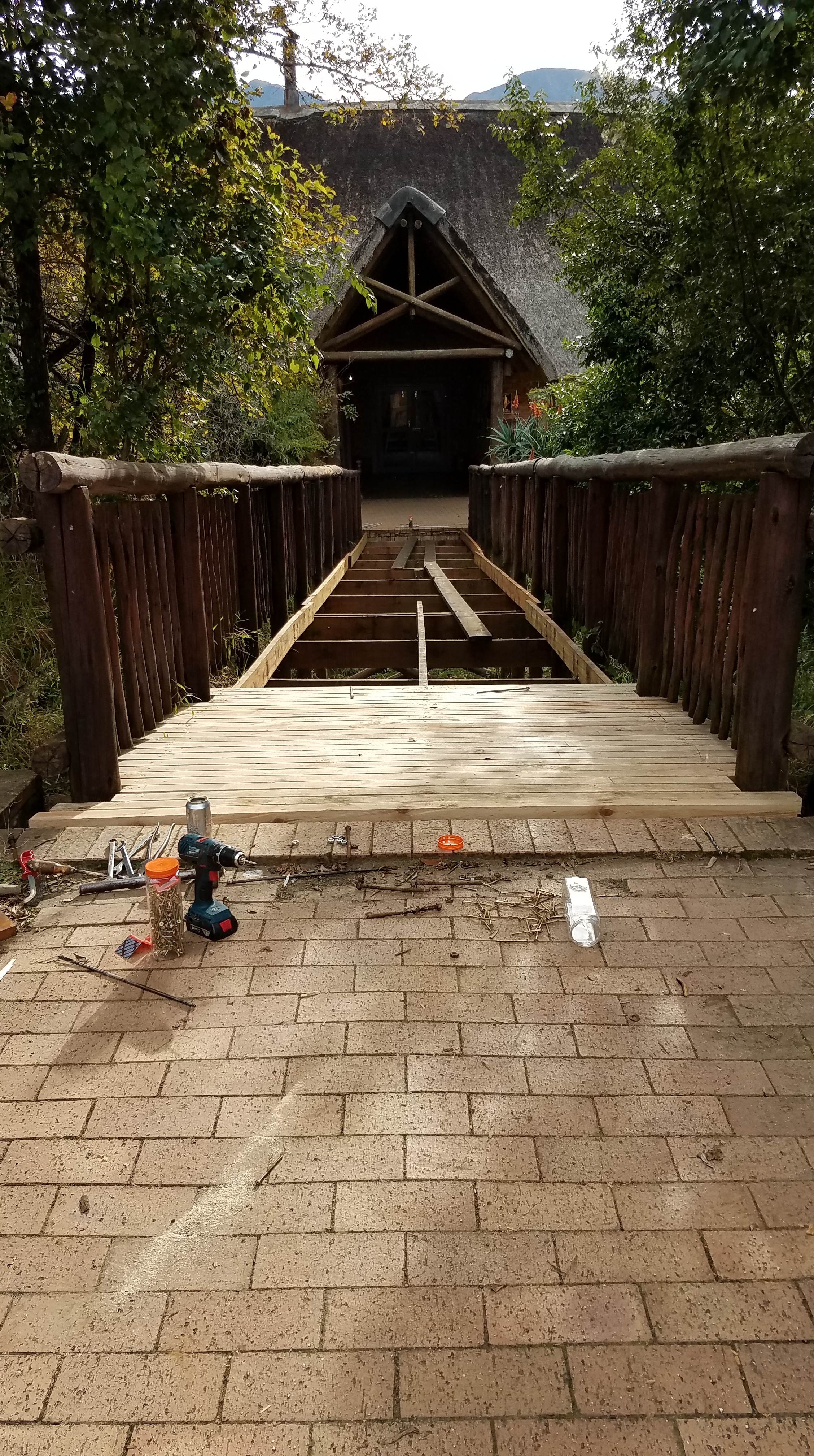
Some of the volunteer work involves working with the parks service, since my host is also an honorary officer for the parks and a local mountain guide. This work began with rebuilding a bridge to the reception office in the Monks Cowl park region of the Drakensberg. We tore up the old planks and replaced them with the park rangers, mostly local Zulu, and the park manager, Mark. It took us three half-days (Saturdays) to finish the bridge. I usually operated the power drill to put holes in the boards, others cut the pieces of timber and screwed the planks into the struts of each side of the bridge. On one of the days we were working, the manager brought down a box of puff adders (poisonous snakes) that he had removed from a local farm and was going to release into the mountains. I crouched down to take a closer look, assuming the box was big enough to contain the snakes. One snake in particular, the fattest one, got annoyed at my lurking and struck up out of the box. I rocked back on my heels and stepped back in time – it was amazing how high the snake could strike! I swear its entire body left the bottom of the box… now I know, and will be extra cautious in the mountains where they like to sunbathe on the trails.

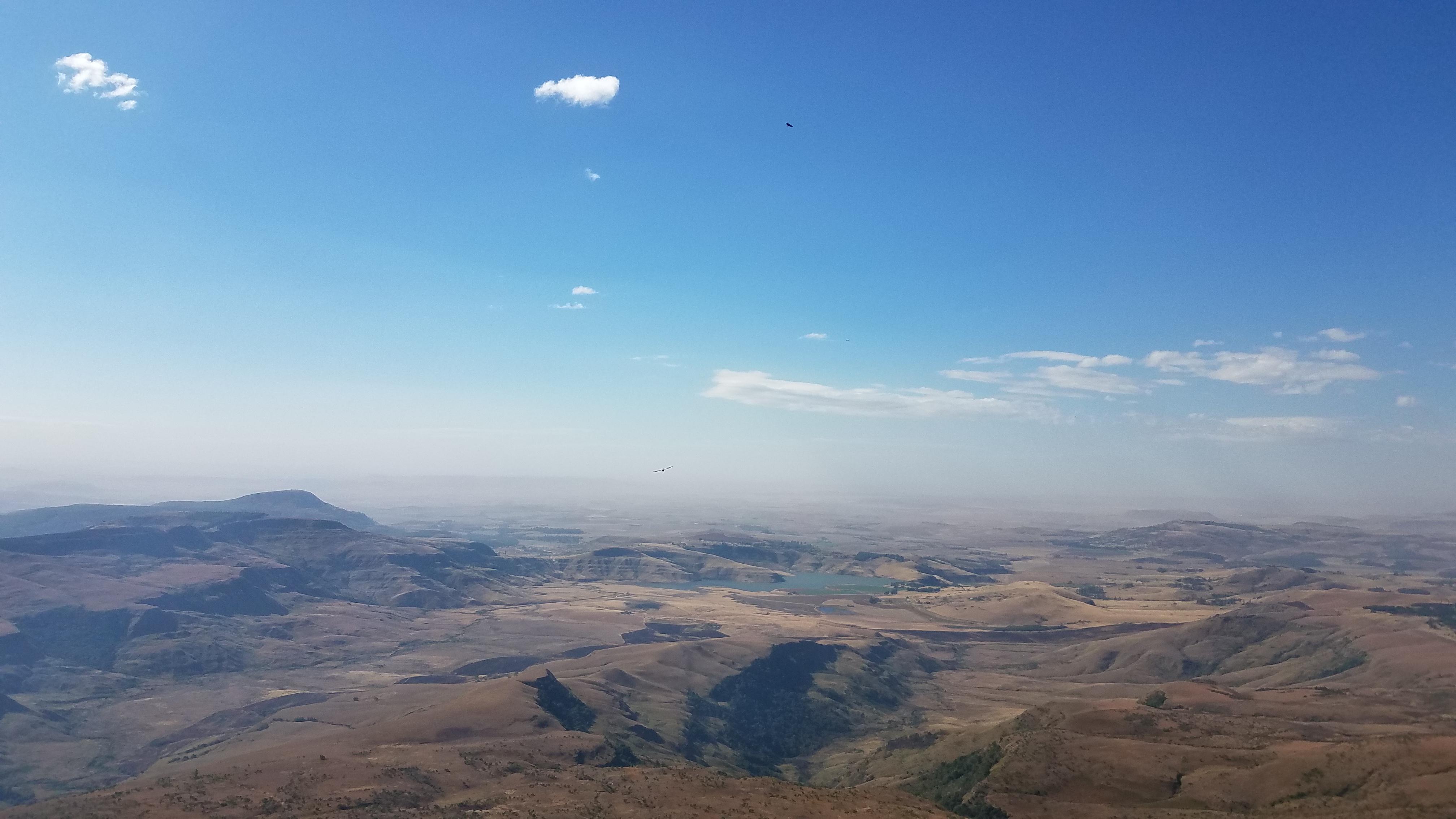
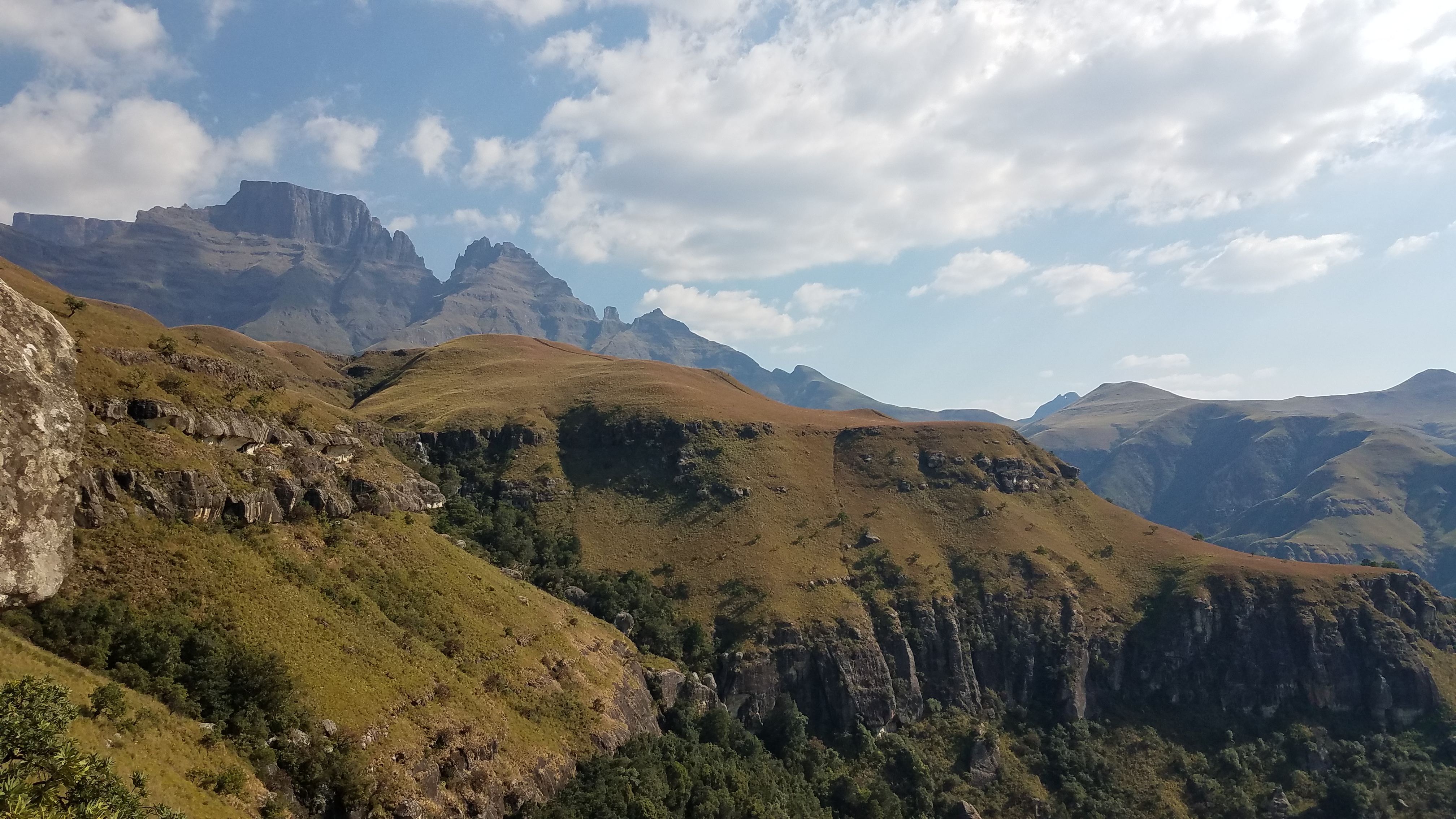
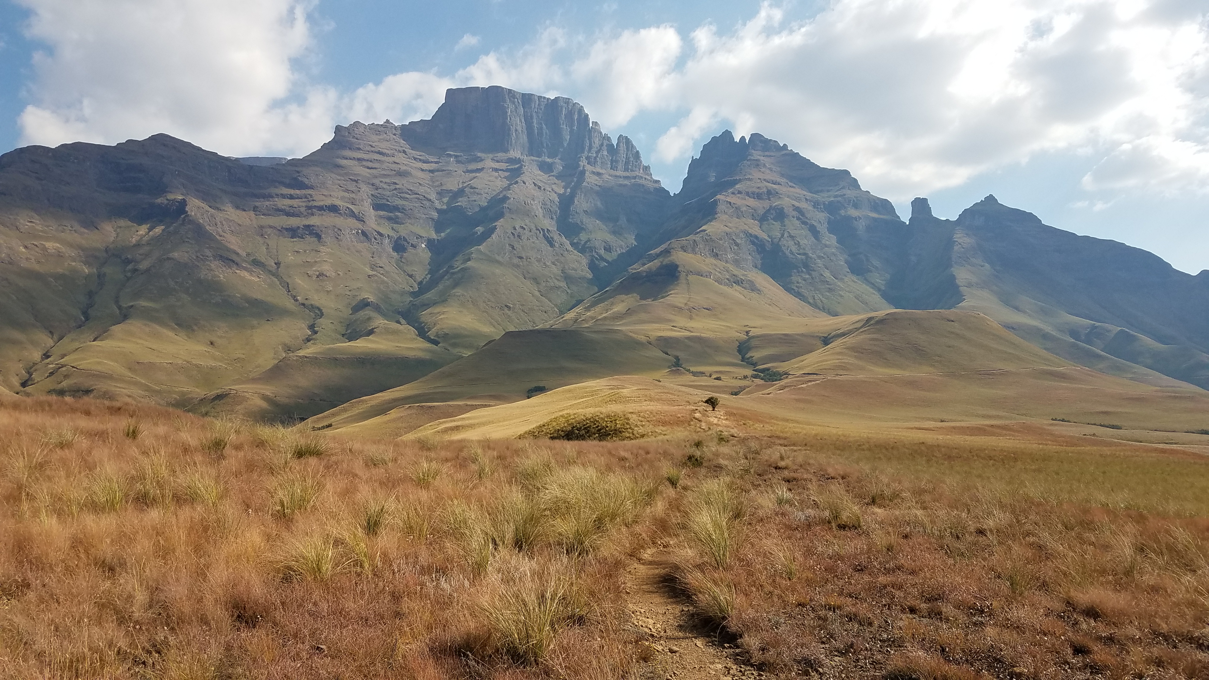
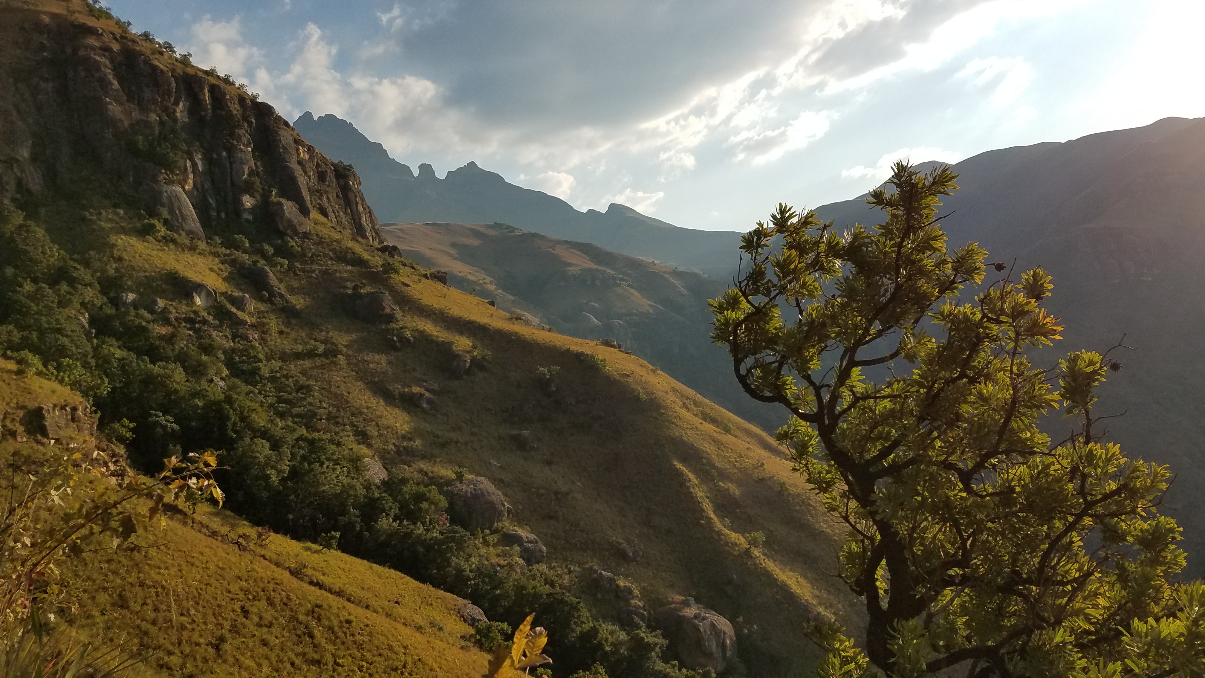
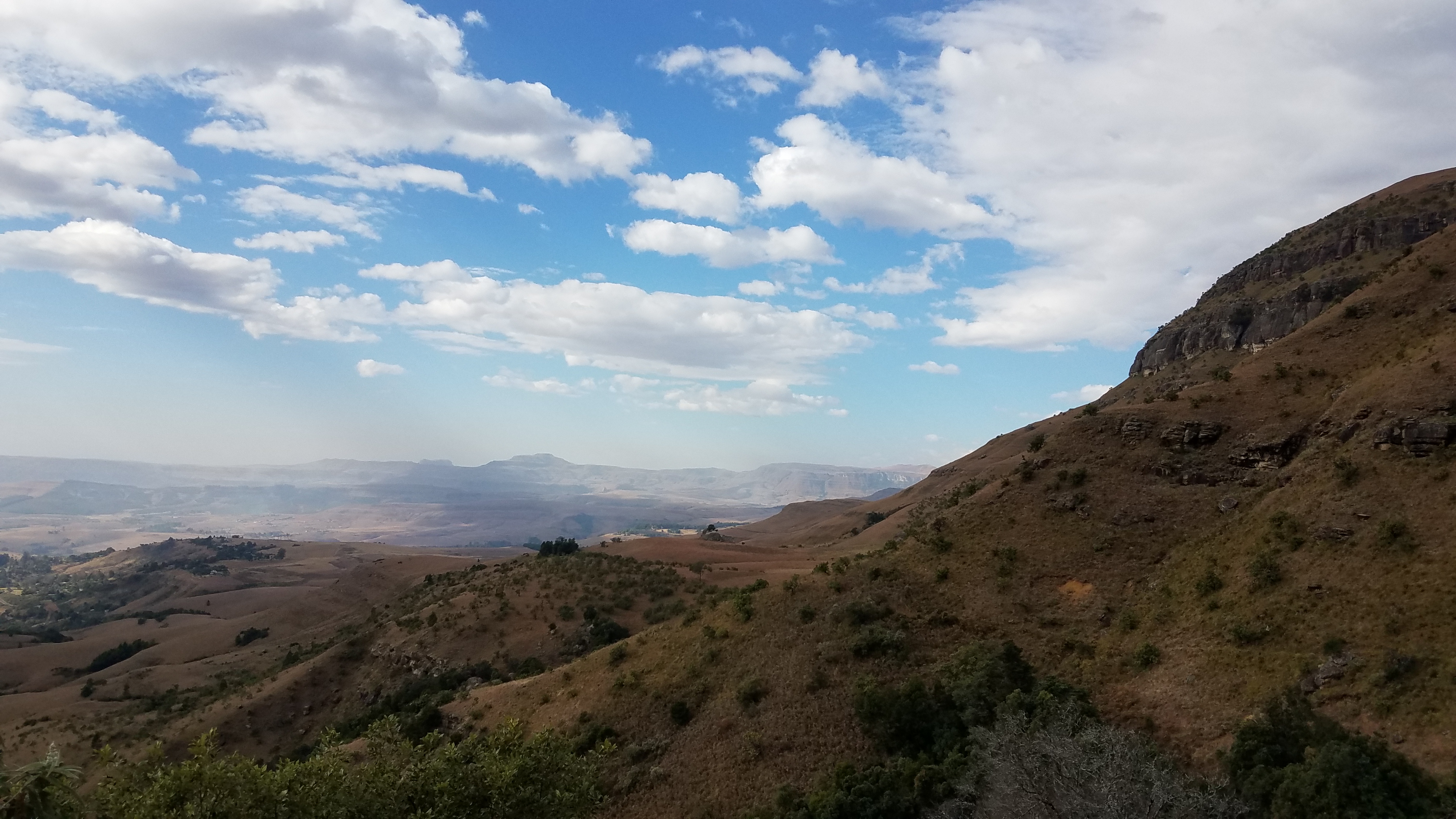
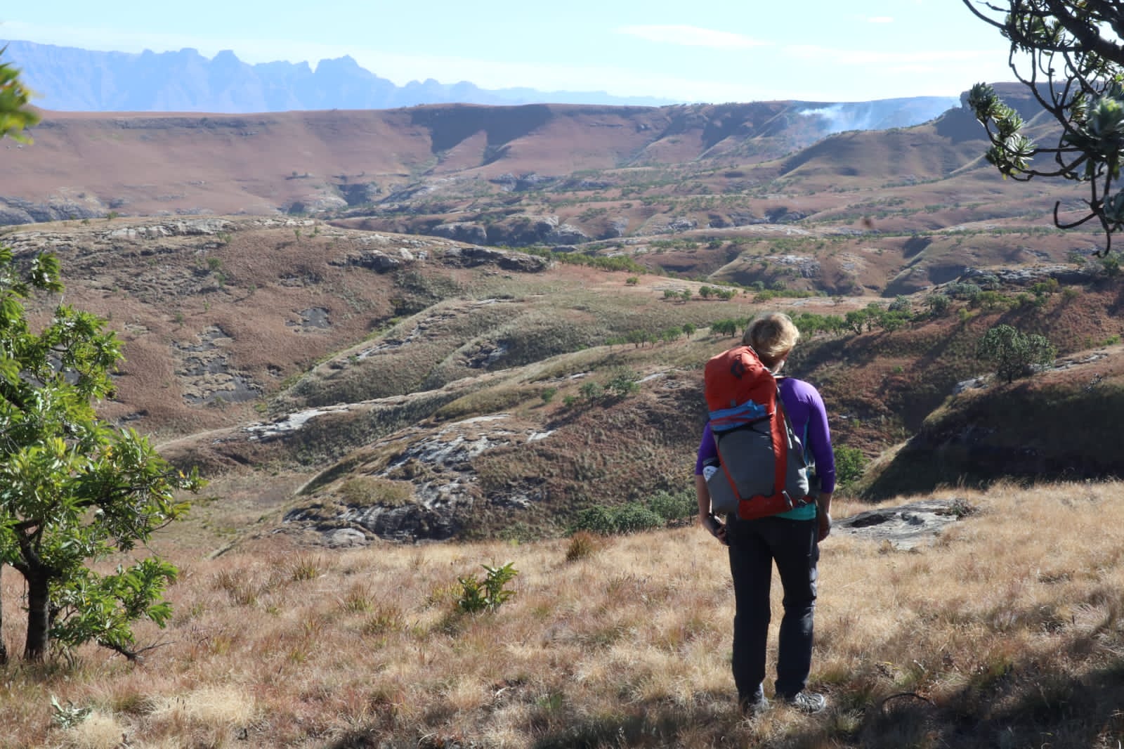
The bridge brought good karma and I was granted access into the park to hike even though it is still closed to the public, as long as I keep it a secret in the valley. One afternoon after finishing work on the bridge, I hiked up a popular trail to Blindman’s Corner and got my first taste of the “berg.” The manager said they had a mission for me to go up there: to check the campsite at the corner and make sure no one had vandalized it. The trail from the ranger station switchbacked up to the lower berg and from there I followed the contour trail along the ridge. The mountains appeared to be fluid, melting from the summits down into the valleys below. Golden hills rolled out before me and fell away on the sides turning to cliffs and eventually thick, lush forests. I gained the 2 kilometers quickly with my eyes fixated on the mountains ahead of me – Cathkin, Sterkhorn, Turret, Amphlett, then Champagne Castle in the back and Greys Pass. Further North below me was Eagle Gorge, a place I must go to explore for a few days. As I grew closer to the corner, I craned my neck to trace the ridgelines to the tops of the peaks. It was spectacular. When I was given directions to Blindman’s Corner, the park ranger said that I couldn’t miss it, because even a blind man could find it. The trail met the base of the mountains and split, North and South. The campsite lay right at the junction and was left untouched – mission accomplished. Above the intersection was a triangular grassy hill, a corner of the mountain. It was the steepest grass hill I’ve ever seen and I wondered how the vegetation managed to cling to its sides. I wondered if the saying from Alaska, “If it’s green, it goes,” applied to the Drakensberg as well. It did, and soon I was sitting cross-legged on top, eating my lunch, dazed by the views. I knew I’d be up on top of the peaks someday soon. It had been awhile since I felt the mountain high – it felt good. I don’t remember much of the hike down as it all seemed like a dream, especially watching the light show as the sun set behind the range. I did not see a soul the entire hike. I’m incredibly lucky to have this natural playground so close to my farm and access to explore.


Cave Surveys and Wildfire Watch
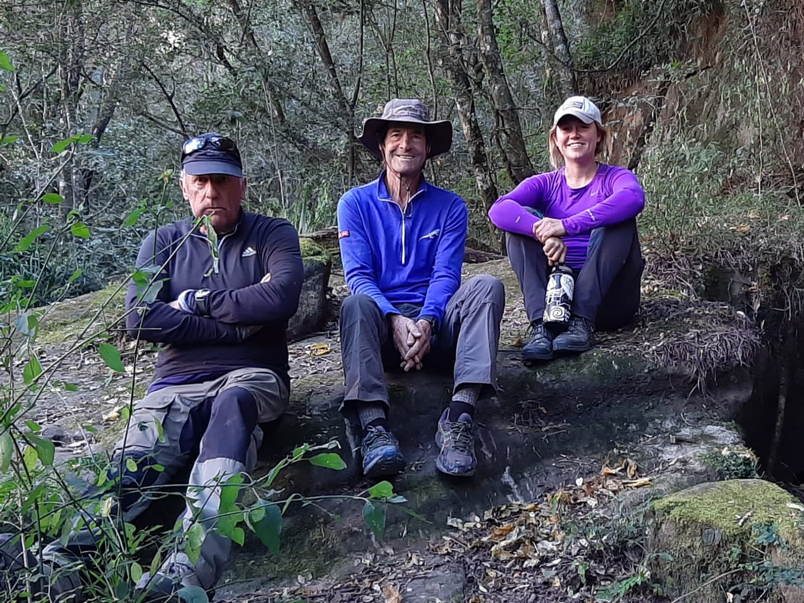
Last week we organized a backpacking trip to do two cave surveys. The cave monitoring cards differ slightly depending on if there is rock art in the cave but the questions are similar and are categorized based on the type of impact – people, fire, natural (animals/plants), and vandalism/illegal activity. This trip was made possible by the bridge karma and of course filling out the survey cards made the trip a mission. My host, another HO, and I planned to hike up and over the little berg to sleep in either Stable Cave or Vaalribokkop Cave, depending on the wind on the ridge. The night before I excitedly packed my red climbing pack with warm clothes (its winter here), my sleeping bag, half of the cooking supplies, and some food. I decided not to bring a foam sleeping pad, it didn’t seem necessary after sleeping on the sand dunes over the past year without any padding.

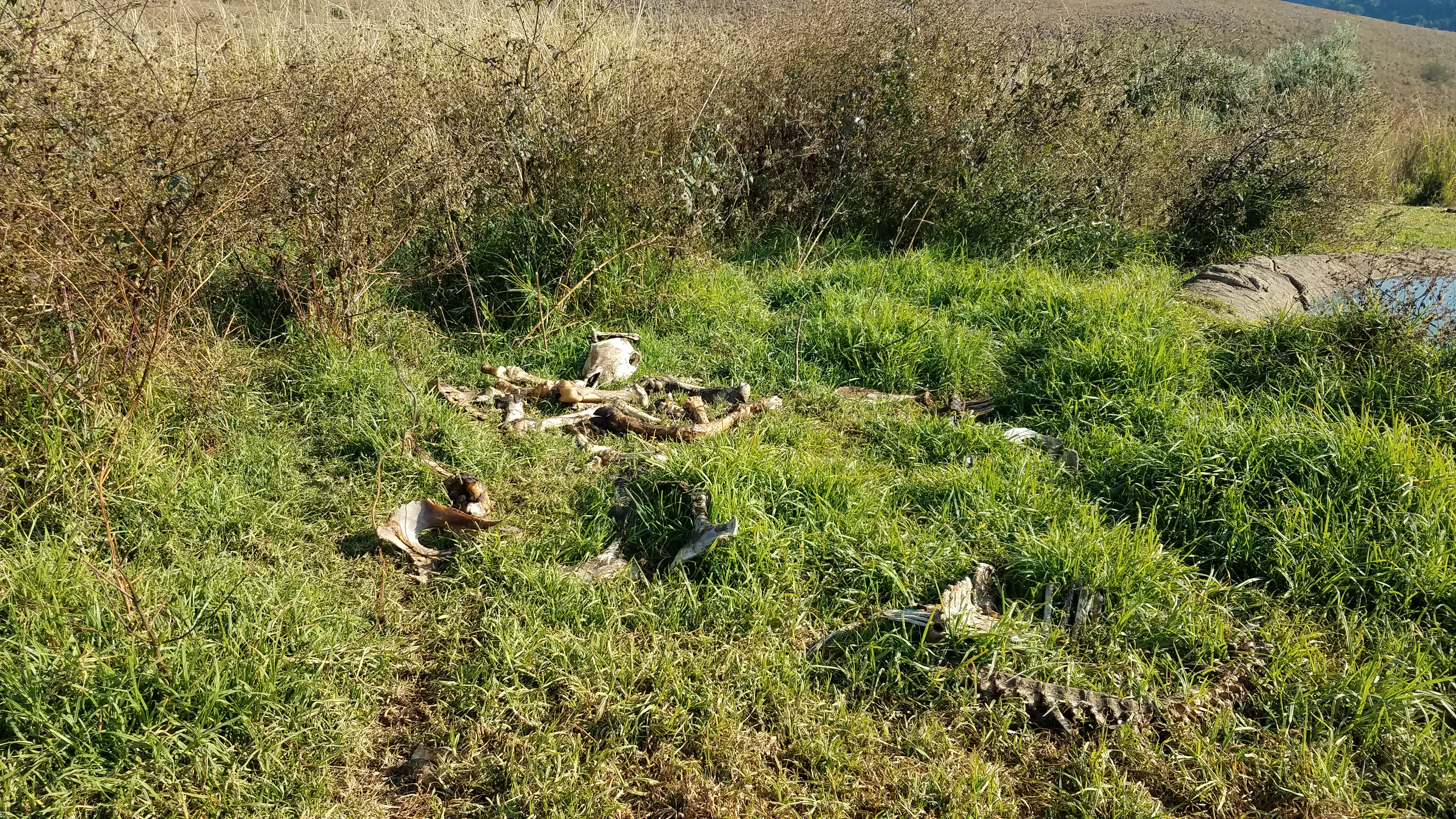
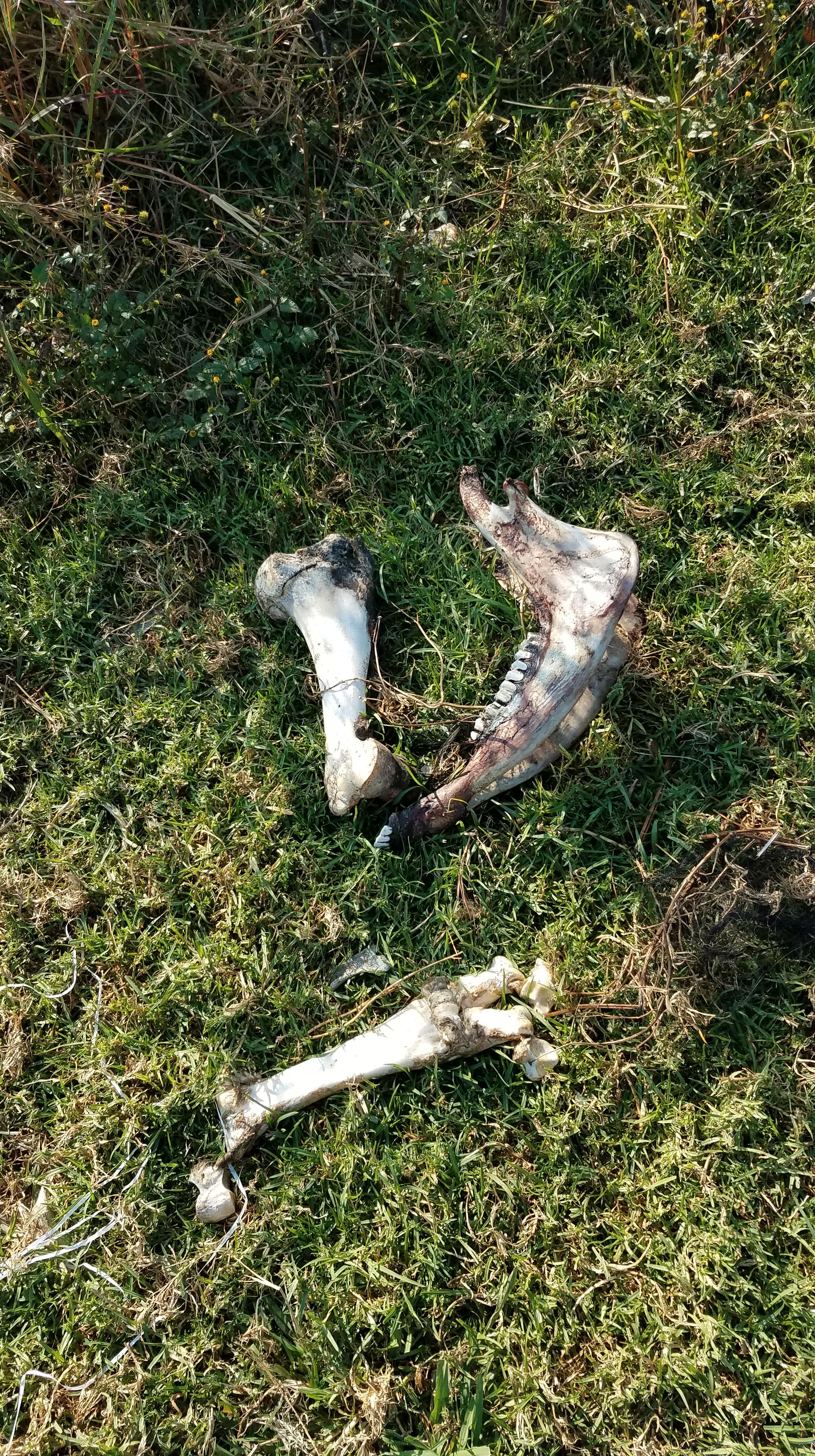
We left the farm early and drove to Roy’s place. Roy works for the parks and manages the vulture restaurant – a concrete slab at the top of the lower berg where he places carcasses of farm animals that have died in the valley out for the bearded and cape vultures to feed on. I’d been up there during my first week here and, though there weren’t any fresh carcasses to scavenge, I saw some of the bearded vultures circling above eyeing the piles of bones from cows, horses, sheep, dogs, cats, you name it. Roy built a hide to watch the vultures, and sometimes brown hyena, scavenge. He offered for me to spend the night there if there is a fresh carcass put out.

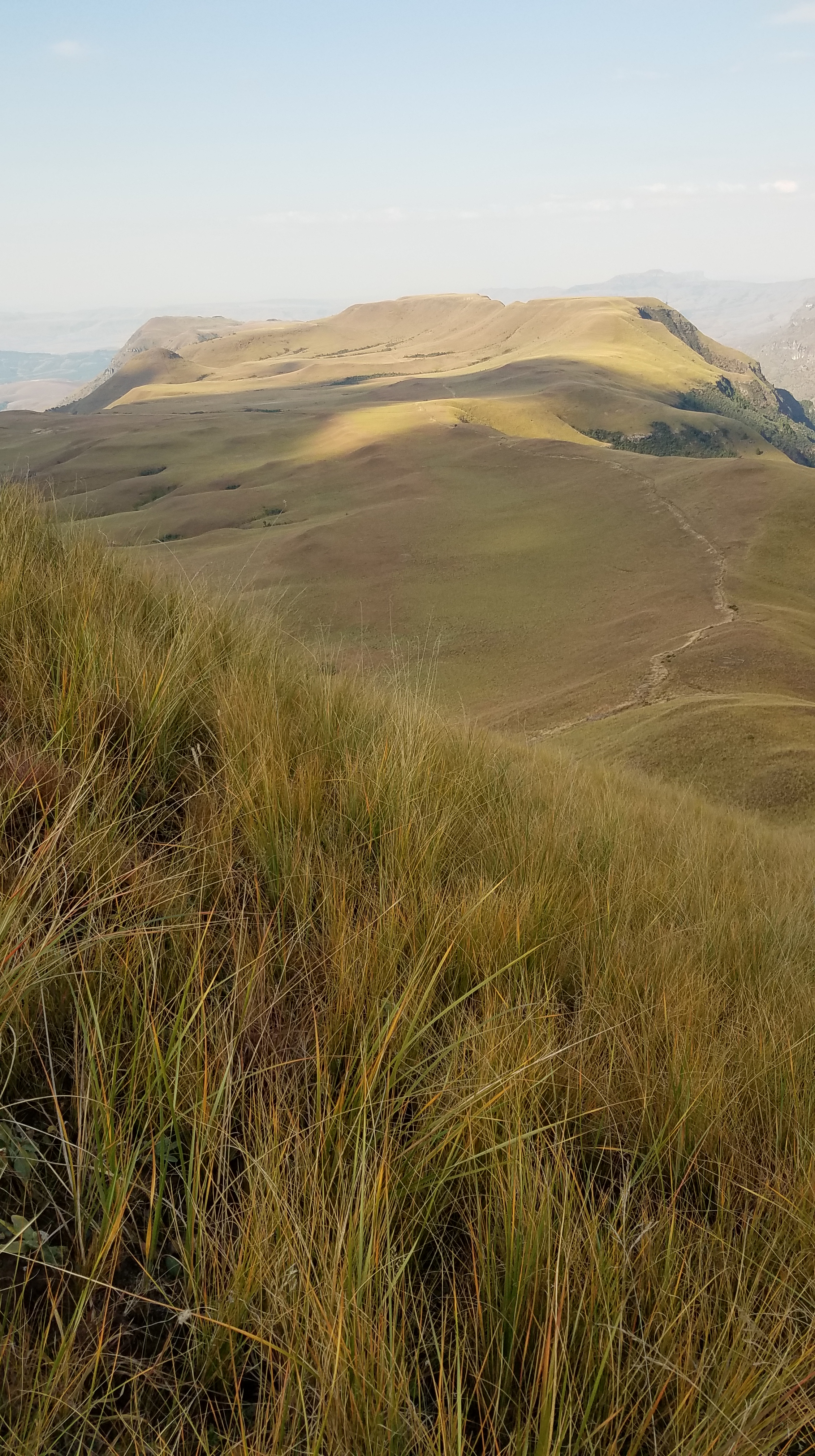
Roy gave us a lift up to the vulture hide, saving us a lot of elevation to hike. We set off on the contour path at a moderate pace. The hills were a bit more golden than the last time I’d been up there and a jet stream pushed puffy white clouds into the sky. We took a break an hour in beside a stream in a forested gully, ate some lunch, and refilled water straight from the stream (no need to filter, boil, or add iodine to the mountain runoff). The contour trail wrapped around into the next valley where we could see the farm and all the trails Nathi and I ride. We ascended the ridge via Jacobs Ladder, a long switchbacking trail, before topping out at an overhang. From here we saw smoke rising from the cliffs above our destination – three separate fires. We notified Mark; he hadn’t seen them yet and asked us to report back if they got bigger. They were likely set by arsonists since there were three separate fires along the ridge. I learned that one should always carry a lighter when hiking during winter. Fires are common, either from being purposely set or by careless acts, and the dry vegetation can quickly fuel a massive fire. Recently, two Canadian visitors burned to death by being trapped by a fire; people die every year from them. If there is no way to escape the fire, and you really can’t run from fire, you should set your own to burn the area around you. That way when the fire comes through, you will be in a place where it can’t burn anymore. I had brought a lighter in my emergency kit, but thought it better to have it more accessible.

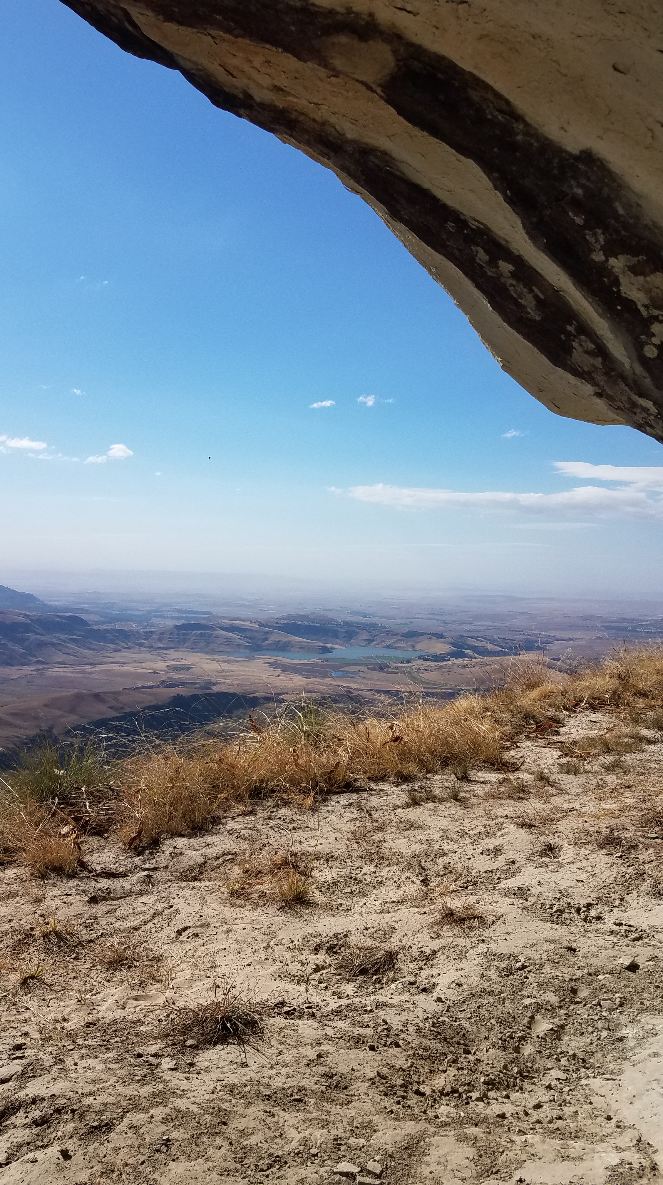
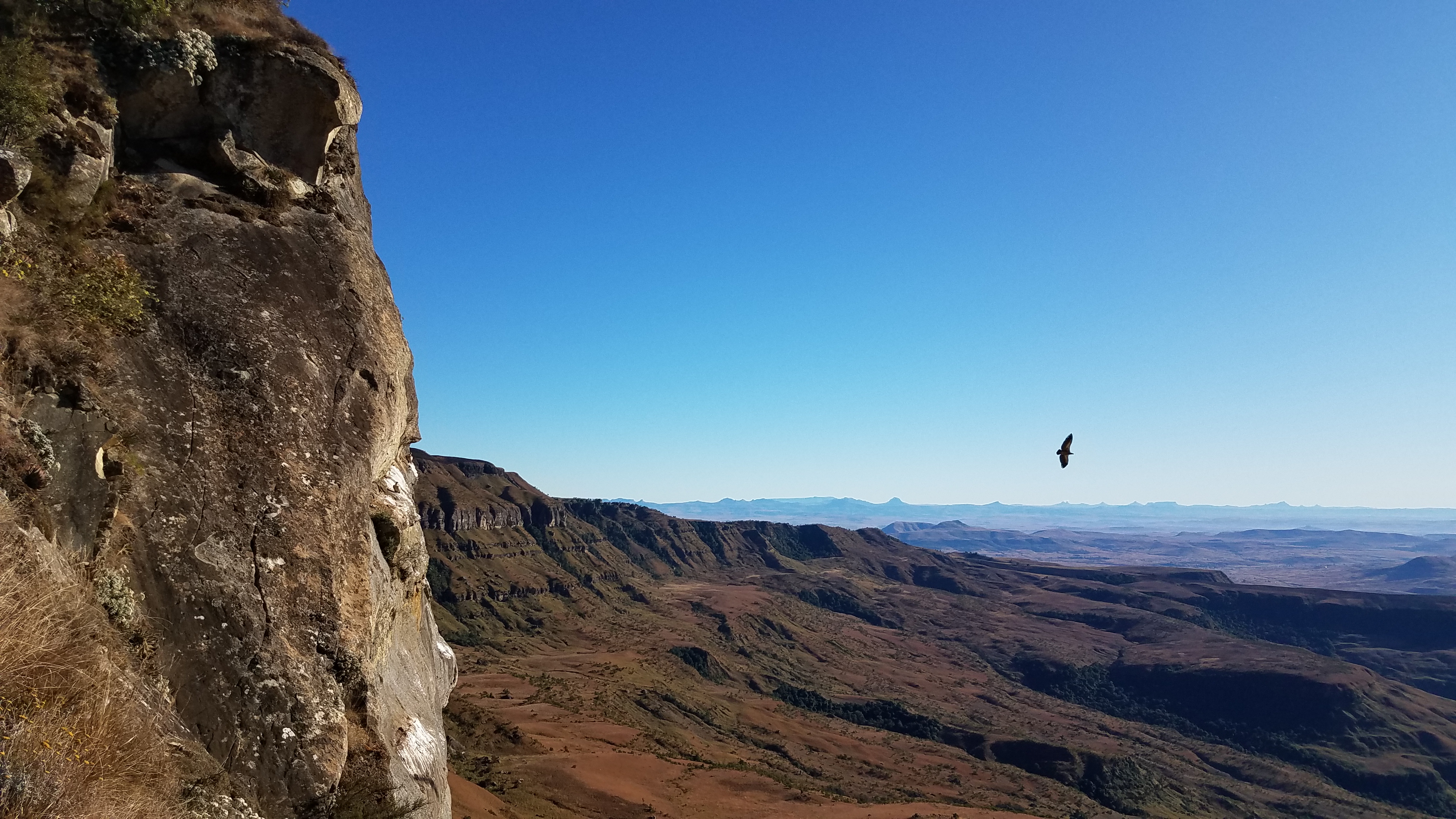
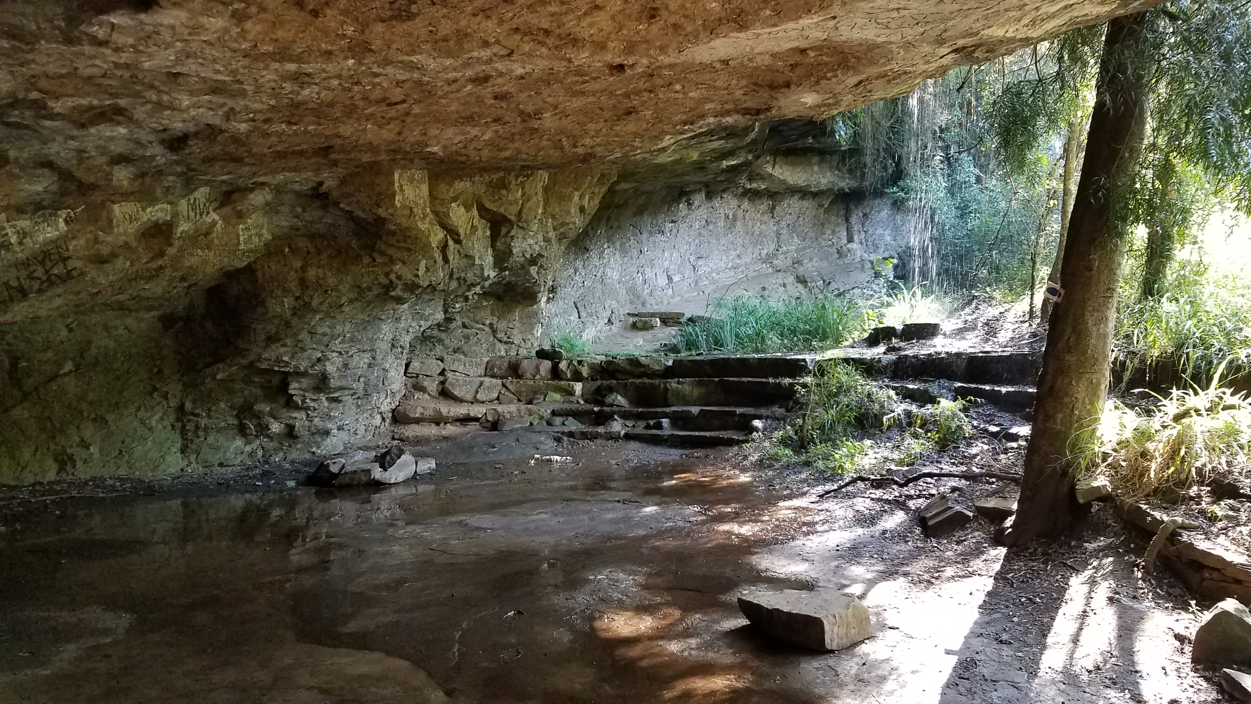
We hiked along the ridge in the wind and passed a cliff where Cape Vultures roost – it was really cool to see them so close diving down off the cliff then rising up on thermals. We sent another update on the fires, which were still burning but not spreading, while we had reception. Then we dropped down the back of the ridge and followed the valley to Vaalribokkop Cave (it wasn’t too windy to make it there to sleep). The cave was large enough to each have our own bivy site and the huge walls sheltered us from the wind. By nightfall, the fires were smoldering. A quick and easy dinner of pasta and precooked chicken, and we passed out by 8 PM.


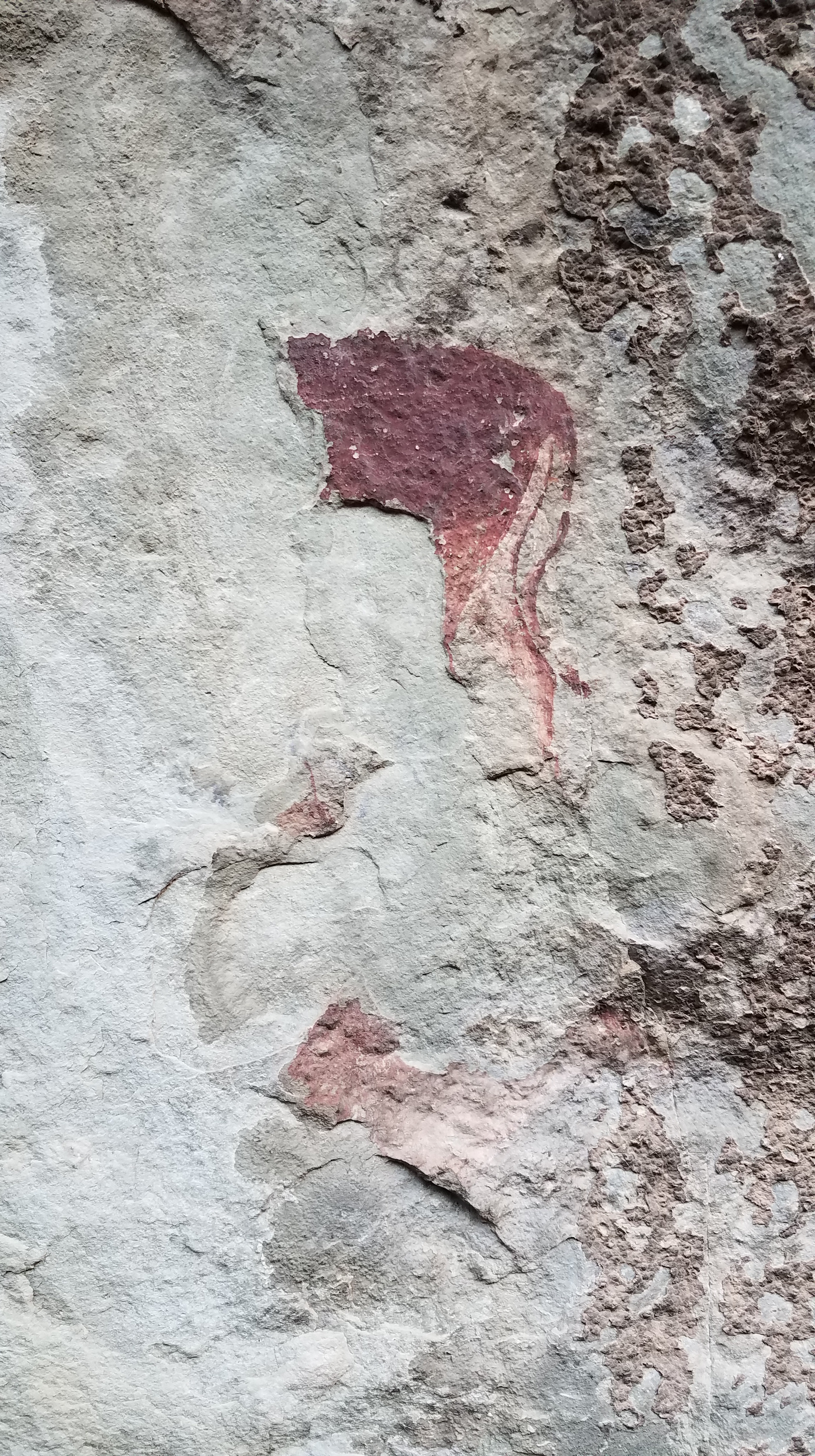
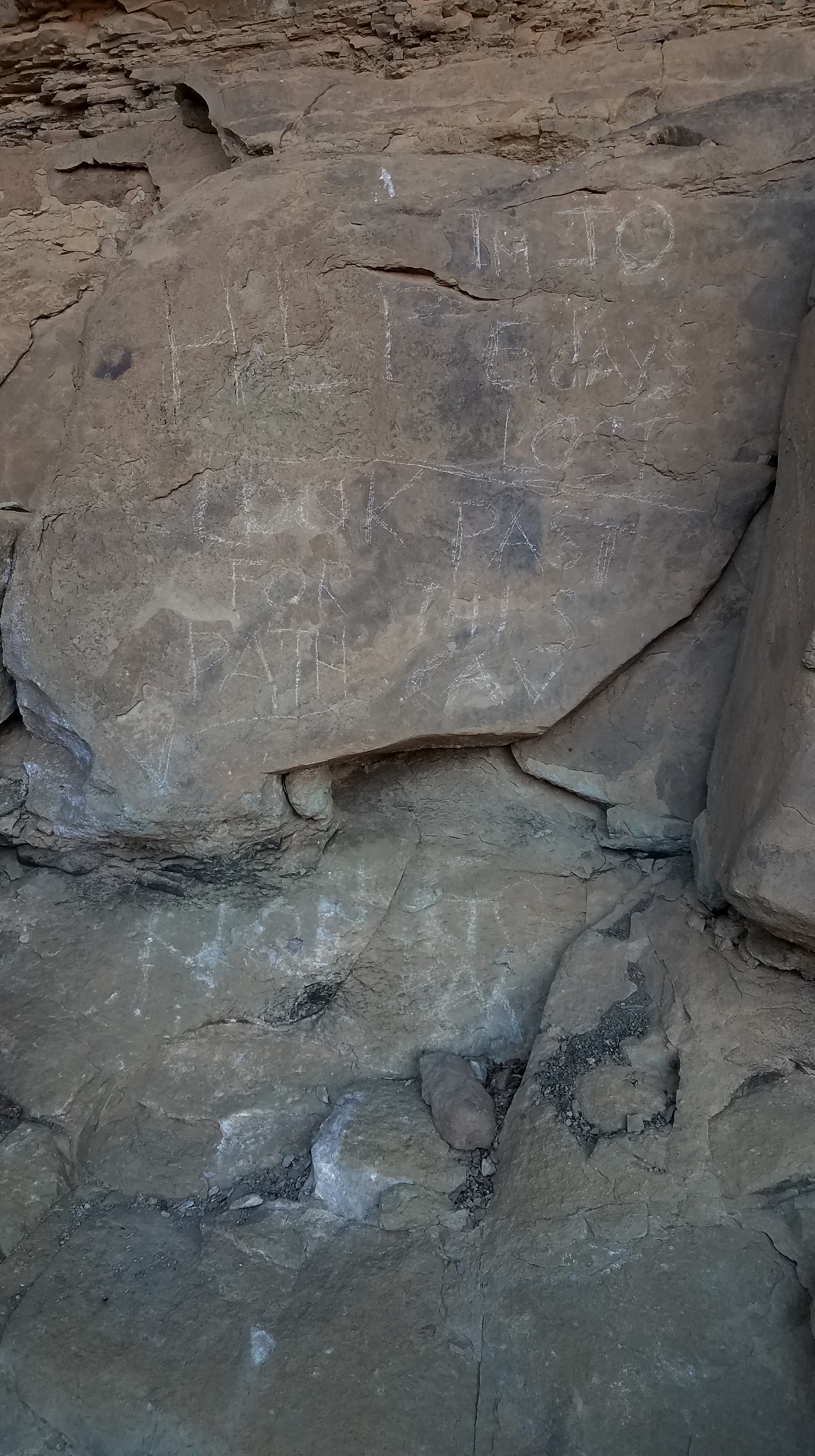
It was a cold night with howling wind but a crystal clear sky. I awoke multiple times and watched the sky for shooting stars between sleeps – there were tons. In the morning we made coffee to warm up and assess the cave. The rock art was untouched, though faint. A triangle symbolized a beehive; I wondered if that meant at one time there was a hive in the cave. There were drawings of eland, as well as a plethora of their scat in the cave. They were likely using it for shelter more now that the park was closed to visitors and campers. On some of the rocks was a deep burgundy coloration. It looked like it was just part of the rock but apparently it is from blood coming off of hides as they were scraped and cleaned against the rock by bushmen. Further down the cave we found what we thought at first was graffiti. Upon closer inspection, the large scrawled writing read “Im Jo. Help. 6 days lost. Look past for this path. No food. Weak.” I took photos of the rock and we wondered when it was written and whether there were more clues. Lockdown began in March, so no one should have been back here since then. Without finding anymore clues, we packed up and hiked back up to the ridge for reception to notify Mark. Sure enough, in April, a man had gone missing and was found on the seventh day. He planned to hike to Blindman’s Corner – a long way from the cave. They think perhaps fog moved in and he turned down the wrong trail and wandered down into the valley, then found shelter in the cave. Within a day after he wrote the message on the rock, he made his way to the vulture hide (where we started our hike), and was found by Roy with little clothes on, no shoes, and very weak. He was a musician from Switzerland who was visiting and was lucky to have found his way back out. During the time he was missing, the mountain rescue crew and police (since he was a missing person) searched on foot and by helicopter all around Blindman’s corner, but not in the valley with the cave. Having data like this, even after the guy was found, is helpful to train for future rescues. Though to us it would seem like common sense to perhaps get on a ridge and look for city lights, or stop moving immediately after feeling lost, sometimes panic sets in and maybe not the best choices will be made. The cave was never searched because no one thought he would end up down in the valley, tucked away in a cave for 6 days.


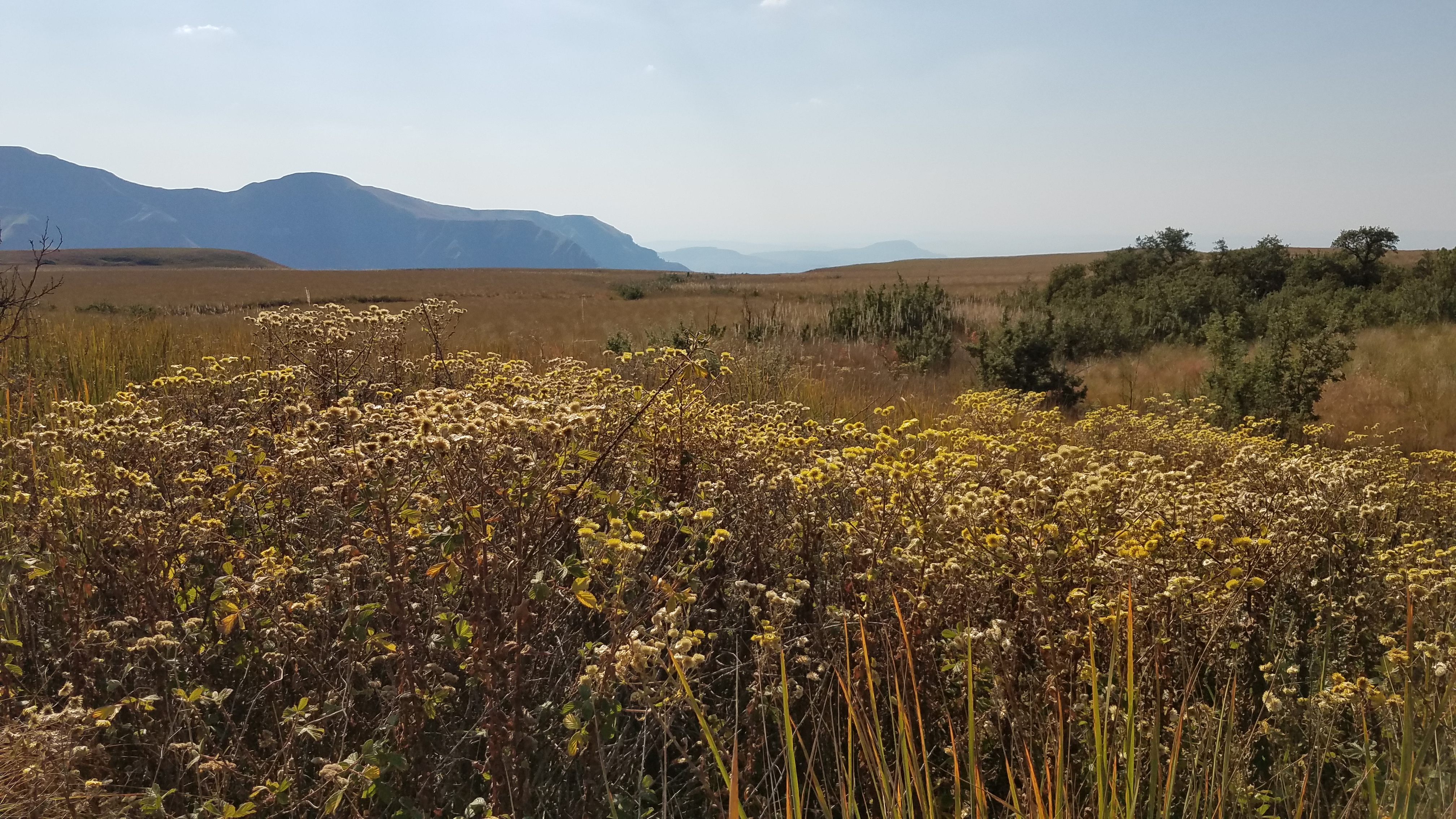
We visited Stable Cave on the way down – no wildfires or Help notes, just a pretty cave. Before the land was protected under the park service, the valley was used for cattle grazing. The herd boys would sleep in the cave and make fires, which was obvious from the blackened rock. We took a detour and hiked through the Blue Grotto on the way down. The waterfall and bright blue pool of water juxtaposed nicely to the golden hills we had been hiking.


Giraffe? In the Drakensberg?
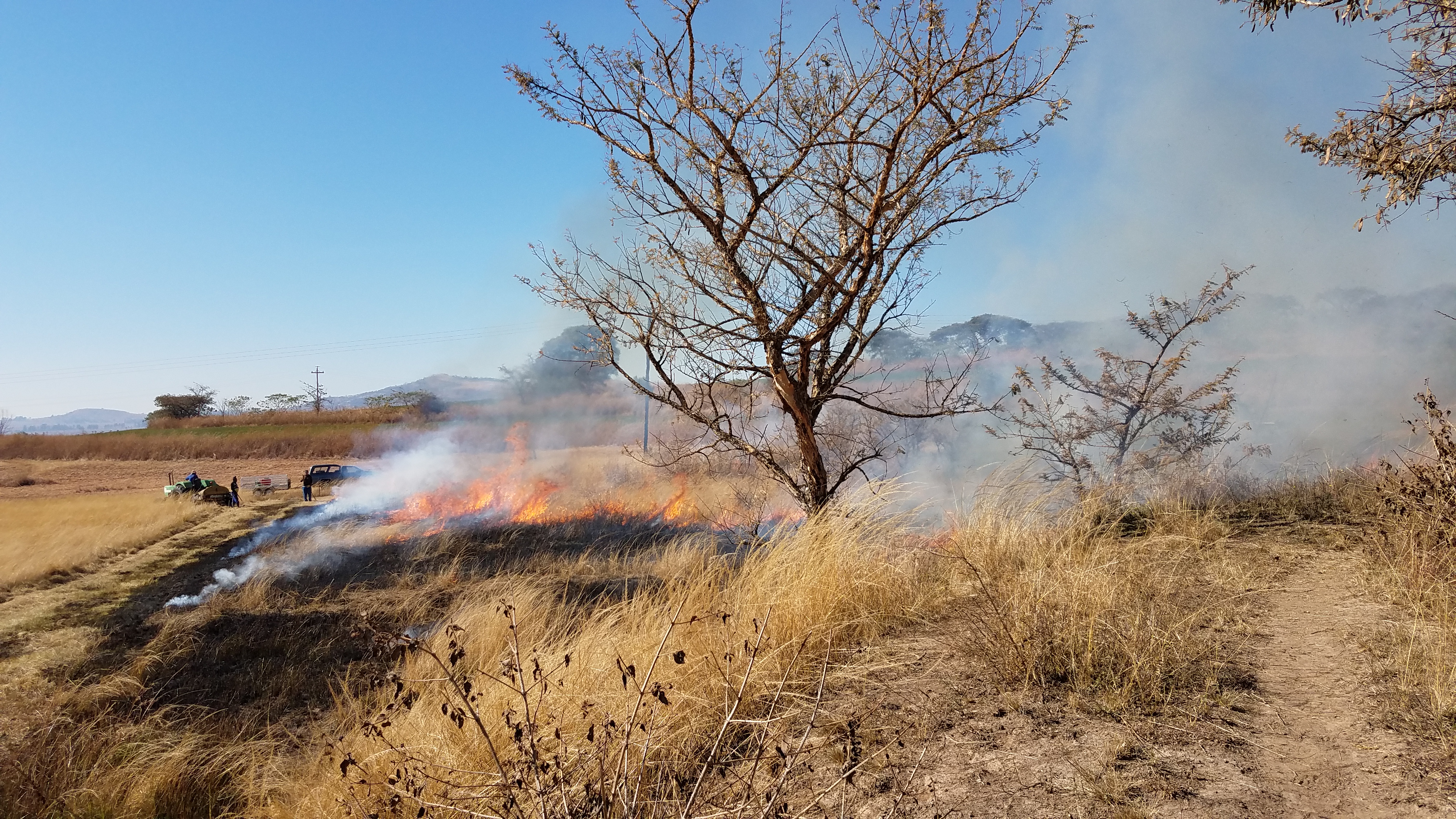
Lately the priority on the farm has been to make fire-breaks. These are lines and patches of land that are burned as breakers to wildfires. It’s actually required by law that farmers make their own fire-breaks by the end of July. Ideally, a large group of people would be hired to help but with lockdown and lack of income, we’re trying to do it with 3-4 people. It involves long days and tough work. I’m usually back-up so after the fire burns through I clobber out the remnants of burning grass so they don’t reignite. As much as I hate when it feels like all of the smoke is getting into my eyeballs, I’ve actually really enjoyed the work. It’s something I’ve never done, or even really thought about.


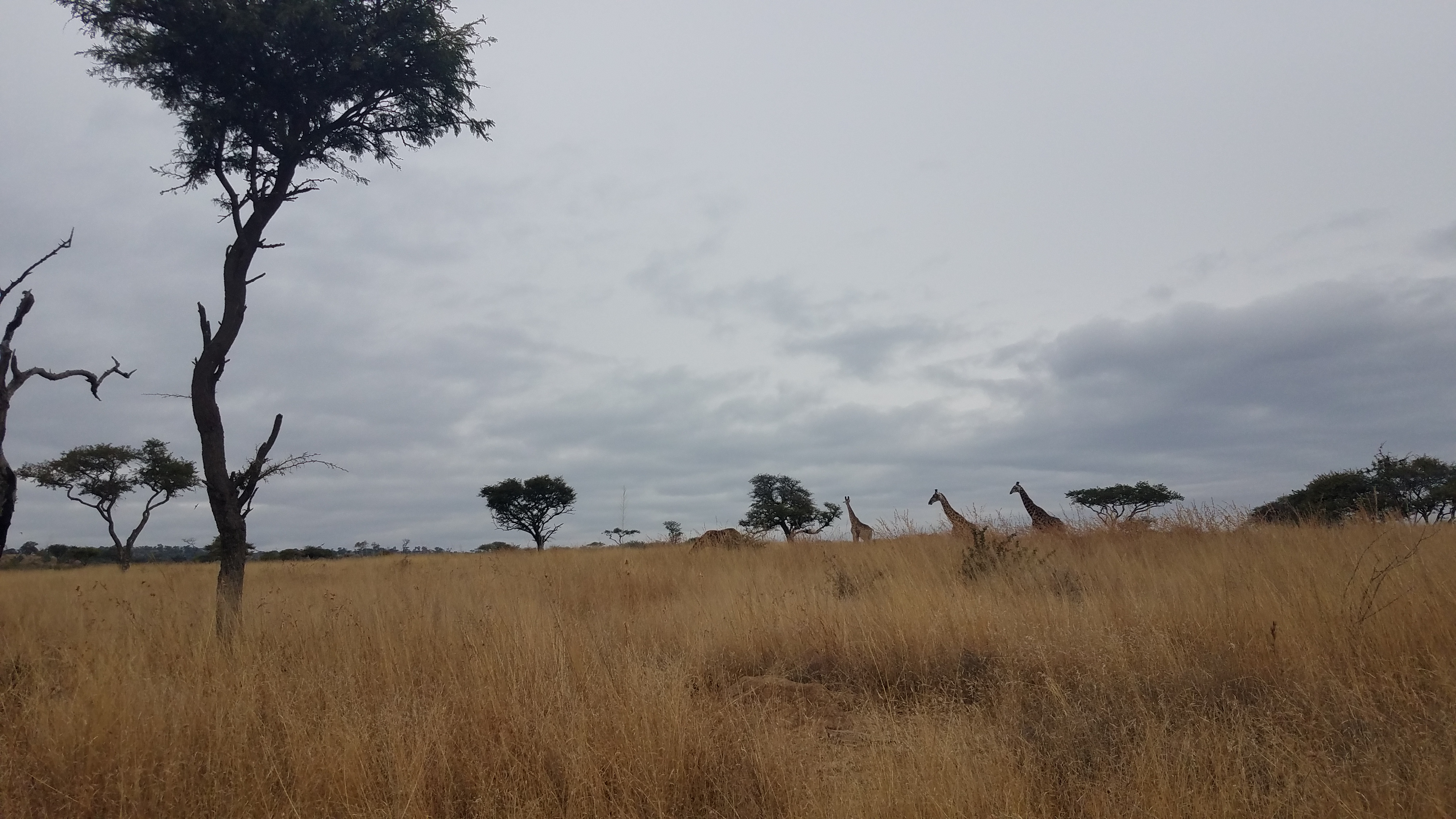
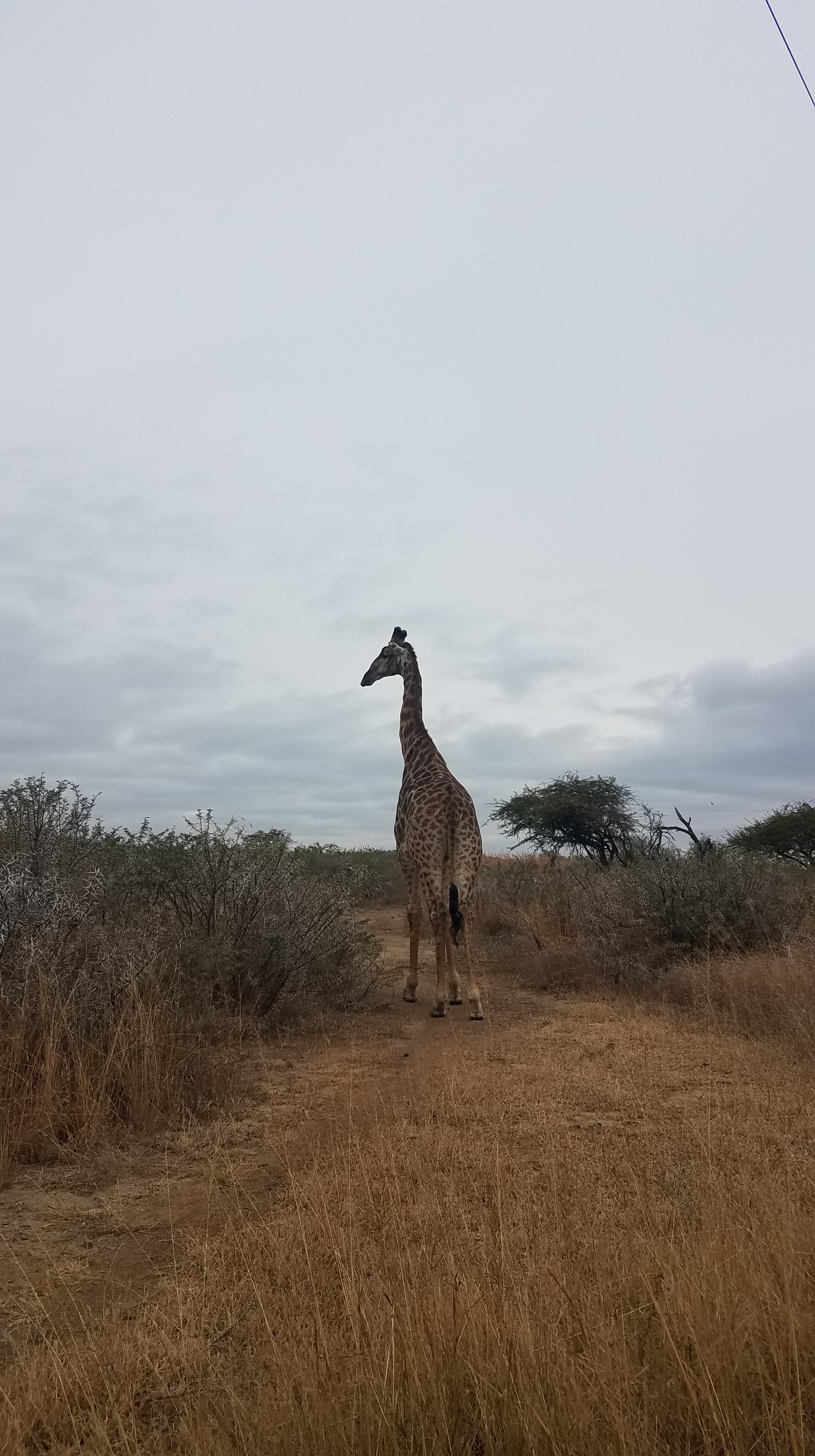
Weather for the most part has been on our side but last week we had a few cold, rainy days. On Wednesday, Karl suggested we visit the nearby game reserve in Weenen. I expected a bunch of antelope, maybe some ostrich, and perhaps some zebra. The first wildlife we saw though when we rolled through the gate were giraffe. Giraffe! I’d seen a bunch on the Bots-Namib roadtrip but from quite a distance. These giraffe must have been pretty used to cars; we drove up right next to one and I was amazed at how massive their legs were. Well the entire animal is massive, but the top of the leg was above our truck. These giraffe were darker than the ones I had seen up North as well.

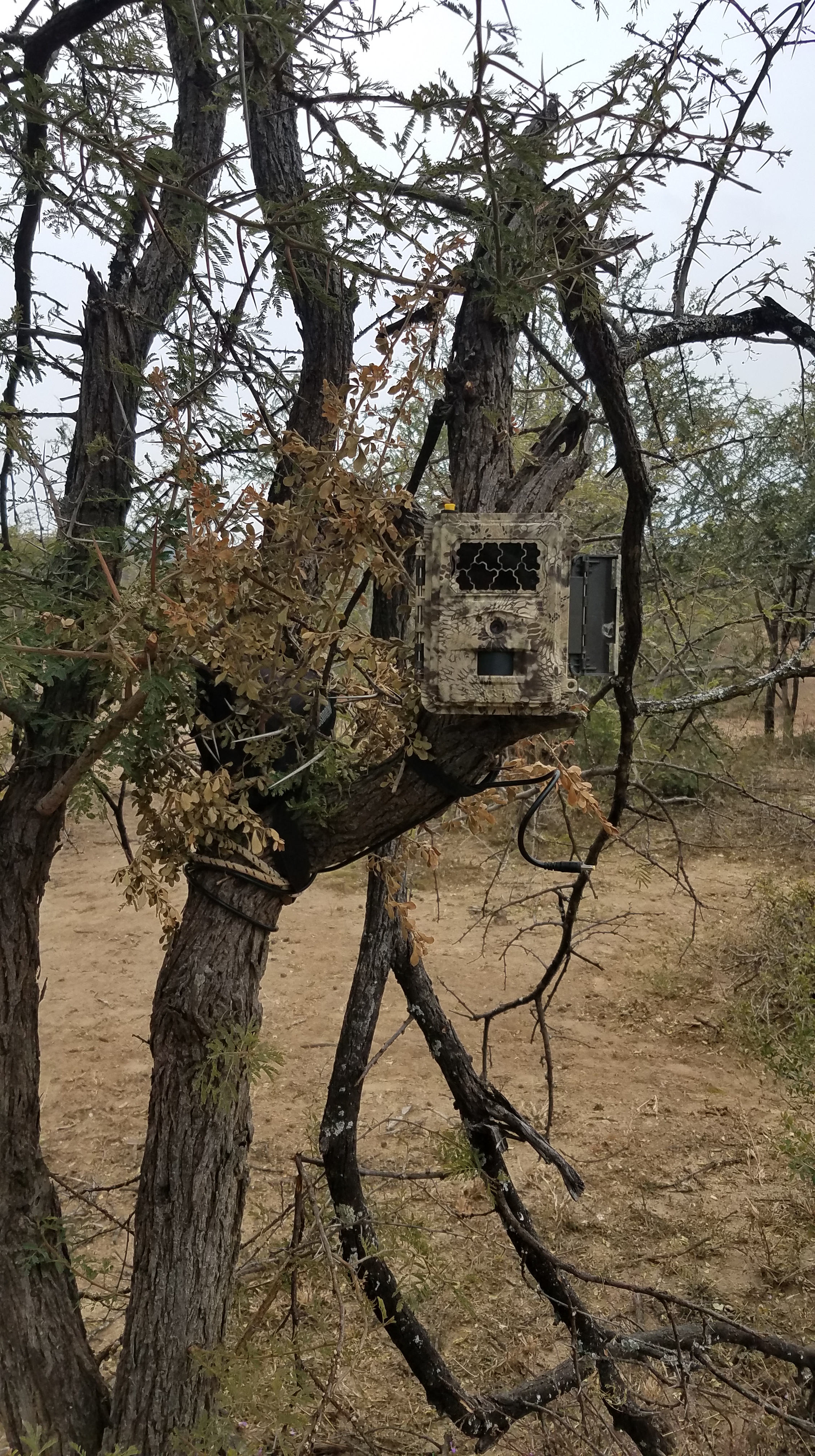
We met the reserve manager for coffee and, after discussing all of the implications covid had on the economy of South Africa, we talked about the work being done on the reserve. A lot of the work now was focused on the white and black rhino populations on the reserve. This involved monitoring with camera traps, dehorning, and supplementary feeding if necessary. Sometimes Workaway volunteers stay at the reserve for a couple of days to help out and we made tentative plans for me to stay for a few days in July. We helped check the camera trap and saw a black rhino and her calf caught at night – it was really really cool. Driving around the reserve we saw 3 white rhino, a bunch of zebra, eland, water buck, jackal, ostrich, and of course, more giraffe. It was a fantastic way to spend a rainy day.


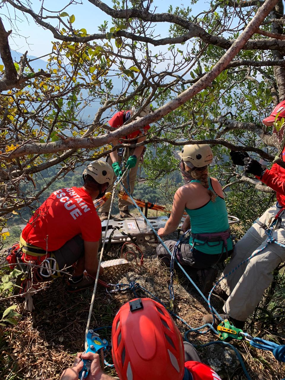
Mountain Rescue Training
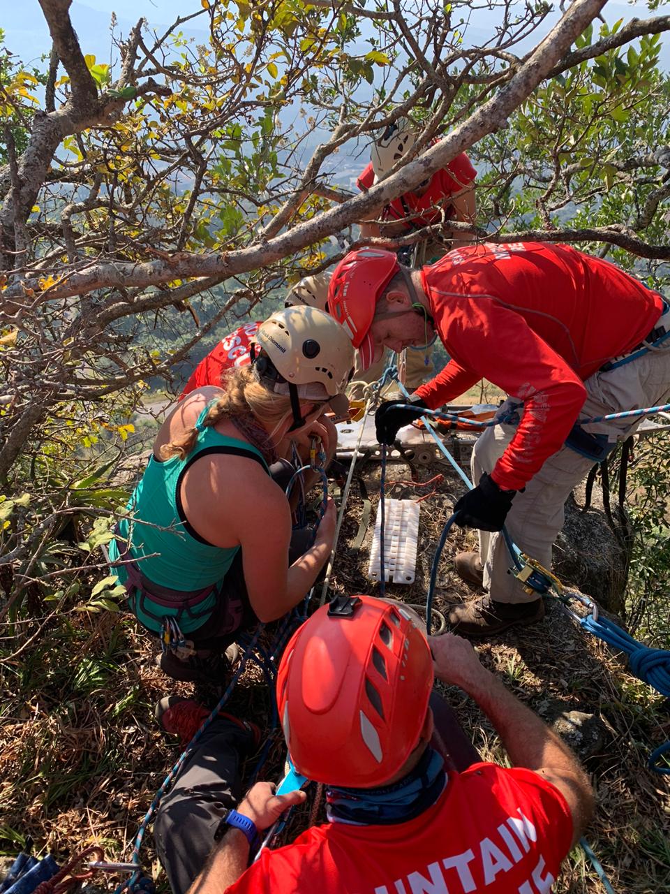
I had the opportunity to shadow a mountain rescue training by the Drakensberg team. Karl is a retired member of the rescue team so he was able to pull a few ropes for me to join. We met about two hours South of the farm at a small park with a cliff. Around 10 people from the team showed up and hauled on packs of ropes, a stretcher, medical kit, and trad gear – they called it a “kit.” We descended the hill to the top of the cliff and the team was briefed with the mock rescue scenario. A climber had fallen and was immobilized at the bottom of the cliff. The plan was to rig two anchors – one for lowering the stretcher and another for the medic to rappel down to treat the patient. We lowered the stretcher over the cliff with the medic riding the stretcher as the “jockey.” Then we switched over the rigging system to bring them back up with the patient. I learned a different pulley system (5 to 1) and a knot similar to a prusik called a “dog tail” that we used as a friction knot to bind around the rope attached to the stretcher and pull it up with the pulley system. Everything went smoothly and I learned a ton.
Back around the cars, the team leader debriefed the team and discussed areas that could use improvement if it were a real rescue – mostly the time it took to build the anchors and set up the pulley systems could be improved. One of the medics offered to do a quick tutorial on how to log-roll a patient with an injured neck onto the stretcher. I offered to be the victim for them to practice on. The new technique that was being taught was how to stabilize the neck and head during the log-roll, and when they practiced it on me I could feel the security of my head and neck with this method. After that discussions turned to stories and memories of other rescues and time everyone could climb and play outside before the pandemic. Beers were finished (that were opened after the rescue training) and I exchanged numbers with a few people, hoping to find a climbing partner for the next month. We’ll see what shakes out. Shadowing this training made me realize that someday, when I stay in one place long enough, I’d like to be a part of a community and volunteer on a mountain rescue team.


Amazing pictures, amazing stories !! I have learned so much from your posts, Kelly. Love and miss you!
LikeLike