03 December – 16 December 2019

December 3rd
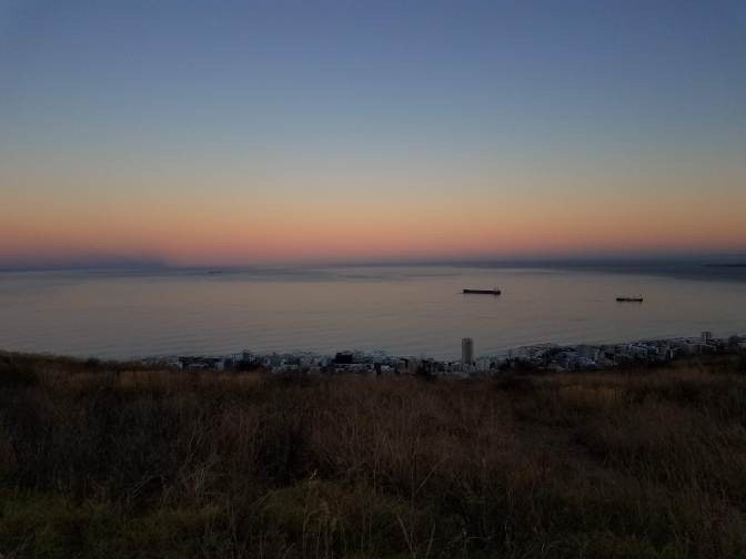
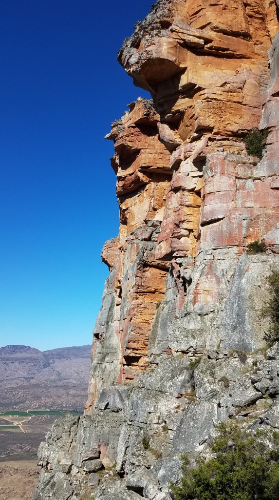
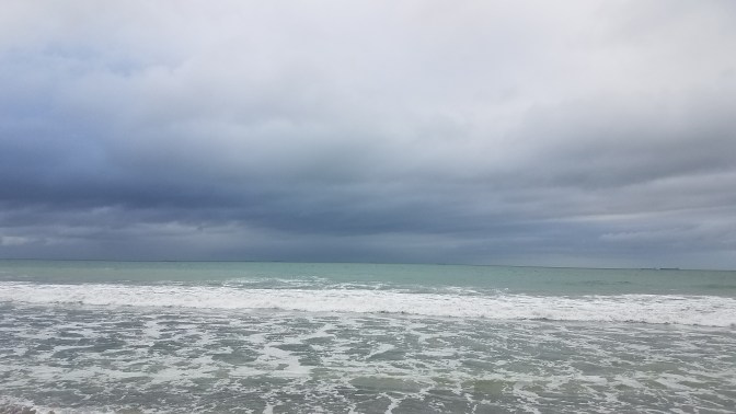
To get to Cape Town from the project is a mission, if you do it the cheap way. To get off the reserve, you need to organize leaving with a towntrip – these fill up quickly. Every 2-3 weeks, 2 managers drive from the project to Upington to run errands like getting food, picking up post, dropping off recycling, refilling tanks of medical CO2 or O2, bringing in vehicles to repair/picking up parts, and dropping off or picking up new volunteers or people going on holiday. It’s a 3 hour drive on sandy washboard roads through the desert. From there, the Intercape bus is the cheapest option to get to the Southern tip of Africa. Sure, you could fly from Upington to Cape Town in a few hours, but for a steep price. It takes 14 hours to bus on the Intercape route but for 10% of the cost it would take to fly.
We loaded up the car and trailer and left the reserve at 5 AM. I wouldn’t make the morning Intercape bus which leaves around 7:30 AM so after the drive in to town, I helped with the errands and walked around the Kalahari Mall. It was a shock to be spat out of the desert and into a busy shopping mall fully geared up for Christmas. I wandered through shops with my big red black diamond pack in my field cloths and messy hair. I felt incredibly uncomfortable and out of place. But I did buy a pair of jeans, which was one of the luxuries I had planned to treat myself to. What felt like eternity finally passed and soon I was dropped off at the bus station in the evening. Worn out and ready for sleep, I waited in line until we finally loaded our bags in the trailer behind the bus and boarded. I was fortunate to have a window seat on the upper level (yes a two story bus). I reclined the seat and passed out before we started moving.
December 4th
The bus arrived at the city center in Cape Town at 9:30 AM the next day. I felt rested despite a few jerking interruptions in my REM cycle. One dream I remember distinctly of being in an airplane flying through turbulence and when I awoke the bus was bucking and swaying along a twisty road. Once in town, before the bus fully stopped, I spotted Finn pressed up against the window. We would be traveling together for the next two weeks. At first it was strange to see him in the real world after 3 months of memories isolated in the Kalahari. But as I bounded off the bus, I knew we would have an adventure ahead of us.

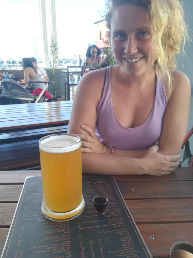
We ordered a coffee in a restaurant on the waterfront. Within minutes though it felt too strange and we decided to get back outside. We walked the shoreline and hopped along the large H-shaped concrete blocks that served as the water break. After I got a nose full of salty air, we picked up ingredients to make sandwiches and drove up Signal Hill for lunch. Plans were perfectly flexible and we discussed options for how to maximize our fun. That night we would be staying at Long Street Backpackers in town. After checking in and dropping our bags, we walked Long Street looking for a good place for a cheap dinner. Over a greasy burger and 750 ml Castle beer for R70, a plan was brewed to wake up before sunrise and hike Lions Head. With full stomachs and a buzz that met our energy, we walked back to the hostel and crashed.
December 5th
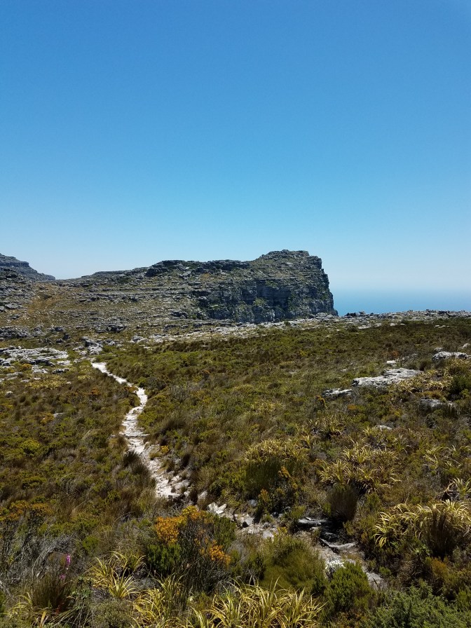
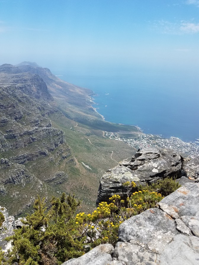
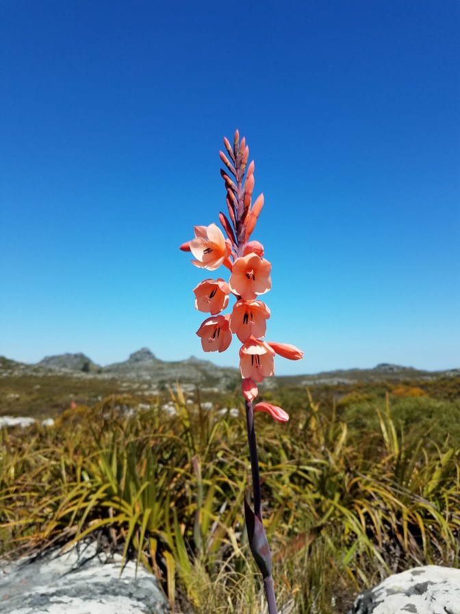
4 AM came too early but we dragged our slightly hungover bodies out of the bunk and into his car by 4:30 AM. The hike up Lions Head is very popular and reminded me of the flatirons in Boulder, CO. We found a spot in the long line of cars along the road of the trailhead – it seemed like everyone shared our idea. The sun was creeping over Table Mountain fast so we quickened our pace but quickly got distracted by the explosions of wildflowers on the hillside. These were all new flowers to me, and seeing color after 6 months of sand dunes was blowing my mind. We twisted around the base of Lions Head and took the alternative route that was more like a scramble to the top. Near the summit, the crowds bottlenecked as the last push became steeper. We found a semi secluded space to rest in the shade and take in the view of the Apostles lined up along the coast with steep cliff faces dropping to the sea. We would be hiking up one of the ravines later that week to trek along the top of Table Mountain.

dav
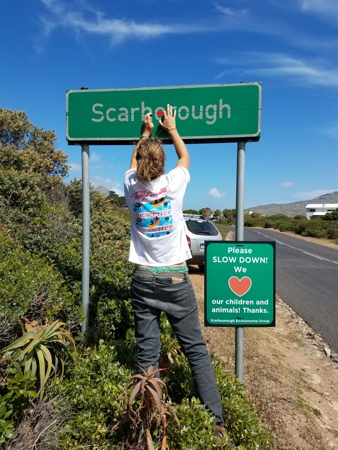
The next stop was Scarborough, the small village where Finn grew up. He took the scenic route around Chapman Peak and we stopped in Hout Bay for a fish fry. One of the things I miss most from the PNW is fish, just thinking about it makes me salivate. We got the fish to go and drove up a little further where he knew of a cave overlooking the bay. We perched in the cave at the edge of the cliff and marveled at the blue of the sea. The fish and fries left our hands greasy.
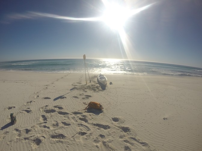
When we arrived at his home in Scarborough his family wasn’t home and we still had a lot of energy from city living the day before. We decided to take out their double sea kayak into the reserve South of town. The winds had died down and the water wasn’t as choppy as it had been earlier in the week apparently. Still, the waters around the coast and especially the point are known for large swells and feisty waves. We dropped the kayak onto the top of the car, strapped it down, threw a few beers into the storage space, and made our way down to the beach. Upon arriving, the waves looked much larger than they had from his house on top of the hill. I wondered how we would make it out past the break, but I should have been more concerned about bringing the boat back in… We punched through the waves out to sea. I paddled in front and Finn paddled and steered with the rudders in the back. I got pretty drenched as we fought the waves out but was surprised that it was relatively easy. We rolled along the large blue waves, sometimes my stomach would drop as if I were on a roller coaster. The water was crystal clear and bright blue. I could see kelp forests underneath us and the occasional shadows of fish. We rounded the rock barrier into the reserve, still past the break, and looked for a place to beach on the remote stretch of white sand. As we watched, it seemed like the waves only got larger and more sporadic. I questioned our choices but ultimately I was not the one in control. Finn claimed he spotted a calmer spot and pointed us towards it with the request that I paddle hard and don’t flip us. I crept my feet to perch on top of the small pegs for footholds in case things went South and I needed to bail. We caught a big wave coming in and the boat surfed on top of it sticking me and the front end of the boat up into the air causing me to shreak. It happened so quickly that I had dropped one leg over to jump out but realized how tipsy it made the boat and returned it back inside. We skipped and rocked and splashed and eventually the boat capsized onto the beach spitting us out on to the sand. It was not a graceful exit by any means but we got the boat onto the beach, and the paddles and beers were intact. We dragged the boat up, cracked open the beer, and walked along the beach looking for washed up treasure. It was completely abandoned though Finn did say poachers frequented the area. We spent most of the late afternoon and evening scouting the beach and dunes and hypothesized how some of the debris washed up on shore. The sun began to set requiring us to come up with an exit plan from the washing machine waves. We learned the timing of the big waves and somewhat of the pattern they were crashing in. Just after a big set rolled through, we plunged the boat in and paddled hard. This time I hooked my feet under the pegs and when a wave crashed into my chest and lifted my butt up and off the boat, I clung with toe hooks to stay in. Soaked, but upright, we were soon back to the safety of the ocean beyond the break. Our landing back into Scarborough was much smoother despite more obstacles of small children playing on the beach.
DCIM100GOPRO 
DCIM100GOPRO 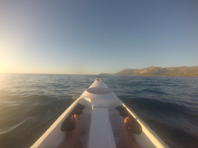
DCIM100GOPRO 
December 6th
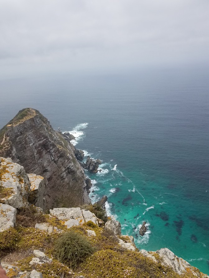
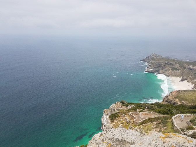
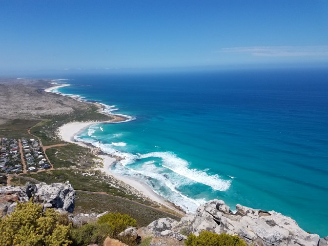
Scarborough is maybe a 20 minute drive from Cape Point, with attractions like Cape of Good Hope and Cape Point Lighthouse. We weren’t sure if there would be an option to paddle around somewhere so we brought the kayak along anyway. On the drive in, I saw my first troop of baboons. Baby baboons clung on to their mothers’ bellies and backs, adolescent baboons screeched and fought, and the alpha male hung back in a tree watching them move up the road. There is a lot of baboon monitoring around the point for mitigating human wildlife conflict. With a new team monitoring and moving the troops away from roads and developments (by using paint ball guns and horns), there have been less vehicle incidents that had before left the animals dead or severely injured. We slowly crawled along the road while the troop split and continued on either side of the car. After entering the park, we pulled off at a large pull-off to check the maps and make a plan. Black lizards that looked like mini Godzillas crawled over everything. We decided to check out the lighthouse and hoped to scramble down the rocks to the very tip of the point.

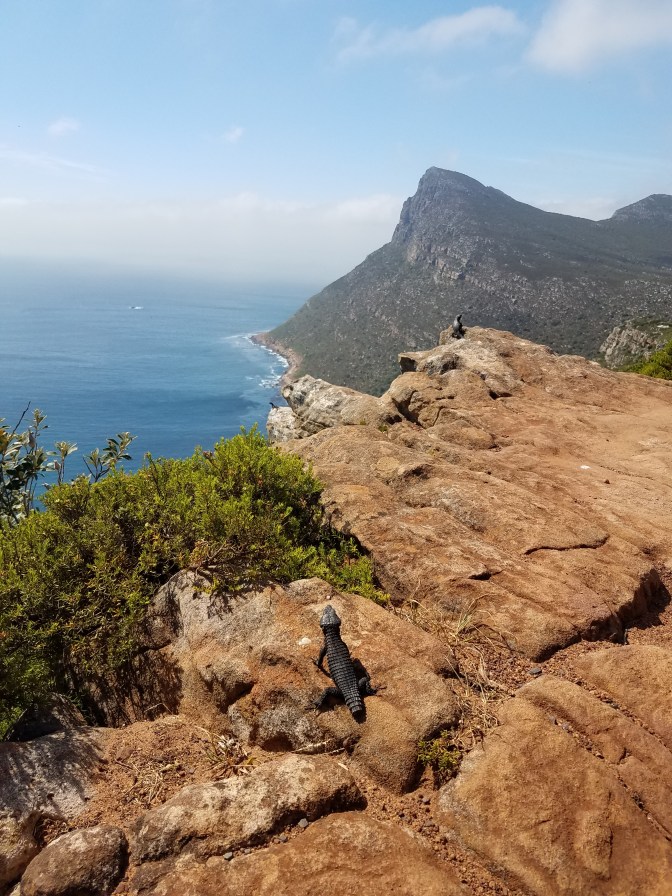
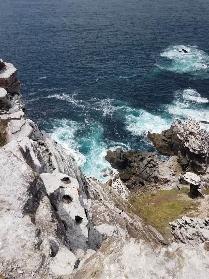
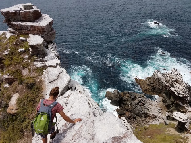
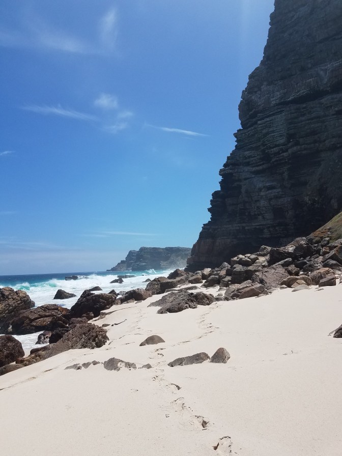
The lighthouse trail was probably the most popular hike but we soon left the crowds behind after dipping down to take the lighthouse keeper trail. Most folks stop at the new lighthouse a few hundred meters from the parking lot, but further down the point there is a smaller, older lighthouse. The point steeply lost elevation and soon the trail became stairs, then scrambling on rock until we reached the very end of the Earth dropping into the sea. From the point, to the left hundreds of seals flopped around on sun bathed rocks and to the right sea bird nests dotted the cliff side. Here waters from the Indian and Atlantic Oceans mix. We watched the waves crash against the rocks and my heart was full from being in salty air again.

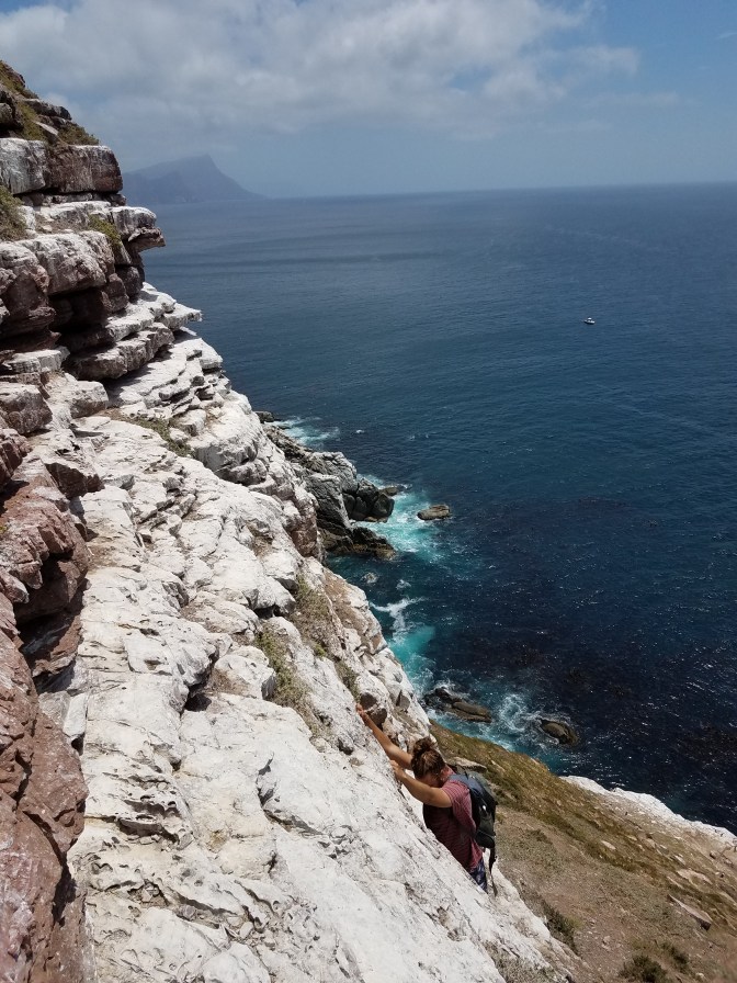
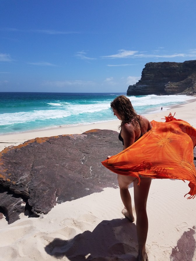
From the point, we could see a beach further up the coast and Finn had heard of sea caves in that direction. We climbed back up to the trailhead then down to Dias Beach. The warning signs along the beach threatened rips and undertow. When we reached the water to cool off, I could feel the power of the sea as I dragged myself away from its pull. The waves remained huge until just before the beach before breaking, it remains deep until that point. The sand from the beach steeply dropped off before the break. I decided I would just dip in and out real quick rather than swim. We picked our way along the rocky outcrops, sometimes over large flat rocks high above the water and sometimes traversing across walls that dropped right into the sea. We stumbled across remnants of a shipwreck on a beach secluded by a huge amphitheater of rock and grassy slopes. Around the next bend, after some more interesting scrambling whilst hearing the rumbling of the waves below, we found the caves. It almost looked like the entrance to a fairytale dwelling. It was at the edge of the beach with tall oblong holes carved in to the rocks from the tide. It was low tide so we went inside to take a look and found the holes made their way back out the other side. We wished to spend more time but the tide was moving in and there was still some sketchy scrambling to do to retrace our steps. It seemed we went a different way and chose a more exposed route which was all the more exciting with bigger waves coming in. We took a break at the beach with a mango (I finally learned how to cut one), then began the hike back up.


We drove along the park looking for a place for lunch. Lunch would be fresh baked bread and tomato basil hummus. Flowers exploded across the hills. One wildflower looked and felt like paper, like fake flowers. It was so bizarre! We arrived back in Scarborough in the evening, played with the dogs, and bounced on the trampoline.


December 7th
Scarborough Mountain wraps around the village as if protecting it from the outside world. Though Finn had climbed it throughout his life, we found a new way up that involved some scrambling that he hadn’t done before. Rock covered the mountain – old bedrock that had been exposed after years and years of weathering. We skirted our way around the blunt part of the mountain up some disconnected cliffs and reached the summit just as the wind picked up. We found a small cave to eat lunch in, if that’s what you could call a plastic bag full of freshly popped popcorn – not a good windy snack. We explored other caves and perches along the top then wound our way back down to the village.
Hungry for fish, we drove over to Kauk Bay and ate along a dock lined with brightly colored fishing boats and seals. The fish place was famous and a line formed out the door. As Finn was basically my tour guide for the Cape Peninsula, we spent the rest of the day driving through neighboring towns and up over passes that linked one side to the other. Soon I was getting the hang of the layout and could point out which direction villages, towns, mountains, and bays were.

December 8th
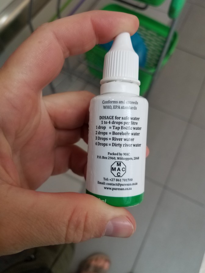
We started the day by searching for cool shells on Shelly Beach. I brought back about 3 lbs of them to the Kalahari. We would be heading up to Cape Town that night to stay in a hostel and start off first thing the next day to backpack up and across Table Mountain. After slowly waking up on the beach, we began making missions to pick up all the supplies we would need. I hadn’t thought to bring my water pump from the US to the Kalahari so I was left to whatever water treatment I could find in Kommetjie. I wasn’t totally sold on a dropper bottle for water treatment with a scale that involved borehole water, river water, and dirty river water, but it’s all I could find so I hoped my stomach would be strong. We picked up some food that wouldn’t require cooking as we weren’t bringing a stove, some snacks, and a bottle of rum. Throughout towns we frequently passed homeless men and women selling small packets of heart stickers for R20. It was part of an initiative started in Cape Town to help people in need raise money to buy food. We bought a pack of 3 to disperse and stick on things for memories. Once back at the house, we sorted our bags and packed for the trip.

We had hoped to catch a bus up to Cape Town but between being a Sunday, heavy load shedding (sections of the city would not be powered with electricity), and the inherent unpredictability of the bus schedule, the bus did not arrive. Here started what would be a sort of urban adventure that usually somehow sneaks its way into my trips. Taxis are like flies swarming the city. Driving is sporadic, usually cutting people off and running stop signs. And these aren’t taxis like little yellow car taxis, they are vans that can cram in nearly 20 people. Finn had seen some bad accidents around Cape Town where they were flipped on the side of roads. Recently, a bus driver for one of the bus companies in the area was shot, supposedly because buses take away business from taxi drivers. But those were stories I heard and not seen myself. We decided to take taxis up from Simonstown to Cape Town, it was also very cheap (about R24 per person). We crammed in to the first one and Finn told me to wrap my leg through the arm of my bag since I was sitting on the outside near the door. Throughout the trip to Wynberg, sure enough the door would open and close dozens of times and new people came on while others left. We arrived in Wynberg and again had hoped to catch another train but it was getting dark and anywhere in the cities are not good to hang around at night. We found another taxi and the driver of this one requested I sit in the very front in the center of the seats. This wasn’t actually a seat, sort of like a counsel or something. When I sat down my legs didn’t reach the ground so I wrapped them around the cushion and gripped like I was riding a horse. I had my red pack full and heavy with gear and food and felt like I had to engage my abs not to be knocked over backwards. The driving was sporadic with lots of horns (hooters) and slamming gas and brake interchangeably while Nicki Minaj blasted over the homemade speakers. Finn managed a regular seat behind me though was also squashed between people.
I managed not to slide around too much and was thrilled to hop out in the city center and make our way up Long Street to another backpackers called Cat and Moose. I realized some of the reasons for the crazy driving was the stage 6 load shedding schedule. When we arrived in Cape Town the power was out including traffic lights, ATMS, you name it. We were fortunate someone was hanging around the gate of the backpackers to let us in or we would have had to wander around until the city was powered up again to buzz in. We dropped our bags and walked through the dead streets until the load shedding moved on to the next district. Just down the road from the hostel was a bar that advertised over 100 beers on tap. After our drinking choices in the Kalahari were basically between two beers (Winhoek and Black Label) I was excited to drink craft beer again. We sat out on the balcony of the pub and listened to live music play across the street. But another side effect of weak draft beer for 6 months was turning us in to lightweights and it only took 2 craft beers (a porter and citrus IPA) to dance our way back to the hostel to sleep.
December 9th
We woke up early to begin our hike up Table Mountain. As I tried to light the burners to make breakfast, I realized it was another load shedding period. This would turn out to affect our morning more than we planned. I used my lighter to light the gas stove and we ate and repacked our bags to get going. The MiCity bus runs all over Cape Town, we thought we should buy a one day ticket just to take the bus up and over the hill to Clifton Beach near the start of the trailhead. But the bus required a ticket that could only be bought at a store, which were all powered down because of the load shedding. The first store we walked to were out of the bus passes anyway, the next only had regular rechargable passes, and the last one which was all the way back downtown did sell passes when the electricity was running but their station did not include our bus. After a lot of shenanigans and laughing in desperation, we bought our tickets once the electricity kicked back on, then walked back across town to catch the bus – at this point it was 11 AM and we could have easily just walked up and over the hill to the trailhead.
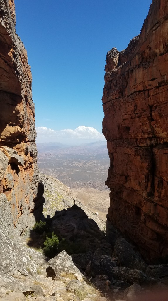
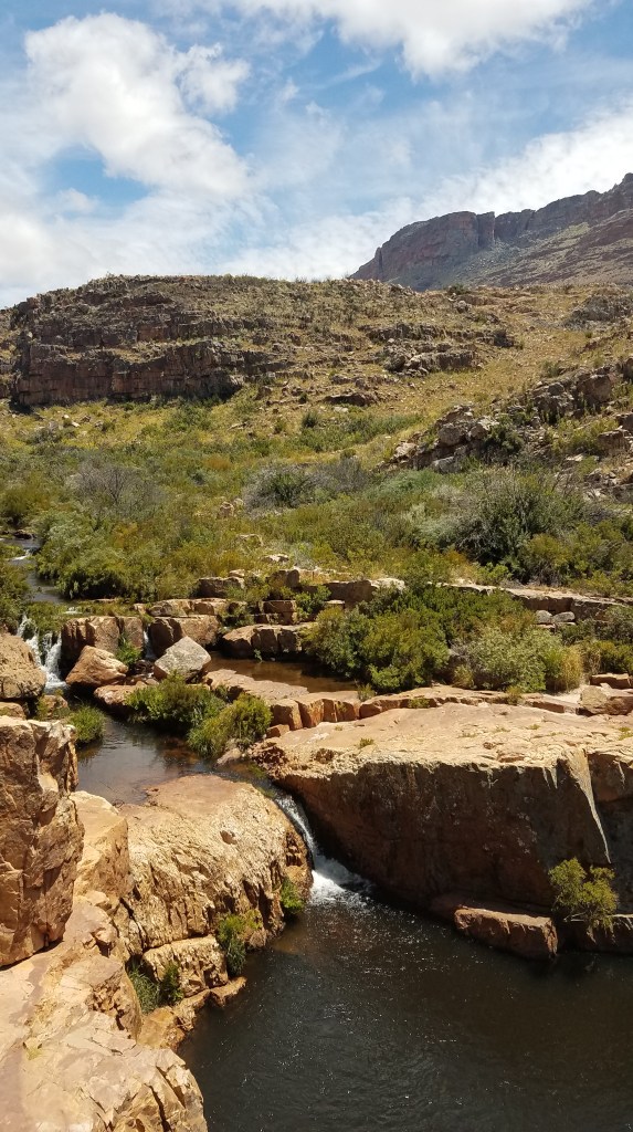
We hiked Pipeline trail, which is in fact a pipe line, to Woody Ravine. The trail edged just above the housing developments along the coast and was popular for mountain biking and day hikes. The ravine on the other hand was not well used. Nearly vertical with a gain of 520 meters, the trail climbs up the ravine between two large buttress walls. The rock looked incredible and birds dove through the gap the ravine had created. It was the heat of the day though and I felt that every sip of water I took turned to sweat dripping off my face and arms. We huffed our packs up, looking for a spot to take a lunch break, but instead continued all the way to the top where the ravine opened up into a rolling meadow breaching up to the buttresses. It was surely an efficient way to get to the top of Table Mountain and within just a few hours of getting off the bus we sat perched on a boulder at the top with our sweat soaked shirts off to dry in the sun.


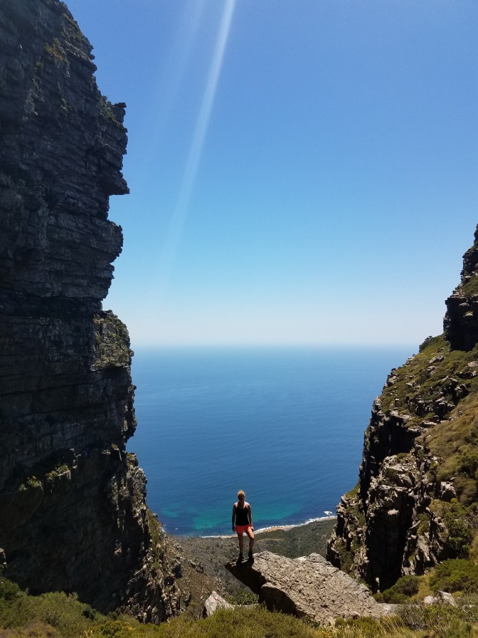
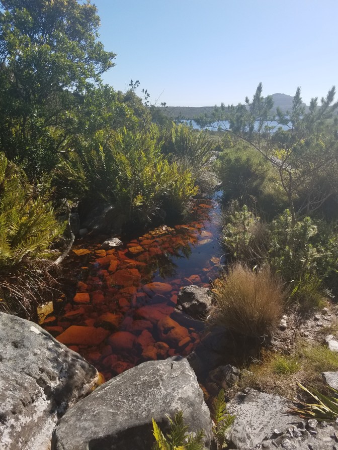
Originally we thought we would hike South along the top of the mountain, camp, then turn around and come back this way to eventually reach the cable station. But from our stance, the terrain to the South looked broken and discontinuous, a cool place to explore but not necessarily to haul our packs through to camp. We decided to sleep near the reservoirs instead, there was a cool crack system of rocks hanging above the reservoir that would provide fun once we set up. We cruised the now flat trail to an overlook above Clifton Beach, took some photos that made Finn want to pass out from anxiety of seeing me close to the edge, then skirted around the reservoirs. The water was “coca cola” colored and though Finn grew up with it and claimed it was fine to drink and didn’t need to be treated, I was skeptical even with my new weird water drops. I drank just enough but not too much to let my stomach see how it felt about it. We swam, it was quite cold, then chased the sunset around a buttress to find the ultimate bivy spot. Each time we felt like we found it, another patch of soft grass or light would draw us farther up. As the sun dropped, we squeezed between one of the crack systems that, once in, opened up to the width of two people. The grass was lush and soft and the rock walls provided a break to the strengthening wind coming up from the flats on the East side of the mountain. When darkness came, we left the cave and climbed on top of a big boulder to watch the lights – Muizenberg, Wynberg, Constantia, the flats, all lit up and sparkled below. We could even see where the load shedding was happening where chunks of darkness remained. After a weird conversation about the meaning of life, we returned to camp. We broke out the rum and made a fort in the cracks, chatted late into the night, and eventually fell asleep.


When we were swimming, Finn seemed uneasy about a trail that came up to the reservoir from the East side of Table Mountain. We had seen a few hikers come up this way but not many. In the past year there had been some conflicts, robbery and mugging I think, on that trail and his uneasiness passed through to me. We didn’t swim for very long. I woke up in the middle of the night feeling a bit anxious – I never worry too much about animals when I camp but humans are unfortunately my biggest fear in the backcountry. Which is a shame and not isolated to any specific place, but everywhere. I woke up thinking I heard movement at the squeeze in the crack where we entered our little cave. I listened hard then heard a growling sound that rose high then ended sharply, then followed by a low rumbling. It sounded like a dog growling. Instantly my mind raced and I thought someone had followed us here. Palms sweaty and heart hammering, I wasn’t sure if I should stay still or move to wake up Finn. Then, Finn inhaled dragging his breath through his throat and nose, stopped breathing sharply for a moment, then let out a lazy low rumbling. He was snoring. It wasn’t a dog and no one had followed us. The mind surely can play tricks in the night.
December 10th
We scrambled up the cracks with our breakfast of granola and watched the sunrise over the reservoirs. The rock was amazing with jugs and pockets, it was like a huge playground. After, we packed up and made our way back down to the reservoirs before shooting back up Echo Canyon. Whether it the effect the coca cola water had or avoiding drinking it that left me dehydrated, I wasn’t feeling so hot on this leg of the trip. I definitely slowed our pace but eventually we made it up to the cable station. I glutinously chugged the fresh, somewhat cold, water. We had thought it would be fun to treat ourselves to lunch at the station but it was closed down (maybe due to load shedding?) so we broke out our cheese, biltong (jerky), and crackers and took a break in the shade.
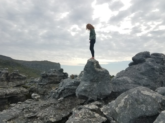
We rallied and continued hiking to the high point on Table Mountain, Maclear’s Beacon. The trail from the cable station to the beacon was full of boardwalks and it was cool to imagine swamps above the city when it rains. Experiencing a wild place like Table Mountain was pretty incredible just acknowledging that it sits above Cape Town. It has its own ecosystem, plant and animal species, even its own weather system. From the beacon we could see all the places I recently learned of. Finn quizzed me on which directions cities and mountains were and was pleased with how much I learned. We left the trail and hiked to the Eastern edge of the mountain and peered over and down the cliffs and ravines. We wanted to summit Devils Peak as well but had hoped there would be an easy way to get down to the saddle between Table Mountain and Devils Peak. The cliffs proved otherwise so instead we looked for a cool spot to sleep, and man did we find one. Back on the Western ledges of Table Mountain we traversed along broken rock and hillside and came to an oddly flat patch of ground. Beyond it was nothing but air and above nothing but rock. We nestled our sleeping bags between large rocks on thick grass. It felt like a bird nest for humans. We were so exhausted at this point that we fell asleep before the sun even set.


DCIM100GOPRO 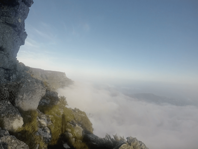

December 11th
We woke up before first light at 4 AM. Clouds had drifted in from the sea and covered up Cape Town below us. We could see the haze of lights below the clouds and heard the call to prayer float up through the fog. We crawled along the rocks looking down on the city below. Maybe it’s because I’ve always felt like an outsider and a little different from everyone else, but I love the feeling of escaping society and watching it from afar. Sharing this feeling and experience with someone in the twilight hours of the day was really cool. It was a magical moment on the mountain.
We fell back asleep for a bit before preparing for the descent. Our legs were pretty wrecked at this point and we creaked and groaned as we lifted our packs and started back towards the cable station to descend back down to sea level. The clouds below remained and now more were blowing across the mountain and pouring into the void where our campsite had been. I could tell we were getting close to the main trail when I heard voices and shuffling and soon enough we were in the congo line on switchbacks of Platteklipkloof gorge. The steep stairs made my legs feel like jello. We were some of the few heading down as it was still early morning and most of the crowds were heading up to the top. We got some funny looks for our large packs but everyone on the trail was friendly, despite asking in desperation how much farther the top was.
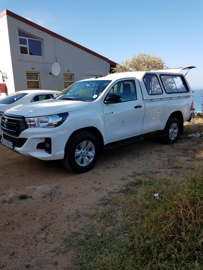
Once down off the trail, we still had a ways to walk. I arranged to pick up a rental truck downtown for the next leg of our trip. It was a few kilometer walk from the trailhead and between exhaustion and giddiness we stumbled our way back into civilization. We smelled pretty bad at this point and absolutely looked the part that we had been backpacking for the last couple of days. Finn had never rented a car before and was convinced he looked and smelled too gross for them to allow him in the car. He put on his rain jacket, despite the heat, and nearly melted at the reception desk. The small truck I reserved wasn’t available so we were upgraded to a large diesel engine Toyota Hylux. I am not very confident driving manual, on the wrong side of the road, through a city, so Finn bravely rolled out into traffic and navigated us back to Scarborough to unpack and repack. Our next stop would be the Cederberg. That night we visited the local pub he had worked in before coming to the Kalahari. It was called the Camel after a rock in town that resembled a camel (sort of). It was fun to dress up a bit and meet locals of the village.
December 12th
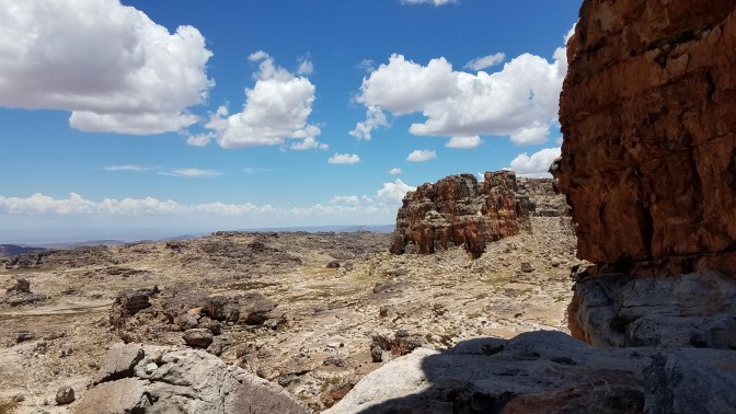
The Cederberg lies a couple hundred kilometers North of Cape Town. Once leaving the city behind, the drive is scenic through farms and wineries with bordering mountains in the distance. The name was derived from the stands of indigenous cedar trees that once covered the slopes of the mountains but were harvested to the brink of extinction. Low shrubs and nonnative trees from Australia now dot the hillside. The park is known for unique rock formations and San rock art from the earliest human inhabitants. European arrival not only decimated the cedar trees but also led to the elimination of the San people population. I unfortunately do not have the words yet to describe my feelings about seeing the rock art and learning about the history of the Cederberg (and South Africa). I can say it brought feelings of anger, confusion, and mostly sadness. It’s difficult for me to also understand the timeline for South Africa as most events happened incredibly recently. I think I learned and felt the most about the culture in this part of the world from this trip.


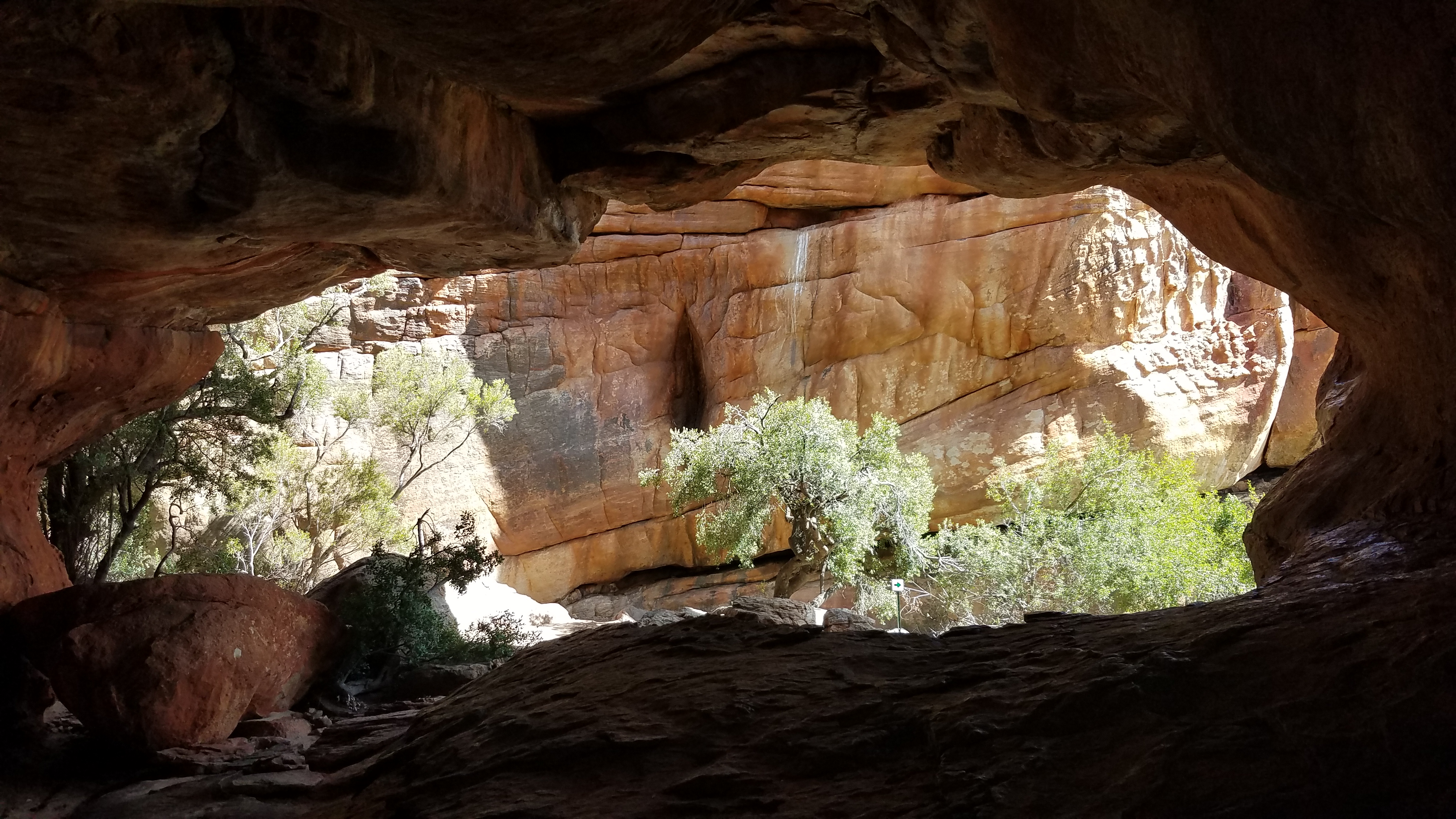
Driving in to the Cederberg, the rock art sites were the first places we hiked to. One painting Finn had found on his own on a trip a few years ago. The illustrations of humans were different from any I had seen in the US. We then hiked to Stadstaal cave which served as a dwelling to San. But soon after imagining what it would have been like to live in the caves, my eyes caught marks on the wall. Names and dates scrawled on the stone dated as early as the late 1800s. But there were also names written in large block font from a few years ago which initiated a thoughtful debate about the difference between historical art/markings and graffiti. We left the caves and scrambled along the back and up some flakes to a cave high above the ground. Inside, there was a small hole and surrounding it was rock art consisting of red fingerprints dotted around the opening. One can only imagine what the significance of these paintings were. Was it one person who made all the fingerprints or many? What did they believe was in or used the small cave? How many other people had seen this if it took some exposed scrambling to come and see this place? On our way back down and back through the caves, we found ourselves drawn to a list of names written on the wall. Unsure at first why this list stood out, perplexed we stared in silence. Finally, Finn realized the list had been stoned. White marks were actually chunks of rock that were missing. PW Botha was the executive State President from 1984 – 1989 and played a significant role in the Apartheid. Researching names down the list provide grim accounts of what happened not so long ago. Though it’s unclear when the names were pockmarked, and whether they continue to be, the tension surrounding the history of the place was present and strong.


We would be living out of the truck for the next couple of days instead of backpacking. We paid for a campsite in a popular campground, since the land was privately owned and monitored – no national forest roads or public land to sneak off to. Soon we realized we’re better at backpacking as we forgot most things that we needed – we had meat to cook and charcoal but forgot a grill, had gin but forgot the tonic, coffee but no cups, and so on. Since it is summer vacation here, there were lots of friendly faces amused at our perils that loaned us what we forgot.

December 13th
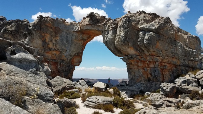
We camped at Sandriff campground beneath the Wolfberg cracks. We woke up early in the back of the truck and packed our day packs for a long hike up to Wolfberg Arch with an elevation gain of about 700 meters. The trail begins gaining the mountain up a ravine before the ground splits open into Wolfberg cracks. I’m not sure how these formed and the rock is a mix of sandstone and what looks like pocketed igneous rock of some sort. The walk up to the base was another drippy, sweaty, legs on fire hike but once we reached the cracks our exhaustion faded as our eyes plotted out routes to scramble up. From here to the top it was pure fun – stemming, boulder hopping, scrambling, some ropes were already in place to lunge and haul up. A small cave broke through to a room among a giant arch. We raced each other across obstacles and chose our own ways that tailored to our skills. Finn is super tall and likes to make big jumps across gaps. I like to run on the sides of walls around obstacles and find a way to climb over things. We popped out at the top on bubbly black rock. After a quick break for lunch of (again) biltong, we continued the hike across the plateau to Wolfberg Arch.
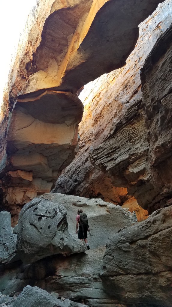
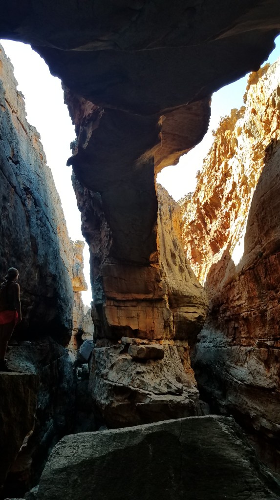
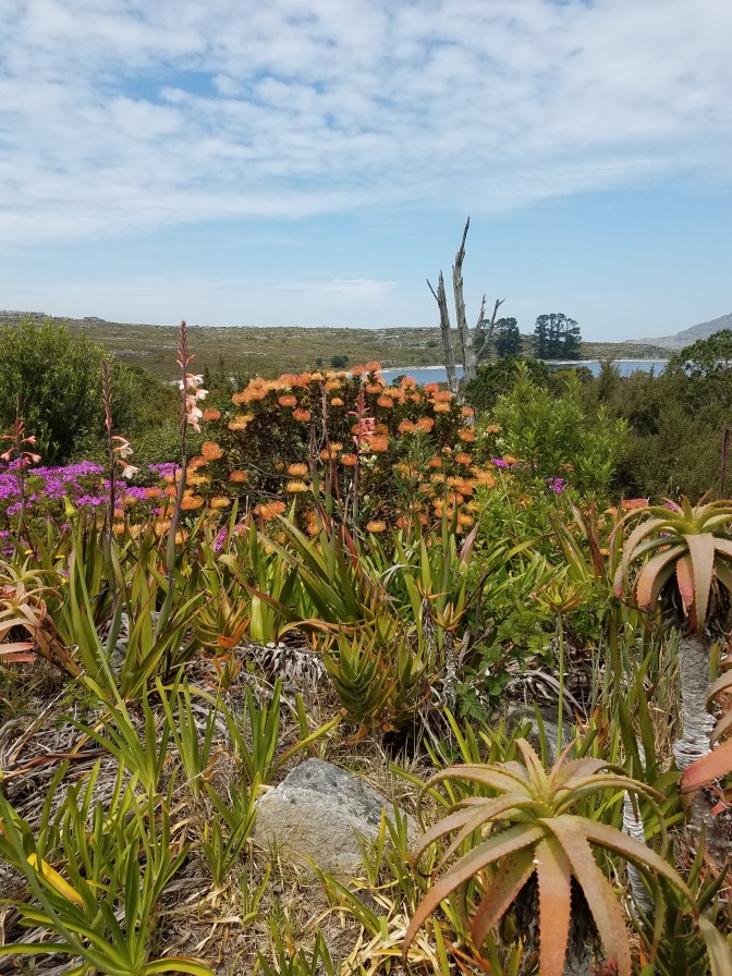
I’ve never seen something quite like the landscape up there. It reminded me of Utah but the rocks were different shapes, there were different flowers and vegetation, and everything belonged to a different palette of colors. It is leopard territory up there and we strained our eyes scanning everywhere for signs of them, but to no avail. The wind picked up at the arch and we watched the clouds roll across the mountains to the South as we let our feet rest. The hike back down went quickly but at one point Finn stopped, looking shocked, and explained he had never been so exhausted.

We did make a run into Clanwilliam, the town nearby, because gin just isn’t good without tonic and after reevaluating our supplies we added in some fruit. Fruit is incredibly cheap – we bought half a watermelon for under $2! That night we braiied, listened to music, and enjoyed the luxuries of a campground – including a much needed shower.
December 14th
As was the theme, our plans had been a bit larger than what our bodies could take for this trip. We had planned to do another big hike to a rock formation called Maltese Cross. But when the morning breeze roused the poplar leaves into a lulling rustle, our legs begged to stay horizontal for a bit longer so we changed the day to be a rest day. At some point in the night I dreamt a dragon breathed fire on my neck. I woke with a large yellow blister. Though I popped it, it’s still oozing today with 3 holes that bleed – I wonder what got me. We cooked up a big breakfast that morning with the rest of our eggs, avocado, peri peri sauce, onion, and peppers. It was too cold to swim but we hiked to Malgot, which means “crazy hole” and is deep enough to cliff jump in to. I’d like to think I would have jumped if it were hot, I would have probably needed a running start not to think about what I was doing though. The weather rolling in shifted our plans again and instead of staying another night at the campground we headed out to drive the West Coast back towards Scarborough. I wanted to take in as much of the sea as I could before returning to the desert.
It was lunch time when we arrived at Lampert’s Bay. Still windy but sunny, we dropped the tailgate and ate a lunch of mangos, cheese, and crackers while salty air filled our noses. We walked along the beach expecting to swim but started seeing clumps of things dot the shoreline. A closer look provided dead baby seals, dozens of them, fresh. Maybe a big storm swell had killed them or maybe this beach was a break where things gathered from the sea. We left looking for a beach without so much death. Heading South, we swung around Eland’s Bay – Finn knew of another rock art site. We hiked up to the cave through piles and piles of shells that were remnants of what the San people ate. I thought this was so cool and surreal, could it really be? Tons and tons of shells heaped around the cave. Inside was a large painting of an eland and hand prints. A similar question to the previous paintings we saw – were all the hand prints made by the shaman who typically created the art? Or from the entire tribe that inhabited the cave? They appeared to all be different sizes.


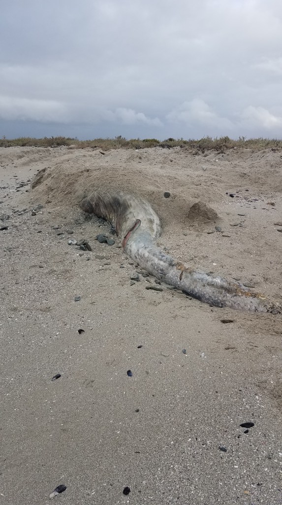
We drove on, in to the rain, to another beach near Velddrif. By now we had been driving a few hours so we planned to cook the rest of our meat (boerewors or sausage). We had pulled off into an area that was set up for a housing development. These were strange, we passed a few of them on our drive. Roads had been paved, street lights and stop signs erected, power boxes installed, boardwalks built to the sea – but no houses. We backed in to where a house may stand some day and walked the boardwalk to the ocean. The smell caught us first, a few meters away was a half buried dead whale. We hadn’t escaped death after all. But seeing the whale was a marvel in itself, even just a part of it. A lesion in the skin around the tail was still bubbling as the body decomposed. Finn guessed a humpback whale. We headed the opposite direction of the smell and looked for skipping stones. The weather was getting pretty wild over the sea and a sense of a storm coming pulsed in the air. We played chase, skipped stones, and found some shells while eating the rest of our watermelon. When the threatening clouds began to provide the rain it had warned, we retreated to the truck and cooked up dinner. The street lights of the empty development turned on. I suggested we sleep in the back of the truck here but being so close to road, Finn was worried about crime. So we packed up and drove the long drive back to Scarborough. I read him the book I had brought – As above so below, by Chris Kalman. My voice was dry and cracking by the time we reached his house. It was so late, we decided to crash in the back of the truck in the driveway.


December 15th
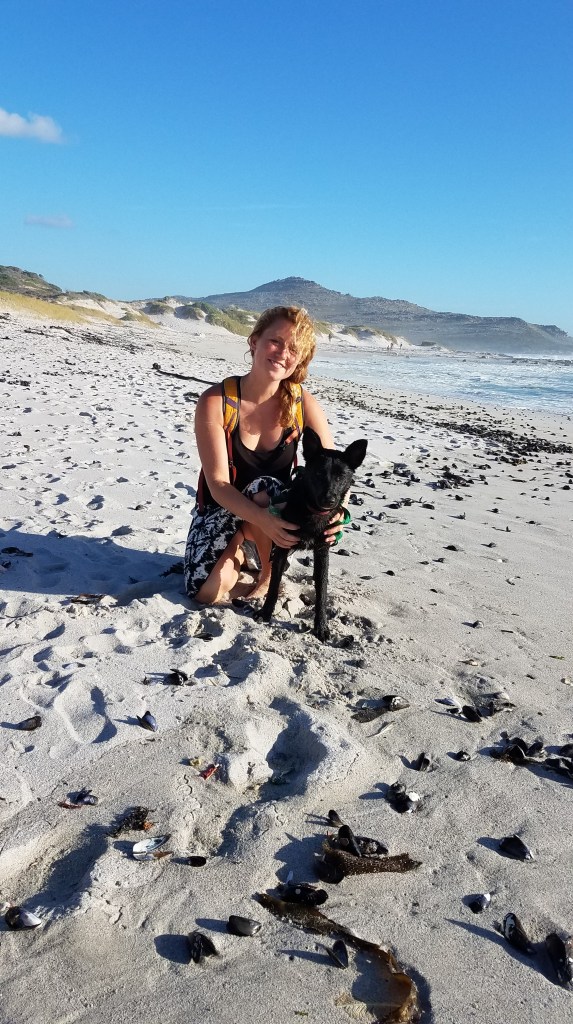
This was my last full day in Scarborough. We walked down to the Camel where a market was held each month. I found a beautiful handmade, black and white skirt made locally. I met a few more of the villagers, then we took the dogs for a walk on the beach. Finn joked that nothing is easy with me, even a walk, since the family dogs were not very well trained and we were yanked all over the beach. I walked (rather ran) their black puppy, Bailey, who was quite terrified of waves but loved chomping on kelp.
December 16th
I wanted to bring back a map of Africa to hang in my room. We left Scarborough the next morning to walk around the waterfront of Cape Town in search of a map. It took most of the morning to find one and I became overwhelmed with the crowds of people. It was a holiday, the Day of Reconciliation, holding space for the day when people of South Africa confessed to the crimes they committed during the Apartheid. Thousands of people flocked the waterfront, but I’m not so sure how it should be celebrated as most of the people who could afford to be enjoying the waterfront were not those who were most affected by recent events. Left with my thoughts and some anxiety of so many new faces (I have seen no more than 40 familiar faces at a time at the research station), I was ready to leave the city.
Before I caught the bus, we stopped by a bar that served 1L beers. We toasted to promising it wouldn’t the last time we’d see each other – here’s to hoping our paths can cross again someday for another adventure.
sdr
Being back in the Kalahari feels like hitting sand after going 100 mph, pun intended. I already lapped the reserve on the bike reestablishing my boundaries marked by the fence line. I live better fast and though my time here so far has taught me a lot about living more slowly, for now I am still missing the freedom and excitement from traveling. But coming back also felt like coming home. I was greeted with hugs, smiles, and 100 questions from my friends. I’ve shared some tales over dinner spreading love and laughter to my clan here. While I was away, it rained and now white flowers dot the greening bushes bringing the desert to life. The big rains will start soon. I hung my shells on strings from my ceiling for a reminder of the sea, sure maybe it looks a little Blairewitch. And my map sprawls across my wall reminding me just how big Africa is and how much there is see. Sometimes it feels like adventure is my drug and returning to reality is sobreity, but I’m learning how to balance and appreciate both ends of the spectrum.

Best Christmas card I’ve ever received! Loved every word! One picture of you out on the point definitely gave me pause, tho’ Keep following your dreams, Kelly! Love, Aunt Pat
LikeLike